Category Archives: topanga state park

Racing the Weather to High Point (Goat Peak) and Back

High Point (Goat Peak), Santa Monica Bay, and clouds.
High Point (Goat Peak)

The forecast for the Los Angeles area (Saturday, December 10) was for a chance of rain in the afternoon, with rain developing overnight and continuing into Sunday morning. There was also a slight chance of light rain or drizzle in the Santa Monica Mountains in the morning.

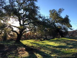
It was overcast in the West Valley as I drove to the trailhead, and I wondered if my run would be dank and drizzly. But as I drove up Reseda Blvd. toward Marvin Braude Mulholland Gateway Park, I was surprised to find patches of blue sky overhead.

Sunrise view of Hondo Canyon, Topanga Lookout, and Henry Ridge in the Santa Monica Mountains.
Hondo Canyon, Topanga Lookout, and Henry Ridge from the top of Fire Road 30.

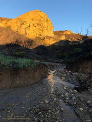
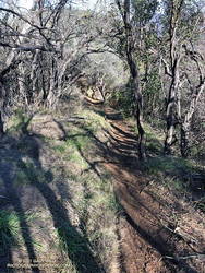
I started the run a little before 7:00 a.m. and headed up the connecting single-track trail to dirt Mulholland and Fire Road 30. Many runs from the Top of Reseda start this way, and I turned onto Fire Road 30 and continued up to the Hub — about 2.5 miles from the trailhead.

For the first couple of miles, I wasn’t sure how long a run I would do or where I was headed. But as I neared the Hub, I had to make a decision. To a large extent, a decision that depended on the weather.

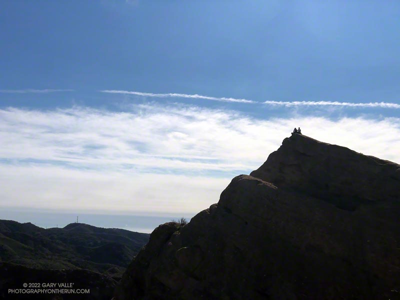
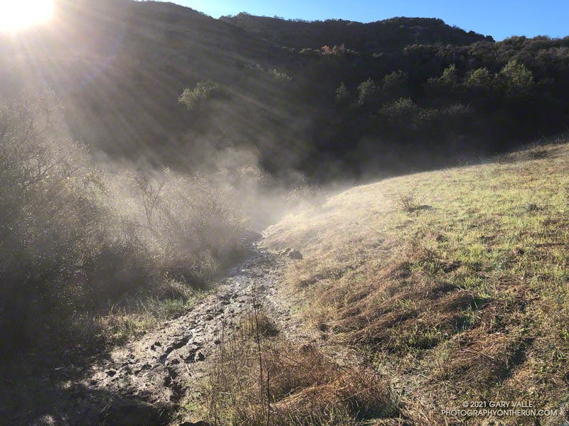
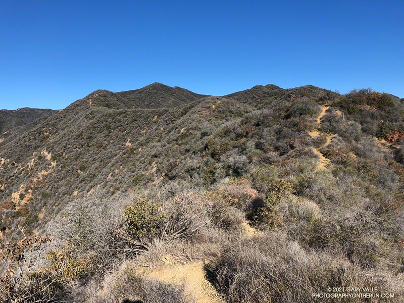
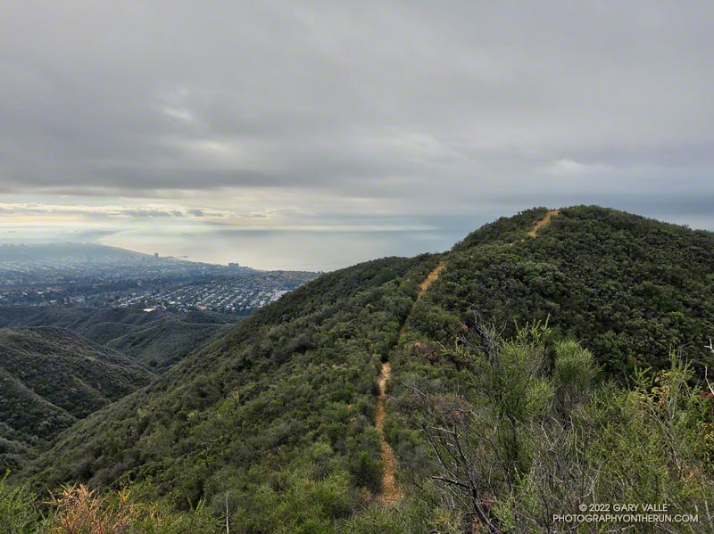
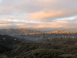
What had been partly cloudy skies had coalesced into a layer of clouds that just touched the top of the highest peaks. I’d been thinking about doing an out-and-back to High Point (Goat Peak), but if the weather continued to deteriorate, the only view I would see from the peak would be the interior of a cloud. I finally decided to give it a go and hope the peak didn’t get socked in with clouds and fog.

Chaparral currant (Ribes malvaceum) along the Backbone Trail
Chaparral currant

Turning left at the Hub onto the Temescal Ridge Fire Road segment of the Backbone Trail, I ran about a half-mile to where the Backbone Trail forks left off the fire road and becomes a single-track trail. This is the popular Rogers Road segment of the Backbone Trail that eventually ends at Will Rogers Historic State Park.

From Temescal Ridge Fire Road, it’s about 4.25 miles on the Backbone Trail to the unsigned junction with the High Point use trail. It’s on the right and easy to miss. The turnoff is about a half-mile before “The Oak Tree” landmark on the Backbone Trail.

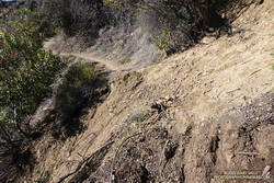
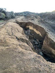
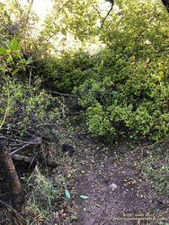
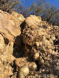
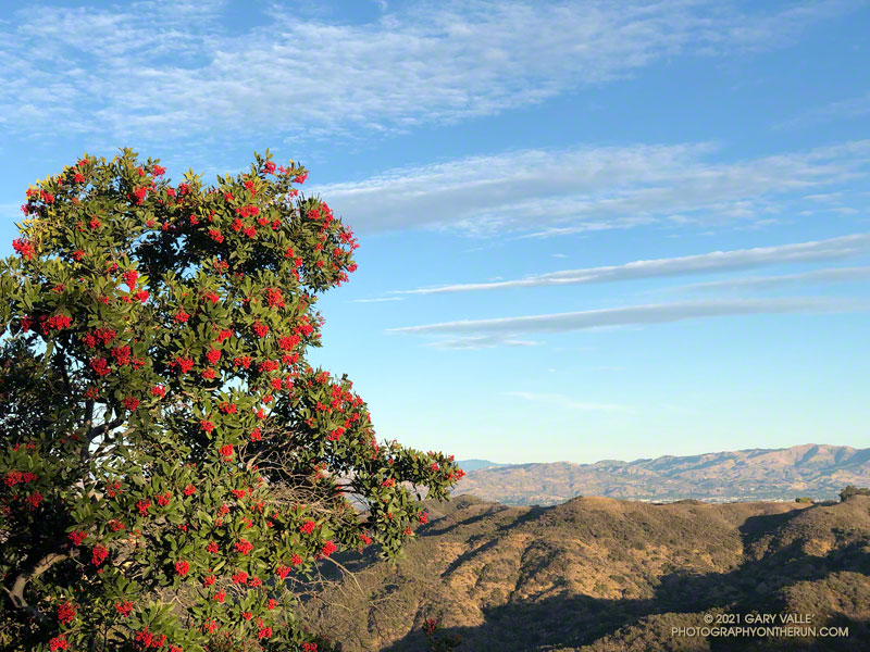
The High Point trail is an unofficial, unmaintained path but is usually in decent shape. There are a couple of short, steep, loose sections on the way to the peak. Nothing is signed, and some side paths diverge from the main trail.

Summit of High Point (Goat Peak), with the San Gabriels, Downtown, and West L.A in the background
Summit of High Point (Goat Peak)

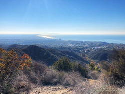
When I reached High Point’s summit, the weather was holding but looked more threatening. Even so, the view was excellent. Panning from east to west underneath the ceiling of clouds, the view included the San Gabriels, Downtown, West L.A., the South Bay, Santa Monica, Palos Verdes Peninsula, Santa Monica Bay, and Catalina.

There were a couple of rogue sprinkles on the way back to the Top of Reseda, but the rain held off in the West Valley until late in the day.

Here is an interactive, 3D terrain view of the High Point (Goat Peak) Out and Back from the Top of Reseda. The map can be zoomed, tilted, rotated, and panned using the navigation control on the right. Track and placename locations are approximate and subject to errors. Poor weather and other conditions may make this route unsuitable for this activity.

Some related posts: High Point (Goat Peak) Via the Rivas Ridge Use Trail, Goat Peak and the High Point Trail

Eagle Rock Silhouette

Silhouetted hikers on Eagle Rock in the Santa Monica Mountains

The photograph of Eagle Rock is from this morning’s meandering trail run to Temescal Peak, Temescal Lookout, Eagle Rock, and the Garapito Trail in Topanga State Park.

All of these viewpoints have sweeping views of the Santa Monica Mountains, Los Angeles Basin, and surrounding mountains.

Temescal Lookout (Peak 2036) is the site of a bygone fire lookout station. It’s located just west of Temescal Ridge Fire Road, about a mile south of the Backbone Trail junction and a half-mile north of the Trailer Canyon Fire Road junction. It’s shown on the USGS Calabasas topo map from 1944. Vestiges of the lookout are all that remain.

Some related posts: Downtown Los Angeles and San Jacinto Peak; Trippet Ranch Loop Plus Temescal Peak; Eagle Rock – Topanga State Park; Will Rogers – Rivas Canyon – Temescal Canyon Trail Run

Trippet Ranch Loop Plus the Santa Ynez Trail

Creek crossing on the Santa Ynez Canyon Trail

I had just waded down a 50 yard stretch of creek where the Santa Ynez Canyon Trail used to be. Three hikers working up the canyon were trying to find a way past the flooded section without getting their boots wet. That wasn’t going to be easy.

Debris at creek crossing in Santa Ynez Canyon.

I had been doing the same thing higher in the canyon. It was a chilly morning, and I had no great desire to soak my shoes in cold water. The usual rock and limb crossings had worked well until the trail ended in a broad area of flowing creek. Once my shoes were wet, it simplified the process.

That the trail was flooded following several days of rain wasn’t that surprising. What was a surprise is that there hadn’t been higher flows and more damaging flash floods in the canyon.

Creek crossing near the Santa Ynez Canyon Trailhead, on Michael Lane.
Creek crossing near the Santa Ynez Canyon Trailhead

Santa Ynez Canyon was the focus of the May 2021 Palisades Fire, and a large part of the drainage was burned to a moonscape. Burned slopes often amplify runoff from heavy rain, producing damaging flash floods and debris flows. While there was clearly high flows in the canyon, the levels were less than what I’ve seen in similar circumstances, in other burn areas. One possibility is that unburned trees and brush along the streambed higher in the canyon had attenuated the flow.

After doing the out and back on the Santa Ynez Canyon Trail, I continued down to Trippet Ranch and then, like last week, returned using the Musch, Garapito, and Bent Arrow Trails.

One of several sections of the Bent Arrow Trail damaged by slides. January 2,2022.
Section of the Bent Arrow Trail damaged by a slide

There were a number small rock slides, sluffs, and sediment flows along the trails and roads. A couple of people were working on clearing the limbs and small trees that had fallen across the Garapito Trail. The collapsed oak at the bottom of the Garapito Trail had settled, and was easier to get through this time.

The trail that really took it on the chin was the Bent Arrow Trail. Several sections of the trail were damaged by slides.

I usually do the Santa Ynez Canyon Trail as part of the Trailer Canyon – Santa Ynez – Trippet Ranch Loop. Tacking on the trail as an out and back addition to the loop was slightly shorter, but had a little more elevation gain/loss.

Some related posts: Trippet Ranch Loop After the 2021 Palisades Fire, Clouds, Canyons and Wildflowers, Running Between Storms on the Trippet Ranch Loop, Go Figure

Running Between Storms on the Trippet Ranch Loop

Musch Trail steaming in the early morning sun.
A wet (and muddy) section of the Musch Trail.

Update January 4, 2022. Did the Garapito Trail again this weekend as part of a longer run through Santa Ynez Canyon. The debris from the fallen oak tree was much easier to get through this time. Some people coming down the trail after me had a small saw, and said they were planning to work on it.

Update December 31, 2021. It turns out that a lot more rain was on the way! Los Angeles recorded 9.46 inches of rain this month, making it the third wettest December on record, going back to 1877. This puts Los Angeles at 10.40 inches for the Rain Year to date, which is about 237% of the normal.

It had rained the past three days, including Christmas. Today was the 26th, and Downtown Los Angeles (USC) had recorded nearly 150% of the rainfall normally recorded in December. And more was on the way.

Early morning light on Eagle Rock
Early morning light on Eagle Rock.

I clicked START on my Garmin as I passed the gate at the Top of Reseda. It was about twenty minutes before sunrise. The temperature was around 40 and the eastern sky was brightening with the advancing sun. As I worked up the initial trail to dirt Mulholland, thousands of lights twinkled across the San Fernando Valley.

The chaparral was soaked with overnight rain; and befitting the Holiday season, was ornamented with thousands of silvery water drops.

I took my usual route, turning off Mulholland onto Fire Road #30, and then following it to the Hub. From the Hub, Eagle Springs Fire Road led down to Eagle Springs, then beneath the sunlit face of Eagle Rock to Eagle Rock Fire Road and the top of the Musch Trail. In the Palisades Fire burn area there was some significant erosion along the fire road where the runoff wasn’t controlled.

I’d be doing the Musch Trail later in the run, but for now continued down Eagle Springs Fire Road toward Trippet Ranch.

Erosion along Eagle Springs Fire Road. December 26, 2021.
Erosion along Eagle Springs Fire Road.

Mud — slippery, cake-on-your-shoes mud — isn’t normally much of an issue until past the Musch Trail and on the steeper downhill that leads to the top of the Santa Ynez Trail and Trippet Ranch. Today there were some slippery spots, but it wasn’t too bad. Remarkably, I didn’t see anyone until I reached the Trippet Ranch parking lot.

My return route from Trippet Ranch was mostly on trails, beginning with the Musch Trail. There are usually a few muddy sections on the Musch Trail after a good rainstorm. Today, one wet, muddy section of trail was steaming in the morning sun. Once I was on the steep climb up to Eagle Rock Fire Road, most of the significant mud was left behind.

Oaks along Eagle Springs Fire Road, above Trippet Ranch.

At the top of the Musch Trail, I turned left on Eagle Rock Fire Road and worked up past Eagle Rock and over to the top of the Garapito Trail. I run this trail often, and know it well. Winding down through decades-old chaparral, I became lost in thought, immersed in the outdoor experience, and enjoying every aspect of the trail.

That was why it was such a shock when, at the bottom of the mile and a half descent, the trail suddenly ended in a wall of brush.

That couldn’t be. Had I somehow turned onto a use trail? Nope, I was on the right trail.

Garapito Trail blocked by fallen oak. (12-26-2021)
Garapito Trail blocked by fallen oak.

That’s when I noticed the “brush” was the top branches of a large oak. The fallen tree had COMPLETELY blocked the trail. I took a quick look around for an alternate route and didn’t see anything obvious. Working through the mishmash of foliage and branches was a bit like bushwhacking through dense manzanita. With some effort, and some rock climbing moves, I eventually emerged on the other side of the mass. The fallen tree was part of an old, multi-trunked oak that has been collapsing over a period of weeks.

The remainder of the run was uneventful, but enjoyable. Continuing up the Garapito trail to Fire road #30, I crossed the fire road and picked up the Bent Arrow Trail. This connects to dirt Mulholland, which leads west to the Top of Reseda.

Some related posts: Trippet Ranch Loop After the 2021 Palisades Fire, Trippet Ranch Wildflower Run, The Heavenly Ranch in the Hills

Goat Peak and the High Point Trail From the Top of Reseda

Goat Peak and the High Point Trail
The High Point Trail

Like many that enjoy our local mountains, I’m always on the lookout for new trails, new peaks, and interesting loops. A couple of months ago, after running to “The Oak Tree” on the Rogers Road segment of the Backbone Trail, I checked out the upper part of the High Point Trail.

This 2-mile long unofficial, unmaintained, use trail connects the Backbone Trail to the Rivas Canyon Trail. My thought was that I could use the trail to do a variation of the Will Rogers – Temescal Canyon Loop. Instead of running down the lower half of Rogers Road Trail to Will Rogers SHP, I could descend the High Point Trail, pick up the Rivas Canyon Trail, and then finish the loop by the usual route. On paper it made perfect sense.

Steep step in Cretaceous-age cobble on the High Point Trail

As sometimes happens, it wasn’t quite as straightforward as it looked on the map. Blame the dinosaurs. The trail has several steep sections where eroding Cretaceous-age cobble does its best to take you for a ride. Plus, I happened to be using shoes worn smooth by nearly 500 miles of running.

More than one hiker going up the trail commented about my choice to descend the trail. Being careful not to do anything stoopid, the descent — and the rest of the loop — worked out OK.

Since doing the High Point Trail in the wrong direction and with worn-out shoes, I’ve wanted to go back and do a different loop that climbs UP the trail. That’s what I was doing this morning.

Hazy view of Santa Monica Bay from the High Point Trail
Santa Monica Bay from the High Point Trail

The first half of the run was the same as the Will Rogers – Temescal Canyon Loop. However, instead of continuing to Temescal Canyon on the Rivas Canyon Trail, I picked up the High Point Trail at the “cactus garden.” This is about 11.5 miles into the run. (The start of the High Point Trail has closely-spaced steps that have been eroded by runoff.)

As you might expect, going up the High Point Trail was much better than going down. Care was still required, but it was a far more enjoyable experience. Between the steep sections there was a surprising amount of runnable trail.

Chaparral on the High Point Trail.
Running through chaparral on the High Point Trail.

This time my shoe choice was the HOKA Speedgoat. These have a full-length, sticky-rubber outsole. I’ve had many pairs, and it’s my trail running shoe of choice for more difficult terrain.

From the top of Reseda, the Goat Peak High Point Trail keyhole loop worked out to about 20 miles, with about 3300′ of elevation gain. Here’s an interactive, 3D terrain view of a GPS track of the route, zoomed in on the keyhole part of the loop. The map can be zoomed, tilted, rotated, and panned. To change the view, use the control on the upper right side of the screen. Track and placename locations are approximate and subject to errors. Poor weather, and other conditions may make this route unsuitable for this activity.

Looking For Christmas Berries

Toyon heavily-laden with berries
Toyon along the Garapito Trail (Winter 2020-2021)

A week after doing the out and back run to the Ray Miller Trailhead, I was back in the Santa Monica Mountains and doing another popular trail run — the Trippet Ranch loop. Near the top of the Garapito Trail it dawned on me I’d seen no berries on the toyon shrubs and trees along the way. These red-orange berries usually add a bit of Holiday color to the chaparral, and at one time were so sought after that a law was passed to protect them.

Toyon usually blooms in the Summer, producing green berries that slowly turn red-orange by the holidays. The title photo — of a toyon heavily loaded with berries — is from last Winter.

For the remainder of the run I checked most of the toyon along the trails back to the Top of Reseda. Not a single toyon had any berries.

How widespread was this? The following two weekends, I did runs in other areas of the Santa Monica Mountains. One was an extended version of the Bulldog Loop, and the other an out and back run from the Top of Reseda to the Oak Tree on Rogers Road segment of the Backbone Trail.

On those three runs I must have passed hundreds (thousands?) of toyon along the trail. Out of all of those I checked, only one had berries. It was near the water tank on Mesa Peak Mtwy fire road, at the top of the climb up from Tapia.

As you might expect, the most likely explanation for the lack of berries is the drought. Precipitation records for Downtown Los Angeles (USC) show that in 2019-2020, the rain season lasted about 5 months — from about mid November to mid April. Leading up to the flowering period for toyon the accumulated rainfall was a little above normal. The result was what you see in the title photo, which was taken in January 2021.

On the other hand, the 2020-2021 rain season effectively began at the end of 2020 and ended in mid March 2021. Less than half of normal rainfall was recorded going into the flowering period of toyon in the Winter of 2021-2022.

The toyon on Mesa Peak fire road that managed to produce some berries is situated near the crest of east-west oriented ridge. It probably benefits from enhanced precipitation because of its location.

Some related posts: Christmas Berry on the Garapito Loop, Best Trailhead to Start the Bulldog Loop, Will Rogers – Rivas Canyon – Temescal Canyon Trail Run