Category Archives: trails|topanga state park

Fog, Flowers and an Ingenious Spider on the Trippet Ranch Loop

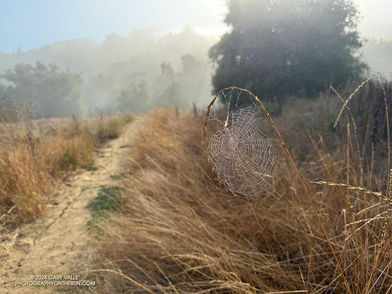
Ingenuity meets Opportunity. Photography by Gary Valle.
Ingenuity meets Opportunity

In their forecast discussion for today, the NWS Los Angeles Oxnard commented, “A long-lasting and extreme heatwave will continue across the region, and especially the interior…” The high temperature was expected to range from 105 to 115 across the interior valleys, mountains and deserts.

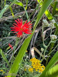
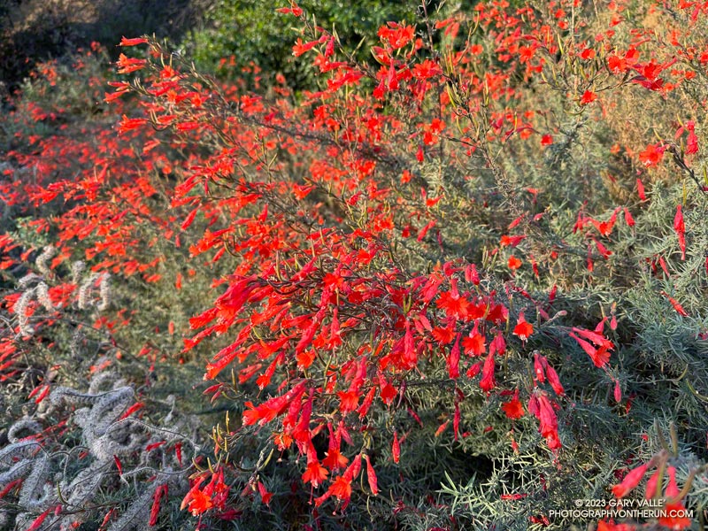
Indian pink, golden yarrow, and California everlasting along the Garapito Trail.
Indian pink, golden yarrow, and California everlasting.

I was doing the Trippet Ranch Loop from the Top of Reseda. The highs on the San Fernando Valley side of the Santa Monica Mountains were expected to be in the 90s. But keep in mind that’s essentially the temperature in the shade. In full sun, the temperature could be 10 to 15 degrees higher. When I reached the Hub, at 7:00 in the morning the in-the-sun temperature was already around 90 degrees.

Nearer the coast, temps were expected to be a little cooler. From the Hub, I could see why. A shallow marine layer had developed along the coast. A couple of miles later, as I neared Trippet Ranch, I descended into a bank of wonderfully cool fog. It wouldn’t last, but I enjoyed the coolness as I continued down to Trippet Ranch and around to the Musch Trail.

I hadn’t run very far on the Musch Trail when I came across a remarkable spider web. The spider had ingeniously bowed a flexible stalk of tall grass to build its web. This solution avoided having to span the web between two stalks. I also wondered if the added tension would make the web more efficient.

At Musch Camp, I topped off my water bottle and then continued working up the trail. Near a still-seeping vernal creek, a speckled-orange Humboldt lily bloomed brightly in a patch of poison oak.

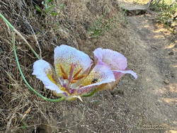
Plummer's mariposa lily along the Garapito Trail. (thumbnail)
Plummer’s mariposa lily along the Garapito Trail

From the camp, the Musch Trail climbs about 400′, in a bit over a mile, to the junction of Eagle Rock and Eagle Springs Fire Roads. A left turn here leads past Eagle Rock to the top of the Garapito Trail.

Other than the Bent Arrow Trail—which remains closed—the Garapito Trail is the “End of Reseda” trail most impacted by our back-to-back wet rain seasons. At times, washouts, debris flows, slides, fallen trees, and vigorously growing chaparral plants have made the trail nearly impassable. The Santa Monica Mountains Task Force worked tirelessly over the Winter to restore the trail.

Of course, the rain that caused all the problems on the Garapito Trail has also resulted in numerous wildflowers along that trail. Today, some of the most prominent were scarlet larkspur, scarlet monkeyflower, Indian pink, and Plummer’s mariposa lily. And, Garapito Creek was still trickling in July!

This high-resolution, interactive, 3-D terrain view shows the Trippet Ranch Loop (yellow). The track of the closed Bent Arrow Trail is shown in red.

Some related posts:
Trippet Ranch Loop, Musch and Garapito Trails – February 2024
Trippet Ranch Loop Plus Temescal Peak and Temescal Lookout
Fogbow Near the Top of Hell Hill in Pt. Mugu State Park

Sullivan Ridge – Will Rogers – Temescal Loop from the Top of Reseda

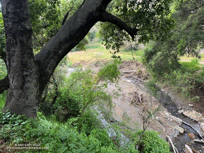
Creek in Rustic Canyon near the bottom of the Josepho Drop Trail.
Creek in Rustic Canyon from near the bottom of the Josepho Drop Trail.

The most popular trail run from the Top of Reseda to Will Rogers State Historic Park takes Fire Road #30 up to the Hub, turns left (east), and then follows the Roger’s Road segment of the Backbone Trail all the way to the Park. Many do the run as a keyhole loop, picking up the Rivas Canyon Trail on the west side of Will Rogers and using that trail to connect to Temescal Canyon. The Temescal Ridge Trail is then used to return to the Hub and Fire Road #30. The run is about 21 miles and gains/loses about 3400′.

There is another — more adventurous — way to do a loop from the Top of Reseda that visits Will Rogers and then returns via the Rivas Canyon and Temescal Ridge Trails. It is about the same length as the regular route and very nearly a complete loop. That’s the route I was doing this morning.

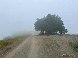
Solitary oak along Sullivan Ridge Fire Road. (thumbnail)
Solitary oak along Sullivan Ridge Fire Road.

Instead of going up to the Hub, I ran east about 2.5 miles on dirt Mulholland to Sullivan Ridge Fire Road and then 3.5 miles down the fire road to “Josepho junction.” There’s a yellow fire gate here, and the road changes from dirt to pavement.

From this point, the goal is to get to the Josepho Drop Trail — a short (0.75-mile) trail that connects Rustic Canyon to the Backbone Trail above the bridge. From the creek to the Backbone Trail, the trail gains about 650′. Much of it is steep, rough, and rubbly.

Years ago, we would run down the private service road from Sullivan Ridge to Camp Josepho, then follow a use trail down the canyon to the Josepho Drop Trail. That hasn’t been an option for some time, but there are other — more interesting — ways to get to the Josepho Drop.

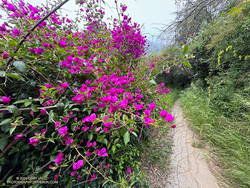
Bougainvillea along the Old Stables Trail. (thumbnail)
Bougainvillea along the Old Stables Trail.

One option is to continue south from Joespho junction on the fire road a tenth of a mile to a single-track trail on the right. On some maps, the trail is labeled the “Old Stables Trail.” Initially, the trail contours below the crest of the ridge but eventually winds down into Rustic Canyon in the area of Murphy Ranch —  an abandoned 1930s compound said to have been a haven for fascists and Nazi sympathizers.

On the way down, there are vestiges of the old compound —  a flourishing Bougainvillea, an overgrown corral, an out-of-place palm.

Near the bottom, another trail/road enters from the left. I turned right here and followed the trail around a corner with a low, graffitied wall, and then down canyon about 130 yards to a trail sign near the creek. The collapsed structure found here must be the ruins of the stables.

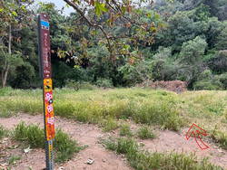
Trail sign marking junction of the Will Rogers and Josepho Drop Trails. (thumbnail)
Trail sign marking junction of the Will Rogers and Josepho Drop Trails.

Finding the junction at the trail sign is the key to staying on route. According to Google Earth, the approximate location is 34.074534°, -118.516381°. The coordinates recorded for the photo are 34° 4′ 28.480000″ N, 118° 30′ 58.720000″ W.

A right-hand (west) turn at the sign crosses the creek and joins the Josepho Drop Trail. I’ve explored the trail south of the sign a few times. In about a half-mile, it leads to the heavily graffitied building that housed the diesel generators for the enclave. Not only is the building graffitied, but everything within reach of a spray can — walls, steps, pavement —  even the trees are painted.

Maps show the “Will Rogers Trail” continuing to Will Rogers, but as the trail sign says, the trail is not maintained. With the rain we’ve had the last couple of years, there’s little doubt the trail is washed out, overgrown, and would be time-consuming to follow.

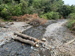
Creek at bottom of Josepho Drop Trail. (thumbnail)
Creek at bottom of Josepho Drop Trail.

I returned up the canyon to the trail sign and followed the Josepho Drop Trail west across the creek . It looked like some trailwork had been done on the bottom part of the trail.

As I worked up the trail, I kept an eye out above. The last time up the Drop, I’d encountered a mountain biker bumping down a steep and very rutted section of the trail. It looked like he was riding down stairs.

When I reached the top of the Drop, I turned left on the Backbone Trail and continued down to Will Roger’s State Park. The loop was completed by following the Rivas Canyon Trail over to Temescal Canyon, then picking up the Temescal Ridge Trail and following it past Skull Rock and Green Mountain to the Hub. From the Hub, Fire Road #30 was followed back to dirt Mulholland and the top of Reseda.

Eucalyptus along the Inspiration Point Loop Trail in Will Rogers State Historic Park. (thumbnail)
Eucalyptus along the Inspiration Point Loop Trail in Will Rogers State Historic Park

I was surprised to find that without the side trip to the Murphy Ranch powerhouse, the Sullivan Ridge variant of the Will Rogers – Temescal Ridge loop is virtually the same length as the “regular” route down the Roger’s Road segment of the Backbone Trail. It just has a bit more elevation gain.

If a shorter run is preferred, another option is to turn right (north) on the Backbone Trail at the top of the Drop and follow that to the Hub. From the Hub, it’s about 2.5 miles to the trailhead at the Top of Reseda. This variant of the trail run works out to about 16.5 miles.

This interactive 3-D terrain view shows my GPS track (yellow) of the Sullivan Ridge – Will Rogers – Temescal Loop from the Top of Reseda. Also shown is my GPS track (red) of the Roger’s Road option on the Backbone Trail.

Here are some photos taken along the way, including some native, non-native, and ornamental flowers.

Some related posts:
Will Rogers – Rivas Canyon – Temescal Canyon Trail Run
Will Rogers – Temescal Loop

Trippet Ranch Loop Plus Temescal Peak and Temescal Lookout

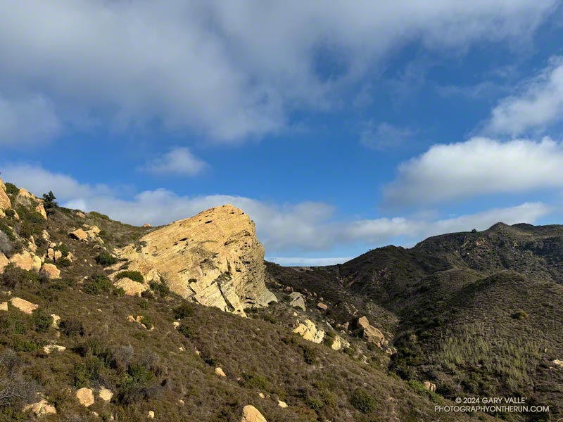
Eagle Rock, Clouds and Sun. Photography by Gary Valle'
Eagle Rock

There are many ways to extend the 12.5-mile Trippet Ranch Loop. A couple of my favorites are the Trippet Ranch Loop Plus Parker Mesa Overlook (18.6 miles) and Trailer Canyon – Santa Ynez Canyon – Trippet Ranch Loop (17.2 miles) trail runs.

Runners descending Cathedral Rocks in Topanga State Park (thumbnail)
Runners descending Cathedral Rocks, near the Hub

Lately, I’ve been doing another option — adding an out and back from the Hub to Temescal Peak and Temescal Lookout and then continuing on the Trippet Ranch Loop from the Hub.

This extends the run to about 16 miles, plus Temescal Peak and Temescal Lookout are excellent viewpoints (video).

That’s the run I did this morning, plus a quick stop at Cathedral Rocks (near the Hub) along the way.

Explore the scenery and terrain on the Trippet Ranch Loop Plus Temescal Peak and Temescal Lookout trail run using our high resolution,  interactive, 3D viewer. The imagery is so detailed, it’s almost like being there! To change the view, use the control on the upper right side of the screen, the CTRL key and your mouse, or touch gestures. Track and placename locations are approximate and subject to errors. Poor weather, and other conditions may make this route unsuitable for this activity.

Some related posts:
Seventh Wettest Water Year Results in Spring-Like Scenery Along L.A. Area Trails
Out and Back Trail Run from the Top of Reseda to Parker Mesa Overlook
Trailer Canyon – Santa Ynez Canyon Trail – Trippet Ranch Loop
Garapito Trail Runs
Popular Trails in Topanga State Park Damaged by Winter Storms

Seventh Wettest Water Year Results in Spring-Like Scenery Along L.A. Area Trails

California fuchsia along Fire Road #30 in Topanga State Park
California fuchsia along Fire Road #30, near the Hub.

Downtown Los Angeles (USC) finished the 2022-2023 Water Year with 31.07 inches of rain, making it the seventh wettest on record in Los Angeles. The rainfall total includes about three inches of rain from former Hurricane Hilary as it moved through Southern California as a rare tropical storm and post-tropical cyclone.

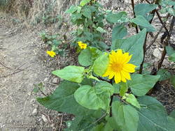
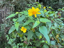
Canyon sunflower blooming out of season along Fire Road #30 in Topanga State Park.
Canyon sunflower blooming out of season along Fire Road #30.

The effects of all that rain can be seen on just about any trail in Southern California. It has resulted in a false Spring in many areas, with greening hills, out-of-season wildflowers, flowing creeks, and profuse growth throughout the area.

This morning, I returned to the Top of Reseda and Topanga State Park to do a variation of the Trippet Ranch Loop and continue exploring and enjoying the unusual conditions.

After running up to the Hub, this variation does an out and back to Temescal Peak and Temescal Lookout. After returning to the Hub, the route continues on Eagle Springs Fire Road down to Trippet Ranch. From Trippet Ranch, it works back to the Top of Reseda using the Musch and Garapito Trails and connecting sections of fire road. This interactive, 3D terrain map shows a GPS track of the trail run.

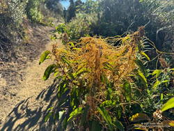
Dodder growing on laurel sumac in October 2023 on the Musch Trail in Topanga State Park.
Dodder growing on laurel sumac on the Musch Trail.

Visiting Temescal Peak and Temescal Lookout increases the run’s mileage from 12.5 miles to 16. On a clear day, the runner is rewarded with far-reaching views of the coast, West L.A., Downtown, and the surrounding mountains.

While most of the roads and trails on this route are frequently used and in decent condition, the Garapito Trail has been overgrown all Summer. As of October 8, it was still overgrown. Some people I’ve encountered on the trail were OK with this, but others haven’t been so happy. If desired, the trail can be bypassed by continuing to the Hub on Eagle Rock Fire Road and retracing your route back to the Top of Reseda.

Here are a few photos (and notes) taken on the run.

Some related posts:
A Second Spring at Ahmanson Ranch
Lake Vista Ridge, the Forest Trail, and September Wildflowers
Looking For Local Impacts of Tropical Storm Hilary

Out and Back Trail Run from the Top of Reseda to Parker Mesa Overlook

Upper Santa Ynez Canyon and Eagle Rock from East Topanga Fire Road

The view from Parker Mesa Overlook was the uniform gray of the inside of a cloud. I was about 30 minutes too early, and the low clouds hadn’t cleared. The Pacific Ocean was out there somewhere.

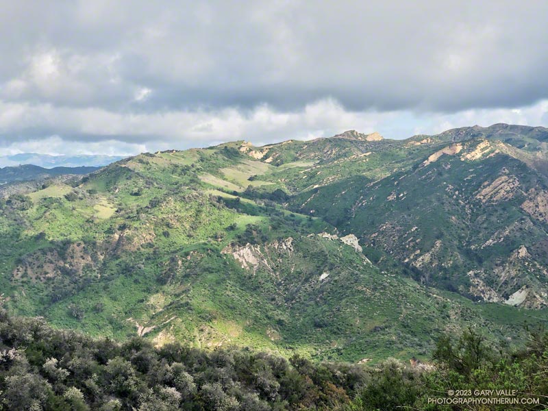
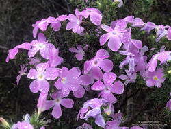
Even so, the run from the Top of Reseda to the Overlook had been excellent. The hills and canyons were painted in a muted palette of sun and shadow. Purple-pink prickly phlox brightened the roadside, and the “Beech-nut Gum” scent of Bigpod Ceoanthus filled the air.

Prickly phlox along East Topanga Fire Road

Fire Road #30, Eagle Springs Fire Road, and East Topanga Fire Road had all been cleared of the sluffs and slides that resulted from January’s rainstorms. Overnight, there had been a little drizzle, but the fire roads hadn’t been muddy at all.

Rather than just retracing my steps, on the way back to the Top of Reseda I opted to do the Musch and Garapito Trails. I had run the Garapito Trail in mid-January but hadn’t been on the Musch Trail since the January deluge.

The Trippet Ranch parking lot had been packed, and several groups appeared to be on their way to Eagle Rock via the Musch Trail. Overall, the trail weathered the storms reasonably well, but one badly eroded section and a couple other spots will need some work.

Section of the Musch Trail damaged in January 2023 rainstorms.
Damaged section of the Musch Trail

While it still had some issues, use of the Garapito Trail had moderated its condition since the last time I was on it. Some brush that had blocked the trail had been removed, and paths were evolving through the collapsed sections of trail. However, some extra care was still required in some spots.

The Bent Arrow Trail was closed, necessitating a return to dirt Mulholland on Fire Road #30, following the same route as had been used at the beginning of the run.

Here is an interactive, 3D terrain view of a GPS track (yellow) to Parker Mesa Overlook from the Top of Reseda. The Bent Arrow Trail is temporarily closed for repair and is shown in red. To change the view, use the control on the upper right side of the screen. Track and placename locations are approximate and subject to errors. Poor weather and other conditions may make this route unsuitable for this activity.

Some related posts: More Malibu Creek Flooding, Looking for Storm Damage in Point Mugu State Park, Popular Trails in Topanga State Park Damaged by Winter Storms

Eagle Rock Silhouette

Silhouetted hikers on Eagle Rock in the Santa Monica Mountains

The photograph of Eagle Rock is from this morning’s meandering trail run to Temescal Peak, Temescal Lookout, Eagle Rock, and the Garapito Trail in Topanga State Park.

All of these viewpoints have sweeping views of the Santa Monica Mountains, Los Angeles Basin, and surrounding mountains.

Temescal Lookout (Peak 2036) is the site of a bygone fire lookout station. It’s located just west of Temescal Ridge Fire Road, about a mile south of the Backbone Trail junction and a half-mile north of the Trailer Canyon Fire Road junction. It’s shown on the USGS Calabasas topo map from 1944. Vestiges of the lookout are all that remain.

Some related posts: Downtown Los Angeles and San Jacinto Peak; Trippet Ranch Loop Plus Temescal Peak; Eagle Rock – Topanga State Park; Will Rogers – Rivas Canyon – Temescal Canyon Trail Run