April 26, 2023 Update. As it turns out, the shiny, new bridge on the Crags Road Trail that made it easy to cross Malibu Creek was not washed away! According to the Malibu Creek Docents, the bridge was designed to be portable, and was removed and stored before this Winter’s rain. It is expected to be reinstalled when the threat of flooding is over — which should be soon.
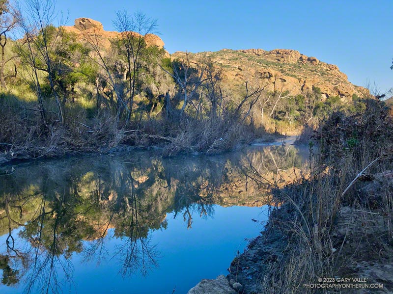
I was just a couple of miles into an extended version of the Bulldog Loop. The temperature was in the mid-30s, and once again, I was having to cross Malibu Creek on a makeshift bridge of wobbly limbs and debris.
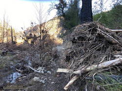
Flood debris on the Crags Road Trail
The flood was the result of a series of three increasingly wet storms between December 30 and January 10. During that period, the Malibu Canyon RAWS recorded about 13 inches of rain. In the last storm of the series, 6 inches of rain was recorded in about 33 hours.
The flooding along the Crags Road Trail from the Forest Trail junction to the M*A*S*H site was similar to the February 2017 and December 2021 events. In the January 2023 event, more debris was deposited on the trail, and sections of the trail were obliterated. That stretch of trail is popular, and a new use trail is already taking shape.
Rainfall and runoff were even higher in Santa Barbara and Ventura Counties. The Rose Valley RAWS recorded over 22 inches of rain for the three storms. According to preliminary streamflow data, the Ventura River Near Ventura reached a new record stage height of 25.42 feet on January 9. The Sespe Creek Near Fillmore gage malfunctioned at the peak flow but reached at least 20.38 feet.
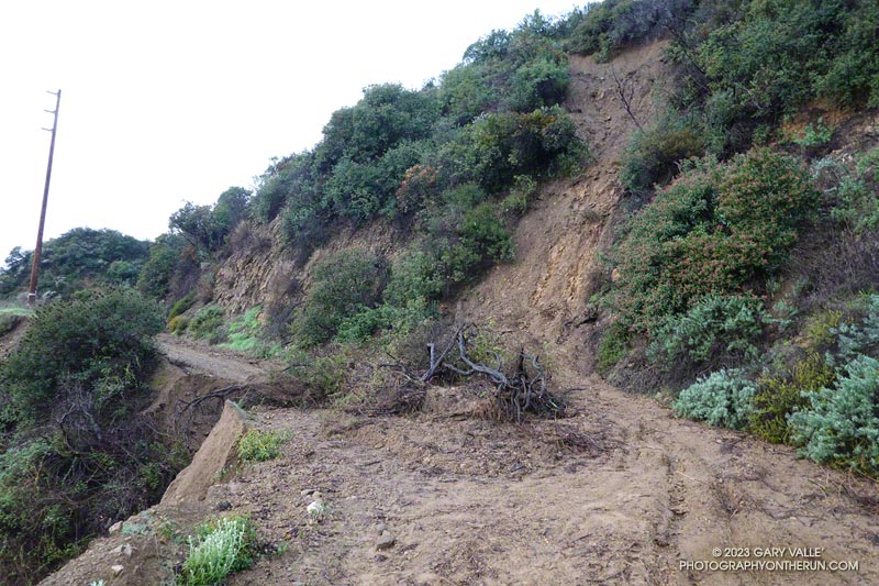
Several popular trails and fire roads in Topanga State Park have been damaged by the cumulative effects of Winter 2022-2023 rainstorms.
Since December 1, 2022, the Topanga Remote Automated Weather Station (RAWS) has recorded nearly 16 inches of rain. The most rainfall occurred January 9-10, when about 5.4 inches was measured.
On Sunday, January 15, I did an exploratory trail run from the Top of Reseda that took me through some popular areas of the Park. This included Fire Road #30, the Hub, Temescal Peak, Temescal Lookout, Temescal Ridge Fire Road, Eagle Springs Fire Road, Eagle Rock Fire Road, the Garapito Trail, and the Bent Arrow Trail.
There were numerous mudslides on the fire roads. The larger slides were on Fire Road #30 below the Hub and Temescal Ridge Fire Road between the Backbone Trail junction and Temescal Lookout. There was also significant roadbed and shoulder erosion in places. At the time, all were passable on foot.
The Garapito Trail was blocked in two places on the upper part of the trail. One problem was from a sluff of soil and brush sliding onto the trail. The other was from the collapse of a section of trail. There were additional sluffs, limbs, and washouts on the trail that were passable at the time.
Update February 5, 2023. The Bent Arrow Trail is closed. Fire Road #30, Eagle Springs Fire Road, and East Topanga Fire Road to Parker Mesa Overlook had all been cleared. The Musch Trail was eroded in spots but OK. Use of the Garapito Trail has moderated its condition. Some brush had been cleared and paths have evolved through the sections of collapsed trail. Extra care is required in some spots.
Other trails and fire roads in Topanga State Park likely had similar impacts. I would expect, like last year, sections of the Santa Ynez Trail lower in the canyon to be washed out.
La Ninas are fickle beasts, and particularly in a time of climate change, the existence of La Nina conditions in the equatorial Pacific is no guarantee of a dry rain season in Southern California.
According to preliminary rainfall data, from December 1, 2022, to January 16, 2023, Downtown Los Angeles (USC) recorded 11.01 inches of rain. This was 77% of the normal rainfall for an entire year.
This brings the Rain Year total precipitation for Los Angeles up to 13.38 inches — the sixth wettest for the date going back to 1877 — and 94% of the normal ANNUAL rainfall.
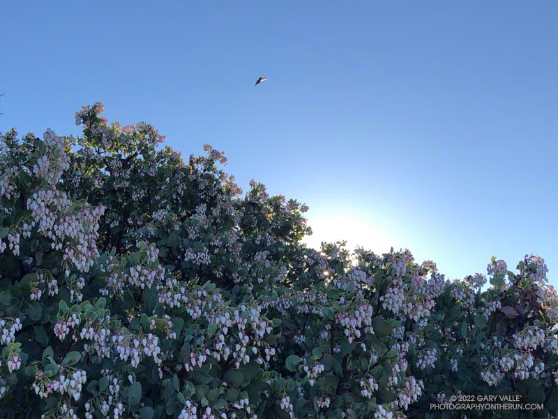
From a hummingbird perspective, it was the perfect place to spend a cold night.
The big berry manzanita was situated on the spine of a north-south oriented ridge near Topanga Lookout. In that location, a bird might benefit from the warmth of both the setting and rising sun.
In addition, the bush’s thicket of stiff branches afforded some protection from predators, and the multitude of nectar-rich blossoms would provide a badly needed boost of wake-up energy.
The temperature was warmer now, but it had been near freezing at the Cold Canyon trailhead when I started the Topanga Lookout Ridge loop. It had been cold enough that I had jogged the steeper sections of Calabasas Peak fire road, just to ward off the chill.
Humans are funny that way — a small drop in body temperature can be life-threatening. How in the world can a diminutive hummingbird, whose caloric needs require it to feed almost constantly, survive a long, cold Winter night?
Research reveals that hummingbirds accomplish this feat by reducing their body temperature and metabolic rate. This physiological state — called torpor — dramatically reduces their energy requirements.
This particular manzanita apparently receives a lot of 5-star reviews, and at the time I passed, was occupied by several buzzing birds.
The forecast for the Los Angeles area (Saturday, December 10) was for a chance of rain in the afternoon, with rain developing overnight and continuing into Sunday morning. There was also a slight chance of light rain or drizzle in the Santa Monica Mountains in the morning.
It was overcast in the West Valley as I drove to the trailhead, and I wondered if my run would be dank and drizzly. But as I drove up Reseda Blvd. toward Marvin Braude Mulholland Gateway Park, I was surprised to find patches of blue sky overhead.
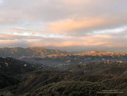
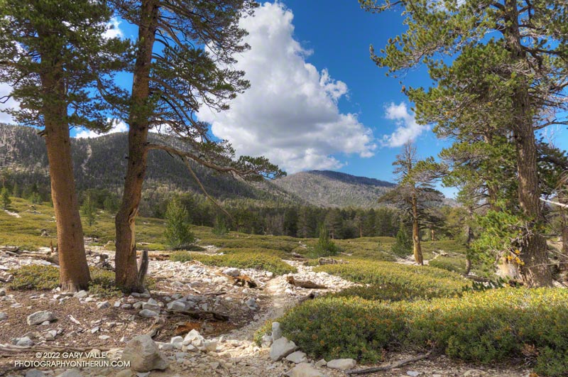
Hondo Canyon, Topanga Lookout, and Henry Ridge from the top of Fire Road 30.
I started the run a little before 7:00 a.m. and headed up the connecting single-track trail to dirt Mulholland and Fire Road 30. Many runs from the Top of Reseda start this way, and I turned onto Fire Road 30 and continued up to the Hub — about 2.5 miles from the trailhead.
For the first couple of miles, I wasn’t sure how long a run I would do or where I was headed. But as I neared the Hub, I had to make a decision. To a large extent, a decision that depended on the weather.
What had been partly cloudy skies had coalesced into a layer of clouds that just touched the top of the highest peaks. I’d been thinking about doing an out-and-back to High Point (Goat Peak), but if the weather continued to deteriorate, the only view I would see from the peak would be the interior of a cloud. I finally decided to give it a go and hope the peak didn’t get socked in with clouds and fog.
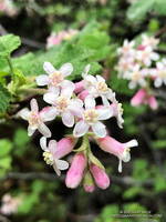
Chaparral currant
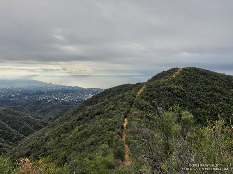
Turning left at the Hub onto the Temescal Ridge Fire Road segment of the Backbone Trail, I ran about a half-mile to where the Backbone Trail forks left off the fire road and becomes a single-track trail. This is the popular Rogers Road segment of the Backbone Trail that eventually ends at Will Rogers Historic State Park.
From Temescal Ridge Fire Road, it’s about 4.25 miles on the Backbone Trail to the unsigned junction with the High Point use trail. It’s on the right and easy to miss. The turnoff is about a half-mile before “The Oak Tree” landmark on the Backbone Trail.
The High Point trail is an unofficial, unmaintained path but is usually in decent shape. There are a couple of short, steep, loose sections on the way to the peak. Nothing is signed, and some side paths diverge from the main trail.
Summit of High Point (Goat Peak)
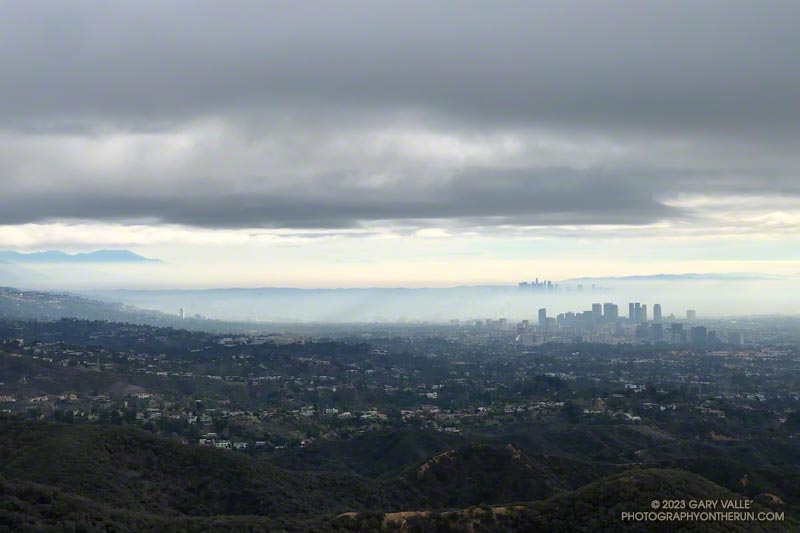
When I reached High Point’s summit, the weather was holding but looked more threatening. Even so, the view was excellent. Panning from east to west underneath the ceiling of clouds, the view included the San Gabriels, Downtown, West L.A., the South Bay, Santa Monica, Palos Verdes Peninsula, Santa Monica Bay, and Catalina.
There were a couple of rogue sprinkles on the way back to the Top of Reseda, but the rain held off in the West Valley until late in the day.
Here is an interactive, 3D terrain view of the High Point (Goat Peak) Out and Back from the Top of Reseda. The map can be zoomed, tilted, rotated, and panned using the navigation control on the right. Track and placename locations are approximate and subject to errors. Poor weather and other conditions may make this route unsuitable for this activity.
I wondered what the hikers would think when they reached this part of the Dollar Lake Trail.
A few minutes before, we had all reached the junction of the Dollar Lake and Dry Lake Trails at the same time. They hadn’t done the peak before and were debating which trail to take. When I mentioned that the Dollar Lake Trail is the shorter route to the summit, that’s the route they chose.
I guessed there might be a few choice words directed my way. About a half-mile beyond the junction, there is a long switchback on the Dollar Lake Trail that seems to never end. It’s about twice as long as any switchback on the Dry Lake Trail or Sky High Trail. With the mountain at your back, it takes the disbelieving hiker farther and farther away from their goal. How could it possibly be the shortest way to the summit?
But it is. The Dollar Lake Trail route is shorter — by about two miles. Following are the estimated mileages from the South Fork Trailhead to Gorgonio’s summit via the Dollar Lake and Dry Lake routes*:
My GPS tracks – Dollar: 9.8 Dry: 11.5 Difference: 1.7
Tom Harrison Maps – Dollar: 10.0 Dry: 12.0 Difference: 2.0
*The Dollar Lake route uses the South Fork, Dollar Lake, Divide, and Summit Trails. The Dry Lake route uses the South Fork, Dry Lake, Sky High, and Summit Trails.
The combined route — Dollar up and Dry down — is one of the best mountain trail runs in Southern California. It’s a favorite, and the route I was doing today.
This morning the sky was mostly clear, and the temperature was mild. Later in the day, there was a chance of a thunderstorm, but I expected to be off the exposed trails higher on the mountain well before thunderstorms had a chance to build.
The first cumulus clouds popped up over the mountain around 10:00 a.m. An hour later — as I was crossing the summit plateau — the clouds were more extensive but with little vertical development.
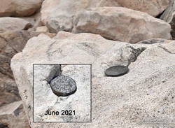
Defaced survey marker on the summit of San Gorgonio Mountain.
There were only a few people in the summit area. Some were on the west summit and some on the east. The twin summits are about 80 feet apart and nearly at the same elevation. Oddly, someone has defaced the survey marker on the west peak since the last time I was there — June 2021. With clouds all around, and 12 miles to go, I snapped a few photos and headed down.
I only saw one group of hikers on the Sky High Trail. They were working up the switchbacks at a good clip and would probably make the summit in an hour or so. Hopefully, the weather would hold for them!
It wasn’t until I was between the C-47 memorial and Mineshaft Saddle that I heard the first rumbles of thunder somewhere in the distance to the east or northeast.
As I continued down the mountain, I occasionally heard thunder in the distance but nothing nearby. There were some sizable cells to the east, but the weather behaved itself. At least where I was. I later heard it dumped at Onyx Summit, and flash flooding was reported at Joshua Tree.
For me, the weather was nearly ideal. Mild temperatures, light winds, and picturesque, sun-shielding clouds. It was short sleeves and shorts up and down. But on another day, it might not have worked out that way.