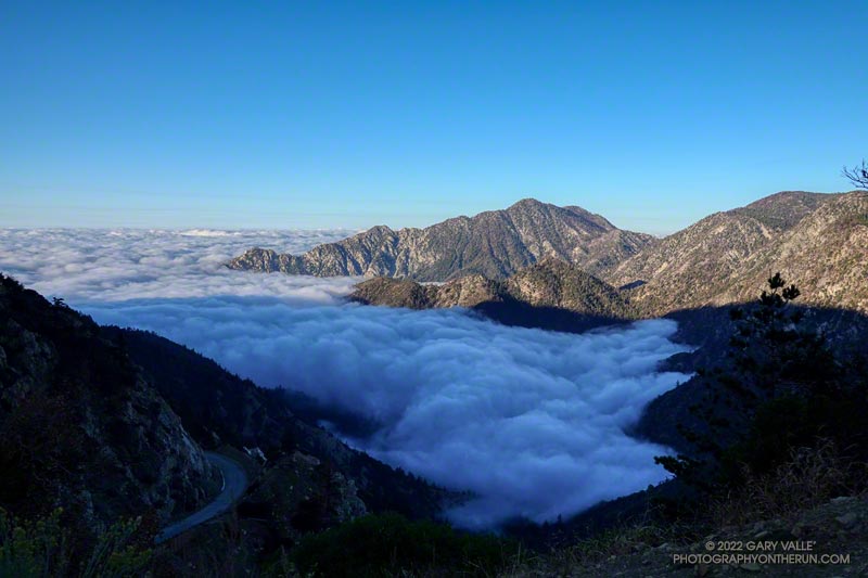
The clouds were associated with a front that stalled to the north of Los Angeles, resulting in some surprising and substantial rainfall totals in Santa Barbara and San Luis Obispo Counties. No measurable rain was reported in Los Angeles County by the NWS.
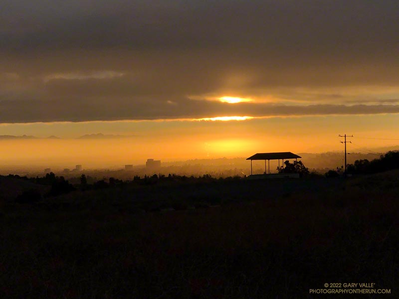
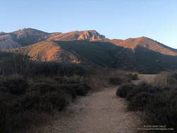
From an early morning run at Ahmanson Ranch (Upper Las Virgenes Canyon Open Space Preserve) on September 20th.
After weeks of dealing with one heatwave after another it was a strange sensation. I was cold. I had on an extra shirt and sleeves, but the slopes of Mt. Islip were deep in shadow and the wind was gusting to 20 mph. The thermometer on my pack read 41 degrees, but the “feels like” temperature had to be in the 30s.
I was in the first mile of an out and back trail run from Islip Saddle to Mt. Baden-Powell. A San Gabriels classic, the route gains (and loses) about 3800′ over 16.5 miles on the PCT.
This morning I was doing the basic out and back, but Mt. Hawkins, Throop Peak and Mt. Burnham are easy peaks that can done along the way. Mt Islip is is a bit more of a detour, but can also be added to the route.
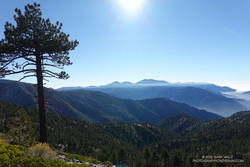
Mt. Baldy and environs from the PCT, between Mt. Hawkins and Throop Peak.
It’s also possible to start the out and back at the Windy Gap Trailhead (5836′) in the Crystal Lake Recreation Area. The distance to Baden-Powell is about the same, but the lower trailhead adds about 800′ of gain.
As I chugged up one of the initial steep sections, I thought about what it must have been like for this year’s participants in the AC100. This year, because the AC100 was an out and back from Wrightwood to Shortcut Saddle, runners got to do this tough segment after running more than 75 miles!
Here is an interactive, 3D terrain view of the out and back from Islip Saddle to Mt. Baden-Powell. The map can be zoomed, tilted, rotated, and panned using the navigation control on the right. Track and placename locations are approximate and subject to errors. Poor weather, and other conditions may make this route unsuitable for this activity.
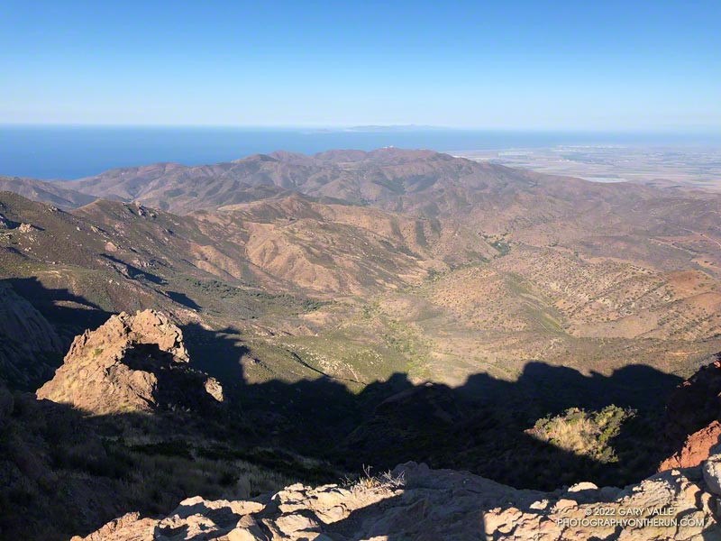
Sycamore Canyon, Laguna Peak, and the Channel Islands from Boney Mountain.
Update on August 17, 2022. As of today, my West Hills weather station has recorded a high of 100 degrees or higher for 12 consecutive days.
It was another triple-digit Sunday. Once again the high in the west San Fernando Valley was forecast to hit one-hundred and something. I’d hope to beat most of the heat by getting an early start and running where it wouldn’t be quite so hot.
I hadn’t been able to get out to Stoney Point Saturday morning, so was looking to do a little easy climbing as part of my Sunday run. I was considering three options: Topanga Lookout Ridge, Strawberry Peak, and Boney Mountain.
Boney Mountain from connector trail above Danielson Road
While none of the three are difficult by rock climbing standards, all require the use of handholds and footholds, good route-finding skills, and good judgment. It is entirely possible to fall on any of them.
The Topanga Lookout Ridge loop is about 8.5 miles long with 2000′ of gain/loss. There are a few short climbing segments on the crest of the ridge that can be accessed from the use trail.
The basic loop up the Western Ridge of Boney Mountain and over Tri Peaks to the Backbone Trail and back to Wendy Drive is about 15.5 miles long with 3400′ of gain/loss. It is longer and more difficult than the Topanga Lookout Ridge loop.
The loop over the top of Strawberry Peak from the Colby Canyon Trailhead is about 12 miles long with 3100′ of gain/loss. There is some class 2/3 climbing on the west side of Strawberry, and it is essential to stay on route. There have been a number of rescues of those attempting to climb the peak.
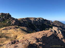
View along the top of Boney Mountain’s western escarpment.
It was a few minutes past six when I pushed the start button on my Garmin and jogged down the hill from the trailhead at Wendy Drive. I’d run about a half-mile when I heard another runner behind me. We chatted for a couple minutes and I learned he was preparing to do the Wonderland Trail around Rainier and then the Bear 100.
We were both going to the same area, but by different routes. I was climbing Boney Mountain’s Western Ridge and then working over to the Backbone Trail. He was doing an out and back to Sandstone Peak via Upper Sycamore, Sycamore Canyon, and the Backbone Trail. We would run into each other again at the Danielson Multi-Use Area on the way back to Wendy Drive.
Morning shadows on Boney Mountain’s western escarpment
As always, the climb up the Western Ridge (Mountaineer’s Route) was enjoyable. The rock climber in me always wants to check out potential lines, but this morning there wasn’t much time for that. The longer it took to get up Boney, the hotter it was going to be later in the run!
The temperature was already in the eighties when I reached the Backbone Trail. Before the fires and floods of past decade, the run down the Chamberlain segment of the Backbone Trail was one of the better running descents in the Santa Monica Mountains. From the Tri Peaks Trail junction to the Old Boney Trail it drops about 1500′ over three miles. Today, except for the stretch of trail near Chamberlain Rock, it was nearly back to its original form.
Holly-leaved cherries along the Chamberlain segment of the Backbone Trail
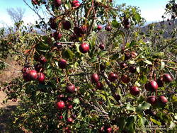
As in other areas of the Santa Monica Mountains, the effect of the heavy December rains was evident. The red shanks, and chaparral in general, seemed to be greener. This year there is a bumper crop of holly-leaved cherries, which must make the coyotes happy. Unlike last year, it looks like there should be some Christmas berries this Winter, since a number of Toyon were covered in green berries.
On the way down the Chamberlain Trail I started to fret that the water at Danielson might not be turned on. The water faucets in Sycamore Canyon are usually dependable, but on a run a few years ago the water system was turned off for servicing. Or what if there had been a drought-related water supply issue?
It turned out the water was still on, and I drank a lot of it. The remainder of the run went well, although I was a little surprised that the sensor on my pack recorded temps in the nineties in Sycamore Canyon. I had expected the south-facing stretch on Danielson road to be torrid, but a nice breeze kept the temperature tolerable.
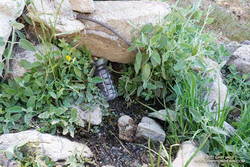
A couple leaving the camp saw that I was trying to collect drips of water from the nearly dry spring. I told them I was OK, and had water in my pack — I was just using a makeshift cup to get a couple of mouthfuls of cool water from the slowly dripping spring.
I had stopped at Sheep Camp (8300′) in the Chumash Wilderness, in Los Padres National Forest. The day was warm and the spring at the camp is usually a refreshing stop on the way back to Mt. Pinos and the trailhead at the Chula Vista parking area. Earlier, I’d talked to a runner training for the Kodiak 100, and he’d mentioned that the spring was a key source of water for his dog.
Trying to collect a mouthful of water from the spring at Sheep Camp
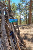
In recent years water has sometimes been an issue at the Sheep Camp spring. In July 2018, six out of the past seven Rain Years had been dry, and the flow of the spring was just a trickle. But it had been enough to slowly refill my Camelbak (TM) and get me down to Lily Camp (6600′) and back. Not so today.
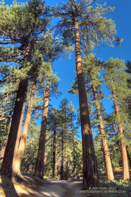
Even without the water, Sheep Camp is a pleasant and worthwhile detour. Old growth pines tower above and bright yellow sneezeweed and other flowers are sprinkled about the forest floor. In the Spring large patches of iris bloom in the damp areas.
Today, I was returning from Mt. Abel, after having done Mt. Pinos, Sawmill Mountain, and Grouse Mountain on the way to Mt. Abel from the Chula Vista parking area. Here is an elevation profile of the run/hike. The cumulative elevation gain on the 15.5 mile run is about 3700′.
North summit of Grouse Mountain.
The short side trips to the summits of Mt. Pinos and Sawmill require almost no extra effort, and the view from Sawmill — if it’s not too smoky or hazy — is wide-ranging. Getting to the twin summits of Grouse takes a bit more work, but it’s fun to follow the short use trail up the south summit and then to wander through the pines to the slightly taller north summit.
The descent that follows — down the use trail from Grouse and then down the Vincent Tumamait Trail to Puerto del Suelo, drops about 1000′ in elevation over 1.6 miles. This, of course, must be repaid on the way back!
When you reach the road at the end of the Vincent Tumamait Trail, you might remark, “But there’s no trail to Abel!” And you would be correct. It’s fairly straightforward to trek up through the forest from the road, though care is required due to the debris from forestry work in the area.
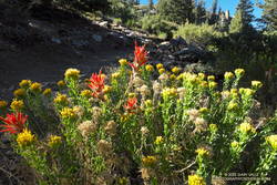
Rabbitbrush and paintbrush along the Vincent Tumamait Trail, northwest of Mt. Pinos.
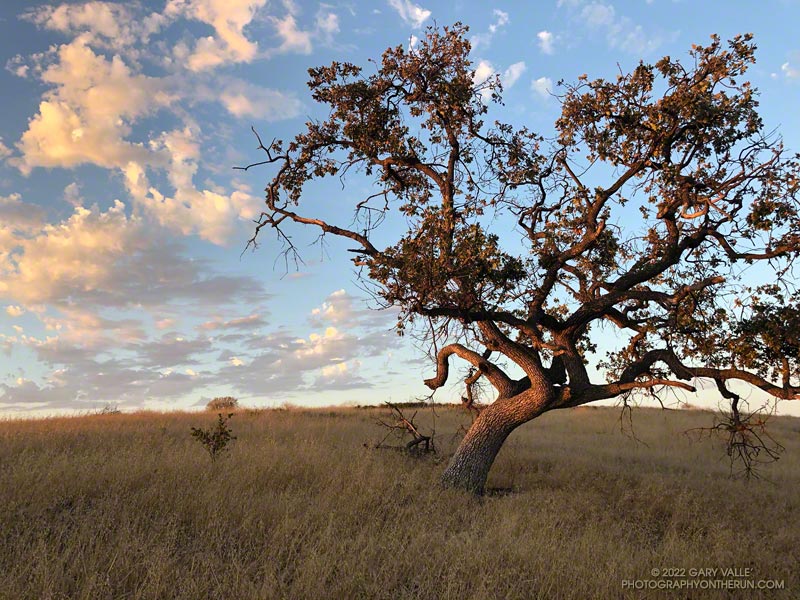
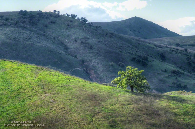
Revitalized by December’s copious rainfall and temperatures in the mid-80s in February, this valley oak at Ahmanson Ranch has produced a lush crown of new leaves.
(Officially named Upper Las Virgenes Canyon Open Space Preserve, most users refer to the open space area as Ahmanson Ranch, or simply, Ahmanson.)