Category Archives: weather|southern california

Crest of the Angeles

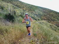
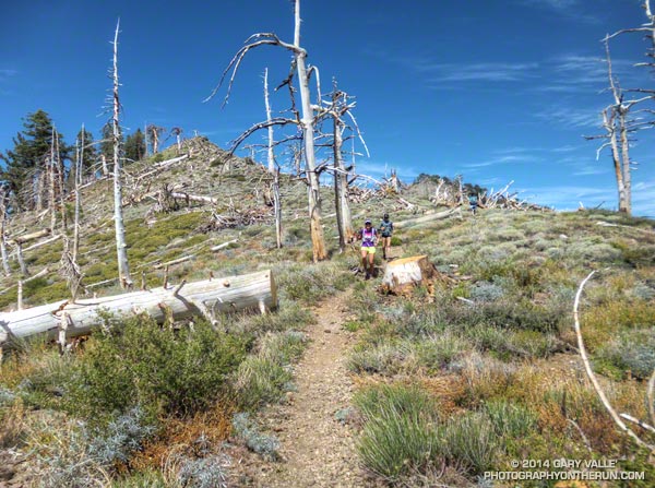
Runners on the PCT west of Mt. Hawkins

Between Vincent Gap and Islip Saddle the Pacific Crest Trail follows one of the most scenic stretches of trail in Southern California, skirting the summit of Mt. Baden-Powell (9399′) and passing Mt. Burnham, Throop Peak and Mt. Hawkins before leaving the crest at Windy Gap (7600′), just east of Mt. Islip. It has long been a favorite of hikers and runners.

There are several ways this classic stretch of trail can be incorporated into a run or hike. Today we were doing the segment as part of a training run for the 2014 Angeles Crest 100 Mile Endurance Run. The AC100 starts at Wrightwood, California; then using parts of the PCT, Silver Moccasin, Gabrielino and several other trails, the AC100 works west through the peaks and canyons of the San Gabriel Mountains to Loma Alta Park near JPL.
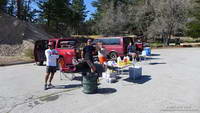


The AC100 training runs, organized and supported by AC100 co-director Hal Winton, cover the 100 mile course in approximately 25 mile segments. With the help of AC100 Racebook editor/photographer Larry Gassan and a host of generous volunteers, “Uncle Hal” makes it happen and always seem to be where runners need him to be. Today’s training run was the fourth, and last, of the 2014 series.
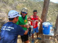


Just a few days before we’d done the third AC100 training run from Chantry Flats to the finish at Loma Alta Park. Beginning at Mile 75 of the AC100, this difficult segment includes the Wintercreek and Idlehour climbs and some of the most technical trails on the course. As a result of the drought water wasn’t easily accessible at Idlehour Creek, so Hal and 2013 AC100 finishers Dave Tan and Rainer Schultz were at the “Cape of Good Hope” on Mt. Lowe fire road to provide much-needed water to thirsty runners.
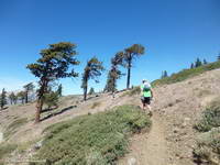


This morning’s run from Wrightwood had begun with an ascent of the Acorn Trail — a climb that matches foot for foot the 2650′ elevation gain of the PCT up Baden-Powell and is every bit as strenuous. After climbing up the Acorn Trail we’d joined the PCT and followed it along spectacular Blue Ridge, past the top of Mountain High Ski Resort, to Angeles Crest Highway at Inspiration Point. From there it had taken less than an hour to reach Vincent Gap and Hal’s aid station. A quick stop to refill my hydration pack and I was back on the PCT and chugging up Baden-Powell.

Far too many switchbacks later, far too much of the peak remained. I was maxed out and doing my best to keep up with Skye’s brisk pace. Finally we rounded a corner and I could see the Wally Waldron tree a 150 yards ahead. Just 150′ in elevation from the top of Baden-Powell, the gnarled and weathered limber pine — estimated to be 1500 years old — stands sentinel at the juncture of Mt. Baden-Powell’s summit trail and the PCT.
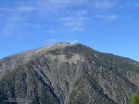


I’d pushed the pace up the Acorn and Baden-Powell climbs and now was paying the penalty. My legs were toast. When I’d reached the Wally Waldron tree the decision whether or not to go to the summit of baden-Powell had been very easy — one trail led steeply up and the other gently down. As we turned west onto the PCT I told Skye I was going to have to take it easy for a bit. She had already started to pick up the pace and it didn’t take long for her to disappear into the forest on the trail ahead.

After a while I glanced at my watch and was surprised to see that it was already 3:00 pm. Because of the long shuttle to Wrightwood we hadn’t started running until 9:20 am. After skirting Baden-Powell, I’d run past Mt. Burnham, struggled up to the shoulder of Throop Peak and now was near Mt. Hawkins. Here, the beginning of the descent to Windy Gap is marked by a prominent Jeffrey pine that has been struck by lightning.
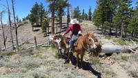


West of Mt. Hawkins the Pacific Crest Trail passes through a ghost forest of large trees burned in the 2002 Curve Fire. Recovery in the area is progressing well, and amid the dead trees are numerous pine and fir saplings. I ran this segment in mid-January and again at the end of May. Sometime between the two runs a large number of the dead trees had been blown down. During the May run it had been necessary to crawl over or work around a log jam of fallen trees. The trees likely blew down during a storm on February 28th, when Chilao recorded winds as high as 91 mph. That wasn’t necessary today, thanks to the expert trail work of PCTA volunteer Ray Drasher and his equine crew.
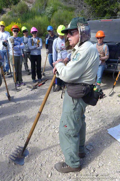


Most of the trail maintenance in the San Gabriels (and elsewhere) is now done by volunteers. One of the requirements to run in the AC100 is eight hours of trail work. This year AC100 entrants have worked on the Idlehour and Wintercreek Trails and will be working on the Gabrielino Trail below Newcomb Saddle in a couple of weeks. For more info about Hal and volunteering see the April 2014 issue of the VOLUNTEER TODAY newsletter (PDF).

Once through the ghost forest on Mt. Hawkins, it didn’t take long to get down to Little Jimmy Spring and from there over to Islip Saddle. It had been another tough training week in a series of tough training weeks. As I descended the final short switchbacks to the Islip Saddle parking area on Highway 2 I tried to visualize what it would be like on race day. How would I feel compared to today? Would I make here before noon? How hot would it be on Cooper Canyon? Would the cutoff at Cloudburst be a problem? Would I make it to Horse Flats before dark? On what trail would I be when sun rose for the second time during the run? All these and many other questions would be answered in just a few weeks.
Trippet Ranch Wildflower Run

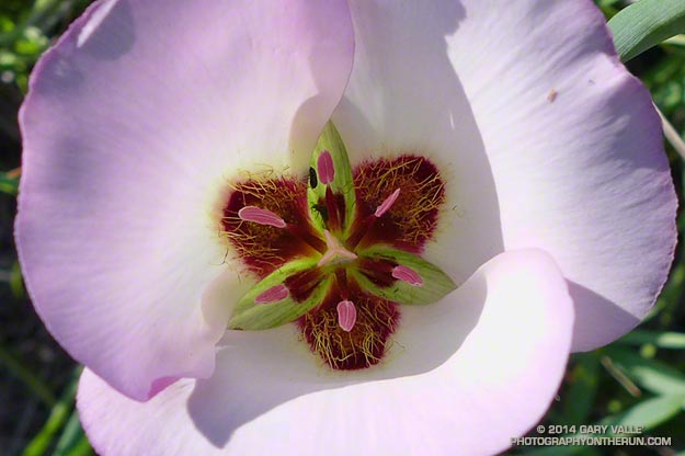
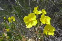
Symmetry of mariposa lily

For most of the Winter it looked like there would be very few wildflowers this Spring in the Santa Monica Mountains. The drought had taken its toll, and many chaparral plants were in survival mode. Most were desiccated, some were diseased and a few were dying. Winter-bloomers such as wishbone bush, prickly phlox, shooting star, big berry manzanita and big pod Ceanothus were practically nonexistent.

Then it rained. From February 26 to March 2 many areas of Southern California recorded more than four inches of rain. Los Angeles had the most rain over five days since 2010. Although the rain didn’t end the drought, it did end one of the driest periods in 100 years, and brought crucial relief to the plants and animals.

The response to the rain was virtually immediate and has continued throughout the Spring. The rain resuscitated the vegetation and wildlife and revived habitats. Now, when you run, hike or ride a trail in the Santa Monica Mountains, if you don’t look too closely, the growth and flowering of plants in the chaparral appears to be almost normal.

Rainfall in the area has been only about 40% of normal, but in a few cases plants have responded as if the rain season had been much wetter. Plants fill more than geographical niches in an ecosystem. They fill sub-seasonal niches of rainfall, temperature, sunlight and other parameters. If rainfall occurs at an optimum time or in an optimum pattern for a plant, its benefits can be amplified. The large number of Catalina mariposa lily and wild hyacinth blooming this Spring demonstrate this effect. The growth of non-native black mustard is also more robust and widespread than might have been expected.

Here’s a slideshow of some of the wildflowers currently blooming in the Topanga State Park area of the Santa Monica Mountains. All of the photographs are from this morning’s 12-something mile loop to Trippet Ranch from the “end of Reseda” at Marvin Braude Mulholland Gateway Park.

Some related posts: Garapito Trail Runs, The Heavenly Ranch in the Hills

Leona Divide 50 Mile 2014

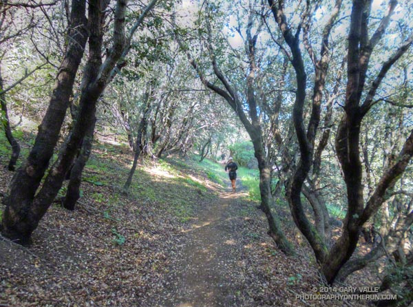
Running through oaks on the PCT during the Leona Divide 50 mile ultrarun.

Last June when she heard the news that the Powerhouse Fire was burning in the Leona Divide area of Angeles National Forest ultra RD Keira Henninger must have shaken her head. Just a couple of weeks before the Springs Fire had burned a large part of her Ray Miller 50M/50K course in Pt. Mugu State Park — now the Leona Divide 50M/50K course was on fire.

Some organizers might have just canceled these events outright, but applying the expertise and persistence that makes her a successful ultrarunner and race director Keira put together alternatives that were every bit as enjoyable, challenging and well-organized as the original events. The Ray Miller 50/50 was transformed into the highly regarded Sean O’Brien 50/50 and the Leona Divide 50/50 course was rerouted.


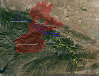
Then just two weeks before the event the Leona Divide courses had to be rerouted a second time because of an unexpected change in the Powerhouse Fire closure area. Not only were the 50M and 50K routes changed, the starting point for the race was changed from Lake Hughes to Green Valley. Here’s an overview of the Leona Divide area that shows this year’s course (yellow), last year’s course (purple), and the perimeter of the Powerhouse Fire (red). Note that the Powerhouse Fire closure area (as of April 25, 2014) is much larger than the area burned by the fire.

If you didn’t know its history, the 2014 Leona Divide 50/50 was so well organized you might have thought it always started in Green Valley. This year all but a few miles of the 50M and 50K courses were run on the Pacific Crest Trail. Here’s an overview of the 2014 course and an interactive Cesium browser View that can be zoomed, panned, tilted and rotated.


An elevation profile for the 50 mile course was created in SportTracks. Elevations were corrected using NED 1/3 arc second DEMs. Using a conservative smoothing setting (55) the elevation gain/loss for the 2014 course was estimated be around 8500′ and for the 2013 course around 7500′. According to the GPS tracks the 2014 course was about 0.5 mile longer than the 2013 course.

The weather for the race could not have been more different than the torrid conditions experienced last year. The NWS issued a winter weather advisory for the Los Angeles County mountains Friday evening that extended into Saturday. Just before the start of the race my car’s thermometer read 37 degrees. It had rained overnight and a few miles into the race, small patches of melting snow were mixed in with the purple chia along the trail. Temps were cool all day, ranging from from the low 40s up into the 50s. Winds were blustery, but were generally less than the 25-35 mph that had been expected.

All things considered, the weather was great for running. If you had any doubt the role heat acclimatization can play in finishing an ultra, you need only compare this year’s six DNFs in the 50 mile to last year’s 42!


My favorite part of the course was the “last minute” addition from Bouquet Canyon to Aqua Dulce. I previewed this segment last week, and in today’s cool, blue sky – puffy cloud conditions it was outstanding. Because I HAD to make the cut-offs, I didn’t take many photos, but here are a few photos taken along the way.

Many thanks to Keira Henninger, the numerous volunteers, the community of Green Valley, the Pacific Crest Trail Association and the Mojave Ranger District for helping to make this event happen. Congratulations to Jay Bonthius, the overall winner in his first 50 mile race, and Kami Semick who took first among the women and placed 10th overall. In the 50K Eric Lynch just edged Chris Glibert for the win in the Mens division and Margaret Nelsen was first in the Women’s division. For more info, photos and all the results see the Leona Divide 50/50 web site and Facebook page.

Some related posts: Up and Over Sierra Pelona Ridge, Back on Leona Divide

Back on Leona Divide

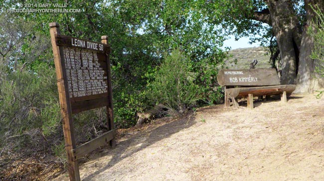
Bob Kimmerly bench on the Pacific Crest Trail

It had been “a while” since I’d run this segment of the Pacific Crest Trail. This photo will give you an idea of just how long. That year January was warm and dry and none of the local creeks had enough water to kayak, so Gary Gunder and I were doing a lot of running. Two of the most enjoyable runs we did were the segments of the PCT from Pine Canyon Rd to Lake Hughes Road (FS 7N05) and Lake Hughes Road to Sierra Highway in Aqua Dulce. These PCT segments are closely associated with the Leona Divide — both the race and geographic feature — and include some of the fastest single track trail in Southern California.


Today I was back in the Leona Divide neighborhood and getting reacquainted with the stretch of the PCT between Bouquet Canyon Road and San Francisquito Canyon Road. Bouquet Canyon Road is the turnaround point for the 2014 Leona Divide 50 mile and this 13 mile stretch — done on the way out and the way back — makes up most of the single track trail on the course.** With the Leona Divide 50/50 coming up April 26 a number of runners (Karl, Dave #1, Matt, Dave #2 and others) were also out on the trail.

This section of the PCT is about as non-technical as a single track trail can be. It’s generally in very good shape with surprisingly few rocks, technical obstacles, or steep hills to slow you down. Most of the trail is in chaparral, out in the open, and on sun-facing slopes. The elevation ranges from about 3300′ to 4300′. Trail mileages are close to what the trail signs advertise — about 7 miles between San Francisquito Canyon Road and Spunky Edison Road, and 6 miles between Spunky Edison Road and the 50 mile turnaround at Bouquet Canyon Road.


The weather could not have been better for today’s run. Some shaded sections of trail were lush and green from recent rains and in places yellow bush poppy, blue Phacelia, purple chia, scarlet bugler and other wildflowers bloomed along the trail. The midday temp was in the 60s at the Grass Mountain RAWS (just off the PCT near Leona Divide Road). The temps at this weather station were in the 80s during last year’s Leona Divide 50/50 when “in the sun” temps reached over 100 degrees.

In today’s cool conditions it was a long run kind of day, and the 26 miles were about as enjoyable as a longer trail run can be.

**Note: The 50M and 50K courses have been rerouted. See the Leona Divide 50/50 web site and the related post Up and Over Sierra Pelona Ridge.

Pattern Change

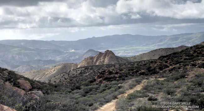
View northwest from Rocky Peak Road near its junction with the Chumash Trail

There seems to have been a change to a more seasonable weather pattern in California. It looks like Spring weather will prevail over the next week or so, with some opportunities for showers or a little rain in Southern California and more significant amounts of precipitation in Central and Northern California.

Even if it was a little cool and blustery, the unsettled weather was perfect for today’s run on the Chumash Trail and Rocky Peak Road!

Backbone Ultra 2014

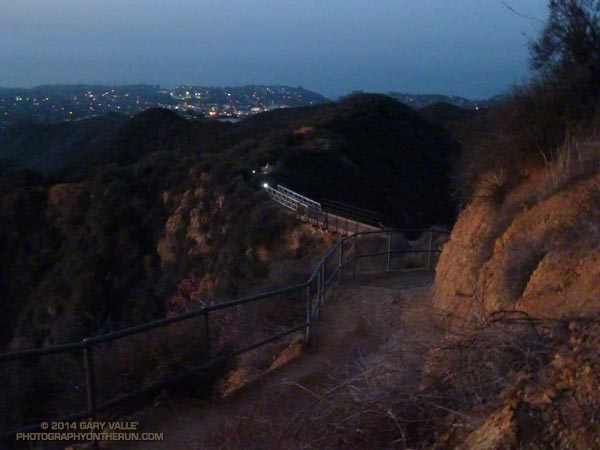
Headlamps of runners in the Coyote Backbone Trail Ultra on the Rogers Road Trail.

Runners on the Backbone Trail at About Mile 2 of the Backbone Ultra

Last year I ran the Coyote Backbone Trail Ultra and enjoyed everything about it — the trails and scenery, the runners, the volunteers, the approach of the organizers, and just the general vibe of the event. The Backbone Ultra team did a superb job, and as far as I know there no major issues. Nobody got lost or seriously injured. The runners and volunteers were respectful to the environment and everyone I talked to had a great time participating in the event.

Still I wondered. Because of its complex logistics and administrative requirements would there be a 2nd annual Backbone Trail Ultra? Then on August 22, a little after lunchtime, the news was posted — there would be a “Game 2!” I needn’t have worried, RDs Howard Cohen and Mike Epler were on it!


On March 15 at 6:07 a.m., at Will Rogers State Park, under the light of a 99% full moon, myself and 46 other runners in the first start group began our Backbone Trail adventure.

In the weeks leading up to the Backbone Ultra I’d been closely watching the weather. Two weeks prior to the run the area was inundated by the most rain in 48 hours since 2011. There had been some concern that heavy rainfall in the Springs Fire burn area in Pt. Mugu State Park would severely damage trails. That didn’t happen.


Ten days out it looked like an upper level low might affect the area. That didn’t happen. As the event neared, the forecast trended drier and warmer — much warmer. Friday as I was getting my drop bag ready, @NWSLosAngeles tweeted “Still expecting high temps to approach records at some locations this weekend” along with this graphic. That did happen!

On Saturday, the first day of the event, Santa Ana winds pushed the temperature at noon at Malibu & Piuma to 86 degrees — 16 degrees higher than during last year’s event! Note that this is the temperature in a ventilated, white-painted box several feet off the ground. The “in the sun” temperature, near the ground, on south-facing slopes was likely in the 90’s. Even more telling, the temperature at Circle X was in the 80’s from noon until 5:00 p.m. and at midnight was 74 degrees!


It must have been something to be on the Backbone Trail at its highpoint near Sandstone Peak in the middle of the night, with 100 mile visibility, a full moon and warm weather. I am really bummed to have missed that! I didn’t get to experience it because I had some kind of heat-related issue and dropped at the Encinal Aid Station at around mile 43.

This is the first time heat has kept me from completing a run or race. So what was the problem? Probably a combination of things. I don’t think I was under-trained or over-trained. I hadn’t just had the flu or a cold. My taper seemed OK. It wasn’t under-hydration, at least not in the first 30 miles. My best guess is that anticipating the heat, I drank too much early on. Not having trained much in the heat this year probably also contributed. It’s hard to know for sure. Sometimes it’s just not your day!

Although I didn’t get to the finish this year, I still very much enjoyed the miles I did run on the Backbone Trail. Here’s a slideshow of some images taken along the way.

It is a tribute to the many people that helped support the Backbone Trail Ultra that — by a substantial margin — there were more volunteers than runners! Many thanks to:

– RDs Howard Cohen & Mike Epler and their team Fred & Lauren Case, Willie Roland, Tres Smith, Erica Gratton and Dan Dicke.
– California State Parks and the National Park Service.
– Trippet Aid: Rene Canizales and the New Basin Blues.
– Stunt Aid: Alison Chavez/Amy Chavez and the SoCal Coyotes.
– Piuma Aid: Art Byrne and the Trail Runners Club.
– Corral Aid: George Plomarity and Patagonia.
– Kanan Aid: Paul Van Zuyle and his leprechauns.
– Encinal Aid: Bill Kee and wife Paula and the Coyote Cohorts.
– Mishe Mokwa Aid: Manley Klassen and wife Mara and the Coyote Cohorts.
– Sycamore  Aid: Puerto Mauricio and the Coyote Cohorts.
– Finish: Erica Gratton & Janna Williams and the Conejo Valley Trail Runners.
– Breakfast: Luis Escobar, Jerry Gonzales and team.
– Medical: The Josepho Team and Ventura County Search and Rescue.
– HAM radio operators at each of the aid stations and the finish.
– Volunteers at the road crossings at Stunt, Piuma, Malibu Canyon, Latigo Canyon, Encinal Canyon, Mulholland Highway and Yerba Buena times 2.
– Sweeps: Kathy Higgins, Rene Canizales, Erin Chavin & Pedro Martinez, Ken Hughes and Jack Fierstadt.
– All the Course Markers & Safety Patrols.

Some related posts: Backbone Training Run 2014 #1, Backbone Training Run 2014 #2, Run, Lop and Shiver, Backbone Ultra 2013