Boney Mountain’s Western Ridge

Boney Mountain's Western Ridge

From today’s run, hike, scramble and climb of Boney Mountain’s Western Ridge. The rounded pinnacle at the  top of the formation is this one.

Some related posts: Boney Mountain Western Ridge & Loop, Over Boney Mountain to Sandstone Peak and Serrano Valley, Boney Mountain Eclipse Run, Boney Mountain – Serrano Valley Adventure Run, Boney Mountain Views

After the Springs Fire: Checking on the Chamberlain Trail

Rock formations on Boney Mountain from the Chamberlain Trail

It had only been a week since I’d run here, but it was still easy to see recovery in Pt. Mugu State Park was continuing at a steady pace. Along the Hidden Pond, Sin Nombre and Blue Canyon Trails daubs of brilliant green contrasted sharply with the somber tones of black, gray and white left by the Springs Fire.


Hopefully recovery will continue at this pace. Most Southern California fires occur in Autumn, when there is a higher likelihood of rain in the weeks and months following the fire. The Springs Fire started May 2. A late season storm moved through the area May 6, helping firefighters to control the fire. The weather station at Circle X recorded about 0.4 inch of rain that day, but the area might not see that amount of rain again for 6-7 months.

In the coastal mountains the marine layer is also a source of moisture. Many of the area’s plants supplement rainfall by extracting water from the moist air. For example, the scalloped shape and surface of coast live oak leaves, and their spine-toothed margin promote condensation and collection of water. On a foggy day you’ll sometimes see a rain-like pattern on the ground under a live oak tree.


This morning the marine layer was in, and skies were partly to mostly cloudy. This was a good thing. Yesterday (June 1) Pierce College in Woodland Hills set a new high temperature record for the date of 104degF. With the hot weather and low humidity the Powerhouse Fire near Lake Hughes had tripled in size. The switch to an onshore flow would cool temps, increase the humidity, and help firefighters to control that blaze.

Today, in addition to checking on the progress of recovery, I wanted to check on the condition of Chamberlain Trail. The Chamberlain Trail is part of the Backbone Trail and the descent from Boney Mountain one of the best in the Santa Monica Mountains.


Last week, on the way to Serrano Valley, we’d seen that the fire had burned up to trail signs at the junction of the Chamberlain Trail and Old Boney Trail. It had been a close call. Brush at the base of the Chamberlain Trail had been scorched and burned, but the fire had not progressed upslope.

But what you can’t see from the junction is that the fire made a serious run up from Serrano Valley on the south side of Boney Mountain. This can be seen on this Google Earth snapshot of a NASA Landsat Satellite Burn Severity image, but from the image it’s hard to tell if the Chamberlain Trail was overrun or not.

Fortunately only a very short section of the Chamberlain Trail about a 0.4 mile from the Old Boney junction was burned.

Some related posts: A Run Through Pt. Mugu State Park, Springs Fire Burn Severity

Ray Miller 50/50 2013 Notes

A luminous stream of headlamps wound up the switchback above the rocky streambed, the lights defining the movement of a huge and sinuous creature making its way up La Jolla Canyon.

In the darkness a great horned owl greets runners with a questioned, “who-whoo, who-whoo.” Excited runners answer back with cupped hands, “who-whoooo, who-whoooo.” Above, a thick veil of high clouds shrouds the last quarter moon. The clouds will also temper the sun, resulting in nearly ideal race-day weather. The trails are in great shape and there should be some fast times.

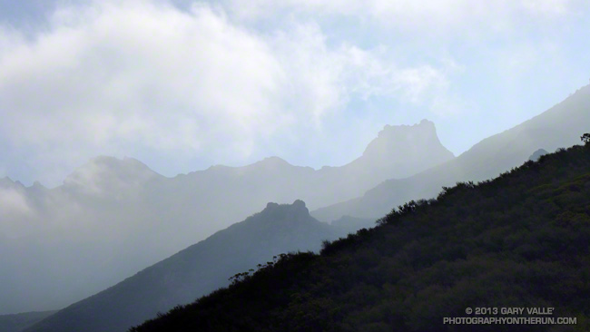
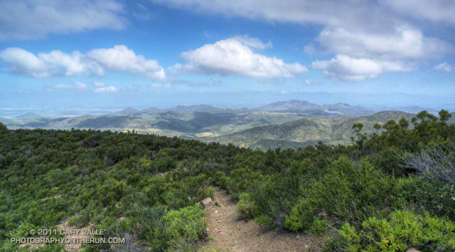
As we round the shoulder of a peak the gray-blue Pacific stretches out to Anacapa and the Channel Islands. The sun is still below the horizon, but the clouds to the east are now illuminated in a startling mix of orange and pink. It is an inspiring start to what will be an  enjoyable run.

Being familiar with an area’s trails is both a pro and a con. The pro is that you know what to expect, but that is also the con. I still had mental scars from the last time I had done the Coyote Trail. The run had been long, the sun scorching and the humidity high. The steep stretch near the top had been an oven. Not today.

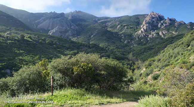
From the top of the Coyote climb there are wide ranging views in every direction. The trail continues north along a roller coaster ridge, past Ranch Center Road, where it becomes the Hidden Pond Trail. Rainfall this season has been well below normal — less than half of normal at Camarillo Airport — and the pond is little more than a damp spot in the brush.

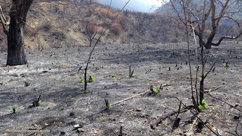
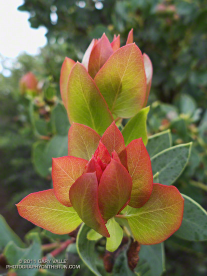
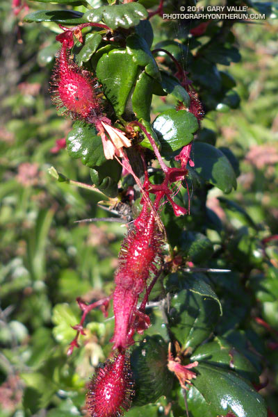
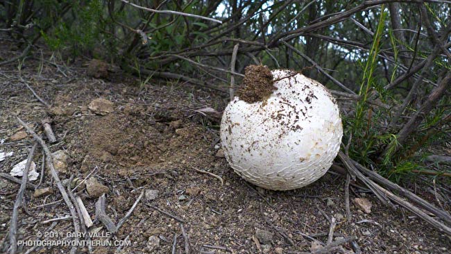
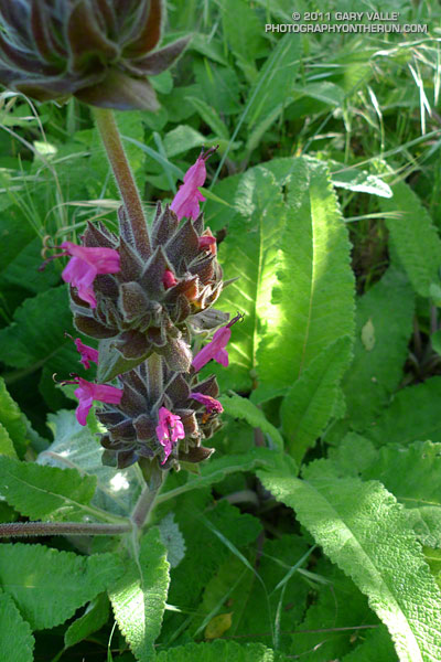
Even so, the signs of spring are everywhere. The white blossoms of Ceanothus highlight the hills, and new grass carpets the open areas. Along the route I see yellow encelia, violet shooting stars, white milkmaids, purple prickly phlox, orange paintbrush and other wildflowers.

Everyone I talk to feels great. Some runners are escaping the cold climes of the Pacific Northwest and Midwest. Some are running their first ultra. There is talk of running shoes, places and races. The miles pass — not effortlessly, but with the right mix of more difficult and easier sections.

A quick stop at the Danielson aid station and I’m back on the trail. It’s a tough climb up the Old Boney Trail to the Chamberlain Trail and the turnoff for the 50 milers. A 100K looms at the end of March and the plan is to do some extra training miles later today. But I also have a 50K in two weeks and decided today’s extra miles should be flat. Deftly passing the 50 mile turn, I wonder if it might have been the better training choice.

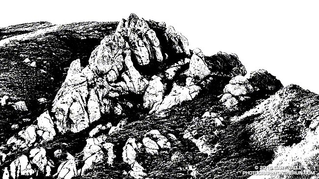
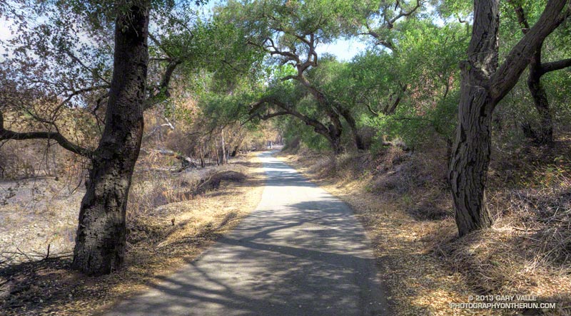
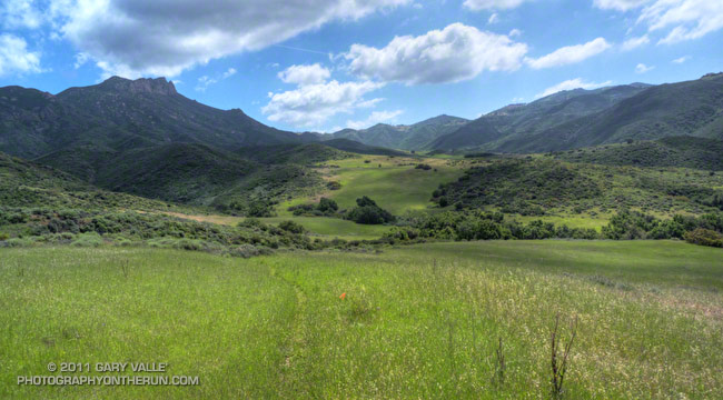
In another 15-20 minutes I start the descent into Serrano Valley. Along with La Jolla Valley, which we traversed earlier in the day, Serrano Valley is one of the scenic jewels of the Santa Monica Mountains and a fantastic place to run.

Despite rain during the week, the creek crossings in Serrano Canyon are dry and the running excellent. In a few minutes I reach the landslide part way through the canyon and not long after that I hear the yells and see the smiles of the crew at the Sycamore Canyon Aid Station. As at all of the other aid stations, the volunteers are super-helpful and make sure I have what I need.

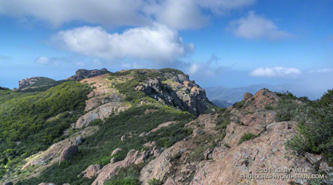
Some races feature one or two particularly long, difficult climbs. The Ray Miller 50K has (depending on how you count them) six climbs ranging from about 500′ in elevation gain to about 1000′ of gain. The 50 mile adds two climbs of 1000′ or more, the big one being the 1800′ climb from Old Boney to Sandstone Peak.

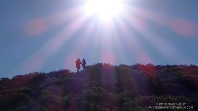
The last climb of the race — from Sycamore Canyon up the Fireline Trail, up the Outlook Fire Road, and then up the beginning of the Ray Miller Trail — is a tough one, gaining about 920′ in 2.3 miles. From the top of the climb the downhill to the finish is the favorite of many, and the hope is always that you will have enough left to run it well!

********

In the 50K Chad Ricklefs of Boulder set a new course record of 3:54:08 and Amanda Hicks’ 4:46:57 edged Meghan Arbogast by 52 seconds. Getting in some snow-free miles Aspen’s Dylan Bowman cranked out a blazing 6:45:08 in the 50 mile, and Amy Sproston — one of several runners from the PNW — flew through the course in 8:38:20.

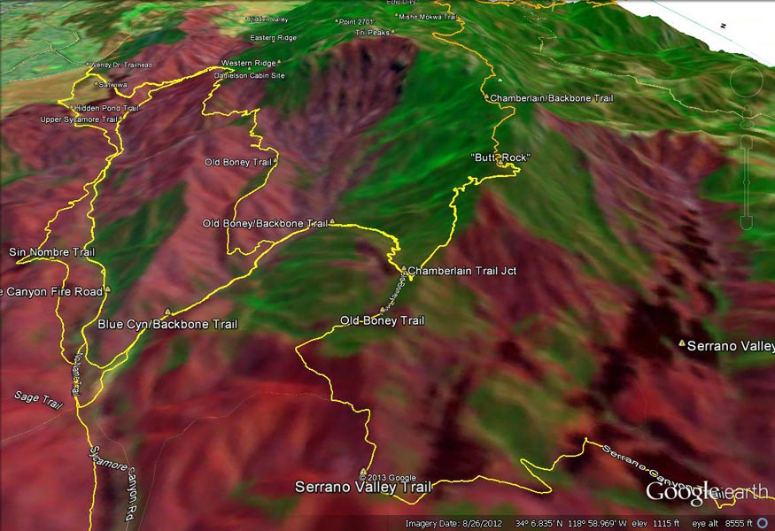
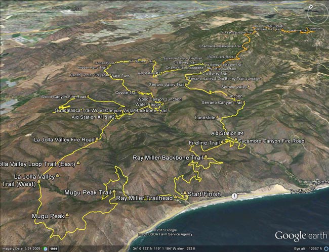
Here’s an interactive, 3D terrain view of the 2013 Ray Miller 50K course, with the 50 mile option marked in orange. Mileages and locations are approximate and based on my 50K GPS track.

Many thanks to R.D. Keira Henninger and her support crew, the great volunteers, the sponsors, and all the runners for an outstanding event! Check the Ray Miller 50/50 web site for additional details and all the results.

Runner’s blogs/web sites: Dylan Bowman, Amy Sproston, Timothy Olson

Some related posts: You Can’t Run Just Part Way Up Serrano Canyon, Serrano Valley from the Chamberlain Trail, Return to Hidden Pond, Coastline From Mugu Peak

Back to Mugu Peak

Hikers nearing the summit of Mugu Peak

The difference in temperature from the bottom of Sycamore Canyon to the top of the Wood Canyon Vista Trail had to be at least 30 degrees. Down on the Sycamore Canyon Fire Road the mud and mud puddles were frozen and I could feel the cold through my sleeves, shirts and gloves. In the sun near Overlook Fire Road it felt like it was a toasty 60-something degrees.

Trying to get in some less hilly miles, Craig and I were doing the run from the Wendy Drive trailhead to Mugu Peak. There would be no personal bests today. We both had long races coming up and this run would be combined with another (shorter) run tomorrow.

It’s tough to find a 20+ mile trail run in the Los Angeles area that doesn’t have much elevation gain. Wendy Drive to Mugu Peak has about 2700′ of gain. Bypassing the peak would reduce the total to around 2300′. One flatter option in this area might be Wendy Drive to PCH and back with a mile or so side trip up Wood Canyon.

Some related posts: Wendy Drive – Mugu Peak Challenge, Serrano Valley from Wendy Drive, Serrano Valley – La Jolla Valley Scenic Loop

Wow, What a Great Day for a Trail Run!

Ridge near summit of Tri Peaks

The Wendy Dr. trailhead in Newbury Park is a gateway to some of the most scenic and spectacular trail runs in the Santa Monica Mountains. Runs, hikes and rides on the extensive and diverse network of trails can range from a few minutes, to many miles and hours.

Today my run was of the “few hours” variety. The weather in Pt. Mugu State Park was perfect for a longer run — partly cloudy, light winds, and the temperatures ranged from the high 40s in the morning to the high 60s midday.

La Nina or El Nino, rain seasons as wet as the 2010-11 season are relatively rare. The wet weather produces a cascade of effects, resulting in conditions that might not be seen again for years. Streams that had not run for years were flowing; numerous wildflowers were blooming; the chaparral and other plant communities, and their inhabitants, were flourishing. I did not want to miss anything.

With that thought in mind, my route took me up and over Boney Mountain and Tri Peaks to the Backbone Trail, and then down the Chamberlain Trail and Old Boney Trail to the Serrano Valley Trail. After running through resplendent Serrano Valley, I continued down Serrano Canyon, crossing the creek 15 times, all the while trying to avoid the lush growth of poison oak along the trail. Even the miles returning up Sycamore Canyon were enjoyable, and involved a few stream crossings. The Upper Sycamore Trail and Danielson Road led back to Satwiwa and the trailhead.

On this particular day it was as fine a trail run as I have done, and probably the most scenic loop I’ve done in the Santa Monica Mountains.

Some related posts: Western Rim of Boney Mountain, Conejo Valley Sun and Boney Mountain Clouds

Here are a few additional photographs from the run:


Boney Mountain NW Ridge


Chamberlain Trail


Serrano Valley Loop Trail
                  
Fuchsia Flowered Gooseberry


Puffball


Hummingbird sage