Category Archives: nature|wildfire

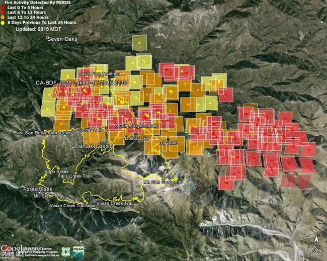
Lake Fire MODIS Fire Detections

Lake Fire MODIS Fire Detections

MODIS Fire Detections from June 19. See links below for most recent image

Updated 07/05/15 12:30 p.m. PDT. Added Lake Fire  perimeter from GEOMAC timestamped 07/03/15 2335.

The following Google Earth images of MODIS 1km fire detections gives a general idea of the extent of Lake Fire in the San Gorgonio Mountain area of San Bernardino National Forest. The image includes the most recent fire perimeter available from GEOMAC at the time the graphic was created:

Perimeter only timestamped July 3, 2015 at 2335.
Perimeter only timestamped July 1, 2015 at 2324.
Perimeter only timestamped June 28, 2015 at 0200.
Perimeter only timestamped June 25, 2015 at 2356.

June 28, 2015 at 1:45 p.m. PDTJune 26, 2015 at 6:15 a.m. PDTJune 25, 2015 at 6:45 a.m. PDTJune 24, 2015 at 9:00 a.m. PDTJune 23, 2015 at 6:15 a.m. PDTJune 22, 2015 at 7:30 a.m. PDTJune 21, 2015 at 1:15 p.m. PDTJune 19, 2015 at 1:45 p.m. PDTJune 19, 2015 at 7:15 a.m. PDT

For more information see the Lake Fire incident page on InciWeb. As of July 5 8:00 a.m. the fire was reported to be 31,359 acres in size and 90% contained.

Fire detection KML files were generated by the USDA Forest Service MODIS Active Fire Mapping Program. Some additional place names have been added — locations are approximate.

PLEASE NOTE THE FOLLOWING IMPORTANT INFORMATION FROM THE KML FILES:

CONUS MODIS 1km Fire Detections

This KML displays the MODIS fire detections at a spatial resolution of 1km for the past 12 hours, 12-24 hours and the previous 6 day period. Each 1km MODIS fire detection is depicted as a point representing the centroid of the 1km pixel where the fire is detected. The 1km footprint of the MODIS pixel for each detection is also displayed.

KML file generated by the USDA Forest Service MODIS Active Fire Mapping Program. Please see //activefiremaps.fs.fed.us for additional fire mapping products and information.

Disclaimer: Although these data have been used by the USDA Forest Service, the USDA Forest Service shall not be held liable for improper or incorrect use of the data described and/or contained herein. The information contained in these data is dynamic and is continually updated. It is the responsibility of the data user to use the data appropriately and consistent within the limitations of geospatial data in general and these data in particular. Using the data for other than their intended purpose may yield inaccurate or misleading results. The USDA Forest Service gives no warranty, expressed or implied, as to the accuracy, reliability, or completeness of these data. Although these data have been processed successfully on a computer system at the USDA Forest Service, no warranty expressed or implied is made regarding the utility of the data on another system or for general or scientific purposes, nor shall the act of distribution constitute any such warranty. This disclaimer applies both to individual use of the data and aggregate use with other data. The USDA Forest Service reserves the right to correct, update or modify this data and related materials without notification.

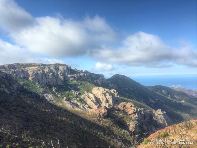
Over Boney Mountain to Sandstone Peak and Serrano Valley

Volcanic rocks along the western escarpment of Boney MOuntain

While running in the Marin Headlands last weekend it occurred to me that it had been at least a couple of months since I’d done a a run in Pt. Mugu State Park. In addition to following the recovery of the area since the May 2013 Springs Fire, I’ve been surveying the effects of the December 2014 flash floods in Sycamore Canyon and its tributaries and hadn’t yet looked to see what happened in Serrano Canyon.

When doing a run in Pt. Mugu State Park I almost always start at the Wendy Drive trailhead. I’ve run from that trailhead to Serrano Valley and Canyon a couple of ways. Both routes connect by way of Satwiwa and Danielson Road to the Old Boney Trail. One follows the Old Boney Trail all the way to the Serrano Valley/Canyon Trail. The other climbs up and over Boney Mountain, eventually connecting to the Backbone Trail, and then descends the Chamberlain Trail and rejoins the Old Boney Trail about a mile east of the Serrano Valley/Canyon Trail.

Today’s run was a variation of option B. After climbing Boney Mountain to Tri Peaks, I ran over to Sandstone Peak using the Tri Peaks and Backbone Trails. Sycamore Canyon Fire Road, Two Foxes Trail and Upper Sycamore Trail were used to get back to Satwiwa and the Wendy Drive trailhead from Serrano Canyon.

Some related posts: Pt. Mugu State Park Debris Flows and Flash Floods, Just Me and the Meadowlarks, After the Springs Fire: A Run Through Pt. Mugu State Park

Strawberry Peak Circuit

North face Strawberry Peak

After being closed 4 1/2 years because of the 2009 Station Fire, Strawberry Peak and the trails comprising the Strawberry Peak loop reopened on May 25, 2014. Today, I finally got a chance to get back on the 15+ mile circuit around Strawberry, and was excited to find that much of it was in better shape than before fire.

Colby Canyon Trail about 0.25 mile from Josephine Saddle
Colby Canyon Trail near Josephine Saddle

I’d heard that COBRA was instrumental in the restoration of the loop, but that is only part of the story. The preservation and maintenance of trails is now largely a community effort — in this case CORBA, Mount Wilson Bicycling Association, Sierra Club, Los Angeles Conservation Corps, National Forest Foundation, REI, Bellfree Contractors, and the BSA all contributed to the effort.

The loop, which is part of the ANFTR/Mt. Disappointment 50K course, circumnavigates Strawberry Peak. The trails that comprise the loop are Josephine Fire Road, Strawberry Spur Trail, Colby Canyon Trail, Strawberry Peak Trail, Gabrielino Trail, and Nature’s Canteen Trail. The loop can be started at Red Box, Colby Canyo, Switzer’s or Clear Creek. I usually start it at Clear Creek so I can refill my hydration pack from the water faucet at the Haramokngna American Indian Cultural Center at Red Box. (Note: Water might not be available here, especially in winter!)

Bear tracks on the Strawberry Peak Trail.
Bear tracks on the Strawberry Peak Trail

Some things to note. The Colby Canyon Trail and the use trail up Strawberry Peak are somewhat hidden from view when you first get to Josephine Saddle. The trails are on the east side of the saddle, and well used. The Gabrielino Trail between Red Box and Switzer’s Picnic area is generally in good shape, but watch out for Poodle-dog bush. The start of Nature’s Canteen Trail is not currently marked. It can be picked up near the top of the paved road that climbs up from Switzer’s, near the telephone/power line poles. It starts on the west side of the road. Most of the trail was overgrown, but it looked like it was being restored, starting at its west end.

I was glad to see that most of the bigcone Douglas-fir on the north side of the peak survived the fire and that Strawberry Potrero was mostly intact. There was a nice set of bear tracks between Strawberry Potrero and the steep section of the Strawberry Peak Trail above the Colby Canyon Trail junction.

Here’s an overview of the Strawberry Peak circuit and an interactive Cesium browser View of the route that can be zoomed, panned, tilted and rotated.

Some related posts: Strawberry Peak Traverse, Blue Skies and Short Sleeves on Strawberry Peak

Three Points Loop: Lemon Lily Along the Mt. Waterman Trail

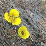
Lemon lily along the Three Points - Mt. Waterman Trail. border=0 src=

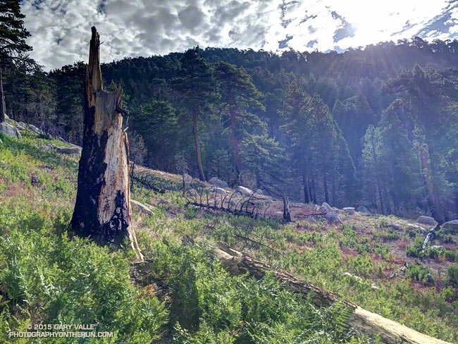
The bright yellow lemon lilies marked the trail. I hopped up on the log, followed it to it’s end, and stepped off. An ill-defined path through thick ferns gradually became more distinct and after a few yards became easier to follow.

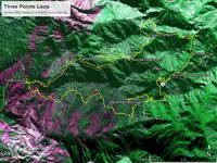
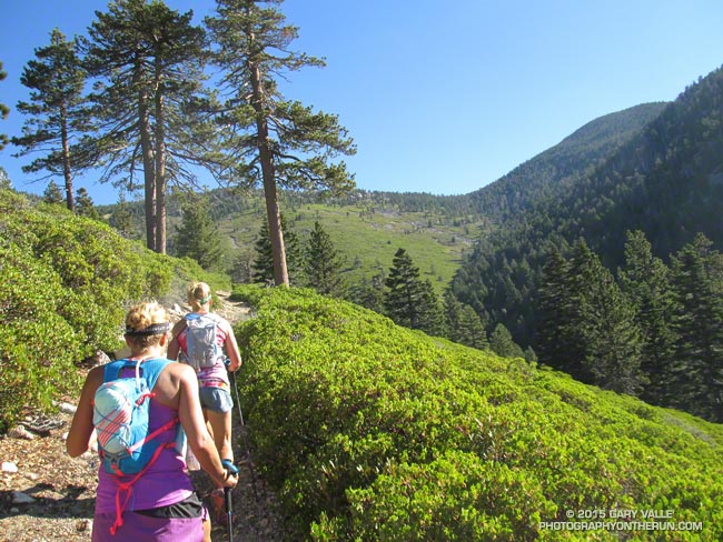
I was on the Three Points – Mt. Waterman Trail (10W04) and doing a counterclockwise circuit of the 20-mile Three Points – Mt. Waterman loop. Counterclockwise because it was a way I could get in some additional training on the Cooper Canyon section of the AC100 course and also check how the south-facing slopes of Mt. Waterman were recovering from the 2009 Station Fire.

The Mt. Waterman Trail is less used than the major trails in the area, such as the PCT and Silver Moccasin Trail.  While it has seen some post-fire maintenance, it has more of the character of a “use trail” — as it did before the Station Fire. The trail is indistinct at times, winding its way around fallen trees and simply defining its route through use.

Some sections of the Mt. Waterman Trail near Three Points were severely burned. Higher up the mountain the fire made long runs up parallel ravines and ridges, creating a patchwork of burned understory and trees. The chaparral in the severely-burned areas appears to be recovering at a more or less normal rate. Of course the trees will take longer to grow, and it was great to see some pine seedlings and incense cedar seedlings have sprouted in the burn area.

The loop joined the AC100 course at Buckhorn Campground, descending the Burkhart Trail and then following the PCT up Cooper Canyon to Cloudburst Summit. From here it is nearly all downhill to Three Points.

Some related posts: Lemon Lily Along the Burkhart Trail, Three Points Loop Twice, Southern Pacific Rattlesnake on the Burkhart Trail, After the Station Fire: Three Points – Mt. Waterman Loop

Watch and Wonder

Crown-sprouting laurel sumac in Pt. Mugu State Park following the Springs Fire.

Trying to understand the behavior of wildlife can be perplexing, particularly when it involves human interaction. Sometimes I just shake my head and wonder what an animal is thinking.

I was in the middle of a 13.5 mile loop in Pt. Mugu State Park, chugging up the Old Boney Trail in the Boney Mountain Wilderness, about 2.5 miles past its junction with the Blue Canyon Trail.


From time to time I’ve been checking the progress of recovery in Springs Fire burn area. Ecologically the area is very complex and as a result of the varied terrain, habitats, vegetation patterns, soil moisture and burn severity, the rate of recovery has also been varied.

The recovery has been further complicated by the season of the fire — just before Summer — and by below average rainfall. Taking into account the unusual circumstances, the sprouting of sycamore, oak, walnut, bay, red shanks, laurel sumac, toyon, mule fat and other plants has been surprisingly robust.

The stretch of the Old Boney Trail I was on now had been severely burned. It was along a steep, rocky canyon that still looked quite barren. Many chaparral plants sprout from surviving roots following a fire, but some plants such as the bigpod Ceanothus in this area must regrow from seeds which sprout following Winter rains.

With the lack of vegetation I was a little surprised to see a California Towhee land on the rocky trail a few feet ahead of me.

The California Towhee lives in the chaparral and I see them frequently on trail runs. It is about as nondescript as a bird can be — gray-brown and little smaller than a dove. They have a peculiar habit of emerging from the brush, scurrying a few feet along a trail just ahead of a hiker or runner, and then darting back into the brush.


Inexplicably this particular bird carried this behavior to the extreme, scampering along the trail just ahead of me for more than 2 minutes, eventually pausing on some rocks along the trail and watching me pass. The time from the first picture of the bird on the trail to the last was 2 minutes 14 seconds. That’s one-Mississippi, two-Mississippi, all the way up to one hundred thirty-four-Mississippi.

I often see towhees in pairs and sometimes with rabbits when both are foraging. The rabbit acts as an early warning device for the bird and vice versa. Did the towhee see me as a really big rabbit? All I could do is watch the bird and wonder.

Some related posts: Chasing Towhees and Other Rainy Day Activities, Coyote Tag, Coyote Tag II, Hawk, Bobcat and Rabbit

Mountain Fire 2013

Mountain Fire perimeter from GEOMAC timestamped 07/28/13 0230

Mountain Fire perimeter from GEOMAC timestamped 07/28/13 0230

Update Wednesday, July 31, 2013 7:00 a.m. As of 6:00 PM yesterday, Inciweb reported the Mountain Fire at 27,531 acres and 100% contained. The fire perimeter has been refined and updated.

Update Saturday, July 27, 2013 3:30 p.m. As of about 2:30 PM today, Inciweb reported the Mountain Fire at 27,531 acres and 98% contained. Full containment is expected by Tuesday, July 30, 2013. The fire perimeter has been refined and updated.

Update Thursday, July 25, 2013 7:00 a.m. As of 6:00 AM today, Inciweb reported the Mountain Fire at 27,531 acres and 92% contained. Full containment is expected by Friday, July 26, 2013. The fire perimeter has been refined and updated.

Update Wednesday, July 24, 2013 8:30 a.m. As of 6:00 AM today, Inciweb reported the Mountain Fire at 27,531 acres and 91% contained. The fire perimeter has been refined and updated.

Update Monday, July 22, 2013 1:15 p.m. Significant rain fell in the area of the Mountain Fire yesterday. The Mt. San Jacinto automated weather station located near Long Valley recorded 2.36 inches of rain. As of 6:00 PM yesterday (July 21), Inciweb reported the Mountain Fire was 68% contained. This morning’s AFMP MODIS fire dectections showed no new detections in the last 24 hours.

Here’s an interactive Cesium browser View the Mountain Fire perimeter from GEOMAC timestamped 07/28/13 0230. This is a 3D view that can be zoomed,rotated and tilted. Placemark locations are approximate. GPS tracks (yellow) of some of the area’s trails have been added. Requires Google Earth plugin.

Previous snapshots (most recent first):

Mountain Fire perimeter from GEOMAC timestamped 07/28/13 0230.

Mountain Fire perimeter from GEOMAC timestamped 07/24/13 1521.

Mountain Fire perimeter from GEOMAC timestamped 07/24/13 0128.

Mountain Fire perimeter from GEOMAC timestamped 07/22/13 2348.

Mountain Fire perimeter from GEOMAC timestamped 07/21/13 2211.

Mountain Fire perimeter from GEOMAC timestamped 07/21/13 0118.

Mountain Fire MODIS fire detections as of 07/21/13 1330 MDT with GEOMAC fire perimeter timestamped 07/21/13 0118.

Mountain Fire MODIS fire detections as of 07/20/13 1430 MDT with GEOMAC fire perimeter timestamped 07/18/13 1402.

Mountain Fire MODIS fire detections as of 07/19/13 1630 MDT with GEOMAC fire perimeter timestamped 07/18/13 1402.

Mountain Fire MODIS fire detections as of 07/19/13 1200 MDT with GEOMAC fire perimeter timestamped 07/18/13 1402.

Mountain Fire MODIS fire detections as of 07/19/13 0730 MDT with GEOMAC fire perimeter timestamped 07/18/13 0000.

Mountain Fire MODIS fire detections as of 07/18/13 2200 MDT with GEOMAC fire perimeter timestamped 07/18/13 0000.

Mountain Fire MODIS fire detections as of 07/18/13 1600 MDT with GEOMAC fire perimeter timestamped 07/18/13 0000.

Mountain Fire MODIS fire detections as of 07/18/13 1430 MDT with GEOMAC fire perimeter timestamped 07/18/13 0000.

MODIS Google Earth fire data is from the USDA Forest Service Remote Sensing Applications Center Active Fire Mapping Program web site. Fire perimeter is the most recently available from the GEOMAC web site at the time this post was updated.

The following additional information was included with the MODIS fire detections KML file:

This KML displays the MODIS fire detections at a spatial resolution of 1km for the past 6 hours, 6-12 hours, 12-24 hours and the previous 6 day period. Each 1km MODIS fire detection is depicted as a point representing the centroid of the 1km pixel where the fire is detected. The 1km footprint of the MODIS pixel for each detection is also displayed.

KML file generated by the USDA Forest Service Active Fire Mapping Program. Please see //activefiremaps.fs.fed.us for additional fire mapping products and information.

Disclaimer: Although these data have been used by the USDA Forest Service, the USDA Forest Service shall not be held liable for improper or incorrect use of the data described and/or contained herein. The information contained in these data is dynamic and is continually updated. This disclaimer applies both to individual use of the data and aggregate use with other data. The USDA Forest Service reserves the right to correct, update or modify this data and related materials without notification.