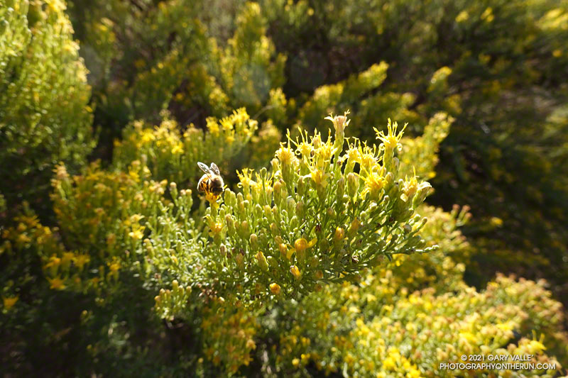
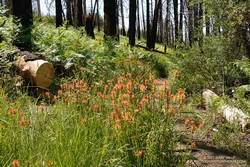
If you’re a bee in the Ahmanson Ranch area, your Fall menu of wildflowers is usually pretty sparse; particularly when the previous rain year has been below normal.
But life has a way of carving out a niche for itself in the toughest of circumstances. One plant you’ll find blooming in the oak grasslands of Ahmanson Ranch following a long, hot, dry summer is goldenbush. In the case of the title photo, it’s Palmer’s goldenbush.
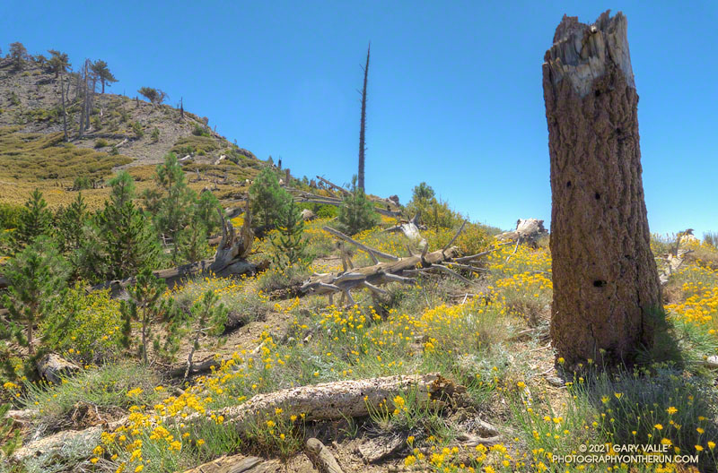
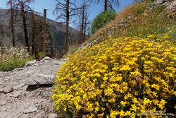
From mid Summer into Fall, the vibrant yellow flowers of rabbitbrush add a refreshing hit of color to the greens, grays, and browns of the San Gabriel Mountains.
The title photo was taken along the PCT, at an elevation of about 8600′, near Mt. Hawkins. The area was burned in the 2002 Curve Fire. Here, and elsewhere in the burn area, new trees — now in their teens — are slowly replacing some of the trees lost in the fire.
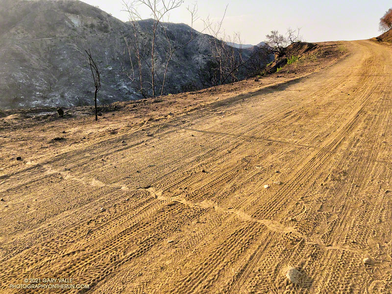
The rattlesnake track above was one of several snake tracks on Eagle Springs Fire Road this morning. This area, which is below Eagle Rock in Topanga State Park, was severely burned in the May 2021 Palisades Fire.
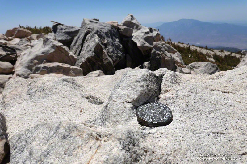
GPS elevation marker on the summit of San Gorgonio Mountain
For the second time this month, I was crossing San Gorgonio’s summit plateau and relieved to be nearing the summit. Most of the uphill was done! My route was the same both times — South Fork, Dollar Lake, Divide, and Summit Trails up; then the Summit Trail, Sky High, Dry Lake, and South Fork Trails down. Here is an interactive, 3D terrain view of the route.
The changes along the South Fork Trail in just two weeks were remarkable to see. It may be Summer in the lowlands, but Spring was still in progress on the mountain. Withered-looking black oaks were now flush with leaves; newly sprouted ferns had unfurled, filling areas of the understory with bright green fronds; colorful wildflowers seemed to have appeared overnight.
Paintbrush and ferns along the South Fork Trail
Over the past two weeks, trailwork continued in the area. The start of South Fork Trail was rerouted for a second time since the 2015 Lake Fire, avoiding a very steep, root-filled section. In a continuing battle, some of the dead trees that had fallen on the trail had been cleared.
Earlier in the month a few small patches of snow could still be seen on the mountain, but today it was nearly gone. Only one tiny, stubborn patch of snow remained on the crest, near the summit. Most of Southern California recorded below average precipitation this past year. According to OntheSnow.com, nearby Snow Summit recorded 121″ total snowfall in the 2020-2021 season. This compares to 110″ in the 2019-2020 season and 143″ in the wet 2018-2019 season. A paltry 36″ was reported in 2017-2018.
As I started up the final rocky hill to the top of San Gorgonio, a small group of hikers scrambled down from the summit. As was the case earlier in the month, the summit area was nearly empty. On an ascent in September 2019 — when wilderness permits were not required — I’d estimated 40-50 people on, or around, Gorgonio’s summit. The restoration of the permits seemed to have made a big difference.
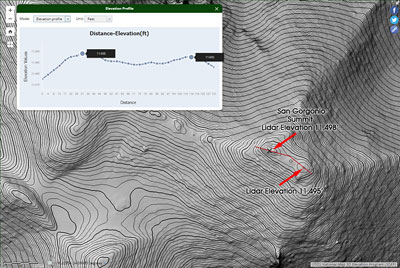
3DEP Lidar data for the top of San Gorgonio Mountain. Click for larger image.
Out of curiosity, following the run I checked the high resolution 3DEP Lidar data for San Gorgonio. It resolves the twin summits, and indicates the official (west) summit is about three feet higher.
In 1989, the “San Bernardino County Surveyors” determined the elevation of San Gorgonio Mountain to be 11,501.6 feet. They placed this small marker on summit. The USGS page Global Positioning Application and Practice discusses some higher precision GPS equipment and survey methods. The elevation of the mountain has probably shifted a little since that measurement was done.
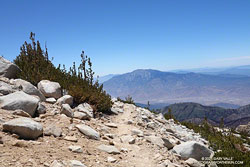
San Jacinto Peak from 11,200′ on the Sky High Trail
After comparing notes with a runner doing the clockwise version of the route I was doing, I headed back down the Summit Trail to its junction with the Sky High Trail.
By their very nature, mountain trails are scenic, but the Sky High Trail is exceptionally so. Running down the Sky High Trail is what running in the mountains is all about. It is spectacular! That doesn’t mean it’s a cakewalk. The trail is rough, rocky, and crosses steep slopes. As with any trail on such terrain, snow on the trail can be a serious issue.
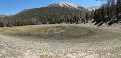
Dry Lake, June 6, 2021
The Sky High Trail ends at Mineshaft Saddle. From here, I picked up the Dry Lake Trail and continued down, down, down. Above Dry Lake, a section of trail pummeled by an avalanche in 2019 had been restored. Continuing, the trail winds down through a complex of glacial moraines above Dry Lake. and then follows the margin of a large moraine down to Dry Lake. The lake dried up early this year, and was already dry on June 6.
Golden yarrow along the Dry Lake Trail
It can be very warm in the afternoon on the Dry Lake Trail between Dry Lake and South Fork Meadows, but today gusty winds kept the temperature moderate. At South Fork Meadows, I gulped down a liter-bottle of water, enjoying the cool shade, and then finished the run.
With vaccinations on the increase and Covid on the decline, it was wonderful to once again be able to visit family.
As we always try to do, Brett and I got in a couple of runs. We usually do at least one run that is new to me, and there are certainly plenty from which to choose in the Bay Area.
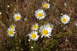
Oxeye Daisy along the Old Ranch Trail
Our first run was on San Bruno Mountain. We’d previously done the Ridge Trail, so this time opted to do a variation of the Summit Loop. The parking lot at the base was was closed, so we started the run using the Old Ranch Road Trail. This was a plus because it added a little mileage and there were a lot of wildflowers along the trail, including monkeyflower, iris, lupine, yellow paintbrush, daisy, and foxglove.
The next day, after watching a spirited youth soccer match, we headed south on 280. On the way, Brett filled me in on the runs he likes to do in Windy Hill Open Space Preserve and Huddart Park. We couldn’t go wrong with either choice but finally decided to save Huddart Park for another day.
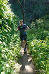
Razorback Ridge Trail
Windy Hill Open Space Preserve is on the northeast-facing slopes of the Santa Cruz Mountains above Portola Valley. We parked near the Alpine Trailhead and ran up the road to the Eagle Trail. Corte Madera Creek was running, but low. Although the grasses along the trail were green and the undergrowth was relatively lush, I suspect the conditions were more like July than May. Open hillsides looked mid-Summer dry and the lichen on the trees was drab and desiccated.
Like the rest of California, the Santa Cruz Mountains have seen well below average precipitation this rain season. One station near Windy Hill, Woodside 3.4 S, recorded only about 28% (12″) of normal precipitation from October 1 to May 19. Another station, Skyline Ridge Preserve, recorded about 41% of normal (16.5″) from October 1 to May 3.
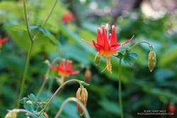
Western columbine
From the Eagle Trail/Private Road we turned onto the Razorback Ridge Trail. According to my Garmin track, the Razorback Ridge Trail gains 1000′ or so over 2.4 miles to its junction with the Lost Trail. It’s all runnable, switch-backing up a thimbleberry and fern-lined trail, shaded by California bay trees.
While the Razorback Ridge Trail continues up another 0.4 miles to Skyline Blvd., we turned right onto the Lost Trail. This trail parallels Skyline as it works in and out of the tributary ravines of Jones Gulch, on its way over to the Hamms Gulch Trail. Along the way there were views across the valley to Mt. Diablo, some 40 miles distant. Western columbine was blooming along the trail, its bright red color complimenting the green theme.
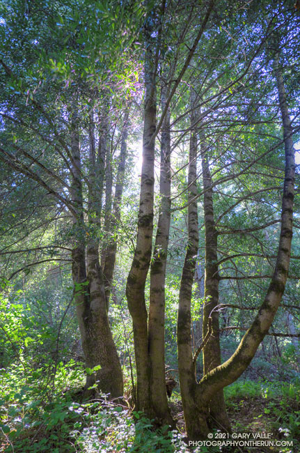
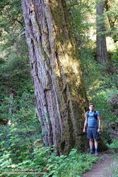
Large Douglas-fir along the Lost Trail
At the top of Jones Gulch, there is an impressive, old-growth Douglas-fir. At chest height, it is about as wide as Brett is tall. This would put its diameter at over 72″ and its circumference at over 220″, suggesting an age in the neighborhood of 350 years.
The run down the Hamms Gulch Trail was as good as the run up Razorback Ridge. Given the weather was nearly perfect for a hike or run, we were surprised to see only a dozen or so people on the trail.
From where we were parked the run worked out to about 8 miles, with about 1500′ of gain/loss. Here is a trail map of the area, and here is an interactive, 3D terrain view of my GPS track of the loop. The interactive map can be zoomed, tilted, rotated, and panned. To change the view, use the control on the upper right side of the screen.
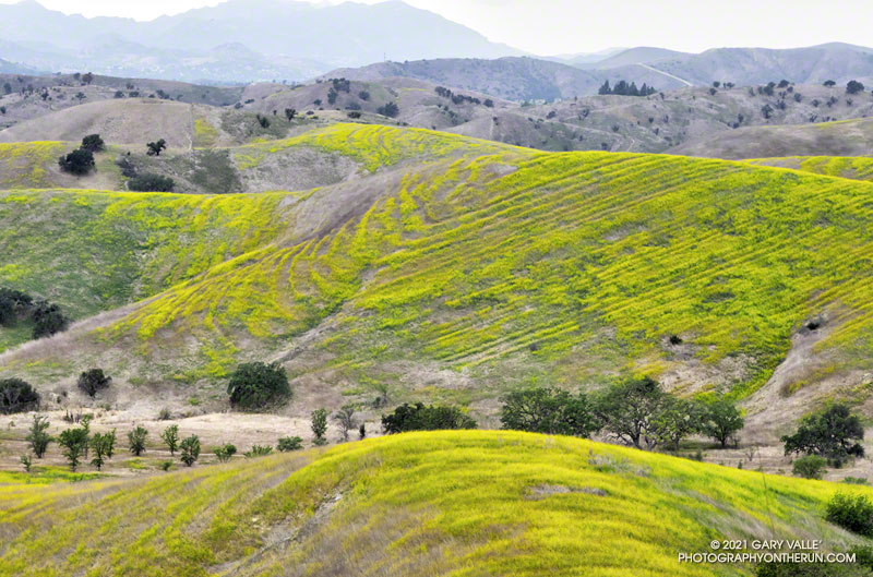
Mustard flowering in Cheeseboro Canyon reveals the underlying structure of a hill.
According to the Dibblee geologic map of the area, the strata are part of the Modelo Formation. And… the Modelo Trail passes directly over the top of the hill.