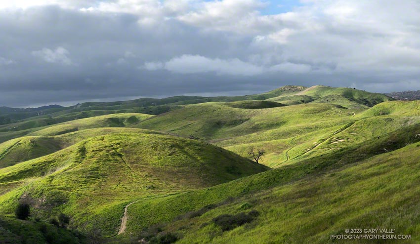
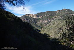
Filtered by clouds, the light of the setting sun highlights the green hills of Ahmanson Ranch (Upper Las Virgenes Canyon Open Space Preserve).

Filtered by clouds, the light of the setting sun highlights the green hills of Ahmanson Ranch (Upper Las Virgenes Canyon Open Space Preserve).
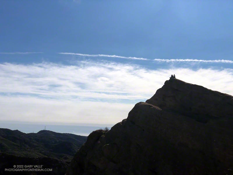
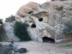
The photograph of Eagle Rock is from this morning’s meandering trail run to Temescal Peak, Temescal Lookout, Eagle Rock, and the Garapito Trail in Topanga State Park.
All of these viewpoints have sweeping views of the Santa Monica Mountains, Los Angeles Basin, and surrounding mountains.
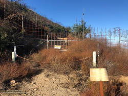
Temescal Lookout (Peak 2036) is the site of a bygone fire lookout station. It’s located just west of Temescal Ridge Fire Road, about a mile south of the Backbone Trail junction and a half-mile north of the Trailer Canyon Fire Road junction. It’s shown on the USGS Calabasas topo map from 1944. Vestiges of the lookout are all that remain.
Some related posts: Downtown Los Angeles and San Jacinto Peak; Trippet Ranch Loop Plus Temescal Peak; Eagle Rock – Topanga State Park; Will Rogers – Rivas Canyon – Temescal Canyon Trail Run
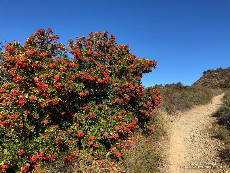
Last November and December there were almost no Toyon bushes in the Santa Monica Mountains with berries. This year the colorful orange-red “Christmas berries” are everywhere.
The heavily-laden bush pictured above (and many others) were along the Rogers Road segment of the Backbone Trail, between Will Rogers State Park and Temescal Ridge Fire Road.
Related post: Looking For Christmas Berries
It was clear and cool when I started up Calabasas Peak fire road from the trailhead on Stunt Road.
Several good trail runs and hikes start here; among them are out and backs to Calabasas Peak and Saddle Peak and an adventurous loop up Topanga Lookout Ridge to Topanga Lookout and Saddle Peak. This morning’s trail run was also going to be a loop, and it was a loop that I hadn’t done before.
Two-thirds of a mile of uphill on the dirt road brought me to a bench and the top of Red Rock Canyon. This is also where the use trail up Topanga Lookout Ridge begins. This time, instead of starting up the ridge, I turned right onto the fire road and began the winding descent into Red Rock Canyon.
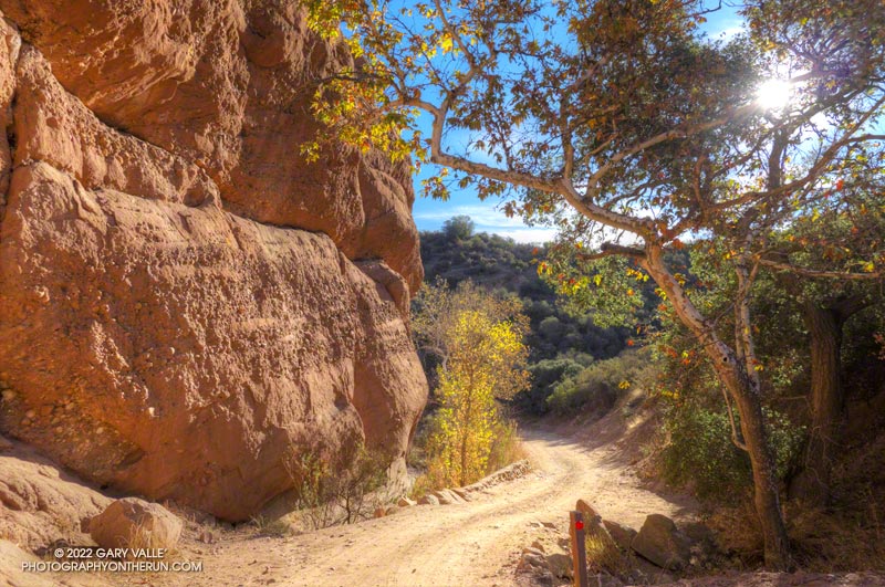
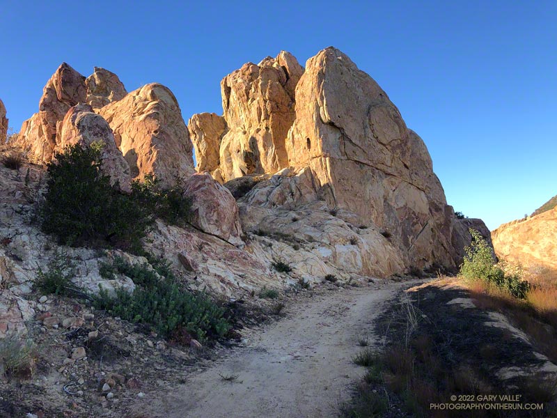
In the canyon, there are Sespe Formation sandstone rock outcrops with a variety of intriguing shapes and colors. About a mile from Calabasas Peak Mtwy is the parking area for Red Rock Canyon Park. From here, the road continues a little less than a mile to Old Topanga Canyon Road.
Running 1.5 miles on a narrow canyon road with little or no shoulder can be hazardous to your health. Doing the run early on a Sunday morning helped. There were about the same number of cyclists as cars, and there weren’t that many of either. The diciest part was a section of road with no shoulder on a blind curve. I was glad to get past that and to the Hondo Canyon Trailhead.
Hondo Canyon is one of the many memorable sections of the Backbone Trail. From Old Topanga, the trail climbs through oaks, grassland, chaparral, and California bay for about four miles to the Fossil Ridge Trail. The trail hides the 1600′ elevation gain well, and long sections of the trail are runnable.
Just below Saddle Peak Road, the Backbone Trail turns right and follows along Fossil Ridge three-quarters of a mile to the service road used to access Topanga Lookout. A left turn leads to the intersection of Saddle Peak Road, Schueren Road, and Stunt Road at the Lois Ewen Scenic Overlook.
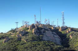
The remainder of the loop follows the same route as the Topanga Lookout Ridge – Saddle Peak loop. Initially, it follows the Backbone Trail west, past a large water tank to a spur trail that goes to the twin summits of Saddle Peak. The West summit, with all the electronics, is slightly higher, but is now closed. The flat East summit is about a quarter-mile from the Backbone Trail.
Returning to The Backbone Trail and continuing west, it’s about 1.25 miles down to the Stunt High Trail junction. From there, it’s another 2.6 miles on the Stunt High Trail down to the Calabasas Peak/Stunt High trailhead and the end of the 14.3 mile loop.
Here is an interactive, 3D terrain view of the Red Rock Canyon – Hondo Canyon – Saddle Peak loop. The Topanga Lookout Ridge route is also shown. The map can be zoomed, tilted, rotated, and panned using the navigation control on the right. Track and placename locations are approximate and subject to errors. Poor weather and other conditions may make this route unsuitable for this activity.
Some related posts: Red Rock Canyon from the Red Rock Trail; July Fourth Trail Run to Trippet Ranch, Hondo Canyon and Saddle Peak; Topanga Lookout Loop, Plus Saddle Peak
As I worked up the Bulldog climb on this morning’s run, I started to reminisce about the original Bulldog 50K course. When I reached the top, instead of making the usual turn to the left on Castro Peak Mtwy, I turned right, toward Castro Peak.
Prior to 2004, this was the route of the Bulldog 50K. Back then, the 50K course worked over the shoulder of Castro Peak to the top of Upper Solstice Canyon, and then followed the Backbone Trail back to the top of Corral Canyon. The course had to be changed when the landowner closed a short stretch of dirt road on Castro Peak.
Today, I ran a bit more than a half-mile before reaching the razor and barbed-wire-laced barrier blocking the road. Then it was back to running the Bulldog – Phantom Loop combo and enjoying the spectacular Fall day.
Some related posts: Sean O’Brien 50K Training Run, Bulldog Training Run 2022, Bulldog Loop Plus the Phantom Loop
Wait a minute… I stopped running down the hill and walked back to look at the sizable pile of scat.
I was on Rocky Peak Road, at about mile 3 of an extended version of the Chumash – Las Llajas loop, and just past the top of the Chumash Trail.
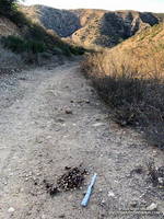
No doubt about it. It was bear scat. The bear had been eating holly-leaved cherries, and the scat was full of cherry pits. Over several decades of running Rocky Peak Road, this was the first time I’d seen evidence of a bear in the area.
Bears aren’t particularly common here, but they are seen from time to time. I wondered if this was the bear that had been discovered in the kitchen of a Simi Valley home in early September.
Bears have also been captured on local trail cams. In December 2015, the NPS photographed a bear and her cub feeding on the carcass of deer in the Santa Susana Mountains. Even more remarkable, in July 2016, a bear was photographed in Malibu Creek State Park by an NPS camera trap.
This morning, I looked for bear tracks around the scat, but thunderstorms and bike traffic had erased them. After taking a couple of photos, I continued toward the high point of the loop, “Fossil Point.”
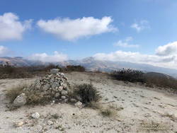
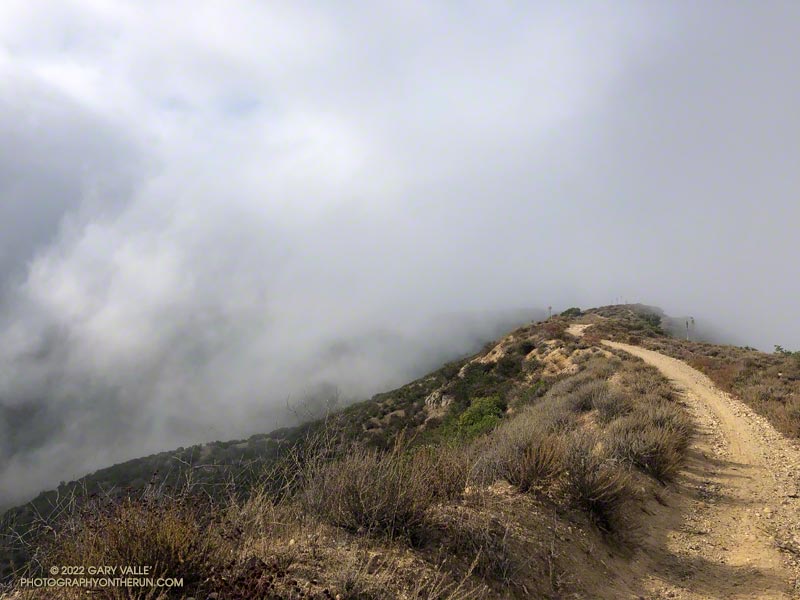
What had started as a very foggy morning was transitioning to a cool Fall day with a mix of sun and clouds. From the cairn at Fossil Point, Oat Mountain was still partially shrouded by clouds. Below the overlook, I spotted a couple of mountain bikers working up the road. The ride up Las Llajas Canyon has become a popular e-mountainbike ride, and e-bikes would be the only type of bike I would see on my way down the canyon.
The run down Las Llajas Canyon was pleasant and fast-paced. Lately, I’ve been doing a variation of the loop that jumps over to the Marr Ranch Trail using a trail that splits off the Coquina Mine trail. This route gets you up and out of the canyon and onto a ridge with good views of the surrounding terrain. It’s a bit more adventurous and adds a little mileage and elevation gain to the usual loop. The Coquina Mine trail is easy to miss — it branches off Las Llajas Road after passing the towering cliffs.
Here’s an interactive, 3D terrain view of a GPS track of the extended Chumash – Las Llajas loop. The map can be zoomed, tilted, rotated, and panned using the navigation control on the right. Track and placename locations are approximate and subject to errors. Poor weather and other conditions may make this route unsuitable for this activity.
Some related posts: Chumash-Las Llajas Loop, Not So Flat Las Llajas Canyon, Exploring Las Llajas, Marr Ranch Wildflowers