Category Archives: photography|landscape

What’s the Shortest Route From South Fork to San Gorgonio’s Summit?

Spectacular afternoon on the Dry Lake Trail while running/hiking the Dollar Lake - Dry Lake keyhole loop on San Gorgonio Mountain.
Spectacular afternoon on the Dry Lake Trail.

I wondered what the hikers would think when they reached this part of the Dollar Lake Trail.

A few minutes before, we had all reached the junction of the Dollar Lake and Dry Lake Trails at the same time. They hadn’t done the peak before and were debating which trail to take. When I mentioned that the Dollar Lake Trail is the shorter route to the summit, that’s the route they chose.

I guessed there might be a few choice words directed my way. About a half-mile beyond the junction, there is a long switchback on the Dollar Lake Trail that seems to never end. It’s about twice as long as any switchback on the Dry Lake Trail or Sky High Trail. With the mountain at your back, it takes the disbelieving hiker farther and farther away from their goal. How could it possibly be the shortest way to the summit?

But it is. The Dollar Lake Trail route is shorter — by about two miles. Following are the estimated mileages from the South Fork Trailhead to Gorgonio’s summit via the Dollar Lake and Dry Lake routes*:

SGWA handout – Dollar: 9.4  Dry: 11.3  Difference: 1.9

My GPS tracks – Dollar: 9.8  Dry: 11.5  Difference: 1.7

Tom Harrison Maps – Dollar: 10.0  Dry: 12.0  Difference: 2.0

*The Dollar Lake route uses the South Fork, Dollar Lake, Divide, and Summit Trails. The Dry Lake route uses the South Fork, Dry Lake, Sky High, and Summit Trails.

The combined route — Dollar up and Dry down — is one of the best mountain trail runs in Southern California. It’s a favorite, and the route I was doing today.

This morning the sky was mostly clear, and the temperature was mild. Later in the day, there was a chance of a thunderstorm, but I expected to be off the exposed trails higher on the mountain well before thunderstorms had a chance to build.

The first cumulus clouds popped up over the mountain around 10:00 a.m. An hour later — as I was crossing the summit plateau — the clouds were more extensive but with little vertical development.

Defaced survey marker on the summit of San Gorgonio Mountain.

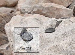
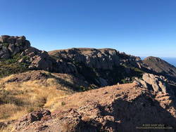
There were only a few people in the summit area. Some were on the west summit and some on the east. The twin summits are about 80 feet apart and nearly at the same elevation. Oddly, someone has defaced the survey marker on the west peak since the last time I was there — June 2021. With clouds all around, and 12 miles to go, I snapped a few photos and headed down.

I only saw one group of hikers on the Sky High Trail. They were working up the switchbacks at a good clip and would probably make the summit in an hour or so. Hopefully, the weather would hold for them!

It wasn’t until I was between the C-47 memorial and Mineshaft Saddle that I heard the first rumbles of thunder somewhere in the distance to the east or northeast.

As I continued down the mountain, I occasionally heard thunder in the distance but nothing nearby. There were some sizable cells to the east, but the weather behaved itself. At least where I was. I later heard it dumped at Onyx Summit, and flash flooding was reported at Joshua Tree.

For me, the weather was nearly ideal. Mild temperatures, light winds, and picturesque, sun-shielding clouds. It was short sleeves and shorts up and down. But on another day, it might not have worked out that way.

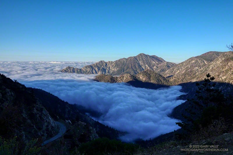
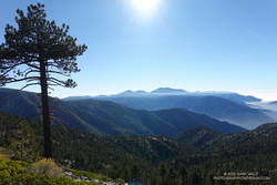
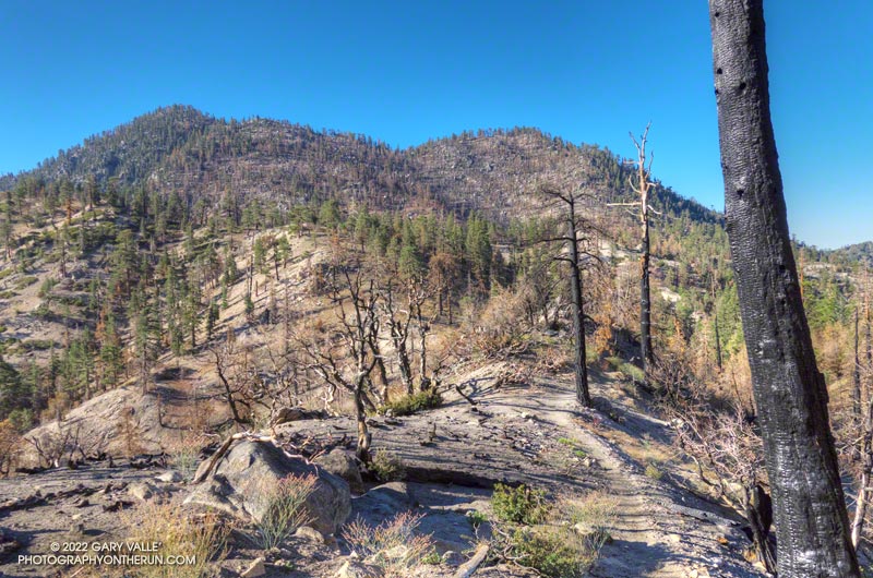
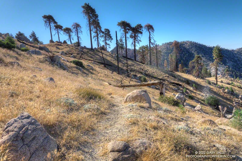
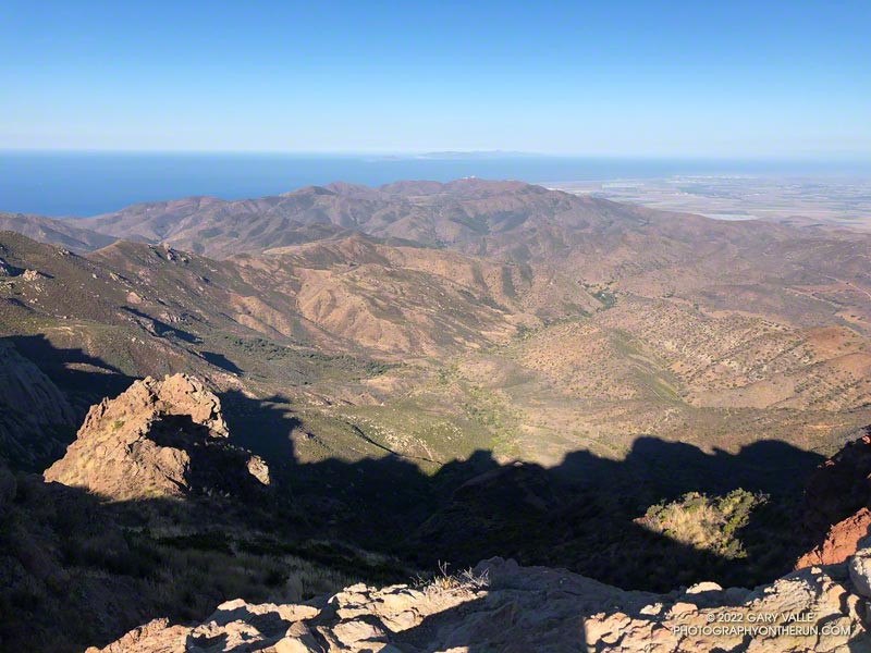
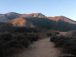
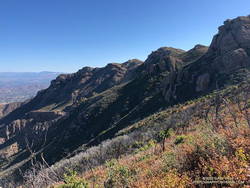
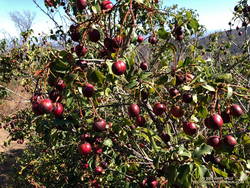
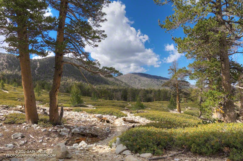
Here are a few photos taken along the way, and an interactive, 3D terrain view of the Dollar Lake – Dry Lake Loop.

Some related posts: San Gorgonio Mountain – June 2021; San Gorgonio Mountain Snow, Avalanches and Glaciers; San Gorgonio High Line

Sunrise Over the San Fernando Valley From Lasky Mesa

Sunrise Over the San Fernando Valley From Lasky Mesa

The clouds were associated with a front that stalled to the north of Los Angeles, resulting in some surprising and substantial rainfall totals in Santa Barbara and San Luis Obispo Counties. No measurable rain was reported in Los Angeles County by the NWS.

From an early morning run at Ahmanson Ranch (Upper Las Virgenes Canyon Open Space Preserve) on September 20th.

Related post: Monsoon Clouds and Valley Oak at Sunrise on Lasky Mesa

A Cool and Breezy Out and Back Trail Run from Islip Saddle to Mt. Baden-Powell

Twin Peaks from the PCT near Islip Saddle

After weeks of dealing with one heatwave after another it was a strange sensation. I was cold. I had on an extra shirt and sleeves, but the slopes of Mt. Islip were deep in shadow and the wind was gusting to 20 mph. The thermometer on my pack read 41 degrees, but the “feels like” temperature had to be in the 30s.

I was in the first mile of an out and back trail run from Islip Saddle to Mt. Baden-Powell. A San Gabriels classic, the route gains (and loses) about 3800′ over 16.5 miles on the PCT.

This morning I was doing the basic out and back, but Mt. Hawkins, Throop Peak and Mt. Burnham are easy peaks that can done along the way. Mt Islip is is a bit more of a detour, but can also be added to the route.

Mt. Baldy and environs from the PCT, between Mt. Hawkins and Throop Peak.

It’s also possible to start the out and back at the Windy Gap Trailhead (5836′) in the Crystal Lake Recreation Area. The distance to Baden-Powell is about the same, but the lower trailhead adds about 800′ of gain.

As I chugged up one of the initial steep sections, I thought about what it must have been like for this year’s participants in the AC100. This year, because the AC100 was an out and back from Wrightwood to Shortcut Saddle, runners got to do this tough segment after running more than 75 miles!

Here is an interactive, 3D terrain view of the out and back from Islip Saddle to Mt. Baden-Powell. The map can be zoomed, tilted, rotated, and panned using the navigation control on the right. Track and placename locations are approximate and subject to errors. Poor weather, and other conditions may make this route unsuitable for this activity.

Some related posts: Islip Saddle – Mt. Baden-Powell Out & Back, Mid January Trail Run from Islip Saddle to Mt. Baden-Powell, Savoring the Snow Between Islip Saddle and Mt. Baden-Powell, Little Jimmy Spring Incense CedarSan Gabriels High Five

Twin Peaks East, Plus Mt. Waterman

Twin Peaks from low on the Twin Peaks Trail, following the Bobcat Fire

Seeing Twin Peaks while doing the Three Points Loop a couple of weeks ago reminded me that I hadn’t done Twin Peaks in quite a while. The last time had been in 2012, when I did a spur of the moment exploration down the southeast ridge of Twin Peaks, toward Triplet Rocks.

As long as I was in the neighborhood, I also wanted to do the short side trip to Mt. Waterman’s summit and see how it fared in the Bobcat Fire. (I’d skipped that side trip on the most recent Three Points Loop run.)

My general impression of Bobcat Fire impacts in the Mt. Waterman – Twin Peaks area is of varying severity. In some areas nearly all the trees were killed, while in other the trees are virtually untouched. Perhaps the most common scenario is a mix of burned, partially burned, and unburned trees.

Here is an interactive, 3D terrain version of the Bobcat Fire Soil Burn Severity Map that is zoomed in on Mt. Waterman – Twin Peaks area. The map can be zoomed, tilted, rotated, and panned. To change the view, use the control on the upper right side of the screen.

Overall, I was surprised to find that there were so few fallen trees on the Twin Peaks Trail. I think I had to step over one log, go around another, and a couple others had been cleared from the trail. The most serious obstacle was some Poodle-dog bush completely blocking the trail. Poodle-dog bush causes dermatitis in many people.

There was little damage from the heavy December storms. The elevation ranges from about 6540′ at the low point of the Twin Peaks Trail, up to 7761′ on Twin Peaks East, so much of the precipitation must have fallen as snow.

A couple of trees were burned on the perimeter of Twin Peaks East’s flat summit, but the tops of both Twin Peaks East and Mt. Waterman were pleasant places to be.

Here are a few photos taken along the way.

Some related posts: Three Points Loop Around Mt. Waterman, Toward Triplet Rocks, Twin Peaks Trail Run

After the Bobcat and Station Fires: Three Points Loop Around Mt. Waterman (Slideshow, 3D Terrain Maps)

Mt. Waterman Trail

Most of the time, when I do a trail run in the San Gabriel Mountains, it starts from a trailhead along or near Highway 2 — Angeles Crest Highway.

There are many fine point-to-point and out-and-back runs along Hwy 2, but not very many loops. Of the handful of loops that are currently open and accessible, two start and end at Three Points.

One is the Three Points – Mt. Hillyer Loop and the other is the Three Points Loop around Mt. Waterman. The Three Points – Mt. Hillyer Loop was not affected by the Bobcat Fire and is described in this April 2021 post.

On the other hand, significant parts of the Three Points Loop around Mt. Waterman were burned in Bobcat Fire, and the trails that comprise the loop were closed until April of this year (2022).

A large area on Mt. Waterman was burned by both the Bobcat and Station Fires. This can be seen in this interactive, 3D terrain view of the area. The Bobcat Fire is yellow and the Station Fire is red. Where they overlap near Mt. Waterman is orange.

The Three Points Loop is the loop I do most often in the San Gabriel Mountains. The basic loop, not including the side trip to the summit of Mt. Waterman, is about 20 miles long and has about 4000′ of gain/loss. The terrain and trails are varied and interesting, and Buckhorn Campground is conveniently placed near the halfway point of the course. Water is USUALLY — BUT NOT ALWAYS — available when the campground is open.

Doing the side trip to Mt. Waterman adds about 1.7 miles and 350′ of elevation gain. The side trip to Cooper Canyon Falls is even shorter — only about a quarter-mile.

Fire perimeters and burn severity maps don’t tell the whole story, and I’ve been curious to see how the area was affected by the Bobcat Fire; how the Station Fire recovery is continuing; and how the area burned by both fires has fared.

Here is an interactive, 3D terrain view of the Three Points Loop. The map can be zoomed, tilted, rotated, and panned using the navigation control on the right. Track and placename locations are approximate and subject to errors. Poor weather and other conditions may make this route unsuitable for this activity.

This slideshow includes photos from the August 2022 run of the loop, as well as additional information.

Some related posts: Twin Peaks East, Plus Mt. Waterman; Three Points Loop Adventure – July 2020: Bobcat Fire Perimeter and Some Angeles National Forest Trails: 3D Terrain View of Bobcat Fire Soil Burn Severity and Some Angeles National Forest Trails

Another Triple-Digit Sunday

Pt. Mugu State Park from Boney Mountain
Sycamore Canyon, Laguna Peak, and the Channel Islands from Boney Mountain.

Update on August 17, 2022. As of today, my West Hills weather station has recorded a high of 100 degrees or higher for 12 consecutive days. 

It was another triple-digit Sunday. Once again the high in the west San Fernando Valley was forecast to hit one-hundred and something. I’d hope to beat most of the heat by getting an early start and running where it wouldn’t be quite so hot.

I hadn’t been able to get out to Stoney Point Saturday morning, so was looking to do a little easy climbing as part of my Sunday run. I was considering three options: Topanga Lookout Ridge, Strawberry Peak, and Boney Mountain.

Boney Mountain from connector trail above Danielson Road

While none of the three are difficult by rock climbing standards, all require the use of handholds and footholds, good route-finding skills, and good judgment. It is entirely possible to fall on any of them.

The Topanga Lookout Ridge loop is about 8.5 miles long with 2000′ of gain/loss. There are a few short climbing segments on the crest of the ridge that can be accessed from the  use trail.

The basic loop up the Western Ridge of Boney Mountain and over Tri Peaks to the Backbone Trail and back to Wendy Drive is about 15.5 miles long with 3400′ of gain/loss. It is longer and more difficult than  the Topanga Lookout Ridge loop.

The loop over the top of Strawberry Peak from the Colby Canyon Trailhead is about 12 miles long with 3100′ of gain/loss. There is some class 2/3 climbing on the west side of Strawberry, and it is essential to stay on route. There have been a number of rescues of those attempting to climb the peak.

View along the top of Boney Mountain's western escarpment.
View along the top of Boney Mountain’s western escarpment.

It was a few minutes past six when I pushed the start button on my Garmin and jogged down the hill from the trailhead at Wendy Drive. I’d run about a half-mile when I heard another runner behind me. We chatted for a couple minutes and I learned he was preparing to do the Wonderland Trail around Rainier and then the Bear 100.

We were both going to the same area, but by different routes. I was climbing Boney Mountain’s Western Ridge and then working over to the Backbone Trail. He was doing an out and back to Sandstone Peak via Upper Sycamore, Sycamore Canyon, and the Backbone Trail. We would run into each other again at the Danielson Multi-Use Area on the way back to Wendy Drive.

Morning shadows on Boney Mountain's western escarpment
Morning shadows on Boney Mountain’s western escarpment

As always, the climb up the Western Ridge (Mountaineer’s Route) was enjoyable. The rock climber in me always wants to check out potential lines, but this morning there wasn’t much time for that. The longer it took to get up Boney, the hotter it was going to be later in the run!

The temperature was already in the eighties when I reached the Backbone Trail. Before the fires and floods of past decade,  the run down the Chamberlain segment of the Backbone Trail was one of the better running descents in the Santa Monica Mountains. From the Tri Peaks Trail junction to the Old Boney Trail it drops about 1500′ over three miles. Today, except for the stretch of trail near Chamberlain Rock, it was nearly back to its original form.

Holly-leaved cherries along the Chamberlain segment of the Backbone Trail

As in other areas of the Santa Monica Mountains, the effect of the heavy December rains was evident. The red shanks, and chaparral in general, seemed to be greener. This year there is a bumper crop of holly-leaved cherries, which must make the coyotes happy. Unlike last year, it looks like there should be some Christmas berries this Winter, since a number of Toyon were covered in green berries.

On the way down the Chamberlain Trail I started to fret that the water at Danielson might not be turned on. The water faucets in Sycamore Canyon are usually dependable, but on a run a few years ago the water system was turned off for servicing. Or what if there had been a drought-related water supply issue?

It turned out the water was still on, and I drank a lot of it. The remainder of the run went well, although I was a little surprised that the sensor on my pack recorded temps in the nineties in Sycamore Canyon. I had expected the south-facing stretch on Danielson road to be torrid, but a nice breeze kept the temperature tolerable.

Some related posts: Looking for Boney Mountain, Looking for Boney Bluff, Orange Sun Rising – A Boney Mountain Adventure Run