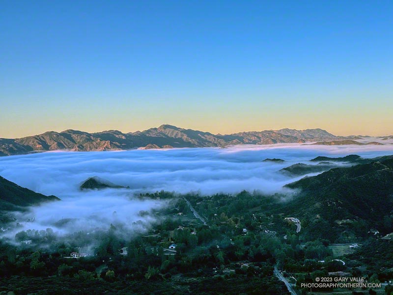
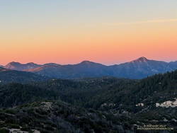
The sun had risen, casting a warm morning light on the Santa Monica Mountains. Overnight, low clouds flowed inland through Malibu Canyon, emphasizing the peaks and covering the valleys.
Backbone Trail below Saddle Peak.
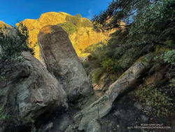
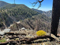
I had just started up Topanga Lookout Ridge and was less than a mile into the Topanga Lookout Ridge Loop. Rain had muddied the ground and cleansed the sky, producing crystal clear views in every direction.
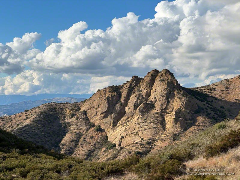
The view of the western Santa Monica Mountains extended from the top of the Tapia climb on Mesa Peak Motorway, past Castro Peak, to Boney Mountain and the highest peak in the Santa Monica range — Sandstone Peak.
In my mind, I traced the route of the Backbone Trail along the crest. My route would take me to the Backbone Trail, but this morning I would enjoy running only a few of its sixty-eight spectacular miles.
I was beginning to wonder if I would get a chance to do the Three Points Loop around Mt. Waterman this year. Angeles Crest Highway had been closed from Red Box to Vincent Gap for many months, and CalTrans projected it might not open until Thanksgiving.
That’s why Friday (November 3) I was excited to hear Angeles Crest Highway had reopened between Upper Big Tujunga Rd. and Islip Saddle.
Alpenglow on the San Gabriels’ Front Range peaks.
At dawn, a couple days later, I pulled into the Three Points parking lot, put on some sunscreen, grabbed my pack, and set out to see what was happening on the Three Points loop around Mt. Waterman.
I’d done the loop many times and in many situations — clockwise, counterclockwise, after the Station Fire closure, after the Bobcat Fire closure, with snow at the higher elevations, in hot weather and in cold. When the trails are in good shape and the weather isn’t too hot, the 20-mile loop is an outstanding trail run. Today, it was a challenge just to complete the loop.
At lower elevation, sections of Three Points – Mt. Waterman Trail (10W04) were overgrown with mountain whitethorn — requiring several “grin and bear it” passages. Higher, long stretches of the little-used path were covered with a second season of grass. This made route-finding difficult, particularly where the trail descends to the Twin Peaks Trail junction.
Twin Peaks from the Buckhorn – Mt. Waterman Trail.
It was an intriguing puzzle to solve, and eventually I made it to the junction of the summit trail and the trail down to Angeles Crest Highway, near Buckhorn (10W05). The trail down to Buckhorn sees much more use than the trail from Three Points and is much better defined. Besides a couple of downed trees, the run down was one of the more enjoyable parts of the loop. The trail is usually very busy, but I didn’t encounter anyone coming up the trail.
As expected, Buckhorn Campground was closed and no water was available. It was a warm day — around 75 degrees — but with the November sun low in the sky, not as warm as 75 degrees in July. If I needed more water, there were several places I could refill.
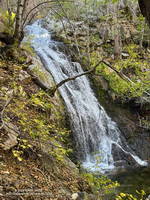
Cooper Canyon Falls (video)
The Burkhart Trail (below Buckhorn) was the only place I encountered a few hikers. They were returning from Cooper Canyon Falls. When I got down to the PCT and saw how much water was in the creek, I did the short side trip to the falls and took this video snapshot. It’s unusual for the falls to be flowing this time of year.
After checking out the falls, I resumed my westward journey on the PCT. Within feet of the creek crossing, an ugly tangle of fallen trees completely blocked the trail. This was just the first of several problems on the PCT between the Burkhart Trail junction and Cooper Canyon Camp. There were the usual downed trees, but there were also several sections of badly overgrown trail. These green thickets were generally adjacent to the creek, where the trail had been (or still was) wet.
Willows along the creek near Cooper Canyon Trail Camp.
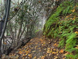
Needing water, and to empty the debris from my shoes, I stopped for a few minutes at Cooper Canyon Trail Camp. Several campsites are nestled in a pleasant area along the creek. With Angeles Crest Highway open, I thought I might see someone here, but like Buckhorn Campground, it was empty.
After reaching Cloudburst Summit, the remainder of the run was more or less usual for the loop. There was some Poodle-dog bush and a small rockslide along the PCT on the way to Camp Glenwood, but neither were an issue. The run was more challenging than usual — and a bit slower — but it had been (mostly) fun and fascinating to work through it.
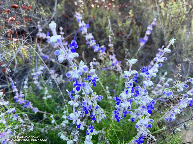
The blue of the woolly bluecurls was just stunning. The plant was along the Ken Burton Trail, in the San Gabriel Mountains, near Los Angeles.
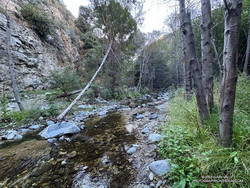
Arroyo Seco below Royal Gorge at Gabrielino Trail crossing.
Woolly bluecurls normally flowers in the Spring, but rain from Tropical Storm Hilary, combined with Spring-like conditions caused it to bloom this Fall. Such blooms are usually not widespread and the flowers are often less robust than their Spring counterparts. Other Spring flowers that were blooming included Ceanothus, bush poppy, and golden yarrow.
The Ken Burton Trail connects the Gabrielino Trail, near Oakwilde, to a saddle at the top of Brown Mountain Road. Today, I was doing a longish out and back trail run to Wella’s Peak from Clear Creek via Switzers and the Gabrielino and Ken Burton Trails. Wella’s Peak is a bump on the west side of the saddle. Brown Mountain towers above the east side of the saddle.
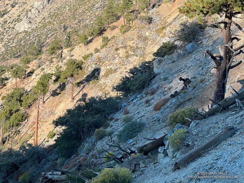
Bighorn sheep blend into the rocky terrain near Windy Gap
Had they not dislodged some rocks, I doubt I would have seen the three bighorn sheep in the photo above. They are easier to see in this zoomed-in photo of the sheep descending the rocky slopes just below Windy Gap (7,588′) in the San Gabriel Mountains. They crossed a brush-covered rib and disappeared from view.
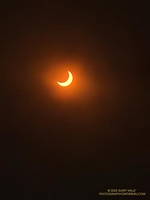
The partially-eclipsed sun crests a ridge east of Windy Gap.
A few minutes after seeing the sheep, I reached Windy Gap and stopped to put my arm sleeves away. It had been cool at the trailhead — about 40 degrees — but the temperature had warmed as I worked up the trail. As its name suggests, the wind can be fierce at Windy Gap, but this morning there was almost no wind, foretelling nearly ideal weather for today’s adventure.
Windy Gap was still in shade, and the sun was just peeking over the ridge to the east. You couldn’t tell, but the eclipse had already begun. The eclipse would be nearly total in parts of Oregon, Nevada, Utah, New Mexico, and Texas. In the Los Angeles area, the moon would obscure more than 70% of the sun’s disc.
Partially eclipsed sun.
From Windy Gap, I headed east on the Pacific Crest Trail toward Mt. Hawkins. From time to time, I would stop and check the progress of the eclipse using eclipse sunglasses. In sunny areas, I looked for lensed images of the sun in the shadows of trees but didn’t see any. Having needles instead of leaves, conifers don’t produce the myriad images of the eclipsed sun seen under trees with leaves.
With nearly three-quarters of the sun obscured, the light from the sun had become enfeebled. The feeling was more than that of a cloud passing in front of the sun. I stopped and listened… to nothing. It was eerily quiet. No birds called or sang, and only chill zephyrs of wind wafted about the area. Somehow, the sun was broken.
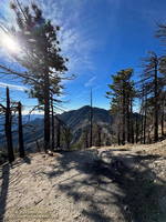
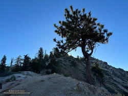
The south ridge of Mt. Lewis can be accessed from the CalTrans shed at Dawson Saddle.
As the eclipse slowly waned, I continued east in the corrupt light, past Mt. Hawkins and Throop Peak, to the PCT’s junction with the Dawson Saddle Trail. In what seemed fitting for the day, instead of continuing to Baden-Powell, I turned left and headed down the trail toward Angeles Crest Highway (Highway 2).
Why? Angeles Crest Highway was closed from Red Box to Vincent Gap, transforming Dawson Saddle into one of the more isolated areas of the Angeles National Forest. I hadn’t been on the Dawson Saddle Trail in years, and with Highway 2 closed, it would be a quirky way to climb Mt. Lewis. Instead of having one of the shortest approaches in the San Gabriels — a few feet from the CalTrans shed at Dawson Saddle — it would involve a trail run of nearly eight miles just to get to the base of the peak.
Angeles Crest Highway from the shoulder of Mt. Lewis.
The eclipse was nearly over when I reached the bottom of the Dawson Saddle Trail on Highway 2. From the trailhead, I ran up an empty Angeles Crest Highway a short distance to Dawson Saddle. Mt. Lewis’ south ridge was accessed from here.
Only about a half-mile long, the south ridge isn’t technical, but the first third is steep and rocky. The elevation gain from the saddle to the summit is about 500′. Offset from the crest of the San Gabriels, the flat summit of Mt. Lewis has unique views of the crest extending from Mt. Baden-Powell to Mt. Islip and beyond.
After a few minutes enjoying the summit, I turned southward and began working my way back down to Angeles Crest Highway, up to the PCT, over to Windy Gap, and back down to the trailhead in the Crystal Lake Recreational Area.
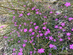
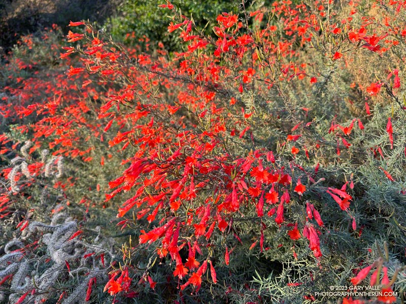
California fuchsia along Fire Road #30, near the Hub.
Downtown Los Angeles (USC) finished the 2022-2023 Water Year with 31.07 inches of rain, making it the seventh wettest on record in Los Angeles. The rainfall total includes about three inches of rain from former Hurricane Hilary as it moved through Southern California as a rare tropical storm and post-tropical cyclone.
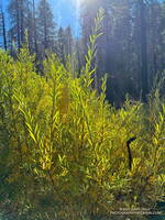
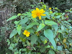
Canyon sunflower blooming out of season along Fire Road #30.
The effects of all that rain can be seen on just about any trail in Southern California. It has resulted in a false Spring in many areas, with greening hills, out-of-season wildflowers, flowing creeks, and profuse growth throughout the area.
This morning, I returned to the Top of Reseda and Topanga State Park to do a variation of the Trippet Ranch Loop and continue exploring and enjoying the unusual conditions.
After running up to the Hub, this variation does an out and back to Temescal Peak and Temescal Lookout. After returning to the Hub, the route continues on Eagle Springs Fire Road down to Trippet Ranch. From Trippet Ranch, it works back to the Top of Reseda using the Musch and Garapito Trails and connecting sections of fire road. This interactive, 3D terrain map shows a GPS track of the trail run.
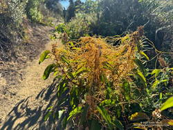
Dodder growing on laurel sumac on the Musch Trail.
Visiting Temescal Peak and Temescal Lookout increases the run’s mileage from 12.5 miles to 16. On a clear day, the runner is rewarded with far-reaching views of the coast, West L.A., Downtown, and the surrounding mountains.
While most of the roads and trails on this route are frequently used and in decent condition, the Garapito Trail has been overgrown all Summer. As of October 8, it was still overgrown. Some people I’ve encountered on the trail were OK with this, but others haven’t been so happy. If desired, the trail can be bypassed by continuing to the Hub on Eagle Rock Fire Road and retracing your route back to the Top of Reseda.