Category Archives: running|adventures

Rim Trail – Kenyon Devore Loop from the Top of Mt. Wilson

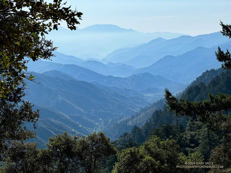
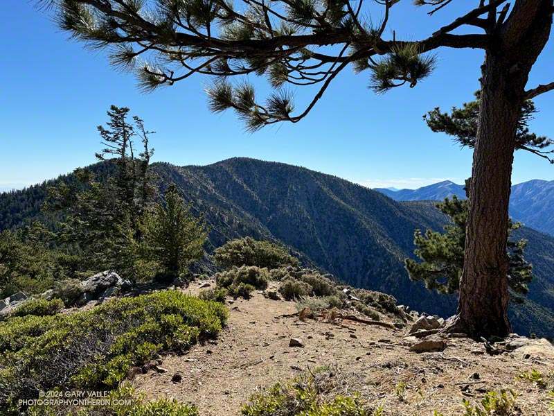
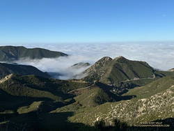
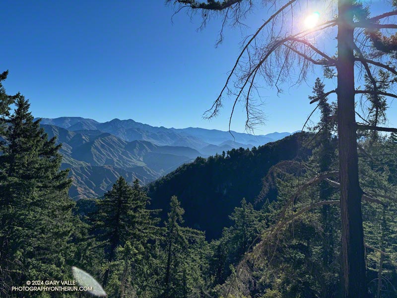
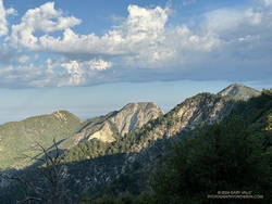
San Gabriels High County from the Rim Trail

It was great to be back on the Rim Trail! One of the most underappreciated trails in Angeles National Forest, the 3.6 mile trail was closed in October 2020 because of the Bobcat Fire. It finally reopened in June of this year (2024).
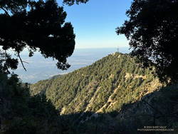
Mt. Harvard from near the start of the Rim Trail on top of Mt. Wilson.
Mt. Harvard from near the start of the Rim Trail.

This morning’s run had started at the top of the Kenyon Devore Trail from the same turnout on Mt. Wilson Circle Road as two weeks before. This time, instead of running down Mt. Wilson Road, I had descended a short distance on the Kenyon Devore Trail and turned right (east) on a half-mile long trail that connects to the main Mt. Wilson parking lot. From there I followed the “Authorized Vehicles Only” road toward the observatory about a quarter-mile to the signed start of the Rim Trail. Interpretive signs along the road note some of the area’s plants and trees.
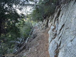
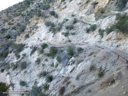
An exhilarating section of the Rim Trail where it is narrow and bounded by a rock wall.
An exhilarating stretch of the Rim Trail.

When done as a counterclockwise loop from Mt. Wilson, the Rim Trail switchbacks down Mt. Wilson’s steep northeast ridge and then contours along the north side of the West Fork – Santa Anita Canyon divide to Newcomb Pass. Along the way are spectacular views of the Mt. Wilson Observatory complex, the canyons of the West and East Forks San Gabriel River, and the high country of the San Gabriel Mountains. On a clear day, Saddleback, San Jacinto Peak, and San Gorgonio Mountain can be spotted from the trail. To the north, the vast Mojave desert stretches out from the foot of the mountains.

Even though it was closed for nearly four years, the Rim Trail was in remarkably good shape. The trail dips into and out of the Bobcat burn area as it works down the ridge and along the divide. Much of the trail was unscathed, but some sections were severely burned. Sadly, this beautiful bigcone Douglas-fir was destroyed.
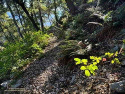
Poison oak along the Rim Trail.

Poodle-dog bush marks the stretches of trail burned in the Bobcat Fire. With care, it was generally avoidable, as was the abundant poison oak found on some sections of the trail. (Like poison oak, Poodle-dog bush causes a rash in many people.)

On the way down the Rim Trail, I’d debated which route to take from Newcomb Pass. One option was to run over to Newcomb Saddle and take Rincon-Redbox Road to West Fork. Another was to follow the Gabrielino Trail to Devore Camp and then West Fork. The single-track route through Devore Camp is a more interesting option and is usually my choice.
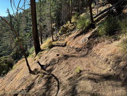
Trailwork on the Rim Trail near Newcomb Pass.

As I neared Newcomb Pass, I was surprised to see recent trailwork on the isolated stretch of trail. This was a hopeful sign the Gabrielino Trail between Newcomb Pass and Devore Camp might be in decent shape.

At Newcomb Pass, all signs of any trailwork ended. I looked at the first few overgrown yards of the trail connecting to Newcomb Saddle and thought, “I’ll give the Gabrielino Trail a try.” I could see an ill-defined path where the Gabrielino Trail should go and tried to follow it. No go. A lower path also appeared to be a dead end.

I enjoy the challenge of following little-used trails, but today was more interested in running than bushwhacking. Retracing my steps, I returned to the trail connecting to Newcomb Saddle.
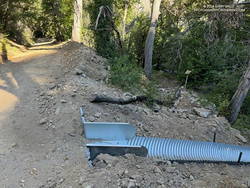
Newly installed downslope drain blocking access to the Gabrielino Trail from Rincon-Redbox Road.
Newly installed downslope drain blocking access to the Gabrielino Trail

It wasn’t as bad as I initially thought. The trail was a bit overgrown, but was on an old roadbed and pretty easy to follow. (Later, I discovered I had a bite from a larval tick, which I’m sure I picked up in the Newcomb Pass area.)

Rincon-Redbox Road was wide open and in great shape. When I reached the point where the Gabrielino Trail crosses the road, neither direction on the trail looked particularly promising. Up the trail looked overgrown, and down the trail was blocked by a newly constructed drainage conduit. The Gabrielino Trail is a National Recreation Trail in a National Monument, so should (hopefully) be fully restored.
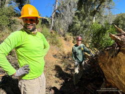
Jose and Gary cleaning debris underneath a log on the Gabrielino Trail near West Fork.

Running down Rincon-Redbox Road and lost in thought, I was somewhat startled to see a red truck round a bend. I was even more surprised when it turned out to be race director and trailmaster Gary Hilliard. Gary and Jose were out the weekend before the AC100 trying to chase down a couple of logs — one reported to be blocking access to the Newcomb Saddle aid station and another on the Gabrielino Trail “a half-mile from West Fork.”

I’ve had the privilege of running in all of Gary’s ANFTR/Mt. Disappointment races. No one works harder or is more dedicated to the trails of Angeles National Forest and trail running. I didn’t recall a log blocking the road, but it would only take Gary a few minutes to drive up to the aid station and be sure. With cruise control on and lost in thought, I continued running down to West Fork.

At West Fork, I stopped at “the pipe” to get water and cool off. From here, it’s a memorable 5-mile, 2600′ climb to the top of the Kenyon Devore Trail.
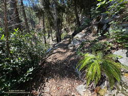
Kenyon Devore Trail on Mt. Wilson
Kenyon Devore Trail

I’d been here two weeks before. The Rim Trail – Newcomb Saddle – Kenyon Devore Loop is the mirror image of the Mt. Wilson – Red Box – Kenyon Devore Loop. Two weeks ago it was around 10 degrees warmer and humid. I’d bonked on the climb, and wasn’t looking to repeat that experience today.

This morning – except for a couple of rattlesnakes – the run from West Fork couldn’t have gone better! I even jogged some of the less steep sections of the Kenyon Devore Trail!

Here’s a high-resolution, interactive, 3D-terrain view of the Rim Trail – Newcomb Saddle – Kenyon Devore Loop. The Gabrielino Trail option through Devore Camp is also shown.

Some related posts:
A Place to Ponder Things Near and Far
A Morning Thunderstorm, Debris-Covered Trail, Fast-Paced Fire Road, and Tough Climb on the ANFTR 25K Course!
Running Mt. Wilson’s Rim Trail
GSU Mt. Wilson CHARA Telescope Array
A Morning Thunderstorm, Debris-Covered Trail, Fast-Paced Fire Road, and Tough Climb on the ANFTR 25K Course!

The canyon of the West Fork San Gabriel RIver and Rincon-Red Box Road from the Mt. Disappointment/Bill Riley Trail.
The ANFTR courses follow Rincon-Red Box Road down this rugged canyon to West Fork.

Update October 2, 2024. I ran the ANFTR 25K Course on Sunday and the cuttings on the Mt. Disappointment/Bill Riley Trail had been removed. The trail was clear and back to normal!

As I drove east on the 210 Freeway, a long bolt of lightning erupted from high in the clouds and pierced the valley below. The thunderstorm near Mt. Lukens looked spectacular. It was backlit by the rising sun, and intermittent lightning flashed against its dark gray clouds.

Theoretically, I was headed to Mt. Wilson. It was July. It was hot. It was time to get on the ANFTR/Mt. Disappointment race course! But was that going to be a good idea? A slight chance of a thunderstorm was forecast for the afternoon and already there was an active storm right in front of me.

Clouds over Mt. Lowe (left), Mt. Markham, Occidental Peak, and San Gabriel Peak. (thumbnail)
Clouds over Mt. Lowe (left), Mt. Markham, Occidental Peak, and San Gabriel Peak.

The Angeles National Forest Trail Races (aka Mt. Disappointment) is a popular event usually run in the heat of Summer after the Fourth of July. Because of the pandemic, Bobcat Fire, and trail and road closures, the race has been on hiatus since 2020, but a new race date appears to be in the works!

Another ragged bolt flashed horizontally across the clouds. The cell looked isolated and appeared to be moving to the north. I decided to take a chance and bet that the morning storm was a quirk. Still, it suggested a real possibility of a thunderstorm later in the day.

About the time I passed Trail Canyon on Big Tujunga Canyon Road, it started to rain, and the rain continued much of the way to Red Box. The activity was actually more extensive than the cell near Mt. Lukens — a band of thunderstorms had swept through the San Gabriel Mountains between Mt. Lukens and Mt. Wilson.

Running down still wet Mt. Wilson Road following a morning thunderstorm. (thumbnail)
Running down still wet Mt. Wilson Road following a morning thunderstorm.

Mt. Wilson Road was still wet as I started down the first leg of the ANFTR/Mt. Disappointment 60K/50K/25K courses. If you have to run on pavement, running downhill on super-scenic Mt. Wilson Road after a thunderstorm is about as good as it gets! The cleansed atmosphere and vivid smells in the wake of the storm were remarkable — as were the views down into the canyon of the West Fork San Gabriel River.

This morning, I was doing the 25K course, but all the distances follow the same route to Red Box. They start by running down Mt. Wilson Road to Eaton Saddle and then following Mt. Lowe Fire Road through Mueller Tunnel to Markham Saddle and the San Gabriel Peak Trail. The San Gabriel Peak Trail leads up to the Mt. Disappointment service road and, surprisingly, the high point of the 60K/50K/25K courses. This stretch of service road is higher than the start/finish on Mt. Wilson!

Cuttings from a forest-thinning project blocking the Mt. Disappointment/Bill Riley Trail. (thumbnail)
Cuttings from a forest-thinning project blocking the Mt. Disappointment/Bill Riley Trail.

Even if you have run a trail many, many times — and think you’re familiar with it — sooner or later, you’re going to encounter something you didn’t expect. From the Mt. Disappointment service road, the ANFTR/Mt. Disappointment courses turn onto the Mt. Disappointment/Bill Riley Trail. After the first couple of switchbacks, there were an increasing number of cut limbs on the trail. Initially, the cuttings were not much of an issue, but became worse as I continued down the trail.

Partway down, I encountered two very upset hikers who had lost the trail. They had just decided to leave the trail and hike on the service road. They cautioned me that the section where they had problems was just below. They weren’t kidding. I’ve done this trail innumerable times and at one point also had difficulty locating it. I had to wade through an expanse of cuttings to stay on the trail.

I’ve been on trails impacted by forest thinning projects before. The crews that worked on those projects at least made an effort to keep the trails clear. No such attempt was made here — the cuttings were left where they fell, and if that was on the trail, too bad!

It was a relief to get off the Mt. Disappointment/Bill Riley Trail and down to Mt. Wilson Road and Red Box.

Update October 2, 2024. I ran the ANFTR 25K Course on Sunday and the cuttings on the Mt. Disappointment/Bill Riley Trail had been removed. The trail was clear and back to normal!

The towers on Mt. Wilson -- where the car is parked -- from Rincon-Redbox Road. (thumbnail)
The towers on Mt. Wilson – where the car is parked – from Rincon-Redbox Road.

Unlike last year, Rincon-Red Box Road was in great shape. It was so well-graded that a Prius might have been able to drive down to West Fork. Much of the 5.5 miles down to West Fork are in full sun, so the temperature has a substantial impact. In the 2019 ANFTR/Mt. Disappointment 50K, the thermometer on my pack read about 80 degrees. In the 2017 50K, the temp on the same stretch was about 100 degrees. Today, it was around 90.

Whatever the temperature, there are excellent views down the West Fork and of the Mt. Wilson area. The towers on Mt. Wilson always look tantalizingly close, and the climb up Strayns Canyon doesn’t look that bad. (Ha!) Like last year, there were four or five creek-like crossings of the West Fork San Gabriel River.

The area around the spring at West Fork was a bit overgrown, but a trampled path through the grass below the cistern led to the outflow pipe. I refilled my hydration pack and drank my fill before setting off on the Gabrielino Trail. With the temperature in the sun at West Fork around 95, I should have spent more time at the spring cooling down.

Gabrielino Trail sign at West Fork. (thumbnail)
Gabrielino Trail sign at West Fork.

It’s only about 1.6 miles from the spring to where the Kenyon Devore Trail forks left off the Gabrielino Trail, but it often seems longer. Probably because I’m anticipating the turnoff and don’t want to miss it. This morning, it was also the hottest stretch on the course, with the temperature in the sun topping out at around 100 degrees.

Based on some recent runs, I expected the Poodle-dog bush on this stretch to be a problem, but most of the Poodle-dog bush had been trimmed or was wilting. It wasn’t the only thing that was wilting. Shortly after turning off the Gabrielino Trail and onto the Kenyon Devore Trail, the combination of heat and humidity hit me like the proverbial brick. I had to back off the pace.

Not long after that, I was startled by a runner coming up behind me. It turned out to be another runner from the West San Fernando Valley! Charlie was training for UTMB and putting in a tough 27-mile, 8700′ gain day. We had a great conversation about races, running, and adventures in the mountains. Despite the heat, he was moving well and soon disappeared up the trail.

Dome of the Hooker 100 inch Telescope on Mt. Wilson. (thumbnail)
It’s about a half-mile to the top of the Kenyon Devore Trail!

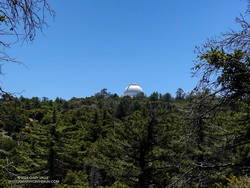
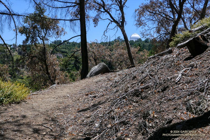
I continued chugging up the trail, noting familiar features as I climbed higher and higher. Eventually, the white dome of the Hooker 100 inch Telescope came into view, and I knew I just about done!

As I worked up the final half-mile of trail, I could see only a couple of  isolated build-ups of cumulus clouds. One was over the desert  and the other was to the east near San Gorgonio.  The sky over Mt. Wilson was mostly clear.

Here’s a high-resolution, interactive, 3D-terrain view of the Mt. Wilson – Red Box – West Fork – Kenyon Devore Loop. The loop is a slightly shorter version of the ANFTR/Mt. Disappointment 25K.

Some related posts:
After the Bobcat Fire: Running the ANFTR 25K Course
An ANFTR/Mt. Disappointment 2020 Adventure

Out and Back Trail Run from Islip Saddle to Mt. Baden-Powell – July 2024 Update

Mt. Baden-Powell from the PCT near Throop Peak.

Update July 22, 2024. The Poodle-dog bush along the PCT near Islip Saddle has been cleared by Gary Hilliard and the AC 100 Trail Team!

When I reached the summit of Mt. Baden-Powell (9,399′), it was empty, save an opportunistic raven who was evaluating the chances that the Larabar I was eating might fall to the ground.

On top, the heat of the strong Summer sun was offset by a cooling breeze. There was still a few thin ribbons of snow in the chutes on Mt. Baldy. With the excellent visibility, San Jacinto Peak could be seen in the notch between Mt. Baldy and Dawson Peak, and San Gorgonio Mountain was sharply visible to the left of Pine Mountain.

Poodle-dog bush (Eriodictyon parryi) along the PCT just east of Islip Saddle. (thumbnail)
Poodle-dog bush along the PCT just east of Islip Saddle.

Other than a few people at Little Jimmy hike-in camp, I saw no one on the way up from Islip Saddle. A quarter-mile from the trailhead, there was an astonishing display of Poodle-dog bush along the PCT. In 2011, when a large part of Angeles National Forest reopened following the Station Fire, I developed an extensive rash after bushwhacking through Poodle-dog on overgrown trails. After that experience I’ve been more careful around the plant, and haven’t had a bad case since.

Trees were across the trail in a few places. Most were fairly easy to bypass, but a couple were “inconvenient,” such as this big log, about 0.75 mile east of Windy Gap.

Bright red beaked penstemon (Penstemon rostriflorus) along the PCT above Windy Gap. (thumbnail)
Bright red beaked penstemon along the PCT above Windy Gap

As I worked up the switchbacks above the log, to the southwest I could see the observatory and towers on Mt. Wilson. As a result of the damage to Chantry Flat in the Bobcat Fire, Mt. Wilson was on the Angeles Crest 100 Mile course last year, and will be again this year. As the raven flies, Mt. Wilson was only about 16 miles away, but for someone running the AC100, the miles along its challenging course would total well over 50!

For several years I’ve been following the regrowth of conifers in four places along the PCT that were burned in the 2002 Curve Fire. What has been underscored in my informal study is a) trees take a long time to regrow, and b) frequent fires in an area are particularly devastating. Stand #1 (1.5 miles east of Islip Saddle on the PCT) was recovering nicely from the 2002 Curve Fire when it was burned in the 2020 Bobcat Fire. This comparison shows the result. The other three stands continue to recover well, with south-facing Stand #4, west of Throop Peak, growing particularly vigorously.

View WNW along Mt. Baden-Powell's west ridge. (thumbnail)
Limber pine (left) along Mt. Baden-Powell’s west ridge.

Ascending the final 400′ of gain on Baden-Powell’s west ridge, I was surprised to see a couple of small patches of snow remained on the north side of the ridge. The snowpack here was nowhere near as big as in 2023, but it was still pleasing to see that a little of the white stuff survived until July.

No out and back to Baden-Powell is complete without a quick stop at Little Jimmy Spring. Today, the water from spring was so cold it was painful to hold my hand in the water flowing from the pipe!

Some related posts:
It’s Mid-July And There Is Still Snow in Los Angeles County!
A Cool and Breezy Out and Back Trail Run from Islip Saddle to Mt. Baden-Powell
Contact Dermatitis from Eriodictyon parryi – Poodle-dog Bush
Regrowth of Trees Along the PCT Following the 2002 Curve Fire

The Ups and Downs of the Angeles Crest 100 Mile Run


The white dome of Mt. Wilson Observatory from near the top of the Kenyon Devore Trail.

First published on June 30, 2015. Updated July 8, 2024.

August 3rd  runners from near and far gather in a small parking lot in Wrightwood, California, to start the Angeles Crest 100 Mile Endurance Run (AC100). Begun in 1986, the AC100 is one of the original five 100-mile U.S. endurance races. It has endured fires, floods, the Covid-19 pandemic, and changing trail restrictions.

There’s a tradition of running grueling endurance races in the San Gabriel Mountains. The Big Pines Trail Marathon was one of the first organized mountain ultramarathons in the U.S. First run in August 1934, its course used some of the same trails that AC100 runners enjoy today.

The AC100 is not like a road marathon. It is an entirely different kind of running event and an entirely different kind of running experience. The 2024 L.A. Marathon had about 25,000 participants. About 1/100th of that number — around 250 runners — are expected to start the AC100.

Sunrise from Blue Ridge during the 2015 Angeles Crest 100.
Sunrise from Blue Ridge during the 2015 AC100.

For many, one of the primary reasons for running the AC100 is to be fully immersed in the beauty and majesty of the San Gabriel Mountains. Runners start at 5:00 a.m., ascend the Acorn Trail, and as the sun rises, find themselves above 8000′, reveling in the spectacular views from Blue Ridge.

Even at this early stage of the race, the field is already becoming dispersed. By the time runners reach the first checkpoint, nine miles into the run, there is an hour spread between the first and last runner. Unlike a road marathon, much of the time a runner in the AC100 will be alone.

This year’s course returns to a point-to-point format, ending in Altadena. Because of damage to the Chantry Flat area by the Bobcat Fire, runners will bypass Chantry and ascend Mt. Wilson using the grueling Kenyon-Devore Trail, returning to the traditional course at the Mt. Wilson Toll Road above Idlehour.

As a result of this frequent storms the past two Winters, many trails have been damaged or blocked by trees and debris. Ultrarunners not only spend many hours enjoying the trails in our local mountains but also do hours of trailwork that helps keep trails open and usable for everyone.

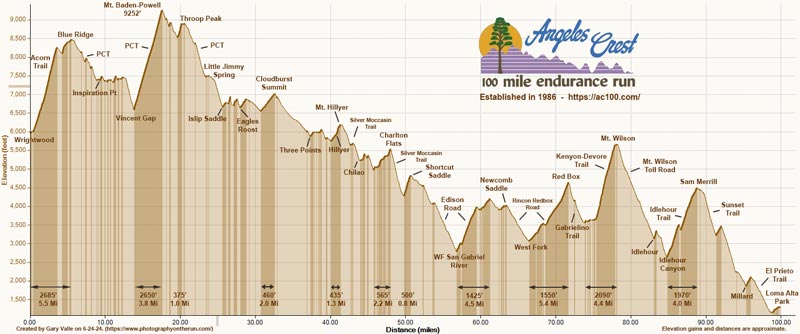
This elevation profile for the 2024 AC100 course was created in SportTracks from a GPX file provided by the event organizers. The elevation profile was corrected using 3DEP 1-meter Lidar-based DEMs. A conservative elevation data smoothing setting was used, resulting in an estimated cumulative gain of about 17,890′ and loss of 22,550′. The actual gain and loss are probably a bit more. Placemark locations, mileages, and elevation gains and losses are approximate. The elevation profile can be downloaded from the Course Overview page on the AC100 website.

Estimated Angeles Crest 100 Mile Elevation Profile (link)
Click to download from AC100 Course Overview page.

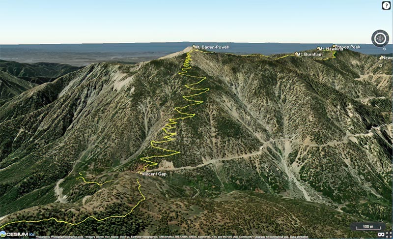
In addition, here is an interactive, high resolution, 3D-terrain map of the 2024 Angeles Crest 100 Mile Race. It is based on the course GPX file downloaded from the AC100 website. The view is initially zoomed in on the climb up Mt. Baden-Powell. To change the view, use the control on the upper right side of the screen. Track and placename locations are approximate and subject to errors.

Click to view 2024 AC100 course with high resolution, photographic 3D terrain.

Here is another high resolution view of the Shortcut Saddle – Red Box – Mt. Wilson section of the AC100 course.

See the AC100 website for official information and details.

Twenty-Plus Years Running the Strawberry Peak Circuit

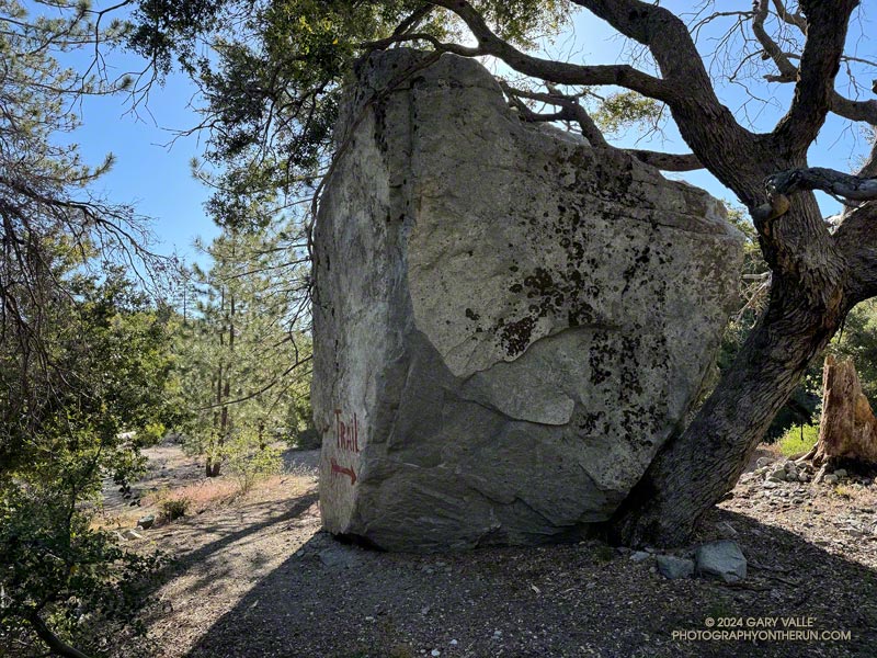
Large boulder near Strawberry Protreo marking the Colby Canyon Trail.
Can’t miss trail marker on the Colby Canyon Trail near Strawberry Protreo.

The repeated cries of a falcon called from high on the north face of Strawberry Peak. Along the sandy trail, lupine, paintbrush, penstemon and yarrow bloomed in a profusion of blues, reds, and yellows. Tracks from running shoes, bikes, boots, and a black bear proclaimed the trail to be truly multi-use.

I sighed and took it all in. I’d been doing this classic 16-mile route for more than 20 years. A favorite of mountain bikers and runners alike, the loop can be broken down into the following segments.

Josephine Fire Road Climb
Scarlet bugler along Josephine Fire Road. (thumbnail)
Scarlet bugler along Josephine Fire Road.

From the Clear Creek Trailhead, Josephine Fire Road climbs about 1250′ over 2.5 miles to a divide connecting Josephine and Strawberry Peaks. At the junction, the route turns right (east) onto a trail along the divide that goes to Josephine Saddle. A left (west) turn goes to Josephine Peak.

On the way up from Clear Creek, the switchbacks on the fire road look intimidating, but the climb goes relatively quickly. There are good views of Strawberry Peak along the way. In the Spring and early Summer, the bright yellow flowers of invasive Spanish broom line the road.

Clear Creek Trailhead from Josephine Fire Road. (thumbnail)
Clear Creek Trailhead from Josephine Fire Road.

An out-and-back ascent of Josephine Peak from the junction adds about three miles to the loop.

There is a Remote Automated Weather Station (RAWS) at Clear Creek Station. The “2.0m Temperature” is more or less the temperature in the shade and the “Fuel Temperature” is a good indicator of the temperature in the sun.

Colby Canyon Trail
Colby Canyon Trail northeast of Josephine Saddle. (thumbnail)
Colby Canyon Trail northeast of Josephine Saddle.

The route joins the Colby Canyon Trail at Josephine Saddle. A large cistern is found here. Just past the saddle, the climber’s trail to Strawberry Peak branches off the main trail and goes up the ridge. The Colby Canyon Trail contours along the left (northwest) side of the ridge and traverses a steep slide area. After that, it works around the shoulder of Strawberry, then turns east and descends, winding in and out of the small canyons on the northwest and north slopes of Strawberry.

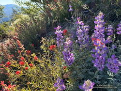
In the Spring and Summer colorful patches of lupine, paintbrush, and other wildflowers are found on this stretch of trail. Long-limbed big cone Douglas-firs grow on these cooler north-facing slopes.

Lupine and paintbrush along the Colby Canyon Trail. (thumbnail)
lupine (violet) and paintbrush (red) along the Colby Canyon Trail.

The bare trunks of trees burned in the 2009 Station Fire are mixed in with surviving trees. Today, I was surprised to find another reminder of the Station Fire — poodle-dog bush. The plant can cause a poison oak-like rash and was much more common following the 2009 Station Fire.

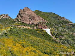
On this stretch, the large rock face on the north side of Strawberry Peak comes into view, and shortly after, the trail passes a huge boulder. The flattish area that follows is Strawberry Protreo. The “meadow” reminds me of lower elevation areas of the Southern and East Side Sierra.

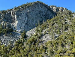
North face of Strawberry Peak. (thumbnail)
North face of Strawberry Peak.

Several climbing routes have been done on Strawberry’s formidable north face. The consensus seems to be that the rock quality is poor and the risk high.

Beyond Strawberry Protreo, the trail descends along the margin of a moraine-like landslide. Then it turns south, reaching a flat, sandy area just before the Colby Canyon Trail – Strawberry Trail junction. I’ve often seen bear tracks on this stretch of trail. The loop takes the right fork onto the Strawberry Trail and climbs to Lawlor Saddle.

Climb to Lawlor Saddle
Yerba Santa along the Strawberry Trail. (thumbnail)
Yerba Santa is a close relative of Poodle-dog Brush.

The Strawberry Trail gains about 750′ over two miles on its way to Lawlor Saddle. As the post “Trail Games” mentions, this stretch will tell you a lot about how your day is going. It dips in and out of side canyons, passing Strawberry Spring along the way. Today, Strawberry Spring was running, but the spring was dry during our recent drought.  It is generally not a dependable water source.

Lawlor Saddle to Red Box
New growth on a bigcone Douglas-fir seedling. May 2024. (thumbnail)
New growth on a bigcone Douglas-fir seedling.

The 2.5 miles to Red Box are enjoyable single-track trail. Most of it is flat or downhill. On the weekend, numerous hikers are on the trail, heading up to climb Strawberry Peak. It is by far the busiest trail on the loop.

There’s a water faucet at Red Box at the Haramokngna American Indian Cultural Center which generally (but not always) has water.

Gabrielino Trail to Switzer’s
Josephine Peak from the Gabrielino Trail between Red Box and Switzer's. (thumbnail)
Josephine Peak from the Gabrielino Trail between Red Box and Switzer’s.

The 4.4 miles down to Switzer’s include some fast-paced stretches and some of the most technical sections of the loop. It is popular with mountain bikers and V-ed and rutted in places. At one point, the trail drops down to the stream (if it’s running) and crosses the creek twice.

Among the many wildflowers found along this trail is crimson-spotted rock rose.

As the trail nears Switzer’s, derelict nature signs are seen along the trail, which the Forest Service apparently can’t afford to repair or remove.

Nature’s Canteen Trail to Clear Creek

The Nature’s Canteen Trail is roughly half a mile long and connects Switzer’s to Clear Creek. It starts a third of a mile up the steep access road between Switzer’s and Angeles Crest Highway. The trail is sometimes overgrown.

Strawberry Peak Variation

There is a more adventurous variation of the Strawberry Peak Circuit that goes over the top of Strawberry Peak instead of around it. This variation requires good route-finding and rock-climbing skills.

This interactive, 3-D terrain view shows the classic Strawberry Peak Circuit and the Strawberry Summit Loop variation.

Some related posts:
Showers on the Strawberry Peak Circuit
Strawberry Peak Summit Loop – Spring 2023 Update
Strawberry Peak Circuit

Encinal Canyon – Mishe Mokwa Loop – Sandstone Peak Running Adventure

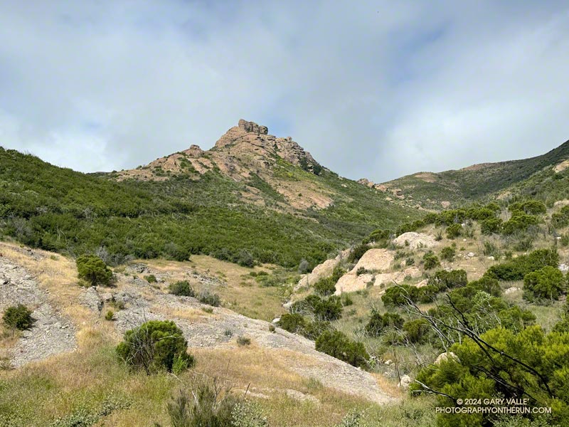
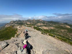
Tri Peaks from the Mishe Mokwa Trail. Photography by Gary Valle'.
Tri Peaks from the Mishe Mokwa Trail.

I enjoy doing trail runs with an added element of adventure, exploration, or quirkiness. A run might climb a peak, look for a particular wildflower, or check out a rock formation, a creek, or an old trail. The possibilities are endless.

Whenever I’ve done the out-and-back trail run from Encinal Canyon to Mishe Mokwa, I’ve thought about extending it to Sandstone Peak. Doing so would add the ascent of the highest peak in the Santa Monica Mountains to an already excellent run. Even better, I could run from Encinal Canyon to Mishe Mokwa, do the Mishe Mokwa Loop — including Sandstone Peak — then run back to Encinal Canyon. That would be an exceptionally scenic 26+ miles, with much of it on the Backbone Trail.

An advantage to doing the run this Spring is that back-to-back wet rain seasons have recharged the area’s streams, and I would (theoretically) be able to get water from a creek on the Mishe Mokwa Trail. Another plus is that all the rain has resulted in historic conditions, with extraordinary displays of a variety of wildflowers.

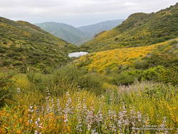
Pond along the Backbone Trail, surrounded by deerweed, black sage. (thumbnail)
Pond along the Backbone Trail, surrounded by deerweed, black sage.

The day dawned overcast and cool, a deep marine layer covering most of the area. I was running west on the Backbone Trail between Encinal Canyon and Mishe Mokwa. The weather could not have been better for the initial 10+ miles of what I hoped to be a challenging and enjoyable run.

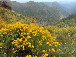
Along the way, I marveled at the explosion of wildflowers along the Backbone Trail. In addition to the extensive bloom of deerweed, pitcher sage, black sage, canyon sunflower and purple nightshade lined the trail.

About 8 miles into the run, as the Backbone Trail crossed the west shoulder of Triunfo Peak, a new trail sign had been posted. It marked the recently completed trail connecting the Backbone Trail to Yellow Hill Fire Road and the top of Triunfo Peak. The new trail replaces a use trail that had evolved here, and expands the route choices when running or hiking in the area.

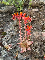
Canyon live-forever on the rocks below Mishe Mokwa. (thumbnail)
Canyon live-forever on the rocks below Mishe Mokwa.

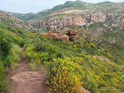
It was still overcast as I ran through the little valley below Mishe Mokwa. Above, I could see the Backbone Trail winding up toward Sandstone Peak and into the clouds. There was a colorful selection of wildflowers along the trail, including speckled Clarkia, canyon live-forever, yellow monkeyflower, woolly blue-curls, and others.

I had planned to make a go-no-go decision at Mishe Mokwa, but something in me had already made that decision miles ago.

When I reached Mishe Mokwa, I didn’t stop. I jogged across Yerba Buena Road and started hiking up the Mishe Mokwa Trail. It was still cool and my legs felt surprisingly good. The only question was: Would the creek at Split Rock actually be running?

Having run the Mishe Mokwa – Sandstone Peak Loop on other adventures, and climbed at Echo Cliffs, I was familiar with the trails. The 6+ mile loop from the Mishe Mokwa parking area is one of the most scenic short loops in the Santa Monica Mountains and deservingly popular.

Golden yarrow along the Mishe Mokwa Trail. (thumbnail)
Golden yarrow along the Mishe Mokwa Trail.

The Mishe Mokwa Trail traverses the rocky slopes directly across the canyon from Echo Cliffs and Balance Rock. The dramatic rock formations are so close that climbers can be heard conversing as they climb the steep faces. This stretch of trail is demanding and has a few steep steps— up and down — that have to be navigated.

As I worked past Echo Cliffs, I passed a large group of hikers that had stopped to enjoy the view from the top of a prominent outcrop.

Earlier, I’d encountered a runner coming down the trail, and he’d been pessimistic about using the creek as a water source. But the burbling sound echoing in the canyon below me left little doubt that the creek was running.

A wildflower-lined section of the Mishe Mokwa Trail near Echo Cliffs. (thumbnail)
A wildflower-lined section of the Mishe Mokwa Trail near Echo Cliffs.

It seemed everyone on the trail converged at Split Rock. When I arrived, one large group was already taking a break there, and by the time I finished getting water, another group joined them.

As a water source, the creek was a bit funky. I debated skipping it but thought of a friend’s comments regarding water sources on the Arizona Trail. How bad could it be? The drainage below Tri Peaks is relatively isolated and there are no cattle. At least, that’s how I rationalized it.

With the cool conditions, I only needed about a half-liter of water. And, of course, a little way up the trail, there was another — probably better — water source. I briefly debated dumping my water and refilling, but decided to continue.

At Split Rock, the character of the trail changes. It becomes much more straightforward as it gains elevation, passes below Tri Peaks, joins the Backbone Trail, and circles around to Sandstone Peak.

After being cloudy for most of the run, skies cleared while I was on Sandstone Peak. (thumbnail)
After being cloudy for most of the run, skies cleared while I was on Sandstone Peak.

Given the number of people on the Mishe Mokwa and Backbone Trails, I expected the top of Sandstone Peak to be a busy place. But the timing worked out perfectly — only two people were on the summit. Most of the clouds had cleared, revealing Sandstone Peak’s superb views.

Since I did the loop counterclockwise, the return to the Mishe Mokwa parking area from Sandstone Peak was much shorter (and steeper) than the trails to get there. Bush lupine lined the road; its unique fragrance and vibrant color a treat for the senses.

Damaged section of the Backbone Trail above Mishe Mokwa. May 2024. (thumbnail)
Damaged section of the Backbone Trail above Mishe Mokwa

Partway down, the shoulder of the trail had collapsed in a slide. It had been temporarily stabilized with a large white sheet of plastic that must have been visible from miles away. Continuing the descent, I took great care not to miss the turn onto the connector to the Mishe Mokwa Trail. At this point in the run, I didn’t want to do any “bonus mileage!”

The return from Mishe Mokwa to Encinal Canyon is a bit of a blur. Everyone I encountered on the trail — and particularly the mountain bikers — were super-cool, several offering a quick high-five as they passed. The encouragement must have helped — my time returning to the Encinal Canyon Trailhead was faster by a few minutes than the time going out!

This interactive 3-D terrain view shows my GPS track of the Encinal Canyon – Mishe Mokwa Loop – Sandstone Peak Running Adventure. The map can be zoomed, tilted, rotated, and panned. It is initially zoomed in on the Mishe Mokwa loop.

And BTW, even though it was a cool day, I was nearly out of water when I got back to Encinal. It took a little time to purify the water from the creek but having the additional water helped. So far, no obvious problems have resulted.

Some related posts:
Encinal Canyon to Mishe Mokwa Out and Back Trail Run
Encinal Canyon to Triunfo Peak
Balance Rock
Mishe Mokwa – Sandstone Peak – Grotto Trail Run