It’s uncommon to have back-to-back Rain Years with 20+ inches of rain in Los Angeles. During Rain Year 2022-2023, Downtown Los Angeles (USC) recorded 28.4 inches of rain — about two times normal. This rain year Los Angeles has already had about 21 inches of rain, so another big year is in progress.
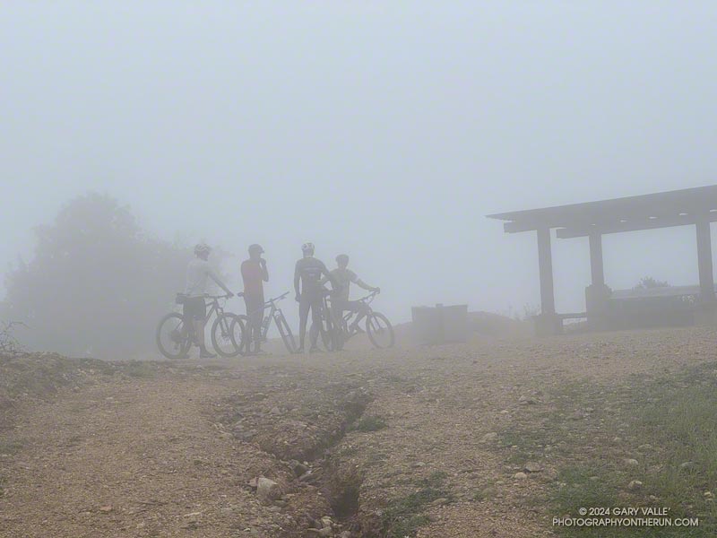
Curious to see how the trail conditions compare to last year, on February 17th and 25th I ran the Trippet Ranch Loop in Topanga State Park.
The big surprise was that the fire roads on the loop — Fire Road #30, Eagle Springs Fire Road, and a short section of Eagle Rock Fire Road — generally fared better than last year. Fire Road #30 had some damage along it’s shoulder, but I did not see the numerous mudslides along these roads like last year.
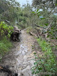
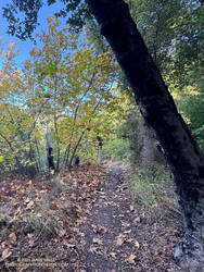
A little mud on the Musch Trail.
The news on the trails was divided. One of the more unusual events occurred where the Garapito Trail crosses the east fork of Garapito Creek. A mudslide from a gully on the northwest side of the creek crossed the creek, and left a pile of debris on the trail. The stream may have been dammed by mud and debris for a short time. Farther up the trail, about a half-mile from Eagle Rock Fire Road, a section of the trail collapsed in a slide.
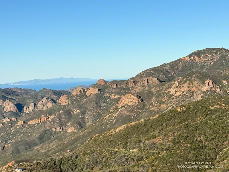
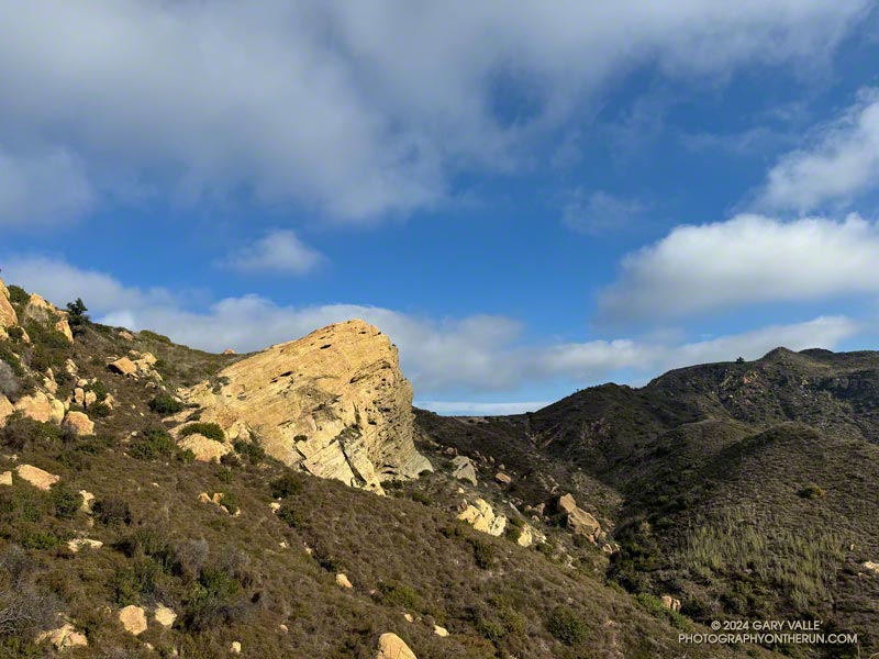
The Backbone Trail contours around Triunfo Peak (on the right) above the rock band that extends across the photo. The Channel Islands are in the distance.
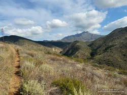
The Backbone Trail between Encinal Canyon and Mishe Mokwa is one of the must-do sections of the 68-mile trail. Engineered to be multi-use, this exceptionally scenic stretch of the Backbone Trail is popular with riders, hikers, and runners alike.
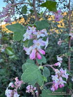
Chaparral Currant
It’s also a pretty good place for a trail run after rainy weather like we’ve had this February. Although the parking lot at the Encinal Trailhead was quite wet this morning, the Backbone Trail was in decent shape most of the way to the Mishe Mokwa trailhead. There were a few muddy and wet spots, but it was generally easy to work around them. And I didn’t have to change my shoes before driving home.
The out & back run worked out to about 21-miles, with a surprisingly moderate gain/loss of about 2500′. The weather and visibility were excellent. Striking rock formations and the Channel Islands could be seen from one side of Etz Meloy Mtwy fire road, and snow on Alamo Mountain and other Ventura County peaks from the other side.
On the way back, as I was working up the long hill on the northwest side of Triunfo Lookout, a descending mountain biker commented that a large group of bikers were at “the corner.” The overlook at this prominent switchback has a wide-ranging view of Mishe Mokwa, Boney Mountain, and Sandstone Peak, and some prefer to turn around here. This variation is about 3.5 miles shorter (round-trip) than dropping down into the canyon and going all the way to Mishe Mokwa.
Over the first six days of February 2024, Downtown Los Angeles recorded 10.2 inches of rain. That’s almost three-quarters of L.A.’s normal ANNUAL rainfall in just a few days and the wettest start to February on record! Some stations in the Santa Monica and San Gabriel Mountains recorded even more — over 13 inches in some locations!
How much did it rain at Ahmanson Ranch (Upper Las Virgenes Canyon Open Space Preserve)? Unfortunately the Remote Automated Weather Station (RAWS) on a hill between Upper Las Virgenes Canyon and Cheeseboro Canyon hasn’t been accurately measuring precipitation. A citizen weather station (KCAWOODL130) near the Victory Trailhead at Ahmanson Ranch recorded over 11 inches from February 1 – 6. Another station near Cheeseboro Road in Agoura (KCAAGOUR41) recorded over 9 inches.
Lately, I’ve been doing another option — adding an out and back from the Hub to Temescal Peak and Temescal Lookout and then continuing on the Trippet Ranch Loop from the Hub.
This extends the run to about 16 miles, plus Temescal Peak and Temescal Lookout are excellent viewpoints (video).
Not all trails will have a smooth tread, good footing, trimmed vegetation, trail signs and other luxuries. What you see is what you get, and sometimes what you get is not perfect.
That was the case on last May’s run to the Serrano Valley from Wendy Drive. A long stretch of the Old Boney Trail was all but impassable. The trail was badly overgrown, the day foggy and gray, and everything was dripping wet.
Serrano Canyon Trail
But there is just something about immersing yourself in the good and not-so-good that nature offers. It’s part of what nature is. The splendid display of wildflowers seen on that run was a result of the rainy season that produced the overgrown trail.
Curious to see how that section of trail had changed in seven months, this morning I was back on the Old Boney Trail and on my way to Serrano Valley. It had rained around 4 inches during the week, and I expected the mud to be like glue and creek crossings wet.
Use of the trail had improved its condition. There were still some overgrown sections but most of the time I could see my feet, as well as the ruts and rocks on the trail. It was muddy in the usual places but the globs of mud on my shoes didn’t reach dinner plate proportions.
Fireline Trail with Boney Mountain in the distance.
In the wake of the storm, the weather was exhilarating. Postcard clouds decorated the crest of Boney Mountain and a cool breeze filtered through the canyons. Despite all the rain, Serrano Creek was flowing at a modest level, and I emerged from Serrano Canyon with dry shoes.
It was a day for a longer run, and when I reached Sycamore Canyon fire road, I turned left (south) and continued down the canyon to the Fireline Trail. Going up the Fireline Trail to Overlook Fire Road extended the run and expanded the views. A right turn on Overlook Fire Road lead to the top of the Ray Miller Trail, and from there to the Hub. These junctions offer additional opportunities for extending the run.
Today, I ran down Hell Hill, over to the Two Foxes Trail via Wood Canyon Fire Road, then picked up Sycamore Canyon Fire Road near the Danielson Multi-Use Area and followed it to the Upper Sycamore Trail, Danielson Road, and Satwiwa. This interactive, 3D terrain view shows the route.
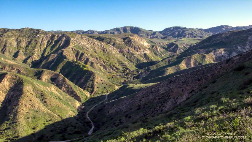
At times the site of a religious colony, a grit mine, an oil field, and a housing development, Las Llajas Canyon is now part of the Marr Ranch Open Space and Rocky Peak Park. Its oak groves, gurgling stream, varied plants, and unique geology make it a popular place to hike, run or ride.
According to California Place Names, Las Llajas might have originated from a misspelling of the Spanish word “llagas,” which literally means sores or wounds. Perhaps this was a reference to the area’s natural oil seeps. These would have been an important resource for the Chumash and early settlers.
The trailhead for Las Llajas Canyon is on Evening Sky Drive in Simi Valley. From the trailhead, it’s about 3.4 miles up the (mostly) dirt road to a windmill and oak-shaded trail junction. From the junction, a connecting trail crosses the creek and then climbs steeply to Rocky Peak Road. A strenuous 9.2 mile loop — Chumash-Las Llajas Loop — follows this route.
There are also some less-used side trails in Las Llajas Canyon. A use trail on the canyon’s east side starts about 0.4 mile from the trailhead and connects to Rocky Peak Road near the highest point in Rocky Peak Park. A very steep, eroded hill marks the beginning of the route. The trail ends at a large cairn near Rocky Peak Road. Fossiliferous limestone, composed of seashells, is found here. It is similar to that found at Coquina Mine.
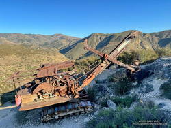
About a half-mile up the trail splits — the Coquina Mine use trail switches back to the right, while a trail connecting to the Marr Ranch Trail continues straight ahead. After the switchback, the Coquina Mine trail traverses across a steep, rocky face that overlooks Las Lajas Canyon and then continues to the top of the peak. As the trail winds up the mountain, there are bits and pieces of rusted mining equipment and abandoned dig sites — signposts of success and failure on the meandering trail of time.
“Thank you so much for this extraordinary image of a P&H 206! Our company built Model 206 machines during the 1920s and 1930s. They were offered in shovel configuration, such as the machine you discovered in Southern California, and also in construction crane, dragline, clamshell, pile driver and backhoe options. It is amazing to behold such a well-preserved Model 206. The arid environment must be a factor.”
“During the last 20 years there has been irregular production from deposits of shell limestone on Rancho Simi, north and east of north from Santa Susana. The quarries are on hills 2 1/2 miles apart and 1 to 2 miles from the Los Angeles County line.”
The report goes on to summarize the operation at Coquina Mine:
“In 1929 Tapo Alto Shell & Fertilizer Company leased the deposit and produced limestone until 1935. They dug limestone with a 1/4-cubic-yard gasoline shovel, and screened and crushed it in a plant having a daily capacity of 15 tons. The principal product was poultry grit…”
“Present quarry is 200 feet long by 70 feet wide, with a 40-foot face. Material is handled by gasoline shovel, having a 1/4-yard dipper, into a l 1/2-ton truck which hauls it about 200 feet to the brow of the hill where it is dumped into a chute 300 feet long. This chute empties into a hopper which discharges into the boot of an elevator; to trommel screen, 4-mesh, screenings to bin, thence to elevator and Cottrell vibrating screens ; products to two-compartment bin ; over-size from trommel to rolls and bin. The plant is so arranged that either product can be put on dump by means of a conveyor. Plant is operated by 25-h.p. Fairbanks Morse gas engine. Plant has a daily capacity of about 15 tons. Products are — 8 + 10-mesh for chickens and — 10-mesh for little chicks.”