Chumash Trail Out and Back to Rocky Peak Road

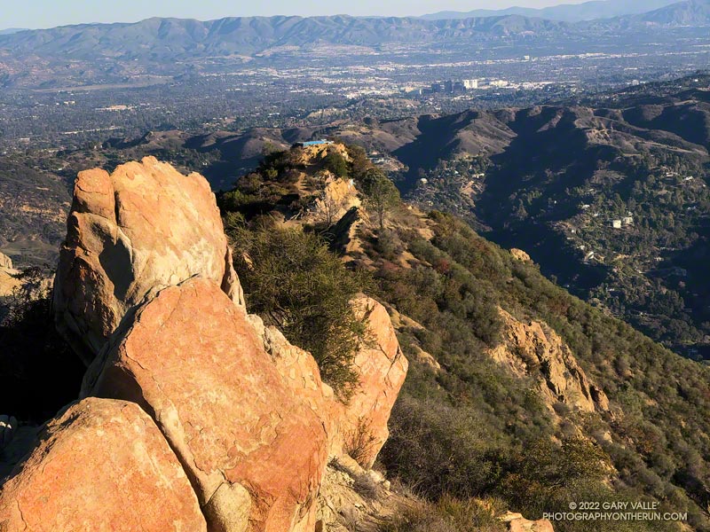
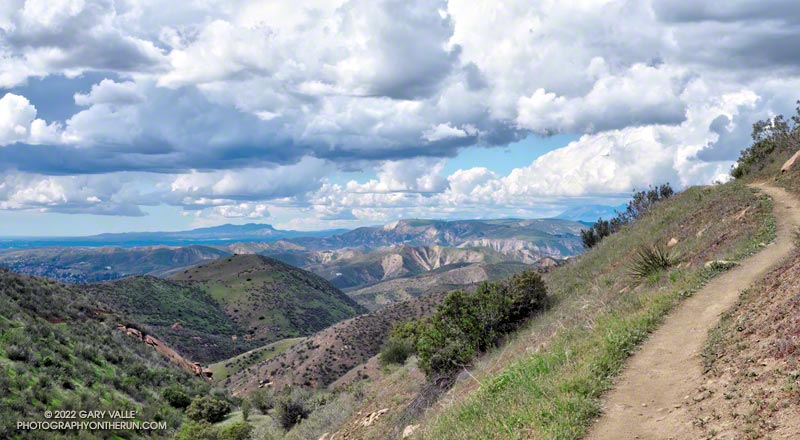
A spectacular Spring day on the Chumash Trail in Simi Valley

Originally published June 28, 2008. Updated December 30. 2022.

Without a doubt, the Chumash Trail is one of my favorite short “after work” trail runs. Popular among hikers, mountain bikers, and runners, the Chumash Trail starts on Flanagan Drive in eastern Simi Valley and ascends the convoluted western flank of Rocky Peak Park to Rocky Peak Fire Road. It’s single-track trail all the way, gaining about 1175′ over 2.7 miles.

From a trail runner’s training perspective, it is a nearly ideal short, technical, higher heart rate workout. It has a few tough sections but is generally very runnable. When I’m chugging up the trail, it seems just about the time my heart rate is going to go lactic, the trail will back off or contour. Because I usually run the trail near my aerobic maximum, it’s a great indicator of where I am in my training. Over-training, or any other fitness issue, is usually plainly — and sometimes painfully — evident.

In many ways running down the Chumash Trail is more difficult than running up. It can be very challenging to run down a rocky, technical section of trail with any speed. Running a trail like the Chumash Trail can help develop the skill and strength necessary to do downhills with better technique and more speed.

I don’t think I’ve ever run this trail fresh, but a couple of times a year, when my legs feel good, it’s fun to really push the Chumash Trail up and down. Like most running, there’s a balance — push too hard on the up and there won’t be enough left to push the down.

Here is an interactive, 3D terrain view of the Chumash Trail Out & Back to Rocky Peak Road. The map can be zoomed, tilted, rotated, and panned using the navigation control on the right. Track and placename locations are approximate and subject to errors. Poor weather and other conditions may make this route unsuitable for this activity.

There are several ways to extend the basic out and back. One option is to turn left on Rocky Peak Road and run a mile to “Fossil Point.” Another is to turn right and run 1.6 mile to the Rock Peak overlook.

Some related posts: Chumash Trail Mule Deer, Category Is: Things Found on the Chumash Trail, Chumash Trail Rocks & Snow, Chumash-Las Llajas Loop

Bigberry Manzanita – A Hummingbird Hotel

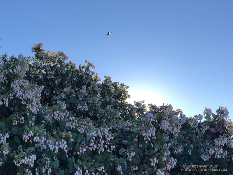
Bigberry Manzanita - A Hummingbird Hotel

From a hummingbird perspective, it was the perfect place to spend a cold night.

The big berry manzanita was situated on the spine of a north-south oriented ridge near Topanga Lookout. In that location, a bird might benefit from the warmth of both the setting and rising sun.

In addition, the bush’s thicket of stiff branches afforded some protection from predators, and the multitude of nectar-rich blossoms would provide a badly needed boost of wake-up energy.

The temperature was warmer now, but it had been near freezing at the Cold Canyon trailhead when I started the Topanga Lookout Ridge loop. It had been cold enough that I had jogged the steeper sections of Calabasas Peak fire road, just to ward off the chill.

Humans are funny that way — a small drop in body temperature can be life-threatening. How in the world can a diminutive hummingbird, whose caloric needs require it to feed almost constantly, survive a long, cold Winter night?

Research reveals that hummingbirds accomplish this feat by reducing their body temperature and metabolic rate. This physiological state — called torpor — dramatically reduces their energy requirements.

This particular manzanita apparently receives a lot of 5-star reviews, and at the time I passed, was occupied by several buzzing birds.

From Sunday’s run of the Topanga Lookout Ridge loop.

Related post: Hummingbird Stories

Racing the Weather to High Point (Goat Peak) and Back

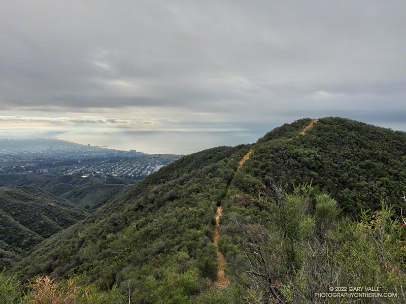
High Point (Goat Peak), Santa Monica Bay, and clouds.
High Point (Goat Peak)

The forecast for the Los Angeles area (Saturday, December 10) was for a chance of rain in the afternoon, with rain developing overnight and continuing into Sunday morning. There was also a slight chance of light rain or drizzle in the Santa Monica Mountains in the morning.

It was overcast in the West Valley as I drove to the trailhead, and I wondered if my run would be dank and drizzly. But as I drove up Reseda Blvd. toward Marvin Braude Mulholland Gateway Park, I was surprised to find patches of blue sky overhead.

Sunrise view of Hondo Canyon, Topanga Lookout, and Henry Ridge in the Santa Monica Mountains.
Hondo Canyon, Topanga Lookout, and Henry Ridge from the top of Fire Road 30.

I started the run a little before 7:00 a.m. and headed up the connecting single-track trail to dirt Mulholland and Fire Road 30. Many runs from the Top of Reseda start this way, and I turned onto Fire Road 30 and continued up to the Hub — about 2.5 miles from the trailhead.

For the first couple of miles, I wasn’t sure how long a run I would do or where I was headed. But as I neared the Hub, I had to make a decision. To a large extent, a decision that depended on the weather.

What had been partly cloudy skies had coalesced into a layer of clouds that just touched the top of the highest peaks. I’d been thinking about doing an out-and-back to High Point (Goat Peak), but if the weather continued to deteriorate, the only view I would see from the peak would be the interior of a cloud. I finally decided to give it a go and hope the peak didn’t get socked in with clouds and fog.

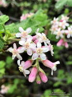
Chaparral currant (Ribes malvaceum) along the Backbone Trail
Chaparral currant

Turning left at the Hub onto the Temescal Ridge Fire Road segment of the Backbone Trail, I ran about a half-mile to where the Backbone Trail forks left off the fire road and becomes a single-track trail. This is the popular Rogers Road segment of the Backbone Trail that eventually ends at Will Rogers Historic State Park.

From Temescal Ridge Fire Road, it’s about 4.25 miles on the Backbone Trail to the unsigned junction with the High Point use trail. It’s on the right and easy to miss. The turnoff is about a half-mile before “The Oak Tree” landmark on the Backbone Trail.

The High Point trail is an unofficial, unmaintained path but is usually in decent shape. There are a couple of short, steep, loose sections on the way to the peak. Nothing is signed, and some side paths diverge from the main trail.

Summit of High Point (Goat Peak), with the San Gabriels, Downtown, and West L.A in the background
Summit of High Point (Goat Peak)

When I reached High Point’s summit, the weather was holding but looked more threatening. Even so, the view was excellent. Panning from east to west underneath the ceiling of clouds, the view included the San Gabriels, Downtown, West L.A., the South Bay, Santa Monica, Palos Verdes Peninsula, Santa Monica Bay, and Catalina.

There were a couple of rogue sprinkles on the way back to the Top of Reseda, but the rain held off in the West Valley until late in the day.

Here is an interactive, 3D terrain view of the High Point (Goat Peak) Out and Back from the Top of Reseda. The map can be zoomed, tilted, rotated, and panned using the navigation control on the right. Track and placename locations are approximate and subject to errors. Poor weather and other conditions may make this route unsuitable for this activity.

Some related posts: High Point (Goat Peak) Via the Rivas Ridge Use Trail, Goat Peak and the High Point Trail

Eagle Rock Silhouette

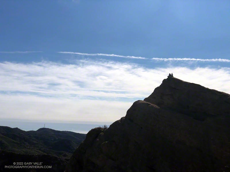
Silhouetted hikers on Eagle Rock in the Santa Monica Mountains

The photograph of Eagle Rock is from this morning’s meandering trail run to Temescal Peak, Temescal Lookout, Eagle Rock, and the Garapito Trail in Topanga State Park.

All of these viewpoints have sweeping views of the Santa Monica Mountains, Los Angeles Basin, and surrounding mountains.

Temescal Lookout (Peak 2036) is the site of a bygone fire lookout station. It’s located just west of Temescal Ridge Fire Road, about a mile south of the Backbone Trail junction and a half-mile north of the Trailer Canyon Fire Road junction. It’s shown on the USGS Calabasas topo map from 1944. Vestiges of the lookout are all that remain.

Some related posts: Downtown Los Angeles and San Jacinto Peak; Trippet Ranch Loop Plus Temescal Peak; Eagle Rock – Topanga State Park; Will Rogers – Rivas Canyon – Temescal Canyon Trail Run