Category Archives: geology

Exploring the Santa Clarita Ultra & Trail Runs 50K Course

Bigcone Douglas-fir along East Canyon Mtwy fire road
Bigcone Douglas-fir along East Canyon Mtwy fire road.

I hadn’t seen a hiker, runner, or mountain biker since turning off East Canyon Mtwy fire road. That was about 2 miles ago. I checked my watch — it read 18 miles. Had I’d made a wrong turn?

Today’s plan was to do the first 25 miles of the Santa Clarita Ultra & Trail Runs 50K. A week ago I’d run the first (blue) and third (yellow) sections of the course, and today’s run would theoretically combine the first (blue) and second (orange) sections.

Oat Mountain (3747'), the highest peak in the Santa Susana Mountains.
Oat Mountain from the Towsley Canyon Loop Trail

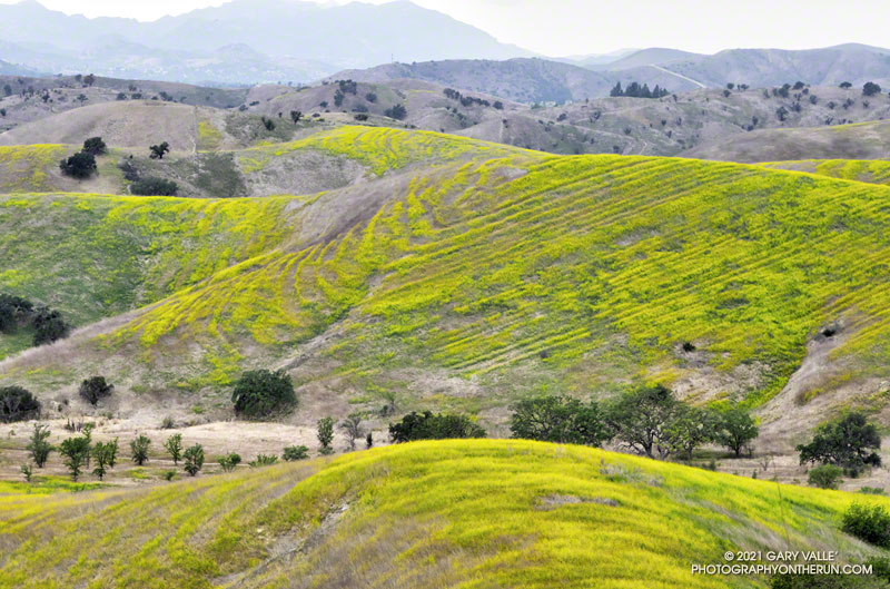
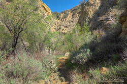
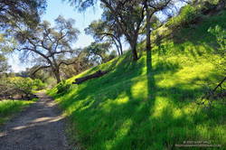
So far, the run had gone well. It had started with an extended version of the popular Towsley Canyon Loop in Ed Tavis Park. After climbing up oil-rich Wiley Canyon to a view point at an elevation of about 2450′, the course descended a series of long switchbacks, and passed through a gap in Towsley Canyon known as the Narrows. A mile down the canyon from the Narrows I’d used segments of the Elder Loop and Taylor Loop trails to run over to Lyon Canyon.

Entrance to the Narrows on the Towsley Canyon Loop Trail
Entrance to the Narrows in Towsley Canyon

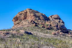
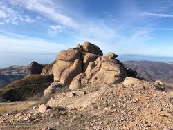
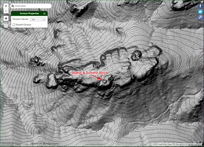
Following an out and back up the canyon to the top of a prominent hill, the course continued on the Taylor Loop nearly to the Old Road, eventually circling back to the parking area at Ed Davis. At the parking lot my watch read a bit over 9 miles.

After switching from a bottle to a pack, I’d run on the Old Road over to the East Canyon Trailhead. From there the course followed East Canyon and Sunshine Canyon fire roads to Mission Point. The climb up to Jones Junction gains about 1300′ in 3 miles, then it’s another 1.5 miles over to Mission Point (2771′), the high point on the course.

A very green stretch of the Taylor Loop Trail
Green along the Taylor Loop Trail.

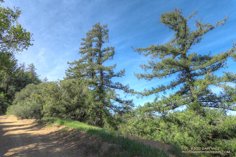
One of the highlights of the run up East Canyon was the very healthy-looking Bigcone Douglas-firs higher on the road. Now relegated to the cooler climes of steep, north-facing mountain slopes, the species used to be far more widespread in Southern California.

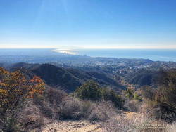
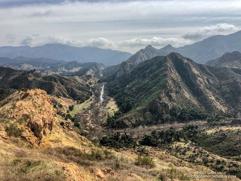
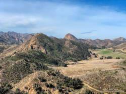
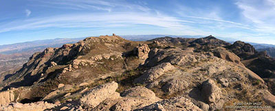
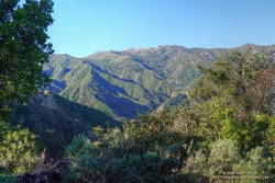
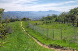
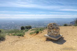
On the way to Mission Point, the views of the San Fernando Valley from the crest were outstanding, and gave a perspective of the Valley I had not seen before. Apart from having to detour along fence lines bordering private property, and continuous gunfire in a section of the canyon that is near a popular gun club, the run to Mission Point was excellent.

The first of three short detours along fencelines on the way to Mission Point.
Detour around private property on the way to Mission Point.

Returning from Mission Point there was another part of the course I needed to do — an out and back on Weldon Mtwy. Which brings me back to mile 18 of today’s run. After turning off East Canyon Mtwy on what I thought was Weldon Mtwy, I had expected the fire road to loose elevation relatively quickly. But that wasn’t happening.

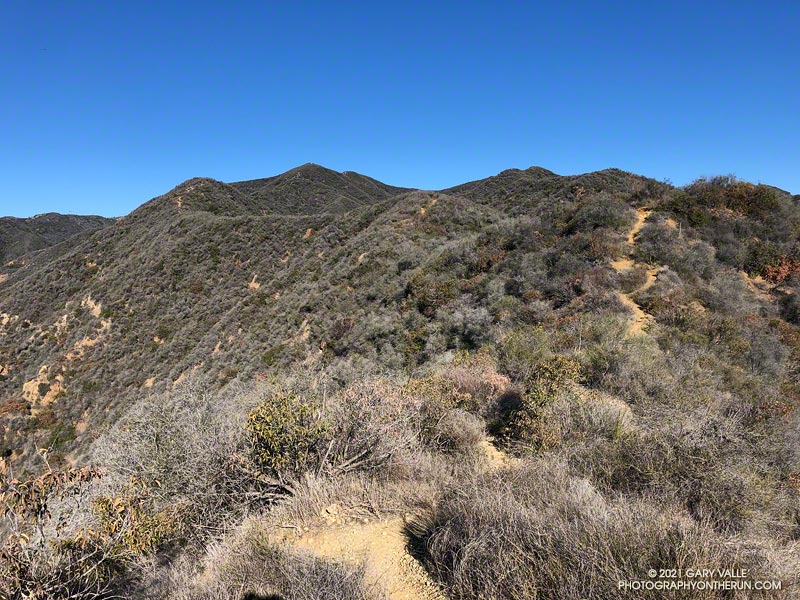
Instead of running down a canyon, I was running along a ridge — a long ridge. Below and to my right was what looked like a landfill. Below and to my left I could see the Old Road and Santa Clarita. They seemed a long way down.

Mission Point, Three Trees and the San Fernando Valley.

There were several ways I could have checked where I was — my watch has maps; my phone had maps; and I had a map in my pack. But I wasn’t in trouble and was already two miles down this road — whatever it was. If I wasn’t on Weldon Mtwy, it would still be a trail I hadn’t done.

After a couple of “I’ll just go a little farther down and see what I can see” episodes, I eventually turned around and headed back up the fire road. When I got back to East Canyon Mtwy, I checked the yellow pole marking the junction of the fire roads — it was marked “WELDON.” Later, I checked my track and found I had turned around a half-mile from the Newhall Pass Trailhead. Now I know.

Overall, I’d enjoyed the course, and decided I would register for the 50K. But registration closed early, and now I see the event has been postponed until November. Oh well, I still got to run in a new area and check out some interesting trails!

Goat Peak and the High Point Trail From the Top of Reseda

Goat Peak and the High Point Trail
The High Point Trail

Like many that enjoy our local mountains, I’m always on the lookout for new trails, new peaks, and interesting loops. A couple of months ago, after running to “The Oak Tree” on the Rogers Road segment of the Backbone Trail, I checked out the upper part of the High Point Trail.

This 2-mile long unofficial, unmaintained, use trail connects the Backbone Trail to the Rivas Canyon Trail. My thought was that I could use the trail to do a variation of the Will Rogers – Temescal Canyon Loop. Instead of running down the lower half of Rogers Road Trail to Will Rogers SHP, I could descend the High Point Trail, pick up the Rivas Canyon Trail, and then finish the loop by the usual route. On paper it made perfect sense.

Steep step in Cretaceous-age cobble on the High Point Trail

As sometimes happens, it wasn’t quite as straightforward as it looked on the map. Blame the dinosaurs. The trail has several steep sections where eroding Cretaceous-age cobble does its best to take you for a ride. Plus, I happened to be using shoes worn smooth by nearly 500 miles of running.

More than one hiker going up the trail commented about my choice to descend the trail. Being careful not to do anything stoopid, the descent — and the rest of the loop — worked out OK.

Since doing the High Point Trail in the wrong direction and with worn-out shoes, I’ve wanted to go back and do a different loop that climbs UP the trail. That’s what I was doing this morning.

Hazy view of Santa Monica Bay from the High Point Trail
Santa Monica Bay from the High Point Trail

The first half of the run was the same as the Will Rogers – Temescal Canyon Loop. However, instead of continuing to Temescal Canyon on the Rivas Canyon Trail, I picked up the High Point Trail at the “cactus garden.” This is about 11.5 miles into the run. (The start of the High Point Trail has closely-spaced steps that have been eroded by runoff.)

As you might expect, going up the High Point Trail was much better than going down. Care was still required, but it was a far more enjoyable experience. Between the steep sections there was a surprising amount of runnable trail.

Chaparral on the High Point Trail.
Running through chaparral on the High Point Trail.

This time my shoe choice was the HOKA Speedgoat. These have a full-length, sticky-rubber outsole. I’ve had many pairs, and it’s my trail running shoe of choice for more difficult terrain.

From the top of Reseda, the Goat Peak High Point Trail keyhole loop worked out to about 20 miles, with about 3300′ of elevation gain. Here’s an interactive, 3D terrain view of a GPS track of the route, zoomed in on the keyhole part of the loop. The map can be zoomed, tilted, rotated, and panned. To change the view, use the control on the upper right side of the screen. Track and placename locations are approximate and subject to errors. Poor weather, and other conditions may make this route unsuitable for this activity.

Modelo Mustard

Mustard flowering in Cheeseboro Canyon reveals the underlying structure of a hill.

Mustard flowering in Cheeseboro Canyon reveals the underlying structure of a hill.

According to the Dibblee geologic map of the area, the strata are part of the Modelo Formation. And… the Modelo Trail passes directly over the top of the hill.

The photo was taken on a run from the Victory Trailhead of Upper Las Virgenes Canyon Open Space Preserve to the Cheeseboro Ridge Trail and back.

Exploring the Lake Vista Trail and Ridge

Malibu Creek, Goat Buttes and Century Lake from Lake Vista Butte

This morning’s running plan morphed from doing a loop I’ve done many times, to exploring a trail I hadn’t done, and hiking along a ridge to the top of a butte with a sweeping view of Malibu Creek State Park.

Lake Vista Ridge and Butte in Malibu Creek State Park

My run started at the Cistern Trailhead on Mulholland Highway. After descending the Cistern Trail, I picked up the Lookout Trail and headed west to the top of the Cage Creek Trail and the start of the Yearling Trail. Continuing on the Yearling Trail, I turned left (south) up the Deer Leg Trail, and continued west on the enjoyable, up-and-down single track.

I usually run the Deer Leg trail in the opposite direction and was a little surprised when I happened upon the Lake Vista Trail. How had I managed to run past this trail junction so many times and not notice it? Any trail with “Vista” in the name is worth exploring, so there was little choice but to turn onto the trail and see where it led.

Malibou Lake and Sugarloaf from Lake Vista Ridge

As it climbed toward an obvious ridgeline, the enjoyable single-track trail wound in and out of several small canyons. About 0.7 mile from the Deer Leg Trail junction, the Lake Vista Trail topped out at a very pretty overlook of Malibou Lake (not a typo). My watch showed the mileage to the overlook from the Cistern Trailhead was about 2 miles.

From the overlook an unofficial “use” trail worked back east along a broad ridge to the top of a prominent butte that has an unique exceptional of Malibu Creek, Century Lake and Goat Buttes. Because of the area’s volcanic origins, the use trail is rough and rocky in places, and the trail is not always obvious. It’s a little under a half-mile from the overlook to the summit of the butte. Even though it was Winter, I kept a wary eye and ear out for rattlesnakes.

Once back at the overlook, I made a loop of it by descending the Lake Vista Trail to the Reagan Ranch parking area, and then working back east on the Yearling and Lookout Trails to the Cistern Trail. Here’s an interactive, 3D terrain view of my GPS track of the run and hike.

A Sandstone Mammoth and a Spiral Labyrinth on the Bulldog Loop

A natural sculpture of a sandstone mammoth on the Backbone Trail

Updated June 26, 2023. The spiral has been periodically removed and rebuilt over the years. Google Earth historical imagery shows that it was removed sometime between March 2021 and February 2022. As of June 25, 2023, it had not yet been rebuilt.

Instead of struggling to escape a tar pit, this “mammoth” seems to have been caught up in 25-30 million-year-old sandstone.

The beast can be seen along the Backbone Trail, east of the Corral Canyon Trailhead. When running/hiking/riding east from the trailhead, the trail climbs over two steep steps and up to gap in the rock. In the photo above, the gap is on the left and the mammoth figure is on the right. From the gap, the trail descends a rock corridor to Mesa Peak fire road.

A closer look at the mammoth reveals that it is pockmarked and there are rocks embedded in the sandstone. The embedded rocks are cobble from an ancient river and the pockmarks are where rounded rocks have fallen out of the eroding sandstone.

Spiral labyrinth constructed of ancient stream cobble along the Backbone Trail
Spiral labyrinth along the Backbone Trail

Stream cobble that has eroded out of sandstone formations in this area has been used to construct a spiral labyrinth on the north side of Mesa Peak Fire Road. The cobble was tumbled and smoothed by streams that drained a range much older than the Santa Monica Mountains.

The title photo is from this morning’s run of the Bulldog Loop.

Some related posts: Moon and Sycamores, Malibu Creek State Park; Bulldog Loop Near Corral Canyon

Looking for Boney Bluff

Boney Bluff from the Backbone Trail

Every time I’ve run the Chamberlain segment of the Backbone Trail, I’ve looked at the intriguing rock formation near the top of the trail and wanted to climb it. Looking a bit like an aircraft carrier that’s run aground on a mountain ridge, it’s one of the most prominent peaks along Boney Mountain’s western escarpment. Named “Boney Bluff” by rock climbers, several sport climbing routes were established on the southeast side of the peak in the early 2000s.

Located just northwest of the junction of the West Tri Peaks Trail and the Backbone Trail, the peak is visible from many points in Pt. Mugu State Park. According to lidar-based 1-meter resolution 3DEP data, its elevation is 2985′, which is slightly higher than the 3DEP elevation of nearby Exchange Peak.

Boney Mountain plateau.
Boney Mountain plateau from Boney Bluff. Click for larger image.

Boney Bluff is one of many small peaks and rock formations that are found across the Boney Mountain plateau. Comprised of a fused mishmash of volcanic breccia, the rock quality of these formations ranges from very good to quite bad. Seemingly solid handholds or footholds can break, and because of the way the rock erodes, low-angle sections are often littered with granular rocks that can be very slippery.

Boney Bluff from the east.

Having climbed the Western Ridge on Boney Mountain, I approached Boney Bluff from the north, via the Tri Peaks Trail. My route climbed a slope to the east side of the peak, then traversed right to the base of a jumbled face with several oddly eroded ledges. A short, steep crack and grassy ramp provided access to the ledges above. NOTE: There may be a better way to climb the peak. I was trying to do a relatively direct route and avoid bushwhacking. The route is somewhat manky, but worked for me.

Summit block of Boney Bluff
Summit block of Boney Bluff.

The high point of the peak is on top of a summit block that caps the “island of the carrier.” Many of the formations on Boney Mountain have summit blocks, and these are often the most difficult part of the climb. Rule #1 involving summit blocks: Don’t climb up anything you can’t 100% for sure climb down! This one looked like it might be tricky, but with careful route-finding was pretty straightforward.

Because Boney Bluff is perched on the edge of the Boney Mountain plateau, on a clear day there are outstanding panoramic views of Pt. Mugu State Park and the Boney Mountain area from its summit. Today, the visibility was excellent and Mt. Baldy was visible, 75 miles to the east.

Lidar-based 3DEP Elevation Estimates of Some Boney Mountain Peaks
Lidar-based 3DEP elevation contours of Boney Bluff. Click for a larger image.

The resolution of the 3DEP Elevation Data is very impressive. While checking the elevation of Boney Bluff, I also noted the 3DEP elevation of several other peaks in the Boney Mountain area. For more info about 3DEP see this U.S.G.S. website.

  • Sandstone Peak 3116′
  • Tri Peaks 3039′
  • Boney Bluff 2985′
  • Boney Crest 2974′ (Accessed via Western Ridge or Cabin Trail)
  • Exchange Peak 2969′
  • Big Dome 2934′
  • Boney Peak 2849′ (Both summits)
  • Inspiration Point 2811′

Some related posts: Looking for Boney Mountain, Looking for Boney Peak