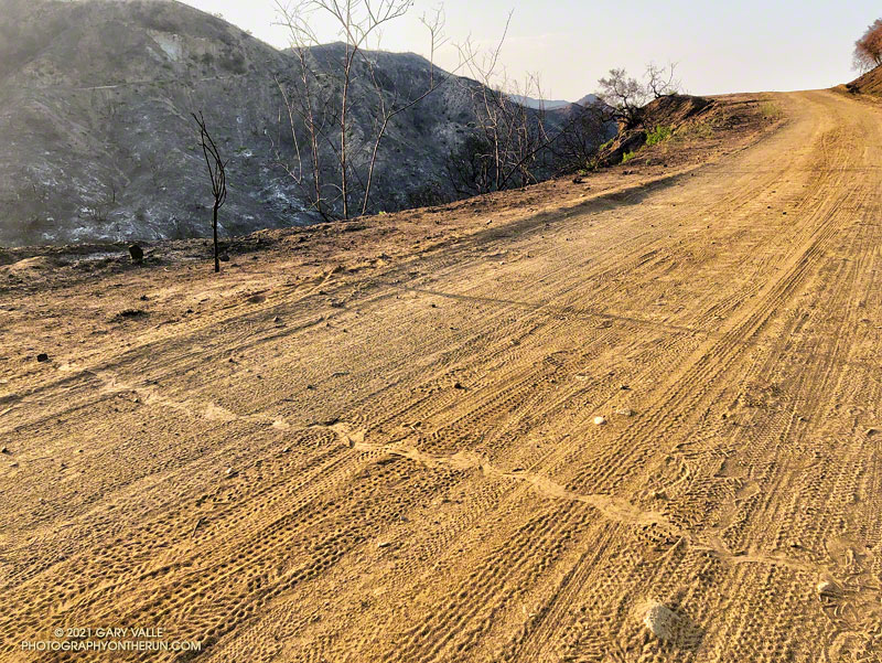
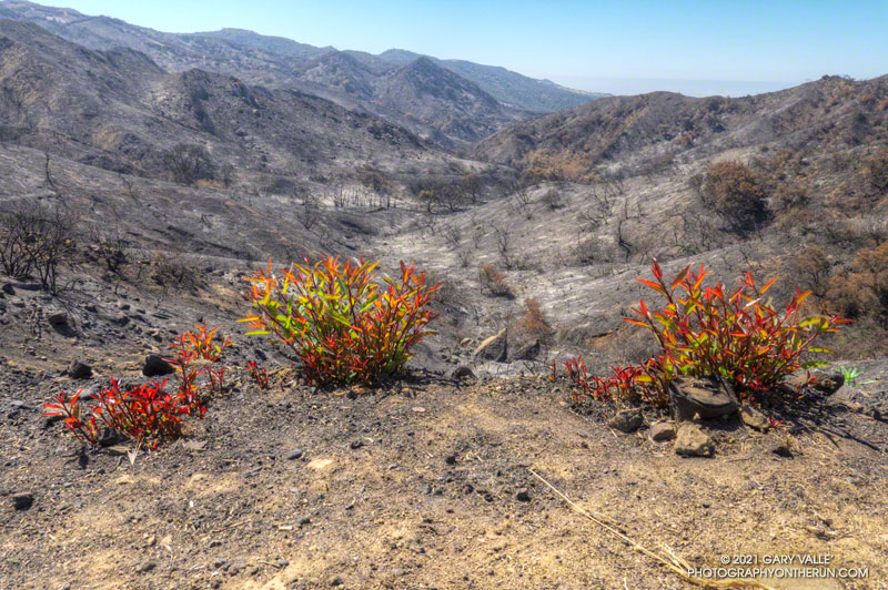
The rattlesnake track above was one of several snake tracks on Eagle Springs Fire Road this morning. This area, which is below Eagle Rock in Topanga State Park, was severely burned in the May 2021 Palisades Fire.
I’d decided to stay off the higher peaks because a combination of monsoon moisture and an upper level low was probably going to produce some thunderstorms in the high country. The action was forecast to stay east of of the Mt. Wilson area, but there was a chance there might be enough clouds to knock the temperature down a few degrees.
But a chance is just that, and the day dawned mostly clear and warm at Red Box. A few feathery high clouds had no effect on the sun, and as I jogged up Mt. Wilson road to the start of the Mt. Disappointment Trail, the temperature was already in the 80s.
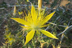
Blazing star near the Mt. Disappointment Trailhead.
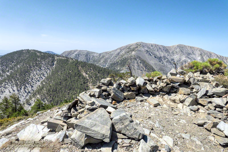
I was doing a 15-mile version of the Red Box – Bear Canyon loop. The main trails that make up this version of the loop are the Mt. Disappointment Trail, San Gabriel Peak Trail, Mt. Lowe Fire Road, Upper Bear Canyon Trail, Bear Canyon Trail, and the Gabrielino Trail. Refer to a trail map for additional details.
As it turned out, the Bear Canyon Trail was in the best condition I’ve seen in years. Thank you Bear Canyon Trail Crew! While still rustic, the trail between the old cabin site and the trail camp was a bit more worn than usual, and a little easier to follow. In some years it can be much more difficult to navigate.
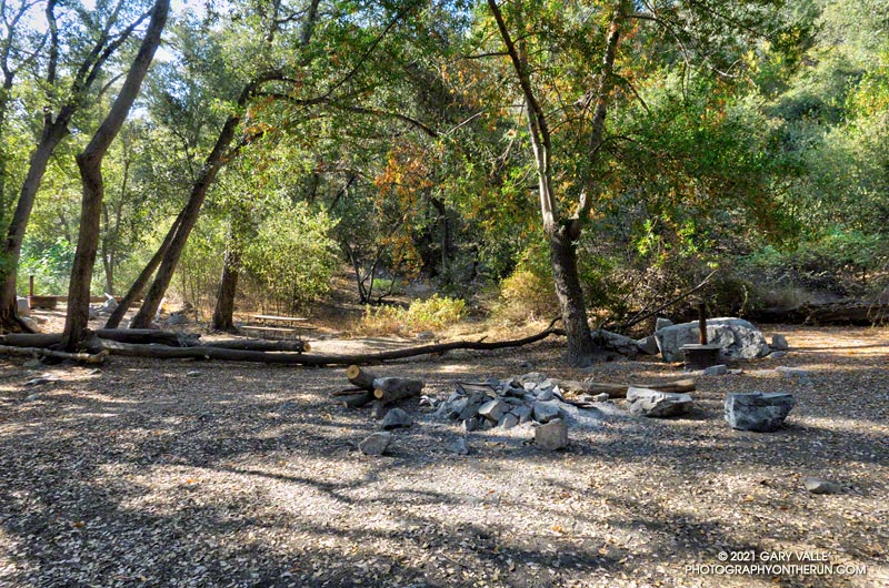
No one was camped at Bear Canyon Trail Camp. The condition of the creek was similar to 2018. There were a few small pools here and there, but almost no surface flow. In addition, strict fire restrictions are currently in effect. See Forest Order No. 05-01-21-04.
The dry conditions had one benefit — I didn’t have any issues with stinging nettle. There was still plenty of poison oak, but it was drying out and turning red. For the most part the poison oak could be avoided.
The Gabrielino Trail between Switzer Falls and Switzer’s Picnic area was as busy as usual, including one hiker walking their cat!
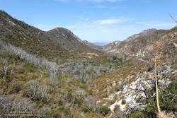
View down Arroyo Seco from the Gabrielino Trail, about 1.5 miles from Red Box
As I worked up the Gabrielino Trail above Switzer’s, I kept looking for those monsoon clouds. Temps in the sun on the exposed trail was in the high 90s, and it was a relief to finally get to the more shaded sections near Red Box.
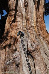
The adventure combines a seven-mile run on the PCT along Blue Ridge with a strenuous 1.5 mile, 1500′ climb up the North Backbone Trail to the summit of Pine Mountain (9648′). The Pine Mountain Juniper, estimated to be 800-1000 years old, is found at the 9000′ level of the North Backbone Trail.
Trunk of the Pine Mountain Juniper. Click for larger image.
On the way out I was glad to see the PCT had been rerouted around a steep, rocky stretch of trail below Mountain High West’s snow-making pond. I stayed on the PCT except for a very short section of dirt road between the top of the Acorn Trail and the overlook of the huge Wright Mountain landslide scar. The single track is more pleasant, and I didn’t have to worry about vehicles or their dust. I left the PCT when I was directly above the North Backbone Trailhead. A short path descended to the road.
The North Backbone Trail seems to be getting more attention these days. This adventure could be extended to include Dawson Peak and Mt. Baldy. A similar route was part of the 44-mile Big Pines Marathon — possibly the first mountain ultra in the U.S.
Laurel sumac crown sprouting along Eagle Springs Fire Road
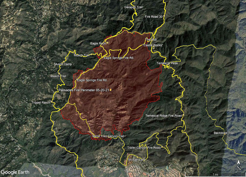
The 2021 Palisades Fire began the evening of May 14, 2021 in Santa Ynez Canyon, near Michael Lane in Pacific Palisades. According to the Los Angeles Fire Department Palisades Fire incident page, 1202 acres were burned, one firefighter was injured, 710 structures were threatened, but no structures were damaged or destroyed. The fire was fully contained on May 26.
Most of Topanga State Park was closed as a result of the fire. The Park reopened, with restrictions, on June 11. On June 13, I found myself chugging up the Garapito Trail toward Eagle Rock, and wondering what I was going to find.
I was doing a variation of one of my favorite trail runs in the eastern Santa Monica Mountains — the Trippet Ranch Loop.
This trail run links together several single-track trails and fire roads between Marvin Braude Mulholland Gateway Park (Top of Reseda) and Trippet Ranch. With the addition of an out and back segment on the the Santa Ynez Canyon Trail, the route included all the trails impacted by the fire.
With vaccinations on the increase and Covid on the decline, it was wonderful to once again be able to visit family.
As we always try to do, Brett and I got in a couple of runs. We usually do at least one run that is new to me, and there are certainly plenty from which to choose in the Bay Area.
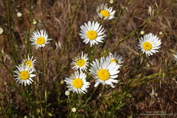
Oxeye Daisy along the Old Ranch Trail
Our first run was on San Bruno Mountain. We’d previously done the Ridge Trail, so this time opted to do a variation of the Summit Loop. The parking lot at the base was was closed, so we started the run using the Old Ranch Road Trail. This was a plus because it added a little mileage and there were a lot of wildflowers along the trail, including monkeyflower, iris, lupine, yellow paintbrush, daisy, and foxglove.
The next day, after watching a spirited youth soccer match, we headed south on 280. On the way, Brett filled me in on the runs he likes to do in Windy Hill Open Space Preserve and Huddart Park. We couldn’t go wrong with either choice but finally decided to save Huddart Park for another day.
Razorback Ridge Trail
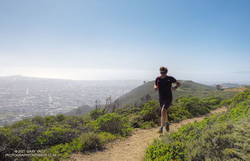
Windy Hill Open Space Preserve is on the northeast-facing slopes of the Santa Cruz Mountains above Portola Valley. We parked near the Alpine Trailhead and ran up the road to the Eagle Trail. Corte Madera Creek was running, but low. Although the grasses along the trail were green and the undergrowth was relatively lush, I suspect the conditions were more like July than May. Open hillsides looked mid-Summer dry and the lichen on the trees was drab and desiccated.
Like the rest of California, the Santa Cruz Mountains have seen well below average precipitation this rain season. One station near Windy Hill, Woodside 3.4 S, recorded only about 28% (12″) of normal precipitation from October 1 to May 19. Another station, Skyline Ridge Preserve, recorded about 41% of normal (16.5″) from October 1 to May 3.
Western columbine
From the Eagle Trail/Private Road we turned onto the Razorback Ridge Trail. According to my Garmin track, the Razorback Ridge Trail gains 1000′ or so over 2.4 miles to its junction with the Lost Trail. It’s all runnable, switch-backing up a thimbleberry and fern-lined trail, shaded by California bay trees.
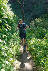
While the Razorback Ridge Trail continues up another 0.4 miles to Skyline Blvd., we turned right onto the Lost Trail. This trail parallels Skyline as it works in and out of the tributary ravines of Jones Gulch, on its way over to the Hamms Gulch Trail. Along the way there were views across the valley to Mt. Diablo, some 40 miles distant. Western columbine was blooming along the trail, its bright red color complimenting the green theme.
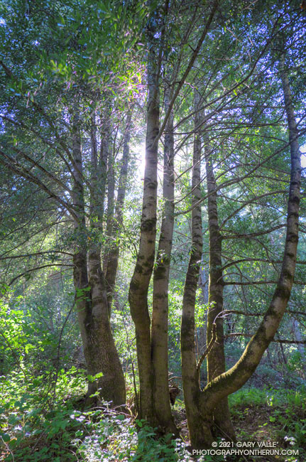
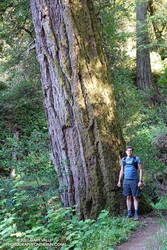
Large Douglas-fir along the Lost Trail
At the top of Jones Gulch, there is an impressive, old-growth Douglas-fir. At chest height, it is about as wide as Brett is tall. This would put its diameter at over 72″ and its circumference at over 220″, suggesting an age in the neighborhood of 350 years.
The run down the Hamms Gulch Trail was as good as the run up Razorback Ridge. Given the weather was nearly perfect for a hike or run, we were surprised to see only a dozen or so people on the trail.
From where we were parked the run worked out to about 8 miles, with about 1500′ of gain/loss. Here is a trail map of the area, and here is an interactive, 3D terrain view of my GPS track of the loop. The interactive map can be zoomed, tilted, rotated, and panned. To change the view, use the control on the upper right side of the screen.
Update June 11, 2021. Topanga State Park was reopened with restrictions. See the Park website for details.
According to the Topanga State Park website, all but a small part of the Park is temporarily closed as a result of the 2021 Palisades Fire. With the closure of most of the Park, I’ve been curious to see which trails were affected by the fire.