Category Archives: trails|pt mugu state park

You Can Run From the Wind, But You Can’t…

Strong winds on Mugu Peak

Offshore wind events have been frequent this rain season. They often follow “inside slider” systems that miss Southern California and take a more inland track over the West. The result is more wind and less rain.

Los Angeles wrapped up calendar year 2013 with the least amount of rainfall on record. When talking about rainfall in Southern California it is more common to refer to the “rain year” which runs from July 1 to June 30.  (The water year was changed to October 1 to September 30,)

So when was the driest rain year in Los Angeles? It was just a few years ago, in 2006-2007 when only 3.21 inches of rain was recorded. It was also driest water year on record with only 3.73 inches of rain.

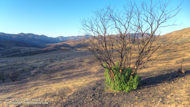
There were also many wind events in that dry rain season, and like this January not a lot of green in the hills. To date we have had less rainfall this water year than in 2006-2007!

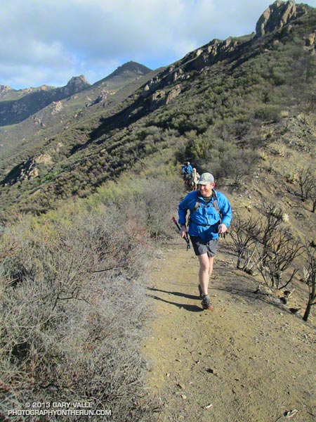
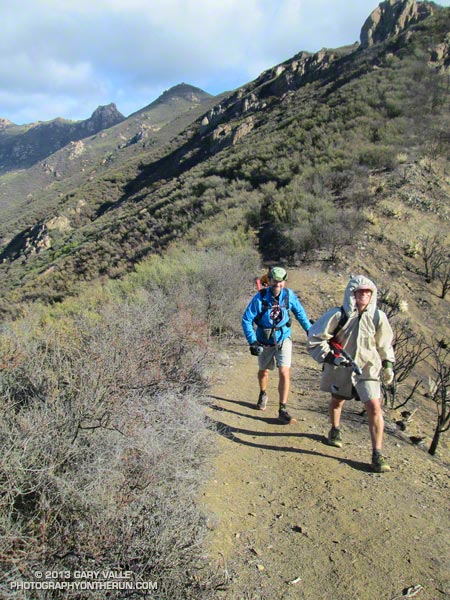
For the most part this Fall and Winter I’ve been able to work around the wind events and do runs that more or less escaped the wind. I thought that was going to be the case again today. The predicted offshore event seemed to be behind schedule and when I left for the Wendy Drive trailhead there wasn’t much wind.

There were stirrings of an offshore breeze at the trailhead and I commented to a hiker that I hoped the winds would hold off until later in the day. The plan was to do the out and back run from Wendy Drive to Mugu Peak. Because of the myriad of route choices, this is a fun run to do as a time challenge. What is the fastest route? Try it and see.

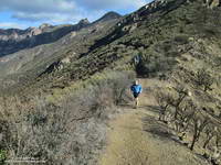
Things looked good all the way down Sycamore Canyon and into La Jolla Valley, but the wind started to pick up as I worked toward Mugu Peak.

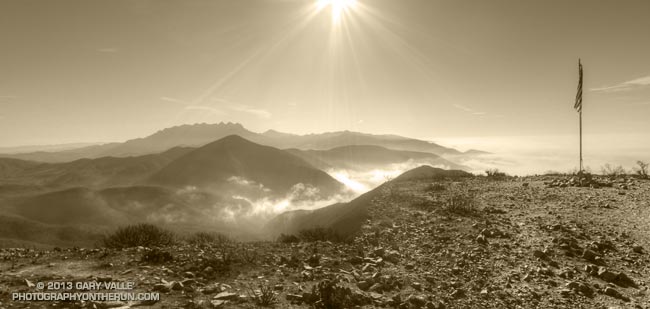
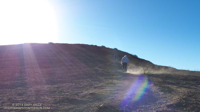
Once on the peak it was like flipping a switch on a wind tunnel! I was ahead of my PR to the peak by several minutes and I was trying to push the pace. That was not happening and several times I had to pause and put a hand down as I staggered in the middle of a big step.

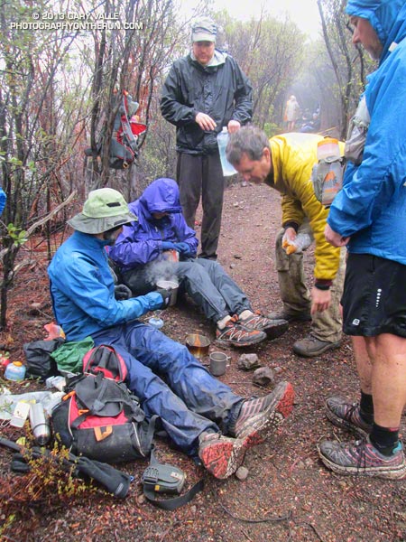
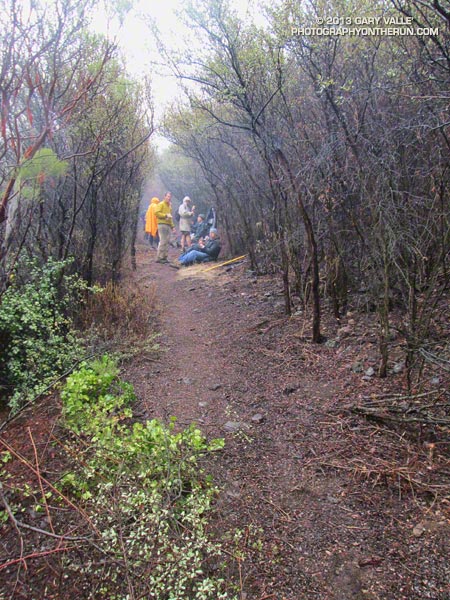
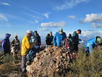
I caught up to a couple of people just before the final steep push to the summit. The wind flow was not as turbulent and gusty here and one of them started to run. With each stride the dust streaked from his shoes. I stopped to take some photos and this short video clip.  The smoother winds didn’t last for long, and neither did the running.

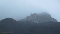
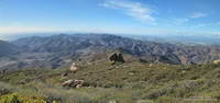
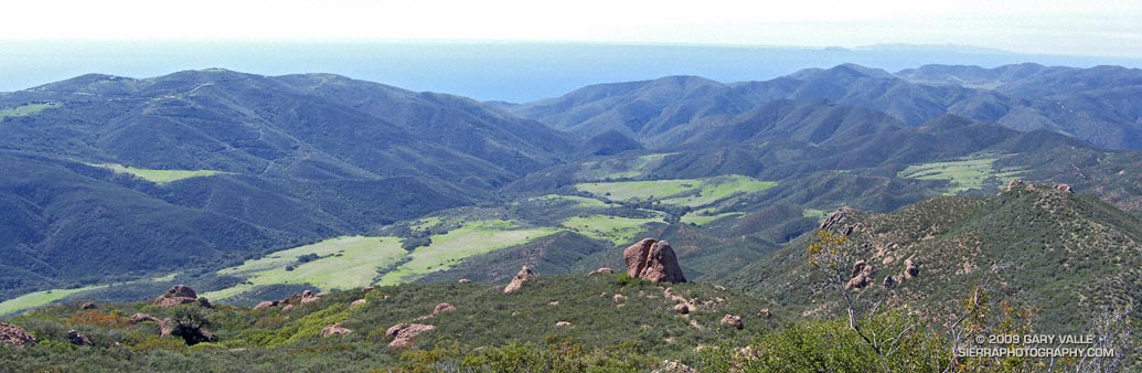
Mugu Peak’s next door neighbor to the west, Laguna Peak, has recorded a wind gust of 125 mph. In this photo from Boney Mountain Mugu Peak is on the far left and Laguna Peak has the communications equipment on the summit. Today I’d estimate the strongest gusts on Mugu Peak were in the range of 50-60 mph. The winds were strong enough that the sewn end of a fluttering strap was like a whip and just as capable of raising a welt.

I spent zero time on the summit and was very happy to get back down to La Jolla Valley.

Some related posts: Wendy Drive – Mugu Peak Challenge, La Jolla Valley & Mugu Peak from Wendy Drive

Run, Lop and Shiver – Trail Work with the SMMTC on the Chamberlain Trail

No big deal, so the temp was in the low 40s and it was a little windy… and rainy… and my work gloves were sopping wet… Yes, Victoria did say she hadn’t been this cold since leaving Russia, but how bad could it be — Mike and Jeanne were wearing SHORTS. I quietly whimpered and lopped off another limb of encroaching chamise. If I kept lopping maybe no one would notice how much I was shivering.

Logistically, the Chamberlain Trail segment of the Backbone Trail is one of the more challenging trails in the Santa Monica Mountains to maintain. It’s difficult to get all the tools and people to the trail and out again and still have time to do a few hours of work.

Coordinating with the Santa Monica Mountains Trails Council, Howard Cohen, RD of the Coyote Backbone Trail Ultra, rounded up a bunch of trusting folk that will do just about anything if running in the mountains is involved.

Starting at the Wendy Drive trailhead runners hoofed it over Boney Mountain to the top of the Chamberlain Trail — about a two hour run/hike — then lopped, and sawed and cleared their way down the trail until told to stop. Then they ran back to their cars.

If the smiles (of relief?) at the end of the day were any indication, good, clean fun was had by all — even if it was a little damp and chilly.

Here are a few additional photos from the adventure. Click for a larger version of the photo.


Boney Mountain


Front Moving In


Soups On


Chamberlain Trail


Wrapping It Up


Clearing Clouds


After Work


Scott


Jeanne & Howard


Clearing Clouds Panorama


Chamberlain Rock Panorama

Watch and Wonder

Crown-sprouting laurel sumac in Pt. Mugu State Park following the Springs Fire.

Trying to understand the behavior of wildlife can be perplexing, particularly when it involves human interaction. Sometimes I just shake my head and wonder what an animal is thinking.

I was in the middle of a 13.5 mile loop in Pt. Mugu State Park, chugging up the Old Boney Trail in the Boney Mountain Wilderness, about 2.5 miles past its junction with the Blue Canyon Trail.


From time to time I’ve been checking the progress of recovery in Springs Fire burn area. Ecologically the area is very complex and as a result of the varied terrain, habitats, vegetation patterns, soil moisture and burn severity, the rate of recovery has also been varied.

The recovery has been further complicated by the season of the fire — just before Summer — and by below average rainfall. Taking into account the unusual circumstances, the sprouting of sycamore, oak, walnut, bay, red shanks, laurel sumac, toyon, mule fat and other plants has been surprisingly robust.

The stretch of the Old Boney Trail I was on now had been severely burned. It was along a steep, rocky canyon that still looked quite barren. Many chaparral plants sprout from surviving roots following a fire, but some plants such as the bigpod Ceanothus in this area must regrow from seeds which sprout following Winter rains.

With the lack of vegetation I was a little surprised to see a California Towhee land on the rocky trail a few feet ahead of me.

The California Towhee lives in the chaparral and I see them frequently on trail runs. It is about as nondescript as a bird can be — gray-brown and little smaller than a dove. They have a peculiar habit of emerging from the brush, scurrying a few feet along a trail just ahead of a hiker or runner, and then darting back into the brush.


Inexplicably this particular bird carried this behavior to the extreme, scampering along the trail just ahead of me for more than 2 minutes, eventually pausing on some rocks along the trail and watching me pass. The time from the first picture of the bird on the trail to the last was 2 minutes 14 seconds. That’s one-Mississippi, two-Mississippi, all the way up to one hundred thirty-four-Mississippi.

I often see towhees in pairs and sometimes with rabbits when both are foraging. The rabbit acts as an early warning device for the bird and vice versa. Did the towhee see me as a really big rabbit? All I could do is watch the bird and wonder.

Some related posts: Chasing Towhees and Other Rainy Day Activities, Coyote Tag, Coyote Tag II, Hawk, Bobcat and Rabbit

But it is a Dry Heat

Mugu Peak in Pt. Mugu State Park

It was humid — Atlanta in the Summer without air conditioning humid. I was sopping wet from head to toe and had just wrung out my high tech shirt like it was a cotton wash rag. Sweat just wasn’t evaporating.

The humidity is often low when it’s hot in Southern California, but not today. I was at the Danielson Multiuse area on my way back to Wendy Drive after doing Mugu Peak in Pt. Mugu State Park. Because of its moderate elevation gain the 21 mile run (round trip) to Mugu Peak is a good one to do back-to-back with another run when training for a longer event. Today’s run was a follow-up to a 20 mile run in the San Gabriel Mountains yesterday.

When I got back home I checked some Remote Automated Weather Stations (RAWS) to see just how humid it was. At the Circle X RAWS at 10:10 am the temperature was 86°F, the dew point 70°F, and the relative humidity 59%. Further inland at the Cheeseboro RAWS at 10:38 am the temperature was 91°F, the “in the sun” temperature was 97°F, and the dew point was 65°F. Those are conditions you might find in Hawaii or the Southeastern U.S. in the summertime.

The NWS uses the Heat Index as a guide for issuing alerts related to heat. In practice runners will find that the Heat Index doesn’t do a very good job because it makes assumptions that don’t necessarily apply to runners — for example that you are in the shade and walking. According to the NWS “exposure to full sunshine can increase heat index values by up to 15°F.”

I’ve found the dew point to be an easy to apply indicator of humidity on hot days. If the air temperature on a run is in the neighborhood of 90°F I start to notice the humidity at a dew point of around 55°F. At a dew point of 60°F the humidity is definitely noticeable, and at a dew point of 65°F and above the humidity is increasingly oppressive.

Some related posts: After the Springs Fire: A Run Through Pt. Mugu State Park, Back on the Backbone Trail, Wendy Drive – Mugu Peak Challenge

Chamberlain Rock

Chamberlain Rock on the Chamberlain Trail segment of the Backbone Trail

The large split rock on the Chamberlain Trail segment of the Backbone Trail is a familiar landmark to those that run and hike the trail. It marks the half-way point on the 3 mile, 1600′ climb from the Old Boney Trail junction to the Tri Peaks Trail junction.

The rock is volcanic in origin and part of a volcanic sequence known as the Conejo Volcanics. According to the Dibblee geologic map of the area the material of which the rock is composed was probably deposited as a lahar (volcanic debris-flow) about 16.1 to 13.1 m.y. ago.

Here’s a link to a couple of videos of lahars on YouTube. After watching the violently churning rocks and debris in the videos it’s easy to see why the rocks embedded in this volcanic matrix are broken into angular pieces and full of stress fractures.


There is a memorial plaque on the rock in tribute to Henry Chamberlain. A 1991 Los Angeles Times article characterized Chamberlain as a wealthy Los Angeles industrialist and rancher.

Comparing the Springs and Green Meadows Fire Perimeters

Prior to the Springs Fire the last fire to burn through Pt. Mugu State Park was the 1993 Green Meadows Fire. Here’s a Google Earth image that compares the perimeters of these wildfires.

The Springs Fire perimeter is from the Geospatial Multi-Agency Coordination Group (GEOMAC) and is time-stamped 05/07/2013 at 0348. The Green Meadows Fire perimeter is from the Department of Forestry and Fire Protection – CAL FIRE Fire and Resource Assessment Program (FRAP).

According to FRAP GIS data, the Green Meadows Fire started on October 26, 1993, and burned 38,479 acres. The Springs Fire started on May 2, 2013, and according to CAL FIRE burned 24,251 acres.

Some related posts: Checking on the Chamberlain Trail, A Run Through Pt. Mugu State Park, Springs Fire Burn Severity, Springs Fire 2013