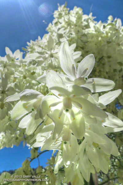
Chaparral yuuca (Hesperoyucca whipplei) at about 4700′ on the Kenyon Devore Trail below Mt. Wilson. The plant was classified as Yucca whipplei for many decades.
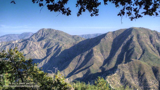
From last weekend’s Mt. Wilson – Devore Camp – West Fork loop.

Chaparral yuuca (Hesperoyucca whipplei) at about 4700′ on the Kenyon Devore Trail below Mt. Wilson. The plant was classified as Yucca whipplei for many decades.
From last weekend’s Mt. Wilson – Devore Camp – West Fork loop.
I’d paused to rinse my arms and legs, hoping to wash away at least a little of the poison oak and Poodle-dog bush I’d been unable to avoid. I was at a small spring part way up the Kenyon Devore Trail, doing a variation of a loop that my son and I had done a year before.
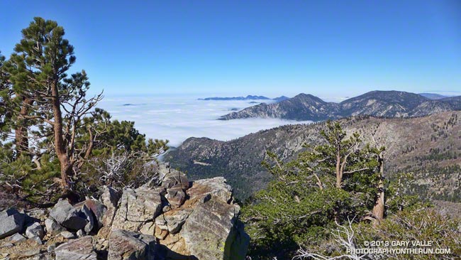
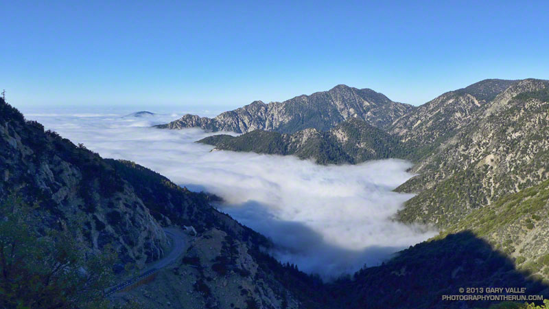
Today’s run had started on the top of Mt. Wilson, descended the Rim Trail to Newcomb Pass then followed the Gabrielino Trail down to the Rincon – Red Box Road. This year instead of taking the forest road down to West Fork, I stayed on the Gabrielino Trail and descended to Devore Camp, and then worked back upstream on the Gabrielino Trail past West Fork to the Kenyon Devore Trail.
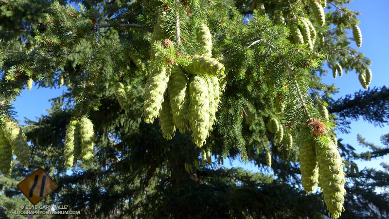
Driving up the Mt. Wilson Road I’d noticed that many of the bigcone Douglas-firs were heavily laden with cones. According to the Forest Service’s Silvics Manual bigcone Douglas-firs don’t often have bumper crops. Why now, following two subpar rain seasons, the most recent of which was unusually dry? Was the tree’s evolutionary knowledge playing the odds that a wet period of Southern California’s wet/dry ENSO cycle is a Winter or two away? At the moment La Nina or Neutral conditions look more likely this coming Winter, but the odds for El Nino could increase for the Winter of 2014-15.
Update June 25, 2018. El Nino conditions did emerge in late Fall 2014 and continued until the Spring of 2016. However, the drought in Southern California persisted and below average precipitation was recorded in both 2014-15 and 2015-16. It wasn’t until the 2016-17 rain season (during a weak La Nina) that Southern California received above average precipitation.
Like last year there was plenty of poison oak and Poodle-dog bush along the Rim and Gabrielino Trails. The poison oak was about the same as last year — mostly but not entirely avoidable — but the Poodle-dog seemed worse. I’d hoped that this year’s much lower than average rainfall would suppress the growth of Poodle-dog bush, but if anything it seemed more robust. Poodle-dog had overgrown the trail in several spots, its long stalks and sticky leaves overlapping the trail like a gauntlet of pikes. Contact was unavoidable.
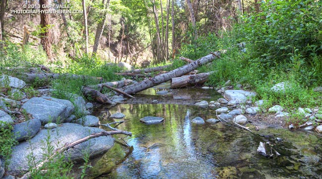
It had been interesting to visit Devore Camp. The last time I’d been there was in March 2003 when Gary Gunder and I paddled from the West Fork San Gabriel River from West Fork to Hwy 39. We had been fortunate to be able to paddle the reach with few portages. With all the downed trees from the Station Fire it may be many years before big storms flush the river channel to point it can be paddled without logs being a constant problem.
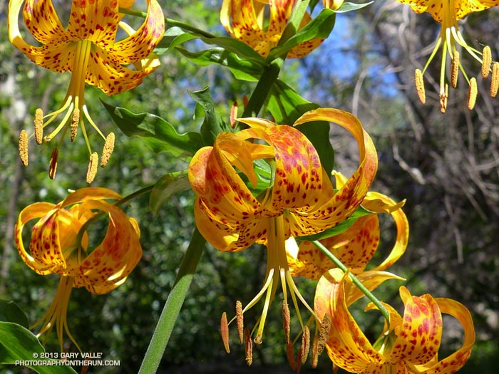
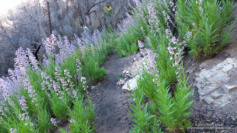
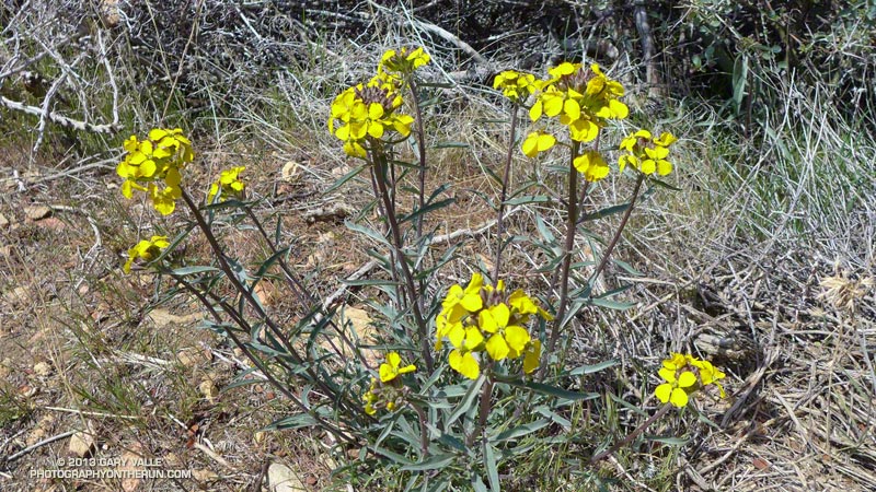
In addition to the expanses of Poodle-dog bush blossoms, a number of other wildflowers were in bloom, including Grinnell’s beardtongue, rose snapdragon, blackberry, pink, paintbrush, bush poppy, buckwheat, gilia, Keckiella and others. Along the West Fork the blossoms of spotted Humboldt’s lilies had beamed like yellow-orange paper lanterns scattered throughout an immense garden.
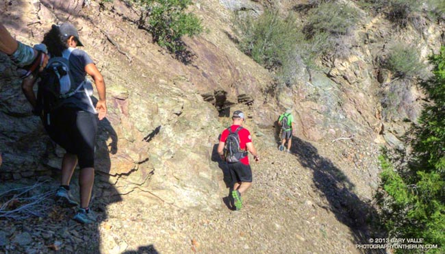
I cannot ascend the Kenyon Devore Trail without thinking about the Mt. Disappointment 50K/50M. During those races the little spring I was at now had always been a welcome source of “extra” water on the final climb to Mt. Wilson. The 2013 races have been cancelled, but are expected to return in 2014. We all know how tough R.D. Gary Hilliard is and look forward to next year’s race!
“Hey, are you on a trail?”
The voice seemed to come from nowhere. I looked to my left and right, but the trail was empty.
“Hey, up here!”
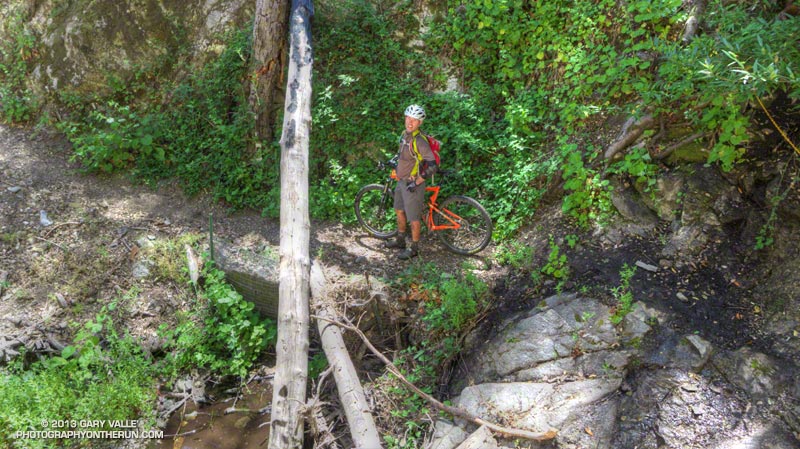
What the… I scanned the STEEP slopes above the creek, but still had a hard time locating the voice. After a moment of rustling, a helmeted figure emerged from the trees, carrying an orange mountain bike.
If you’ve done the Kenyon Devore Trail as part of the Mt. Disappointment races or at another time you probably recall the slippery stream crossing with the chain. The MTBer had apparently missed a switchback about a mile up the trail and descended directly down a ridge to the spring.
Update Friday, June 21, 2013. Lucked out with the Poodle-dog bush* and poison oak! Just one small spot of irritation on the top of an ankle, and it’s already almost gone.
*The taxonomic name for Turricula parryi (Poodle-dog bush) has changed to Eriodictyon parryi. The Jepson Manual: Vascular Plants of California, Second Edition (2012) has returned Turricula to the genus Eriodictyon, as originally described by Gray. According to the Wikipedia entry for Turricula (April 11, 2012), “… molecular phylogenetic analysis carried out by Ferguson (1998) confirms that Turricula should be treated as a separate genus within a clade (Ferguson does not use the term “subfamily”) that includes Eriodictyon, and also the genera Nama and Wigandia; Eriodictyon is the genus to which Turricula is closest in molecular terms, and is its sister taxon.” I use “Turricula” and “Poodle-dog bush” interchangeably as a common name.
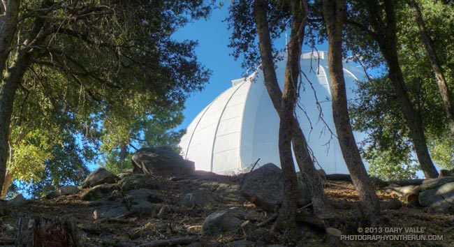
Some related posts: Mt. Wilson Rim Trail – Kenyon Devore Trail Loop, GSU Mt. Wilson CHARA Telescope Array, Why Won’t My Smart Key Work?
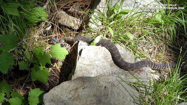
This southern Pacific rattlesnake was on the Burkhart Trail below Buckhorn at about 6200′ in the San Gabriel Mountains. We encountered the snake last Saturday while doing a loop from Three Points around Mt. Waterman. It’s the second rattlesnake I’ve seen while doing this loop. The other encounter was on the Three Points – Mt. Waterman trail in a grassy area on the south side of Mt. Waterman at about 7000′.
The highest elevation I recall seeing a southern Pacific rattlesnake was at about 7200′, near the summit of Suicide Rock, in the San Jacinto Mountains near Idyllwild. In Rattlesnakes: Their Habits, Life Histories, and Influence on Mankind, Volume 1 (Klauber, University of California Press, 1972) there are accounts of northern Pacific rattlesnake encounters at 11,000′ in the Sierra Nevada, and southern Pacific rattle encounters at 10,000′ and above in the Big Bear area and near the summit of San Jacinto Peak (10,843′).
My most unusual rattlesnake encounter to date was while kayaking the Forks of the Kern in the southern Sierra Nevada. I had just done the entrance move on the rapid Big Bean and had stopped in a small eddy on the left side of the river, just above the most difficult part of the rapid. My kayak was facing up river and was nearly against the bank. I was looking back over my left shoulder, mesmerized by the power of the water pouring over the big drop. Preparing to do the move, I was totally focused on the river, when suddenly — above the roar of the rapid — there was the startling buzz of a rattlesnake at my right ear. I turned to see a rattlesnake on the bank at shoulder level. Fortunately the snake just rattled and did not strike. Double-adrenalized, I peeled out from the eddy and paddled over the drop.
For more information see California Rattlesnakes (CaliforniaHerps.com).
Update May 29, 2014. According to an Angeles National Forest press release issued May 20, nearly all remaining areas in the Angeles National Forest closed since the 2009 Station Fire were reopened on May 24. Some forest areas remain closed for reasons of public safety or further work needed on trails. In addition to the Colby Trail in the area of Strawberry Peak, the closed areas include Lower Gabrielino Trail (below Bear Canyon Trail), Barley Flats Trail, Ken Burton Trail, Millard Water Fall User Trail, Santa Clara Divide Road (FS3N17), Messenger Flats Campground, Lightning Point Campground, and Big Buck Campground. Check with the Forest Service for the most current information.
Update May 31, 2013. On May 24th Angeles National Forest quietly extended the closure of the 46,194 acre Station Fire Recovery Area through May 24, 2014. No press release or information regarding the rationale for the continued closure was published on the Angeles National Forest web site. A fire closure of this duration and acreage appears to be unprecedented in California and possibly the U.S. Even in the case of the largest California fires, the Cedar and Zaca fires, closed areas in Cleveland and Los Padres National Forests were reopened within a year of the fire. In many cases fire closures in the National Forests and State Parks of California have been lifted within days or weeks of a large fire. This reflects a general policy that closures of public lands should be implemented and maintained only as a last resort.
Update April 16, 2013. Strawberry and Josephine Peaks have now been closed over THREE AND A HALF YEARS. Will Angeles National Forest allow the Station Fire Recovery Area Closure Order to expire on May 24, 2013? Note that none of the trails to the summit of Strawberry Peak are maintained. They are “use” trails — paths that have evolved over time through use. The route to Strawberry’s summit from Red Box is use trail from Lawlor Saddle to the summit; and the routes that ascend the west ridge are use trail above Josephine Saddle. The west ridge also includes some third class rock climbing. It should also be noted there were rescues and other incidents on Strawberry Peak (and in other Forest areas) BEFORE the Station Fire and there will continue to be rescues and incidents. Whether a trail is a good trail or bad trail, accidents can occur and mistakes in judgment can be made. The Forest Service should not keep an area closed without definitive — and supportable — reasons for doing so.
Update May 25, 2012. Today Angeles National Forest reopened about 41,000 acres of the Station Fire closure area south and west of Big Tujunga Dam, and extended the closure of the remaining 46,194 acres to May 24, 2013. Newly opened resources include the Stone Canyon Trail, Trail Canyon Trail, and Delta Flat. Condor Peak also appears to be within the open area. According to the updated Forest Service map of the Station Fire Recovery Area (PDF), Strawberry Peak and Josephine Peak are in the area that remains closed.
As a result of its relatively easy access, panoramic summit view, varied routes and generally mild Winter conditions Strawberry Peak is one of the most frequented summits in the San Gabriel Mountains. At least it used to be until it was closed by the Station Fire. Here we are, more than two and a half years after the Station Fire, and Strawberry Peak, Josephine Peak and Mt. Lawlor are still closed.
Why? The reason might be as arcane as it was simply easier to define the closure boundary as Angeles Crest Highway.
It cannot legitimately be claimed that the area was more damaged by the fire. If anything the damage done by the fire and subsequent flash floods and debris flows was greater on the open (south) side of Angeles Crest Highway — between Switzer Picnic Area and Red Box — rather than on Strawberry Peak.
It cannot be the progress of recovery. I’ve closely followed the recovery of chaparral following several fires. The photographs and other evidence I’ve seen suggest the chaparral on Strawberry Peak is recovering at an absolutely normal pace. I think many would be surprised to see how far it has come. In fact its regrowth now threatens long established paths and trails.
I was under the impression that the route up Strawberry from Red Box was so overgrown and damaged as to be nearly impassable. Apparently that’s not the case. People are doing the peak and based on the reports I’ve read, photos I’ve seen, and firsthand information relayed the trail is in poor condition, but passable with care. There are certainly more hazardous trails and areas in the open areas of Angeles National Forest.
That route from Clear Creek also appears to be passable with care. I’m told there’s absolutely no issue on Josephine fire road. The use trail on the western ridge is a little overgrown, but can generally be followed. Apparently a short section of the ridge below the class 3 section is a bit overgrown with Turricula (Poodle dog bush). A little more use and snip here and a snip there would take care of that.
Restricted use is an important concern. Having seen the condition of several trails immediately after portions of the Station Fire area reopened, and then a year later, it’s clear to me that use is an essential element of trail health. People using a trail help keep it alive. Conscientious users will pick up litter, remove debris, and do other on-the-go trail maintenance. Use quickly puts the focus on problem areas, and encourages participation when more comprehensive trailwork is done.
With the regrowth of the chaparral well underway we are at a critical point in the preservation of the trails and paths in the Station Fire closure area. They must be reopened to use — not only on Strawberry Peak, but also on popular peaks such as Condor Peak and Mt. Lukins. If we are not allowed to use the trails, the time and work required to restore them could increase to the point that some trails are lost!
The photograph of Strawberry Peak (left) and Mt. Lawlor is from a trail run in September 2011.
Some related posts: Blue Skies and Short Sleeves on Strawberry Peak, Coincidence, Strawberry Peak Traverse
Just six days before I’d been sitting in my car at Islip Saddle debating whether to run. It had been COLD. The temperature had been about 35°F and the wind a steady 20 mph with higher gusts. It was cloudy and at times foggy, and it looked like rain, sleet or snow might begin at any moment.
Today I was back at Islip Saddle and the temperature was definitely not in the 30s. On a scale of 1 to 10, today’s trail running weather was going to be a 9 or 10. At least here in the San Gabriel Mountains the weather was going to be a 9 or 10. Down in the valleys the temps would hit the mid-90s in some locations.
We were doing the Islip Saddle – South Fork Camp – Vincent Gap – Mt. Baden-Powell loop, one of my favorite adventure runs in the San Gabriels. Because this loop starts by running down to the high desert heat is often a factor, and an early start desirable.
Running down the South Fork Trail it felt like it was going to be a great day for the run, and by the time we were chugging up the Manzanita Trail toward Vincent Gap, there was no doubt about it. There was a cool, down-canyon breeze, and even in the sun the temperature was pleasant. The hatch of gnats that usually follows Spring showers wasn’t happening and all in all the conditions were as good as I’ve had on the loop.
Here is a slideshow with a few photos from the run, and here are an interactive Cesium browser View and an elevation profile of the run.
Some related posts: Heat Wave, San Gabriel Mountains Running Adventure, Bear Cubs on the South Fork Trail, Islip Saddle – Mt. Baden-Powell South Fork Loop
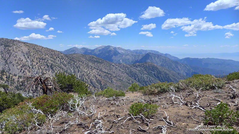
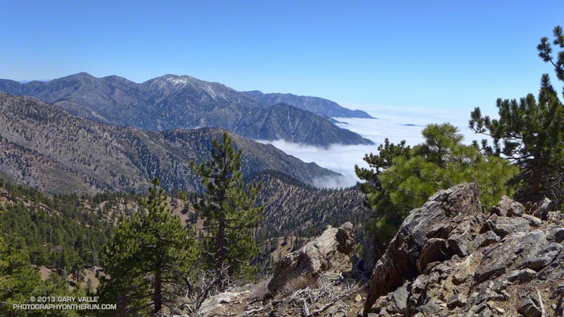
View Southwest from Middle Hawkins past Twin Peaks to Mt. Wilson
The snow was rock hard and covered with lodgepole pine needles and other debris. Having experience climbing snow and ice I can usually deal with a little early season snow, but I could see no way to safely cross this patch. The snow was steep and icy, the runout long and the risk high. My usual tricks for crossing short stretches of snow were not going to work.
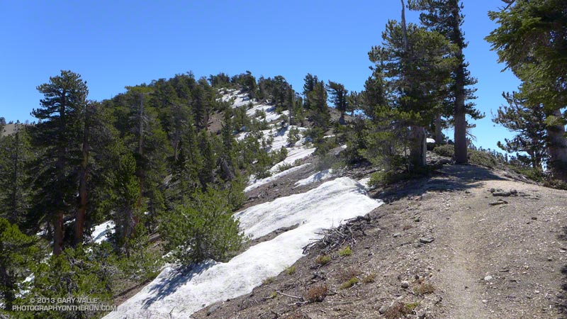
Snowfall had been sporadic in Southern California over the Winter and this was the earliest in the Spring I had tried to do the out and back from Islip Saddle to Mt. Baden-Powell. I had thought there might be some patchy snow on the north-facing slopes at the higher elevations, but I hadn’t expected it to be an issue.
Borrowing from river paddling philosophy, you never run (or hike, or ride) the same trail twice. I knew it was going to be an interesting day when a bighorn sheep darted from the trailhead at the beginning of the run. I’d followed bighorn tracks from Islip Saddle up the PCT for about a quarter mile to an overlook of Hwy 39 and Twin Peaks.
The view from the overlook had been spectacular. Marine layer stratus filled the canyon, nearly immersing Triplet Rocks on Twin Peak’s elongated east ridge. The stratus was evidence of a strong onshore flow, but above Islip Saddle a strong — and cold — wind was blowing almost directly out of the north. It had been cold enough that I pulled on my extra sleeves, ultralight shell and light gloves.
The wind was unrelenting and seemed to work its way around every corner and into every canyon. At Windy Gap and the other wind gaps along the crest the wind was funneled and accelerated, and I wondered if this would be the day I would see or hear one of the huge ghost trees from the Curve Fire crash to the ground.
At times I go where my camera takes me, and about a half-mile west of Mt. Hawkins it took me off the PCT and onto the Hawkins Ridge Trail. There are three peaks along this ridge — Middle Hawkins, Sadie Hawkins and South Mt. Hawkins. It had been years since I’d done these peaks, and today it looked like there might be some good views from the ridge.
The Hawkins Ridge Trail was warm and mostly sheltered from the wind and I continued down the trail a little further than necessary before leaving it and scrambling up to the summit of Middle Hawkins. Warmed from the steep climb I had returned to the PCT and continued toward Baden-Powell.
Near the junction of the PCT and Dawson Saddle Trail there had been patches of snow mixed in with the chinquapin and limber pines, but it hadn’t been until the PCT skirted north around Mt. Burnham that the trail was blocked by snow. I abandoned the attempt to cross the icy patch and headed up the steep slopes of Mt. Burnham to the crest.
It was still cold and windy when I reached the summit of Mt. Baden-Powell, but a sparkling day with Mt. Baldy to the southeast across Vincent Gulch, San Jacinto Peak and San Gorgonio area peaks in the distance to the southeast, the Sierra to the north, and miles of stratus to the south. After spending a few minutes on the summit I retraced my steps back down the crest and the PCT to Islip Saddle, making the requisite stop at Little Jimmy Springs along the way.
Some related posts: San Gabriels High Five, La Nina Looming, Running Hot & Cold, Toward Triplet Rocks