According to preliminary NWS reports, Downtown Los Angeles (USC) recorded average monthly temperatures well below normal in November 2022 and January thru March 2023. March was particularly cool, with an average high of about 64 degrees and an average low of about 50 degrees.
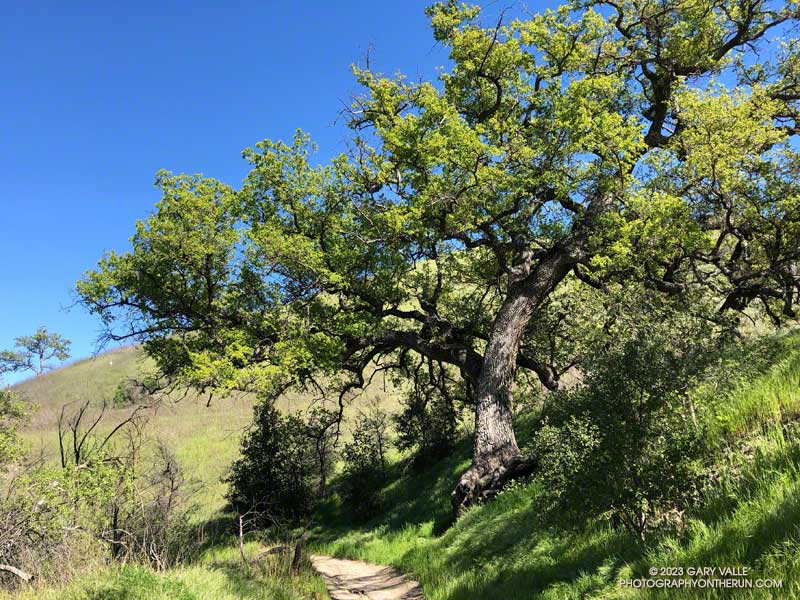
Besides high heating bills, Southern California’s unusually cold Winter affected several seasonal processes, one of which was when the valley oaks at Ahmanson budded and grew new leaves.
The leaves of valley oaks at Ahmanson Ranch typically turn in mid-December, and the trees usually begin to leaf out during the latter half of February. Depending on the tree’s microclimate, the emergence of new leaves may vary by a week or more.
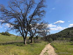
Valley oaks in Las Virgenes Canyon in early April 2023.
The earliest I’ve photographed a valley oak at Ahmanson sprouting new leaves was February 3, 2015. Last year, a valley oak had new leaves on February 10, 2022.
The latest I’ve seen valley oaks sprouting new leaves is this year — from about March 20, 2023, in favored locations to April 4, 2023, in cooler areas such as Las Virgenes Canyon.
Prior to this year, the latest I’ve photographed a valley oak at Ahmanson with new leaves was March 9, 2009.
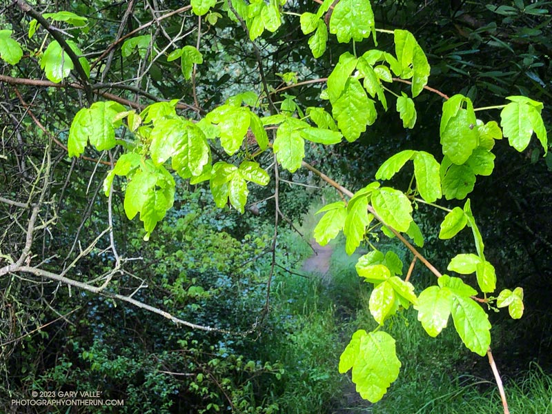
Fresh new leaves of poison oak hanging above the Backbone Trail
When one of the runners coming down the Rogers Road segment of the Backbone Trail saw me coming up the trail, he commented, “At least now we know the trail goes through!”
He was only half-joking. With all the wet weather, trails may not only be wet and muddy but might be flooded, severely eroded, blocked by trees and debris, or destroyed by runoff, mudslides, or slope failures.
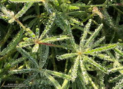
Water droplets on bedstraw (aka cleavers) along the Backbone Trail
It had rained the previous two days, and more rain was forecast in a day or two. I was on this stretch of the Backbone Trail because I wanted to check out a use trail near High Point (Goat Peak) in the Santa Monica Mountains. I could do that by slightly modifying the route described in “Racing the Weather to High Point (Goat Peak) and Back.”
Two use trails connect to the High Point trail near High Point. Both are on the east side of the ridge. When traveling northbound from High Point, the first trail encountered is the “Rivas Ridge Trail.” Its junction with the High Point trail is on a hilltop, a bit more than a tenth of a mile north of High Point. The junction with the other trail — aptly named the “Great Escape” — is about a tenth of a mile north of the Rivas Ridge trail junction and a quarter-mile north of High Point.
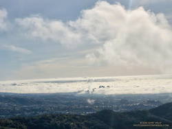
West L.A and advancing marine layer clouds in the Los Angeles Basin.
Instead of doing the run as a pure out and back, on the way back, I took the Great Escape down to the Backbone Trail. This short use trail connects to the Backbone Trail about 0.4 mile south of “The Oak Tree.” It was an interesting trail to explore and only added about a third of a mile to the regular out-and-back route.
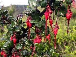
Fuchsia-flowered gooseberry along the Backbone Trail
The condition of the Backbone Trail between Fire Road #30 and The Oak Tree was about what you would expect during such an active rain season. There were a few slimy, slippery spots and some eroded stretches of trail. My shoes and socks were already soaked from the wet grass along the trail by the time I reached The Mud Puddle. This was good because I didn’t waste any time looking for a way around the flooded section of trail — I just waded right in. Nearby, a short section of trail had collapsed in a slide, but there was enough of a shoulder to easily go around it.
With the wet rain season, everything is growing like crazy. This includes poison oak, which was already dangling into the trail in several places. More wildflowers were beginning to bloom. This scarlet-red Fuchsia-flowered gooseberry was blooming along the Backbone Trail near its junction with the High Point Trail.
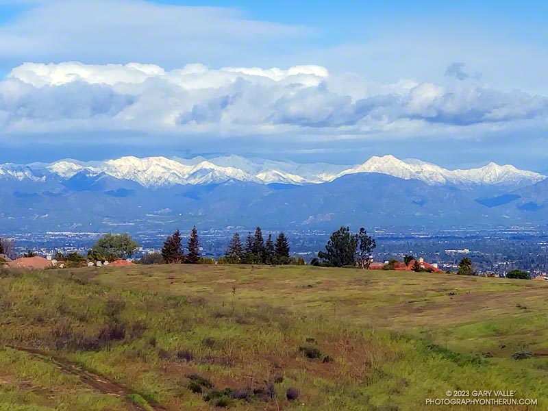
It had rained another inch overnight, and my shoes were soaked from the wet grass along the trail. Seeking some relief from the 20 mph northwest wind, I descended a single-track trail to an old paved road east of the ranch house on Lasky Mesa.
Motivated more by staying out of the wind than anything else, I did two sets of hill repeats on different sections of the road. Then, on tired legs, I jogged up to Lasky Mesa and was greeted by an Arctic blast. The temperature had dropped to the mid-40s, and the wind was blowing a steady 20 mph, gusting to around 30 mph. I didn’t need a wind chill chart to tell me the effective temperature was in the 30s.
I was so focused on dealing with the cold I wasn’t paying much attention to my surroundings. Deciding to do one more hill, I rounded a corner, and the brilliantly sunlit, snow-covered San Gabriel Mountains came into full view. It was just jaw-dropping!
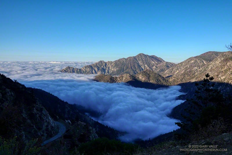
The paved turnout where I usually park at the Stunt Road trailhead was covered with mud, rocks, and debris. And near the entrance of Calabasas Peak fire road, two large boulders had been dragged to the shoulder to clear the road.
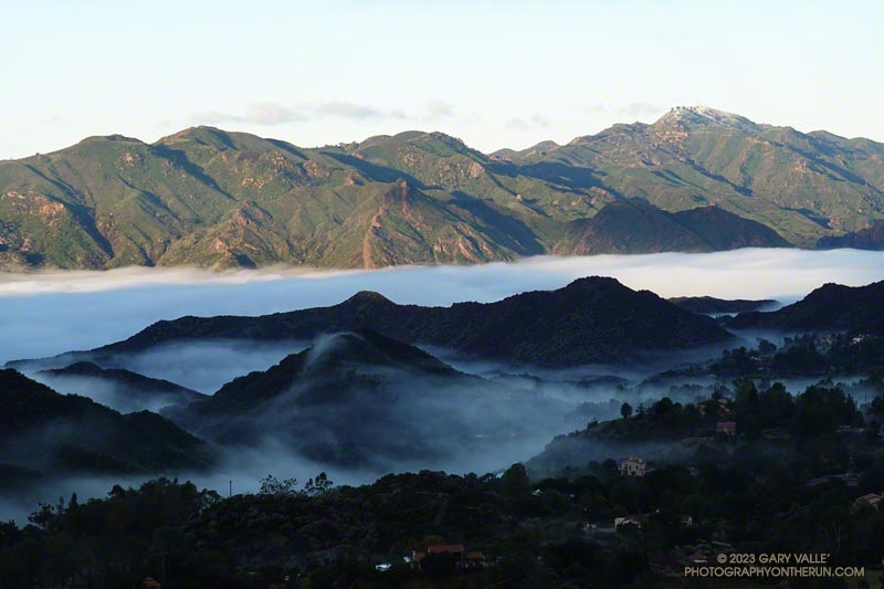
Following another big storm in a Winter of big storms, I was doing the Topanga Lookout Ridge Loop — curious to see what I could see. Nearby Stunt Ranch Reserve had recorded over 10 inches of rain the past three days, and there had been numerous reports of low elevation snow.
After weeks of dealing with one heatwave after another it was a strange sensation. I was cold. I had on an extra shirt and sleeves, but the slopes of Mt. Islip were deep in shadow and the wind was gusting to 20 mph. The thermometer on my pack read 41 degrees, but the “feels like” temperature had to be in the 30s.
I was in the first mile of an out and back trail run from Islip Saddle to Mt. Baden-Powell. A San Gabriels classic, the route gains (and loses) about 3800′ over 16.5 miles on the PCT.
This morning I was doing the basic out and back, but Mt. Hawkins, Throop Peak and Mt. Burnham are easy peaks that can done along the way. Mt Islip is is a bit more of a detour, but can also be added to the route.
Mt. Baldy and environs from the PCT, between Mt. Hawkins and Throop Peak.
It’s also possible to start the out and back at the Windy Gap Trailhead (5836′) in the Crystal Lake Recreation Area. The distance to Baden-Powell is about the same, but the lower trailhead adds about 800′ of gain.
As I chugged up one of the initial steep sections, I thought about what it must have been like for this year’s participants in the AC100. This year, because the AC100 was an out and back from Wrightwood to Shortcut Saddle, runners got to do this tough segment after running more than 75 miles!
Here is an interactive, 3D terrain view of the out and back from Islip Saddle to Mt. Baden-Powell. The map can be zoomed, tilted, rotated, and panned using the navigation control on the right. Track and placename locations are approximate and subject to errors. Poor weather, and other conditions may make this route unsuitable for this activity.
Sycamore Canyon, Laguna Peak, and the Channel Islands from Boney Mountain.
Update on August 17, 2022. As of today, my West Hills weather station has recorded a high of 100 degrees or higher for 12 consecutive days.
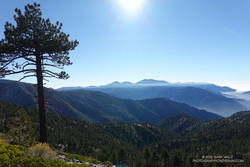
It was another triple-digit Sunday. Once again the high in the west San Fernando Valley was forecast to hit one-hundred and something. I’d hope to beat most of the heat by getting an early start and running where it wouldn’t be quite so hot.
I hadn’t been able to get out to Stoney Point Saturday morning, so was looking to do a little easy climbing as part of my Sunday run. I was considering three options: Topanga Lookout Ridge, Strawberry Peak, and Boney Mountain.
Boney Mountain from connector trail above Danielson Road
While none of the three are difficult by rock climbing standards, all require the use of handholds and footholds, good route-finding skills, and good judgment. It is entirely possible to fall on any of them.
The Topanga Lookout Ridge loop is about 8.5 miles long with 2000′ of gain/loss. There are a few short climbing segments on the crest of the ridge that can be accessed from the use trail.
The basic loop up the Western Ridge of Boney Mountain and over Tri Peaks to the Backbone Trail and back to Wendy Drive is about 15.5 miles long with 3400′ of gain/loss. It is longer and more difficult than the Topanga Lookout Ridge loop.
The loop over the top of Strawberry Peak from the Colby Canyon Trailhead is about 12 miles long with 3100′ of gain/loss. There is some class 2/3 climbing on the west side of Strawberry, and it is essential to stay on route. There have been a number of rescues of those attempting to climb the peak.
View along the top of Boney Mountain’s western escarpment.
It was a few minutes past six when I pushed the start button on my Garmin and jogged down the hill from the trailhead at Wendy Drive. I’d run about a half-mile when I heard another runner behind me. We chatted for a couple minutes and I learned he was preparing to do the Wonderland Trail around Rainier and then the Bear 100.
We were both going to the same area, but by different routes. I was climbing Boney Mountain’s Western Ridge and then working over to the Backbone Trail. He was doing an out and back to Sandstone Peak via Upper Sycamore, Sycamore Canyon, and the Backbone Trail. We would run into each other again at the Danielson Multi-Use Area on the way back to Wendy Drive.
Morning shadows on Boney Mountain’s western escarpment
As always, the climb up the Western Ridge (Mountaineer’s Route) was enjoyable. The rock climber in me always wants to check out potential lines, but this morning there wasn’t much time for that. The longer it took to get up Boney, the hotter it was going to be later in the run!
The temperature was already in the eighties when I reached the Backbone Trail. Before the fires and floods of past decade, the run down the Chamberlain segment of the Backbone Trail was one of the better running descents in the Santa Monica Mountains. From the Tri Peaks Trail junction to the Old Boney Trail it drops about 1500′ over three miles. Today, except for the stretch of trail near Chamberlain Rock, it was nearly back to its original form.
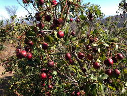
Holly-leaved cherries along the Chamberlain segment of the Backbone Trail
As in other areas of the Santa Monica Mountains, the effect of the heavy December rains was evident. The red shanks, and chaparral in general, seemed to be greener. This year there is a bumper crop of holly-leaved cherries, which must make the coyotes happy. Unlike last year, it looks like there should be some Christmas berries this Winter, since a number of Toyon were covered in green berries.
On the way down the Chamberlain Trail I started to fret that the water at Danielson might not be turned on. The water faucets in Sycamore Canyon are usually dependable, but on a run a few years ago the water system was turned off for servicing. Or what if there had been a drought-related water supply issue?
It turned out the water was still on, and I drank a lot of it. The remainder of the run went well, although I was a little surprised that the sensor on my pack recorded temps in the nineties in Sycamore Canyon. I had expected the south-facing stretch on Danielson road to be torrid, but a nice breeze kept the temperature tolerable.