Category Archives: nature|wildflowers

Three Points Loop: Lemon Lily Along the Mt. Waterman Trail

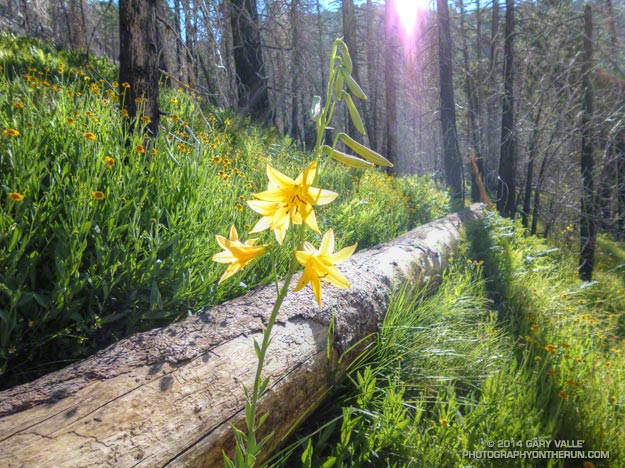
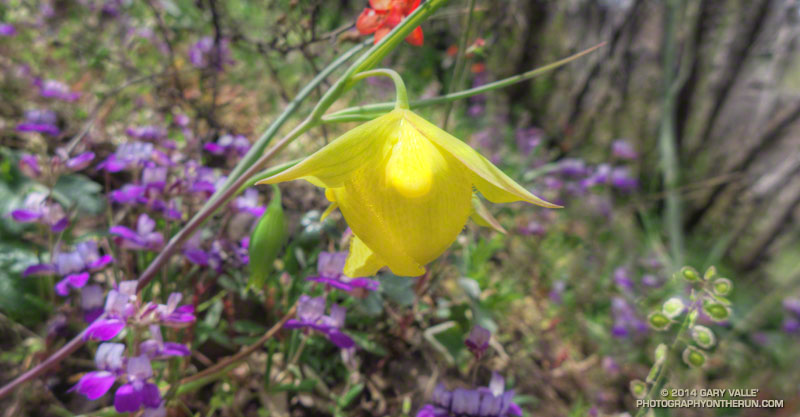
Lemon lily along the Three Points - Mt. Waterman Trail. border=0 src=

The bright yellow lemon lilies marked the trail. I hopped up on the log, followed it to it’s end, and stepped off. An ill-defined path through thick ferns gradually became more distinct and after a few yards became easier to follow.

I was on the Three Points – Mt. Waterman Trail (10W04) and doing a counterclockwise circuit of the 20-mile Three Points – Mt. Waterman loop. Counterclockwise because it was a way I could get in some additional training on the Cooper Canyon section of the AC100 course and also check how the south-facing slopes of Mt. Waterman were recovering from the 2009 Station Fire.

The Mt. Waterman Trail is less used than the major trails in the area, such as the PCT and Silver Moccasin Trail.  While it has seen some post-fire maintenance, it has more of the character of a “use trail” — as it did before the Station Fire. The trail is indistinct at times, winding its way around fallen trees and simply defining its route through use.

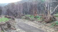
Some sections of the Mt. Waterman Trail near Three Points were severely burned. Higher up the mountain the fire made long runs up parallel ravines and ridges, creating a patchwork of burned understory and trees. The chaparral in the severely-burned areas appears to be recovering at a more or less normal rate. Of course the trees will take longer to grow, and it was great to see some pine seedlings and incense cedar seedlings have sprouted in the burn area.

The loop joined the AC100 course at Buckhorn Campground, descending the Burkhart Trail and then following the PCT up Cooper Canyon to Cloudburst Summit. From here it is nearly all downhill to Three Points.

Some related posts: Lemon Lily Along the Burkhart Trail, Three Points Loop Twice, Southern Pacific Rattlesnake on the Burkhart Trail, After the Station Fire: Three Points – Mt. Waterman Loop

Running Down Diablo

Running the North Peak Trail on Mt. Diablo

More often than not when you run down a mountain, you’ve also had to climb up it. Not so today. Today our Mt. Diablo run started on the summit of Mt. Diablo (3849′), worked over to North Peak (3557′), and then descended the Bald Ridge, Eagle Peak and Mitchell Rock Trails to the trailhead at the Mitchell Canyon Interpretive Center and Ranger Station.

I was more than happy to save the ascent of Mt. Diablo for another day. With the AC100 just a couple months away my mileage has been on the increase. Yesterday, after driving up to San Francisco, Brett had taken me on a run on Mt. Tamalpais. Earlier today I’d done a run to Fort Point and this afternoon would be doing another run when we returned to the city.

Except for an astoundingly steep and slippery section of service road between Prospector’s Gap and North Peak, today’s run was nearly all single track trail. Not the “cruise downhill, don’t have to think about it” kind of single track, but technically interesting single track that tries hard to find a way to trip you up and knock you down.

Mount Diablo fairy lantern

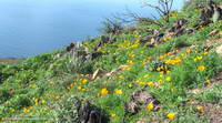
One of the reasons for doing Diablo was to see if we could find the rare and endangered Mount Diablo fairy lantern (Calochortus pulchellus). There were a surprising number (50-100) of the yellow flowers along the North Peak and Bald Ridge Trails. It might be assumed that this was due to the area being burned in the September 2013 Morgan Fire, however there appeared to be as many instances of the plant outside the burn area as inside. I think there is another explanation.

The unusual pattern of rainfall that we experienced this rain season in Southern California was replicated across much of the state, including the Bay Area. As of February 1 San Francisco Airport (KSFO) had recorded only 1.5 inches of rain since July 1 and storms in February and early March accounted for a large part of this season’s rainfall.

This pattern of rainfall, sun and temperature appears to have favored wild lilies, particularly mariposa lilies of the genus Calochortus, such as the Mt. Diablo fairy lantern. The butterfly mariposa (Calochortus venustus) was very widespread on Mt. Diablo, numbering in the thousands. It appears to fill a similar ecological niche as the Catalina mariposa (Calochortus catalinae) in the Santa Monica Mountains. The Catalina mariposa was also very abundant this year, along with some other members of the Lily family.

Here are a few photos from the Diablo run.

Coastal Trail Runs and Pacific Coast Trail Runs offer trail running events that start and finish at the Mitchell Canyon Trailhead on Mt. Diablo. Brazen Racing also organizes the Diablo Trails Challenge.

For more information about Mt. Diablo see the Mt. Diablo State Park, Save Mount Diablo and Mount Diablo Interpretive Association web sites. This State Park brochure includes a trail map.

Related post: Diablo Trails Challenge 50K 2018

Tamalpais Trail Run

Running ahead of me at a brisk pace, Brett suddenly stopped and turned, gesturing for me to slow and be quiet. On the shaded trail ahead I could see something large and brown hunched over on the trail. It took a moment to realize that it was a big male turkey in full regalia.

We were on Mt. Tamalpais, and about a half-mile into an afternoon run from the Bootjack parking area in Mt. Tamalpais State Park. This scenic loop was the first of several runs over a too-short Bay area weekend visit. One of the innumerable loops and variations in and near the Park, our route included segments of the Old Mine, Rock Spring and Matt Davis Trails.

According to this November 2012 article in the Marin Independent Journal the turkeys were introduced into Marin County in 1988 by Fish & Game to provide hunting opportunities on private land. They have since become a nuisance and usurp resources from native species. During the birds’ mating season they have reportedly frightened hikers and bikers. (I might have scoffed at that statement before seeing the size of this tom.)

It was a warm in the sun, cool in the shade afternoon with the temperature in the mid-70s. Earlier in the week an offshore flow had pushed temperatures in the Bay area well into the 90s. The heatwave produced numerous record highs, with the temperature at San Francisco Airport reaching over 90 degrees on Tuesday and Wednesday. The remote automated weather station (RAWS) on Middle Peak can be used to get an idea of the weather on Mt. Tam.

Today the winds were onshore, but the visibility was still very good. The twin summits of Mt. Diablo could be clearly seen across the bay, about 40 miles away. Mt. Diablo would be the site of one of tomorrow’s runs. Rumor had it the rare Mt. Diablo fairy lantern was blooming, and Brett had planned a run on Diablo that included North Peak, Bald Ridge and Eagle Peak.

Here are a few photos from today’s run on Mt. Tam. More info can be found on the Mt. Tamalpais State Park and the Friends of Mt. Tam web sites. This State Park brochure includes a trail map.

Trippet Ranch Wildflower Run

Symmetry of mariposa lily

For most of the Winter it looked like there would be very few wildflowers this Spring in the Santa Monica Mountains. The drought had taken its toll, and many chaparral plants were in survival mode. Most were desiccated, some were diseased and a few were dying. Winter-bloomers such as wishbone bush, prickly phlox, shooting star, big berry manzanita and big pod Ceanothus were practically nonexistent.

Then it rained. From February 26 to March 2 many areas of Southern California recorded more than four inches of rain. Los Angeles had the most rain over five days since 2010. Although the rain didn’t end the drought, it did end one of the driest periods in 100 years, and brought crucial relief to the plants and animals.

The response to the rain was virtually immediate and has continued throughout the Spring. The rain resuscitated the vegetation and wildlife and revived habitats. Now, when you run, hike or ride a trail in the Santa Monica Mountains, if you don’t look too closely, the growth and flowering of plants in the chaparral appears to be almost normal.

Rainfall in the area has been only about 40% of normal, but in a few cases plants have responded as if the rain season had been much wetter. Plants fill more than geographical niches in an ecosystem. They fill sub-seasonal niches of rainfall, temperature, sunlight and other parameters. If rainfall occurs at an optimum time or in an optimum pattern for a plant, its benefits can be amplified. The large number of Catalina mariposa lily and wild hyacinth blooming this Spring demonstrate this effect. The growth of non-native black mustard is also more robust and widespread than might have been expected.

Here’s a slideshow of some of the wildflowers currently blooming in the Topanga State Park area of the Santa Monica Mountains. All of the photographs are from this morning’s 12-something mile loop to Trippet Ranch from the “end of Reseda” at Marvin Braude Mulholland Gateway Park.

Some related posts: Garapito Trail Runs, The Heavenly Ranch in the Hills

Chaparral Yucca Along the Kenyon Devore Trail

Chaparral Yucca Along the Kenyon Devore Trail

Chaparral yuuca (Hesperoyucca whipplei) at about 4700′ on the Kenyon Devore Trail below Mt. Wilson. The plant was classified as Yucca whipplei for many decades.

From last weekend’s Mt. Wilson – Devore Camp – West Fork loop.

Bigcone ENSO Prediction, Poodle-dog Bush Blues, and a Surprise on Kenyon Devore

Morning sun on the dome of the Mt. Wilson Observatory

I’d paused to rinse my arms and legs, hoping to wash away at least a little of the poison oak and Poodle-dog bush I’d been unable to avoid. I was at a small spring part way up the Kenyon Devore Trail, doing a variation of a loop that my son and I had done a year before.

Today’s run had started on the top of Mt. Wilson, descended the Rim Trail to Newcomb Pass then followed the Gabrielino Trail down to the Rincon – Red Box Road. This year instead of taking the forest road down to West Fork, I stayed on the Gabrielino Trail and descended to Devore Camp, and then worked back upstream on the Gabrielino Trail past West Fork to the Kenyon Devore Trail.


Driving up the Mt. Wilson Road I’d noticed that many of the bigcone Douglas-firs were heavily laden with cones. According to the Forest Service’s Silvics Manual bigcone Douglas-firs don’t often have bumper crops. Why now, following two subpar rain seasons, the most recent of which was unusually dry? Was the tree’s evolutionary knowledge playing the odds that a wet period of Southern California’s wet/dry ENSO cycle is a Winter or two away? At the moment La Nina or Neutral conditions look more likely this coming Winter, but the odds for El Nino could increase for the Winter of 2014-15.

Update June 25, 2018. El Nino conditions did emerge in late Fall 2014 and continued until the Spring of 2016. However, the drought in Southern California persisted and below average precipitation was recorded in both 2014-15 and 2015-16. It wasn’t until the 2016-17 rain season (during a weak La Nina) that Southern California received above average precipitation.


Like last year there was plenty of poison oak and Poodle-dog bush along the Rim and Gabrielino Trails. The poison oak was about the same as last year — mostly but not entirely avoidable — but the Poodle-dog seemed worse. I’d hoped that this year’s much lower than average rainfall would suppress the growth of Poodle-dog bush, but if anything it seemed more robust. Poodle-dog had overgrown the trail in several spots, its long stalks and sticky leaves overlapping the trail like a gauntlet of pikes. Contact was unavoidable.


It had been interesting to visit Devore Camp. The last time I’d been there was in March 2003 when Gary Gunder and I paddled from the West Fork San Gabriel River from West Fork to Hwy 39. We had been fortunate to be able to paddle the reach with few portages. With all the downed trees from the Station Fire it may be many years before big storms flush the river channel to point it can be paddled without logs being a constant problem.


In addition to the expanses of Poodle-dog bush blossoms, a number of other wildflowers were in bloom, including Grinnell’s beardtongue, rose snapdragon, blackberry, pink, paintbrush, bush poppy, buckwheat, gilia, Keckiella and others. Along the West Fork the blossoms of spotted Humboldt’s lilies had beamed like yellow-orange paper lanterns scattered throughout an immense garden.

I cannot ascend the Kenyon Devore Trail without thinking about the Mt. Disappointment 50K/50M. During those races the little spring I was at now had always been a welcome source of “extra” water on the final climb to Mt. Wilson. The 2013 races have been cancelled, but are expected to return in 2014. We all know how tough R.D. Gary Hilliard is and look forward to next year’s race!

“Hey, are you on a trail?”

The voice seemed to come from nowhere. I looked to my left and right, but the trail was empty.

“Hey, up here!”


What the… I scanned the STEEP slopes above the creek, but still had a hard time locating the voice. After a moment of rustling, a helmeted figure emerged from the trees, carrying an orange mountain bike.

If you’ve done the Kenyon Devore Trail as part of the Mt. Disappointment races or at another time you probably recall the slippery stream crossing with the chain. The MTBer had apparently missed a switchback about a mile up the trail and descended directly down a ridge to the spring.

Update Friday, June 21, 2013. Lucked out with the Poodle-dog bush* and poison oak! Just one small spot of irritation on the top of an ankle, and it’s already almost gone.

*The taxonomic name for Turricula parryi (Poodle-dog bush) has changed to Eriodictyon parryi. The Jepson Manual: Vascular Plants of California, Second Edition (2012) has returned Turricula to the genus Eriodictyon, as originally described by Gray. According to the Wikipedia entry for Turricula (April 11, 2012), “… molecular phylogenetic analysis carried out by Ferguson (1998) confirms that Turricula should be treated as a separate genus within a clade (Ferguson does not use the term “subfamily”) that includes Eriodictyon, and also the genera Nama and Wigandia; Eriodictyon is the genus to which Turricula is closest in molecular terms, and is its sister taxon.” I use “Turricula” and “Poodle-dog bush” interchangeably as a common name.

Some related posts: Mt. Wilson Rim Trail – Kenyon Devore Trail Loop, GSU Mt. Wilson CHARA Telescope Array, Why Won’t My Smart Key Work?