Category Archives: adventures

Trippet Ranch Loop Plus Temescal Peak and Temescal Lookout

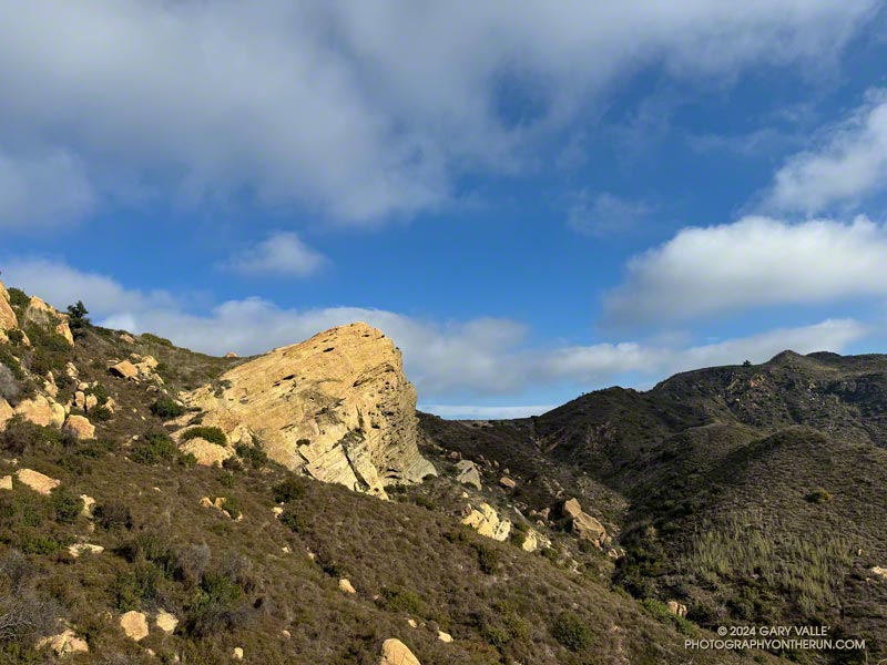
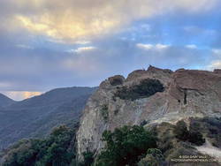
Eagle Rock, Clouds and Sun. Photography by Gary Valle'
Eagle Rock

There are many ways to extend the 12.5-mile Trippet Ranch Loop. A couple of my favorites are the Trippet Ranch Loop Plus Parker Mesa Overlook (18.6 miles) and Trailer Canyon – Santa Ynez Canyon – Trippet Ranch Loop (17.2 miles) trail runs.

Runners descending Cathedral Rocks in Topanga State Park (thumbnail)
Runners descending Cathedral Rocks, near the Hub

Lately, I’ve been doing another option — adding an out and back from the Hub to Temescal Peak and Temescal Lookout and then continuing on the Trippet Ranch Loop from the Hub.

This extends the run to about 16 miles, plus Temescal Peak and Temescal Lookout are excellent viewpoints (video).

That’s the run I did this morning, plus a quick stop at Cathedral Rocks (near the Hub) along the way.

Explore the scenery and terrain on the Trippet Ranch Loop Plus Temescal Peak and Temescal Lookout trail run using our high resolution,  interactive, 3D viewer. The imagery is so detailed, it’s almost like being there! To change the view, use the control on the upper right side of the screen, the CTRL key and your mouse, or touch gestures. Track and placename locations are approximate and subject to errors. Poor weather, and other conditions may make this route unsuitable for this activity.

Some related posts:
Seventh Wettest Water Year Results in Spring-Like Scenery Along L.A. Area Trails
Out and Back Trail Run from the Top of Reseda to Parker Mesa Overlook
Trailer Canyon – Santa Ynez Canyon Trail – Trippet Ranch Loop
Garapito Trail Runs
Popular Trails in Topanga State Park Damaged by Winter Storms

Chumash – Las Llajas Loop Plus

Coquina Mine Trail/Marr Ranch Trail Connector

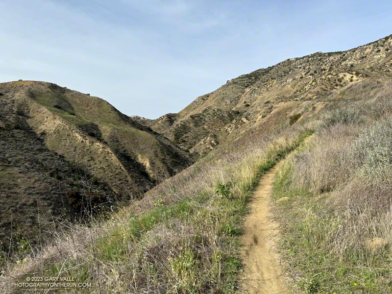
In this case the “Plus” is an alternate finish to the counterclockwise Chumash – Las Llajas Loop.

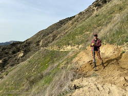
Working on the trail that connects the Coquina Mine Trail and Las Llajas Canyon to the Marr Ranch Trail. (Thumbnail)
Working on the trail that connects the Coquina Mine Trail (and Las Llajas Canyon) to the Marr Ranch Trail.

This variation bypasses the last couple of miles of Las Lajas Canyon by using a relatively new trail that splits off the Coquina Mine Trail and connects to the Marr Ranch Trail.

It adds about 1.5 miles and a few hundred feet of elevation gain to the Chumash – Las Llajas Loop but gets you up and out of the canyon and on a ridgeline with excellent views of the surrounding terrain.

I’ve always wondered who maintains the connector trail and happened upon that person on this morning’s run.

Some related posts:
Chumash-Las Llajas Loop
Not So Flat Las Llajas Canyon
Exploring Las Llajas

Back on the Old Boney and Serrano Valley Trails

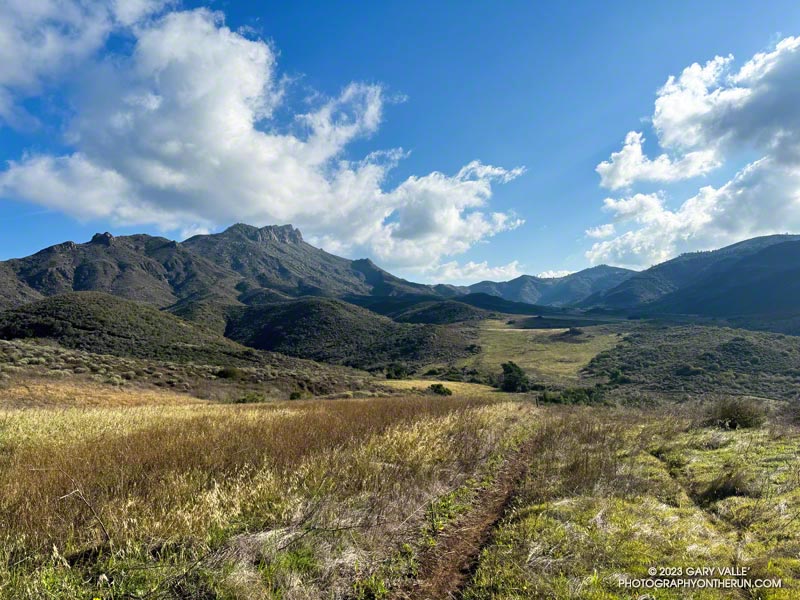
Boney Mountain from the Serrano Valley Trail.

Not all trails will have a smooth tread, good footing, trimmed vegetation, trail signs and other luxuries. What you see is what you get, and sometimes what you get is not perfect.

That was the case on last May’s run to the Serrano Valley from Wendy Drive. A long stretch of the Old Boney Trail was all but impassable. The trail was badly overgrown, the day foggy and gray, and everything was dripping wet.

Sycamore leaves scattered along the Serrano Canyon Trail (thumbnail)
Serrano Canyon Trail

But there is just something about immersing yourself in the good and not-so-good that nature offers. It’s part of what nature is. The splendid display of wildflowers seen on that run was a result of the rainy season that produced the overgrown trail.

Curious to see how that section of trail had changed in seven months, this morning I was back on the Old Boney Trail and on my way to Serrano Valley. It had rained around 4 inches during the week, and I expected the mud to be like glue and creek crossings wet.

Use of the trail had improved its condition. There were still some overgrown sections but most of the time I could see my feet, as well as the ruts and rocks on the trail. It was muddy in the usual places but the globs of mud on my shoes didn’t reach dinner plate proportions.

The Fireline Trail climbs out of Sycamore Canyon. Boney Mountain is in the distance.
Fireline Trail with Boney Mountain in the distance.

In the wake of the storm, the weather was exhilarating. Postcard clouds decorated the crest of Boney Mountain and a cool breeze filtered through the canyons. Despite all the rain, Serrano Creek was flowing at a modest level, and I emerged from Serrano Canyon with dry shoes.

It was a day for a longer run, and when I reached Sycamore Canyon fire road, I turned left (south) and continued down the canyon to the Fireline Trail. Going up the Fireline Trail to Overlook Fire Road extended the run and expanded the views. A right turn on Overlook Fire Road lead to the top of the Ray Miller Trail, and from there to the Hub. These junctions offer additional opportunities for extending the run.

Today, I ran down Hell Hill, over to the Two Foxes Trail via Wood Canyon Fire Road, then picked up Sycamore Canyon Fire Road near the Danielson Multi-Use Area and followed it to the Upper Sycamore Trail, Danielson Road, and Satwiwa. This interactive, 3D terrain view shows the route.

Some related posts:
A Really Overgrown Trail, Thirty Creek Crossings, and Thousands of Wildflowers
Old Boney to Serrano Valley, Plus Fireline and Overlook
Serrano Valley from Wendy Drive

A Displaced Bridge, Exceptional Backbone Trail Views, and a Card Table Along the Bulldog Loop

Rock formation along the Backbone Trail. Photography by Gary Valle'

The photograph above was taken a few steps off the Backbone Trail, between the Corral Canyon Trailhead and Mesa Peak Motorway fire road. Also in the area was a set of table and chairs that might be used for an ocean-view card game or a lunch break.

These scenes were about halfway through a variation of the Bulldog Loop that starts/ends at the Cistern Trailhead on Mulholland Highway. The route follows the Cistern, Lookout, and Cage Creek Trails down to the Crags Road Trail, just east of where it crosses Malibu Creek.

A permanent bridge used to span the creek, but after being washed out several times in Winter floods, a “seasonal” bridge was put in place. The seasonal bridge is removed when there is a threat of flooding, such as during the rainy season.

This morning, the temperature in the canyon was in the mid-thirties. That was cool enough that I didn’t want to get wet, and I hoped the removal of the bridge had been delayed. But several days of rain were in the forecast, and as I neared the creek, I could see the bridge now lay alongside trail.

A log spanned the creek where the bridge once stood. Using a suitable stick as a hiking pole, it was easy to cross the log, stay dry, and continue the loop.

Some related posts:
Best Trailhead to Start the Bulldog Loop?
Bulldog Loop Plus the Phantom Loop
After the Woolsey Fire: Bulldog Loop

Which Stretch of the Backbone Trail Has the Longest Uninterrupted Descent and Most Elevation Loss?

Runners descending the Backbone Trail pass Chamberlain Rock.

It’s a section of the westbound Backbone Trail that starts two miles west of Sandstone Peak and continues down the Chamberlain, Old Boney, and Blue Canyon Trails to the Danielson Multi-Use Area and Big Sycamore Canyon Fire Road. At the point where the trail turns south on the fire road, it has dropped about 2400 feet in 4.8 miles. Continuing south on the fire road, the Backbone Trail gradually descends another 100 feet over a mile and a half until it starts up the Wood Canyon Vista Trail.

What about the long downhill between Saddle Peak and Malibu Canyon? That would be a contender if it weren’t for a gradual uphill that starts a little east of the Piuma Road crossing. It gains about 180 feet over 0.8 mile. If that break in the downhill is ignored, then the stats for the two descents are similar.

Boney Mountain from Satwiwa.

This morning, I did the Backbone Trail segment from Sandstone Peak to the Danielson Multi-Use Area as part of a loop from the Wendy Drive Trailhead on Potrero Road in Newbury Park. Including the optional side trip to Sandstone Peak, the loop totals about 18 miles with around 4000′ gain/loss.

Fires and heavy rain the past decade have taken their toll on the Backbone Trail and other trails in the Santa Monica Mountains. Today, except for a short stretch near Chamberlain Rock, most of the long downhill was in decent shape and enjoyable to run.

Here’s an interactive, 3D terrain view of a GPS trace of my route. The eastern ridge route is also shown. The map can be zoomed, tilted, rotated, and panned using the navigation control on the right. Track and placename locations are approximate and subject to errors. Poor weather and other conditions may make this route unsuitable for this activity.

Some related posts:
Not So Busy Sandstone Peak
Looking for Boney Mountain
Backbone Trail Mystery

The Western Santa Monica Mountains from Topanga Lookout Ridge

https://photographyontherun.com/content/binary/WesternSantaMonicaMountainsMorningLowCloudsSun4949b.jpg

The sun had risen, casting a warm morning light on the Santa Monica Mountains. Overnight, low clouds flowed inland through Malibu Canyon, emphasizing the peaks and covering the valleys.

Backbone Trail below Saddle Peak.

I had just started up Topanga Lookout Ridge and was less than a mile into the Topanga Lookout Ridge Loop. Rain had muddied the ground and cleansed the sky, producing crystal clear views in every direction.

The view of the western Santa Monica Mountains extended from the top of the Tapia climb on Mesa Peak Motorway, past Castro Peak, to Boney Mountain and the highest peak in the Santa Monica range — Sandstone Peak.

In my mind, I traced the route of the Backbone Trail along the crest. My route would take me to the Backbone Trail, but this morning I would enjoy running only a few of its sixty-eight spectacular miles.

Some related posts:
Topanga Lookout Loop, Plus Saddle Peak
Looking for Snow on Topanga Lookout and Saddle Peak
Topanga Lookout Site and the San Fernando Valley