Chasing a Sunrise, Taking a Moonshot, Los Padres Snow, and a Dark Line in the Sky

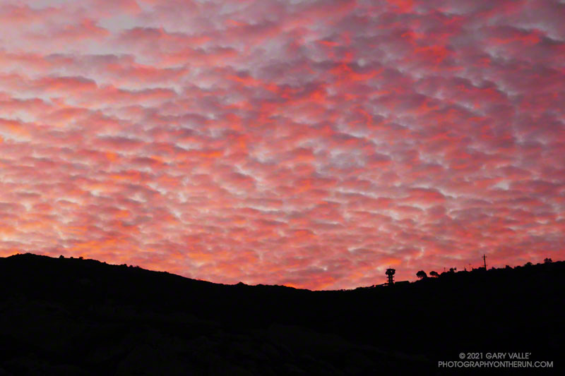
Colorful sunrise in the eastern Santa Monica Mountains

I was running up Calabasas Peak Mtwy fire road trying to get a better view of the eastern sky, but the view in that direction was blocked by a steep hillside. The road turned to the northeast up ahead, and I hoped the best moments of a rapidly-evolving sunrise would not be lost.

A couple of breathless minutes later, I rounded a corner and was rewarded with an unobstructed view of a vivid, pink-red-orange mackerel sky. Focusing on the ridgeline near Topanga tower, I shot several sets of bracketed photos.
Handheld snapshot of the Moon, using a Lumix ZS100
Handheld snapshot of the Moon. Click for larger image and more info.

Excited by the sunrise, I continued up the fire road, scanning my surroundings for another photo. My eye settled on the gibbous moon. High in the sky, it’s bright face was subdued by a thin veil of pinkish-gray cloud. I’d previously experimented with handheld shots of the Moon using my running camera — a Lumix ZS100. Zooming to an equivalent focal length of about 250mm, I held my breath, steadied the camera the best I could, and took a few shots. Here’s one of the images — cropped and sharpened — with enough detail to see craters, maria, and some other lunar features.

At the bottom of Topanga Lookout Ridge there were several bigberry manzanita bushes covered with flowers. A hummingbird was up before sunrise, buzzing about the blossoms, busily drinking the precious nectar. Although it had rained a couple days before, this rain year there had been little rainfall, and a corresponding scarcity of early season wildflowers.

As I climbed higher on the ridge, the mountains northwest of Los Angeles came into view, white with snow from the recent storm. The snow-covered peaks are south of Mt. Pinos and Frazier Mountain, in the area of San Raphael Peak, McDonald Peak, Sewart Mountain and Snowy Peak.
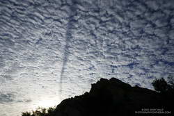
Contrail shadow near Los Angeles
Contrail shadow.

Like snow on a mountain, there is a purity in the form and appearance of clouds. When a long, dark streak appeared across a layer of high clouds, it was hard to miss. In this case, the dark line appears to be the shadow of a contrail of a jet flying above the clouds. At the time LAX was reporting scattered clouds at 19,000′ and 23,000′, with a broken layer of clouds at 28,000′. Given the height of the clouds and orientation of the contrail, it may have been from a flight from San Diego to San Francisco.

Topping out on the ridge, I smiled when I saw the masked couple dancing on the Lookout, and continued west toward Saddle Peak.

Some related photos: An Early Morning Dance at Topanga Lookout, Fallstreak Hole, Rainbow Colors in Cirrus Clouds Over Los Angeles

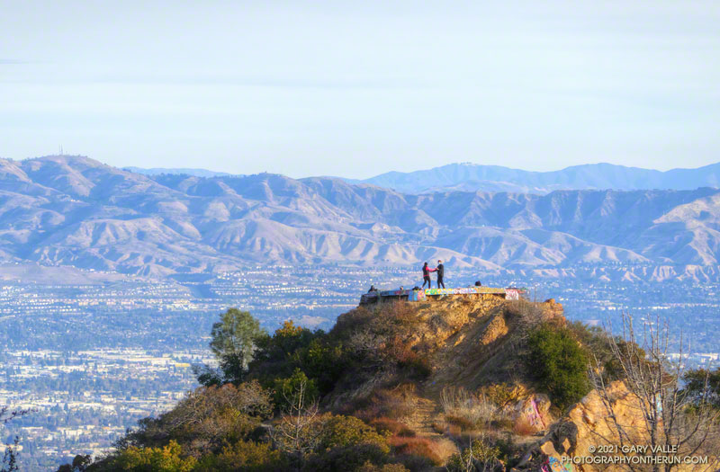
Pandemic Cool: An Early Morning Dance at Topanga Lookout

With the San Fernando Valley as a backdrop, a couple dances at Topanga Lookout, during the pandemic

As I neared the top of Topanga Lookout Ridge, I could hear music coming from the Lookout. It looked like there were people on top, but from my vantage point down on the ridge, it was hard to tell what was going on.

When I reached the isolated platform, I was surprised to find a couple dancing! Wearing masks, and with much of the San Fernando Valley as a backdrop, they had found a unique way to deal with the complications of the pandemic.

Some related posts: Topanga Lookout Ridge Loop; Malibu Canyon to Saddle Peak, Topanga Lookout, Calabasas Peak, and the Secret Trail

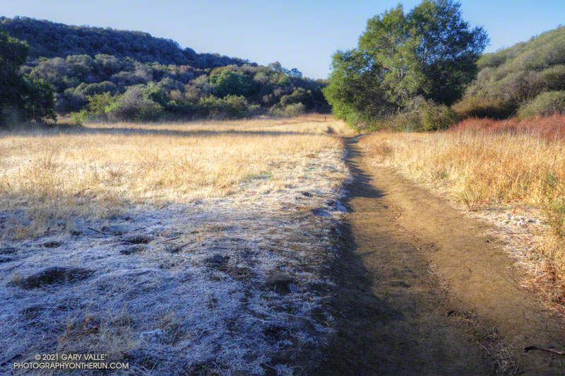
Musch Meadow Frost

Frost along the Backbone Trail at Musch Meadow

As I approached Musch Camp, a scrub jay flew from a trailside faucet and into a nearby eucalyptus. There had been a little rain the day before, but the birds at the closed camp were still thirsty. Less than a quarter-inch of rain had fallen, and nearby creeks were still dry.

Melting frost
Melting frost “steaming” at Musch Meadow

I was doing a run from the “Top of Reseda,” and on a warmer day would have topped off my water bottle at the camp. I stopped at the faucet and briefly turned on the spigot. Maybe that would make it easier for the jay.

Leaving the camp behind, I continued south on the Backbone Trail, across frost-covered Musch Meadow. Early morning sun had just reached the meadow, and water vapor from the melting frost steamed in the cold air.

In another mile I reached the Trippet Ranch trailhead, and then begin the six mile run back to the Valley. At several points on the run there had been wintry views of the local mountains. On the way back the best view of the snowy mountains was from the Hub, where Mt. Baldy could be seen gleaming white in the morning sun.

Some related posts: Garapito Trail Runs, Musch Trail Mule Deer, Musch Trail Morning

A Sandstone Mammoth and a Spiral Labyrinth on the Bulldog Loop

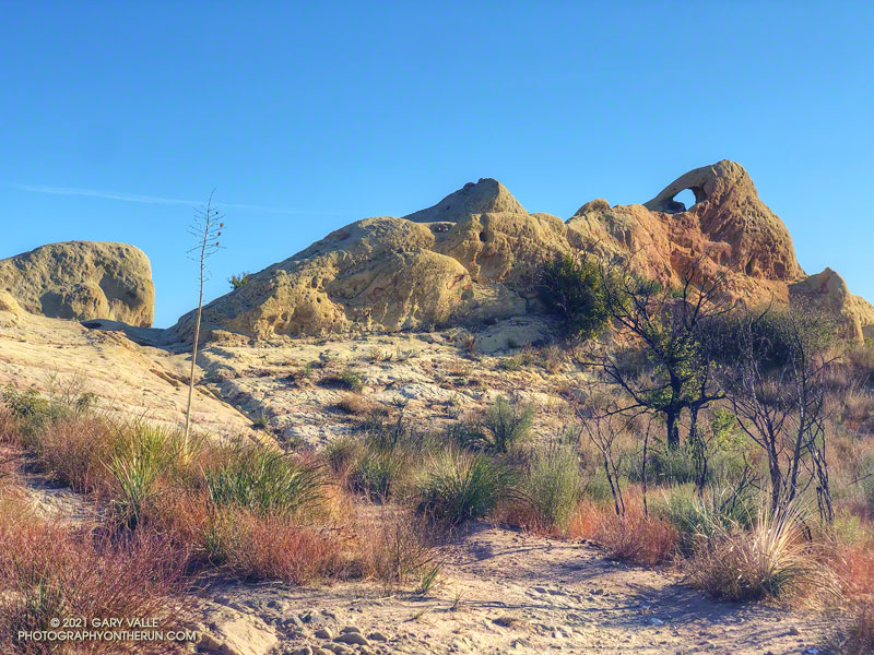
A natural sculpture of a sandstone mammoth on the Backbone Trail

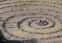
Updated June 26, 2023. The spiral has been periodically removed and rebuilt over the years. Google Earth historical imagery shows that it was removed sometime between March 2021 and February 2022. As of June 25, 2023, it had not yet been rebuilt.

Instead of struggling to escape a tar pit, this “mammoth” seems to have been caught up in 25-30 million-year-old sandstone.

The beast can be seen along the Backbone Trail, east of the Corral Canyon Trailhead. When running/hiking/riding east from the trailhead, the trail climbs over two steep steps and up to gap in the rock. In the photo above, the gap is on the left and the mammoth figure is on the right. From the gap, the trail descends a rock corridor to Mesa Peak fire road.

A closer look at the mammoth reveals that it is pockmarked and there are rocks embedded in the sandstone. The embedded rocks are cobble from an ancient river and the pockmarks are where rounded rocks have fallen out of the eroding sandstone.

Spiral labyrinth constructed of ancient stream cobble along the Backbone Trail
Spiral labyrinth along the Backbone Trail

Stream cobble that has eroded out of sandstone formations in this area has been used to construct a spiral labyrinth on the north side of Mesa Peak Fire Road. The cobble was tumbled and smoothed by streams that drained a range much older than the Santa Monica Mountains.

The title photo is from this morning’s run of the Bulldog Loop.

Some related posts: Moon and Sycamores, Malibu Creek State Park; Bulldog Loop Near Corral Canyon

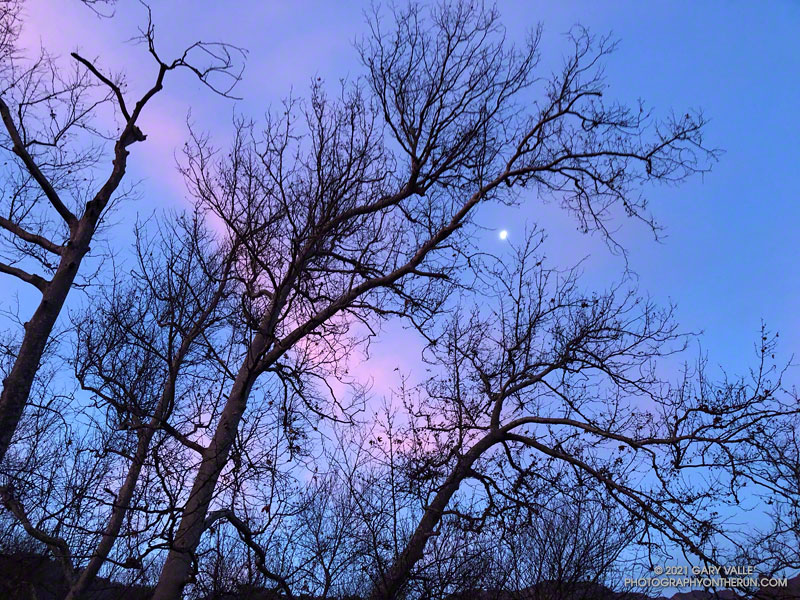
Moon and Sycamores, Malibu Creek State Park

Moon and Sycamores, Malibu Creek State Park

The photograph Moon and Sycamores was taken at dawn, near Malibu Canyon and Piuma Road, at the start of this morning’s Bulldog Loop trail run in Malibu Creek State Park.

A quarter-mile from the top of Bulldog Mtwy fire road in Malibu Creek State Park.
A quarter-mile from the top of the Bulldog climb.

According to the Tempe sensor on my pack, the temperature ranged from a chilly 32° F along Malibu Creek to around 65° F on the crest. It was a near perfect morning to be outdoors.

Here’s an interactive, 3D terrain view of my GPS track from a previous run of the Bulldog Loop from Malibu & Piuma.

Some related posts: Bulldog Loop Plus the Phantom Loop; Trees, Bees, and a Washed-Out Footbridge on the Bulldog Loop in Malibu Creek State Park; After the Woolsey Fire: Bulldog Loop

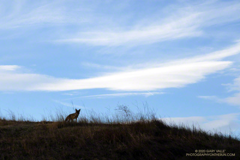
Curious Coyote

Curious coyote at Upper Las Virgenes Canyon Open Space Preserve (Ahmanson Ranch)

This afternoon I was running down a single-track trail at Upper Las Virgenes Canyon Open Space Preserve (Ahmanson Ranch), when I noticed a coyote on a parallel track across a small ravine. From time to time I would stop and watch the coyote, and from time to time it would pause and watch me. After a few minutes, it went its way, and I went mine.

Earlier in the run I’d been in the same area when a coyote, running at full speed,  came blasting down a single-track trail. It turned into the brush about 30 yards in front of me. I’d seen similar behavior once before when one coyote was chasing another. In this case a hiker followed the coyote down the trail. In my experience, it usually take more than a simple encounter with a hiker to panic a coyote.

Coyote at Upper Las Virgenes Canyon Open Space Preserve (Ahmanson Ranch)
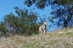
Another curious coyote. Click for a larger image.

Update February 18, 2021. The coyote pictured on the right was in the same area as the coyote in the title photo. When I first encountered the coyote, it had just crossed the trail and was below me. For some reason it reversed its course and climbed to a viewpoint above me, and watched as I ran up the trail. After a few moments it ran back down hill, retracing its original course across the trail. It was one of the most well-conditioned coyotes I’ve seen out at Upper Las Virgenes Canyon Open Space Preserve (Ahmanson Ranch).

I have had a couple of unusual encounters with coyotes out at Ahmanson. One time, a coyote decided to run with me, as if on a leash.

Some related posts: Coyote Tag, Coyote Tag II, Coyotes Are Curious Creatures

Photography and inspiration from running and other adventures in the Open Space and Wilderness areas of California, and beyond. No ads. All content, including photography, is Copyright © 2006-2024 Gary Valle. All Rights Reserved.