Strawberry Peak Summit Loop – Spring 2023 Update

The northwest ridge of Strawberry Peak just before the Class 2-3 rock climbing segment.

Usually, I prefer to start the Strawberry Peak Summit Loop at the Colby Canyon Trailhead on Angeles Crest Highway. But it had been a while since I’d done the loop from Clear Creek, and I was feeling a little nostalgic. One of the aid stations for the ANFTR/Mt. Disappointment race is at Clear Creek, and the course climbs Josephine Fire Road.

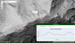
I was also curious how my time to Josephine Saddle using the fire road would compare to the direct route up the Colby Canyon Trail. As it turned out, at a moderate pace it was about the same either way.

Foliated rock along the use trail to the northwest ridge of Strawberry Peak

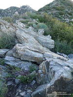
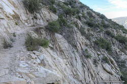
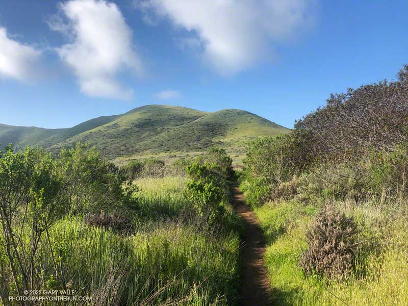
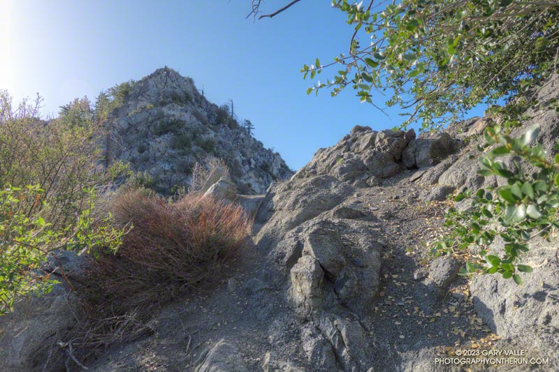
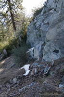
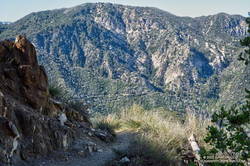
The use trail up from Josephine Saddle was in decent condition. It looked like it may have recently had a snip here and there. Part way up the path, an outcrop on the ridgeline provides a good warmup for the climbing higher up. The circuitous path eventually ends at the base of the steep, jumbled northwest ridge of Strawberry Peak. I was surprised to find two small patches of snow here.

It’s difficult to describe the route on the ridge since there are many variations. It’s not fear-mongering to say that people get into trouble on this section. A common comment about this segment is, “Don’t climb anything sketchy or difficult.” But what is an easy scramble for one person may be nearly impossible for another. With 50+ years of rock climbing experience, I still remind myself not to climb up anything I’m not 100% sure I can climb down. If you don’t have “real” rock climbing experience, go with someone that knows the route.

Snow on the NW side of Strawberry Peak on April 30, 2023.
Small patches of snow on the NW side of Strawberry Peak on April 30, 2023.

Following a wet, snowy, cold Winter, I took extra care while climbing. Solid holds and blocks can sometimes be loosened over the Winter and fail unexpectedly. This morning, I didn’t notice any obvious changes on the route I climbed.

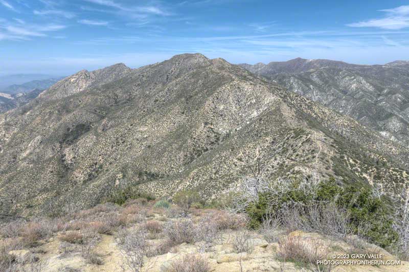
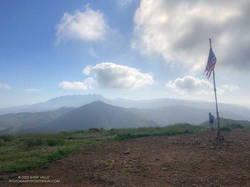
The setting changes dramatically on the east side of Strawberry Peak. You go from the cool shadows of a steep, rocky face with (typically) no one around to a sunny, sandy, busy summit and trail.

As I approached the summit, a couple of people were setting up to do a video for a vlog. Another person had just reached the top, and another hiker wasn’t far behind. With snow in the high country, Hwy 2 still closed at Red Box, and the Bobcat Fire Closure still in effect, the trail up Strawberry was a popular option. The question of the day from the people coming up was, “How many false summits are there?”

Looking across the canyon to the Gabrielino Trail below Red Box, and Supercloud Canyon

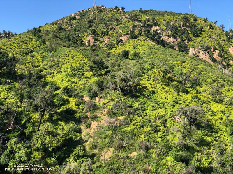
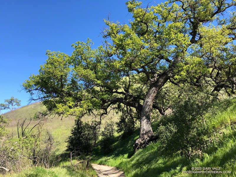
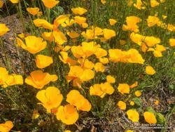
Overall, the Strawberry Peak Trail was in reasonable shape. The trail needed a little work in a few places, but as far as mountain trails go, its condition was about what you would expect. In several places, the trail was carpeted with the remnants of old yucca leaves. Very nice!

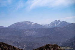
Just before reaching Red Box, I snapped a photo of the snow on Mt. Baldy. At Red Box, all but one parking space was taken, and that one was snagged by an arriving car.

As I started down the Gabrielino Trail from Red Box, LASD Air Rescue 5 began to orbit overhead. Apparently, there had been yet another vehicle accident on Angeles Crest Highway. It wasn’t long until I heard the whaling sound of sirens coming up the canyon.

Upper Arroyo Seco at Switzer's Picnic Area.
Upper Arroyo Seco at Switzer’s Picnic Area.

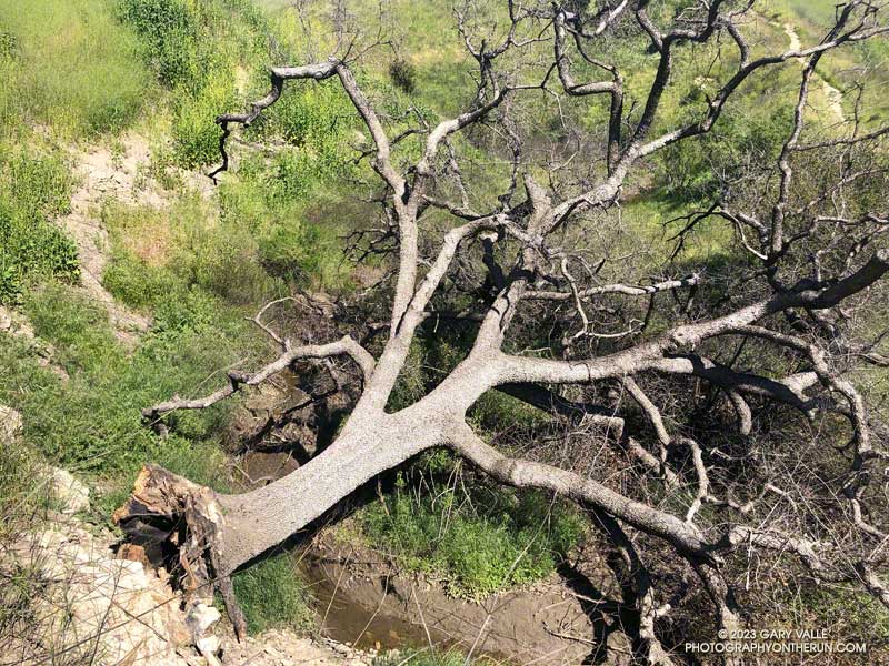
Some trailwork had been done on the upper half of Gabrielino Trail between Red Box and Switzer’s. Quite a few small trees and limbs had been removed from the trail, and the bushes trimmed. Most of the work (as of today) ended at mass of fallen trees halfway down the trail.

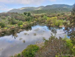
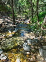
Upper Arroyo Seco was flowing. The sound of water plunging over the debris dams made the flow seem higher than it was. There were a couple of minor creek crossings.

Switzer’s was busy — as usual. To finish the loop, I walked up the stairs to the access road and hiked up to the start of Nature’s Canteen Trail. It was a bit overgrown, but I was back at Clear Creek in a few minutes.

Some related posts: Strawberry Peak Summit Loop; Plan B: Barley Flats; Strawberry Peak, Switzer’s and the Old Colby Trail

Wonderful Wildflowers, a Seasonal Bridge, and a Cranky Rattlesnake on the Bulldog Loop

Canyon sunflowers covering a hillside in Malibu Creek State Park that was burned in the 2018 Woolsey Fire
Canyon sunflowers covering a hillside burned in the 2018 Woolsey Fire

Update May 5, 2023. Did a run this afternoon in Malibu Creek State Park and the seasonal bridge across Malibu Creek on the Crags Road Trail is back in place!

As I approached the M*A*S*H site, I could see some people taking photos. I stopped to say hi, and without skipping a beat, one of them asked, “Did you wade across the creek?”

He was asking about the creek crossing where Crags Road crosses Malibu Creek upstream of Century Lake and east of the M*A*S*H site.

Prickly phlox along the Tapia Spur Trail in Malibu Creek State Park
Prickly phlox along the Tapia Spur Trail.

There’s a substantial log spanning the creek at the moment, and I wanted to answer that I danced across it with my eyes closed. But instead, I explained that I decided to wade — and for sure keep my phone dry — rather than take a chance of falling uncontrolled into three feet of water, ker-splash.

Speaking of which, this morning, I talked to a mountain biker who saw the bridge pulled off to the side of the creek before any flooding had occurred and thought it may have been hauled away. Good news! According to the Malibu Creek Docents, the bridge is seasonal and was designed to be portable. It was removed and stored before this Winter’s rain. It is expected to be reinstalled when the threat of flooding is over — which should be soon.

Vinca growing at the base of a coast redwood in Malibu Creek State Park
Vinca growing at the base of a coast redwood along the Forest Trail.

After crossing Malibu Creek and before continuing to the M*A*S*H site, I took a quick detour on the Forest Trail. Bordered by Century Lake on one side, and steep, rocky slopes on the other, the Forest Trail has a character all its own. It’s a wonderful place to observe, reflect, and enjoy nature. It’s also home to several coast redwoods. Unfortunately, less than half the trees originally growing along the trail survived the 2011-2015 drought. This morning, a redwood that died several years ago had fallen and was partially blocking the trail near its halfway point.

As has been the case in most of Southern California this Spring, the wildflowers on this run were spectacular. Canyon sunflower was particularly prevalent, with many thousands of the bright-yellow blossoms covering the hillsides burned in the 2018 Woolsey Fire.

Very dark Southern Pacific Rattlesnake on a fire road in Malibu Creek State Park
Southern Pacific Rattlesnake on Castro Peak Mtwy fire road.

Also exciting was my first rattlesnake encounter of 2023. I was running down Castro Peak Mtwy Fire Road from the Bulldog “T” when I saw something in the road that looked like a partially exposed root. As I neared, I could see it was a very dark — almost black — Southern Pacific Rattlesnake.

The snake was stretched out straight on the road, basking in the sun. As I approached, it did move, and it did not rattle. Usually, snakes in this state are pretty docile, and I can cautiously walk a few feet behind them. Yikes! This one was super-aggressive. In the blink of an eye, it turned and moved toward me, doubling back on itself. I jumped a mile! It coiled but still did not rattle! It must have recently emerged from its Winter hideaway.

Here are a few photos (primarily wildflowers) taken on the Bulldog Loop.

Some related posts: More Malibu Creek Flooding; Bulldog Training Run; After the Woolsey Fire: Malibu Creek State Park Redwoods, M*A*S*H Site and Bulldog Climb

Also check out the M*A*S*H site web page.

Ahmanson Valley Oaks Finally Get Their Leaves

Cold weather delayed the leafing out of valley oaks at Ahmanson ranch until late March and early April 2023.

According to preliminary NWS reports, Downtown Los Angeles (USC) recorded average monthly temperatures well below normal in November 2022 and January thru March 2023. March was particularly cool, with an average high of about 64 degrees and an average low of about 50 degrees.

Besides high heating bills, Southern California’s unusually cold Winter affected several seasonal processes, one of which was when the valley oaks at Ahmanson budded and grew new leaves.

The leaves of valley oaks at Ahmanson Ranch typically turn in mid-December, and the trees usually begin to leaf out during the latter half of February. Depending on the tree’s microclimate, the emergence of new leaves may vary by a week or more.

Cooler than normal temperatures during January to March 2023 delayed the leafing out of these valley oaks in Las Virgenes Canyon.
Valley oaks in Las Virgenes Canyon in early April 2023.

The earliest I’ve photographed a valley oak at Ahmanson sprouting new leaves was February 3, 2015. Last year, a valley oak had new leaves on February 10, 2022.

The latest I’ve seen valley oaks sprouting new leaves is this year — from about March 20, 2023, in favored locations to April 4, 2023, in cooler areas such as Las Virgenes Canyon.

Prior to this year, the latest I’ve photographed a valley oak at Ahmanson with new leaves was March 9, 2009.

(Officially named Upper Las Virgenes Canyon Open Space Preserve, most users refer to the open space area as Ahmanson Ranch or simply Ahmanson.)

Some related posts: Revitalized Valley Oak at Ahmanson Ranch, Goldfields Are Blooming and Valley Oaks Greening, Valley Oak Leaf

Condor Peak and Fox Mountain Adventure Run

Condor Peak from Fox Mountain

The out and back trail run to Condor Peak (5440’+) and Fox Mountain (5033′) from Vogel Flat is an adventurous 17-mile, lower elevation run in the San Gabriel Mountains.

Exposed stretch of the Condor Peak Trail

When I last did this run (May 2020), portions of the trail below Fox Mountain were washed out and overgrown. Later I learned that this was before the Condor Trail restoration project had been completed. Thanks to the hard work of the Lowlifes Trail Crew the trail has been brought back to life. Today, several groups — including hikers, bikers, and runners — were making their way to Condor Peak.

Hazy view of snow on Mt. Waterman and Twin Peaks from the Condor Peak Trail.
Snow on Mt. Waterman and Twin Peaks from the Condor Peak Trail.

As mentioned in my posts from 2007 and 2020, this adventure is best done when the weather is cool. It can really bake on the south-facing sections of trail. From the Vogel Flat Trailhead on Big Tujunga Canyon Road the trail climbs about 2600′ in 6 miles to reach Fox Divide. Much of this stretch is surprisingly runnable. As with most mountain trails, extra care is required because of steep drop-offs and other hazards.

Today, the trail was in the best shape I’ve seen in years. The weather was relatively cool and good for running. As has been the case in other low elevation areas, a colorful assortment of Spring wildflowers were blooming along the trail. With our copious Winter rain, two small streams were crossed on the traverse above Fusier Canyon. It’s hard to say how long they will last.

USGS Lidar-based 3DEP 1m contour map of Condor Peak

Condor Peak has twin summits. A register and summit sign currently reside on the west peak, but USGS 3DEP 1-meter Lidar-based data suggests the west and east peaks have virtually identical elevations – about 5441′.

This time, after climbing Condor Peak, I also climbed Fox Mountain. Although steep, it’s short, and doing Fox only added about 30 minutes to the total time.

Here are a few photos taken along the way. Additional info, photos, and an interactive map with 3D terrain can be found in the following related posts.

Some relate posts: Condor Peak Out and Back Adventure Run, Condor Peak Trail Run

Ahmanson Blue Oak Succumbs to Climate Change

Rare at this latitude, this blue oak at Upper Las Virgenes Canyon Open Space preserve succumbed to drought, fire, and above average temperatures.

When I rounded the corner on the Lasky Mesa Trail, I could hardly believe my eyes. The Ahmanson Blue Oak was gone. Where there had been a sprawling oak, there was nothing.

Crossing an eroded section of trail and walking over to the edge of the old roadbed, I looked down the slope. Much like this valley oak along Rocky Peak Road, the entire Ahmanson blue oak  had fallen from its hillside perch near the bottom of the canyon.

Oaks in the oak-grasslands of Upper Las Virgenes Canyon Open Space Preserve have had a tough time with climate change. The five-year drought from July 2011 to October 2016, increasing temperature, and the 2018 Woolsey Fire have combined to kill a large number of trees.

This blue oak was one of very few found at the southern extent of its range.

Related posts: Ahmanson Blue Oak, Ahmanson Valley Oaks Battling Drought, After the Woolsey Fire: Ahmanson Ranch, Fallen Oak, Valley Oak Savanna

Soggy Shoes, Soppy La Jolla Valley, and Sensational Wildflowers

Approaching Mugu Peak from La Jolla Valley
Approaching Mugu Peak.

After doing a climbing /trail running combo in Pt. Mugu State Park last Sunday, I headed back to Wendy Drive this morning to do a trail run to Mugu Peak and back.

The plan was to get in a long run (20 miles) with fewer “get your feet wet” stream crossings, and also check out the conditions on several trails I hadn’t done this year.

Boney Mountain (left skyline) from Mugu Peak

So much for keeping the feet dry! The temp was in the mid-30s when I turned off Big Sycamore Canyon fire road and onto Wood Canyon fire road. The main creek draining Sycamore Canyon cuts across the fire road here, and there was no way I was going to get across it without wading. Some smaller stream crossings followed, ending with Wood Canyon Creek.

My shoes were squish-squashing loudly as I started up Hell Hill. The 600′ climb was almost enjoyable with the cool temperatures. Partway up, a slurry of rock and mud had flowed from the hillside onto the road — the soil saturated from storm after storm.

California poppies mixed with lupine along the Mugu Peak Trail

Several trails/roads converge at the top of Hell Hill, and I turned right onto the fire road that leads to the La Jolla Valley Loop Trail. I like to do Mugu Peak as part of a counterclockwise loop that combines segments of the La Jolla Valley Loop Trail and Mugu Peak Trails.

Long stretches of the La Jolla Valley Loop Trail between the walk-in camp and Mugu Peak were sopping wet. I’ll be curious to see how quickly it dries out, but today (April 2) it was really, really wet.

La Jolla Loop pond in La Jolla Valley in Pt. Mugu State Park.
La Jolla Loop pond is rarely this large — or even a pond.

Mugu Peak was pretty much as it always is on this side — busy and steep. The steepness of the “Direct” trail helped wring the water from my Ultraglides and Injinji socks. By the time I reached the top, my feet were only damp.

Mugu Peak is VERY popular, and there are almost always a few people taking in the wide-ranging views from the summit. Most do the short, steep hike from PCH on the Chumash Trail. A few start at the Ray Miller Trailhead — or like I was doing today — the long route from Wendy Drive.

Vivid red paintbrush along the La Jolla Loop Trail in Pt. Mugu State Park.
Vivid red paintbrush along the La Jolla Loop Trail

Although I usually climb the peak, two other options are worthwhile: the loop around the ocean-facing side of Mugu Peak and
the loop around La Jolla Valley.

The wildflowers along the Mugu Peak Trail and La Jolla Loop Trail were fantastic. California poppies were plentiful on the south-facing slopes. The vibrance of the bright orange poppies could not have been better accentuated than by purple lupine. Yellow bush sunflower, royal blue phacelia, and rich red paintbrush also decorated the trail.

Bright yellow collarless poppies along Danielson Road.

I followed my usual route on the way back to Wendy — returning to the Hub, descending Hell Hill, retracing my steps in Wood Canyon, then following the Two Foxes single-track trail north to a short connector to Sycamore Canyon Road. This is near the Danielson Multi-Use Area. Once on Sycamore Canyon Road, the route back was the same as last week — up 1.8 miles of paved road and then onto the Upper Sycamore Trail. After that, up Danielson Road and across Satwiwa to the Wendy Drive trailhead.

Here is an interactive, 3D terrain map of my GPS track to Mugu Peak and back from Wendy Drive. To change the view, use the control on the upper right side of the screen. Track and placename locations are approximate and subject to errors. Poor weather and other conditions may make this route unsuitable for this activity.

Also, see the archived maps of Rancho Sierra Vista/Satwiwa and Pt. Mugu State Park from the NPS website, and the maps of Pt. Mugu State Park on VenturaCountyTrails.org.

Some related posts: Out and Back Trail Run to Mugu Peak, Running to Serrano and La Jolla Valleys from Wendy Drive, Busy Mugu Peak