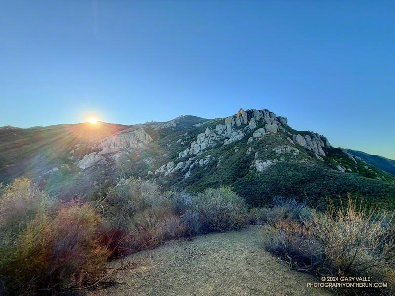
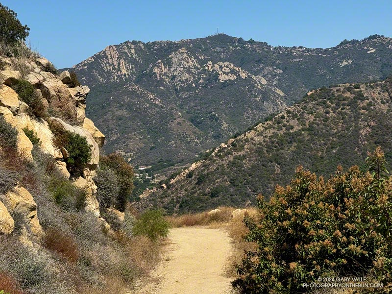
It had taken me about an hour to reach the benchmark from the Wendy Drive trailhead. It would take another hour to scramble up the ridge to the high point on the crest (unofficially “Boney Point”), and then another hour to work over Tri Peaks to the Backbone Trail and the summit of Sandstone Peak.
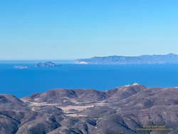
La Jolla Valley, Anacapa, and Santa Cruz Island from Boney Mountain
Once again, I got to the summit of Sandstone when no one was on the peak. After recording a video panorama from the summit, I scrambled back down the peak and then headed west on the Backbone Trail to the top of the Chamberlain Trail. Boney Bluff looms above the trail here and marks the beginning of the long descent to the Old Boney Trail.
On the way down Chamberlain, I talked to a hiker that was also doing an adventurous loop from the Wendy Drive Trailhead. At the top of the Chamberlain Trail he was planning to take the Tri Peaks Trail to Tri Peaks, and then work over to “Boney Point.” From there, he was going to descend the Lost Cabin Trail.
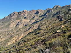
Western escarpment of Boney Mountain
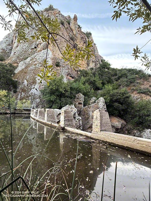
At the bottom of the Chamberlain Trail I turned right on the Old Boney Trail and continued down to Blue Canyon. I hadn’t been through Blue Canyon since January and was curious to see how it fared after all the rainy season storms. The canyon is filled with rocky debris from millennia of flash floods. Flooding in the canyon sometimes obliterates sections of the Backbone Trail. Today, it looked like use and trailwork had reestablished washed out sections of the meandering trail.
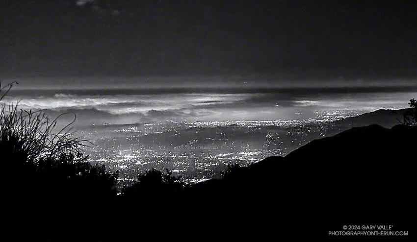
The Angeles National Forest Trail Race starts and ends on top of Mt. Wilson. This was the view south over Pasadena and the Los Angeles Basin from the mountain-top parking lot, about an hour and a half before sunrise and the start of the race.
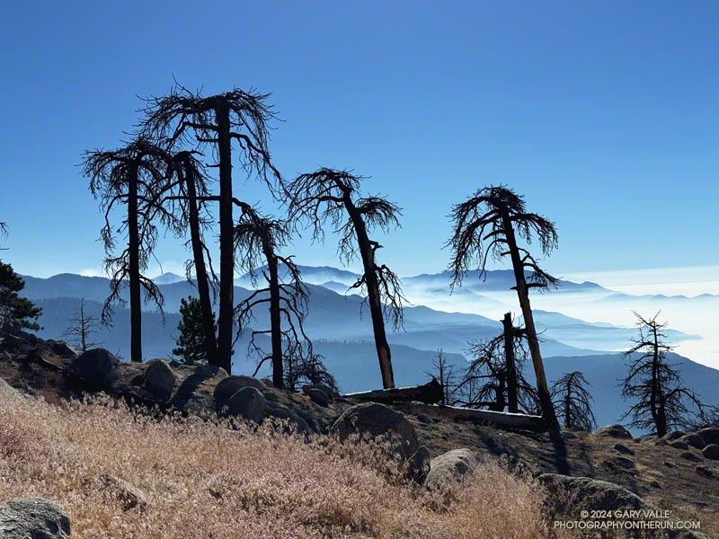
It was a sobering sight. I had stopped at a point on Mt. Waterman burned by the Station Fire in 2009 and the Bobcat Fire in 2020.
To the east, smoke from the Bridge Fire filled the canyons and clung to the ridges between Mt. Baldy and the East Fork San Gabriel River. A group of skeletal Jeffrey pines, once full and green, stood starkly in the foreground.
Another devastating fire had stormed through the San Gabriel Mountains, destroying homes and ravaging the forest and all that lives within. Not far away, the Line and Airport Fires were also burning, the extent of the three fires totaling over 117,500 acres.
Conventional methods of land and fire management usually do not prevent the rapid spread of a fire when forest or weather conditions are extreme — and extreme conditions are now the norm.
Incremental changes to long-established policies will not be enough to prevent runaway wildfires. Novel approaches must be considered, researched and evaluated. New tools and technology, including AI, need to be more widely applied. The hesitancy to spend money proactively must be overcome.
Today, it is difficult to do a hike or run of more than a few miles in the foothills or mountains of Southern California without passing through an area that has been burned in the past 25 years. In 50, 100, or 200 years what will the outdoor experience be? Will conifers only exist in widely scattered stands? Will the ecology be forever compromised?
Every effort must be made to mitigate the impacts of runaway wildfires and preserve the nature and ecology of our open space areas and wildlands.
Saddle Peak from the Mesa Peak Mtwy on the Bulldog Loop.
It was near dawn, and I was driving west on the 101 Freeway, going to the Wendy Drive Trailhead to do a run in Pt. Mugu State Park.
I’d just passed Moorpark Road and changed lanes to exit at Lynn Road. Suddenly, the whole car started to shake. The vibration was so intense it took a moment to realize I had a flat tire. [Expletive deleted!] I pulled onto the shoulder of the freeway and cursed again.
After decades without a flat, I had managed to have two in just three weeks. Both were early on Sunday morning and on the way to do a run. The first happened on Angeles Forest Highway while driving to Islip Saddle. That time, I was able to pull into a large turnout and change the tire. Traffic wasn’t an issue. Not so on the Ventura Freeway. The flat was on the driver’s side, and the shoulder was narrow. I called for service.
Apparently, there aren’t many roadside service vehicles out and about before sunrise on a Sunday. An hour and a half later, I was finally headed back to the San Fernando Valley.
I was first in line when Tires Buy Mark opened at 10:00. While waiting for the tire to be patched, I debated a Plan B for a run. Eventually, I decided to do an extended version of the Bulldog Loop. The run would be in the middle of the day, which wasn’t ideal, but it was nearby. It would be an excellent 16-mile run, even if a little on the toasty side.
At 11:30, I started up the short hill at the beginning of the Cistern Trail. Even though it wasn’t an unusually hot day, the temperature in the sun was already in the 90s, and there wasn’t a cloud in the sky.
It was slightly cooler on the trail along Malibu Creek. There was still water pooled in the creek, and I was glad the seasonal footbridge was in place. A pool near the M*A*S*H site was surprisingly large.
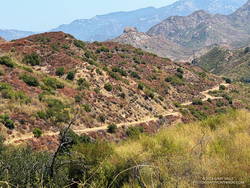
A section of Bulldog Mtwy low on the climb.
I expected it to be warm on the Bulldog climb, and it was. I just pretended I was on the second loop of the Bulldog 50K and continued chugging up the hill. Speaking of which… The Bulldog Ultra was the previous weekend, and a new course record was set in the 50K. Anthony Fagundes did the 29 mile course in the remarkable time of 3:30:03. This works out to an AVERAGE pace of 7:15 min/mile! His race analysis on Strava lists a split on the downhill on Mesa Peak Mtwy fire road at 5:25 min/mile. I don’t have the exact time, but on the first loop it looks like he did the Bulldog climb — from Crags Rd. to Castro Crest Mtwy — in about 30 minutes.
It took me a little longer than that to get up Bulldog. There was a noticeable drop in temperature as I worked up to the top of the long climb. On Castro Crest and Mesa Peak fire roads, the temperature was a relatively comfortable 80-something. The breeze from the ocean was intermittent, but when present, felt like air conditioning.
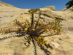
Santa Susana tarweed along the Backbone Trail, east of the Corral Canyon Trailhead.
The plant has a California Rare Plant Rank of 1B.2, which means it is considered “rare, threatened, or endangered in California and elsewhere…” The plant normally blooms after Winter rains. In the ANF technical notes** accompanying its description on SMMflowers.org, B. A. Prigge & A. C. Gibson describe how the plant may produce out-of-season flowers in the Summer, following a wet rain season with late Spring precipitation.
The option on Malibu Canyon Road requires crossing the highway twice. There is a pedestrian walkway on the east side of the bridge and a traffic light and crosswalk at Piuma Road. The trail that crosses the creek directly can be a little tricky to find because of other use trails in the area. When there is heavy rain, the flow may be too high to cross the creek safely.
Today, I decided to use the highway. There was a never-ending line of cars headed to and from the beach. It probably would have been faster — and safer — to use the trail. After crossing the creek on the highway bridge, and before doing the climb on the Tapia Spur Trail, I topped off my water at a faucet in the Tapia Day Use Area. Later, I also grabbed a quick drink at the water faucet next to the restrooms at the main Malibu Creek State Park parking lot.
From the main parking lot, it’s about 1.4 miles along Crags Road to the bottom of the Lookout Trail, and from there another three-quarters of a mile back to the Cistern Trailhead on Mulholland Highway.
Above are thumbnails of a few photos from the 16-mile out-and-back trail run to Mt. Baden-Powell from the Islip Saddle Trailhead. Click on an image for a larger photo and more information.
Almost two months had passed since I’d been on the PCT between Islip Saddle and Mt. Baden-Powell. Not a lot changed in the routine of the city in those seven weeks. The street sweeper still came by on Wednesday mornings, the trash was picked up each Friday, and the neighborhood looked pretty much the same as it did at the end of June.
Angeles Crest Highway was still closed between Islip Saddle and Vincent Gap. Gone was the noise of vehicles on the road below, replaced by the sound of the wind in the trees and the occasional outburst of a Clark’s nutcracker.
At the saddle near Mt. Hawkins, I stopped to photograph the stump of the Mt. Hawkins lightning tree. Perhaps weakened by one or more lightning strikes, this Jeffrey pine lost its crown during the Winter of 2019-2020. Now without bark, it’s easy to see that lightning followed the spiral grain of the tree. This tree has a right-hand spiral grain. When viewed from above, it is twisted counterclockwise.
It was windy and cool at higher elevation. The National Weather Service’s Wind Chill Temperature formula doesn’t apply to temperatures over 50°F, but with bare arms and legs, it can be surprisingly chilly when there is a strong wind and the temperature is in the 60s. Had I not been pushing the pace, I would have needed to pull the sleeves and shell from my pack.
Here is an interactive, high resolution, 3D terrain view of the out and back from Islip Saddle to Mt. Baden-Powell. An alternative start at the Windy Gap Trailhead in the Crystal Lake Recreation Area is also shown. Starting at this trailhead adds about 800′ of elevation gain. The map can be zoomed, tilted, rotated, and panned using the navigation control on the right. Track and placename locations are approximate and subject to errors. Poor weather and other conditions may make this route unsuitable for this activity.

 Above are thumbnails of a few photos from the 16-mile out-and-back trail run to Mt. Baden-Powell from the Islip Saddle Trailhead. Click on an image for a larger photo and more information.