Old Boney to Serrano Valley, Plus Fireline and Overlook

Paintbrush along the Old Boney Trail in Pt. Mugu State Park

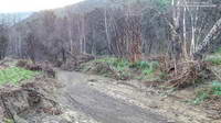
Serrano Valley and Canyon had been on my run list for a few weeks. I was curious to see how December’s rainfall had affected Serrano Canyon. Runoff from those storms had (once again) washed out sections pf the Blue Canyon Trail and Upper Sycamore Trail. Had the Serrano Canyon Trail also been damaged?

Greenbark Ceanothus along the Old Boney Trail

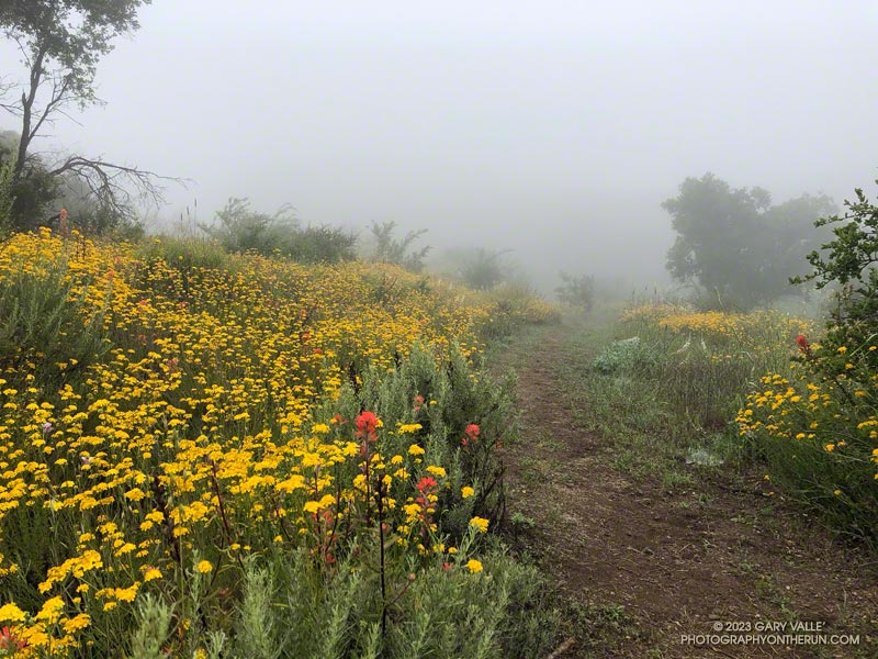
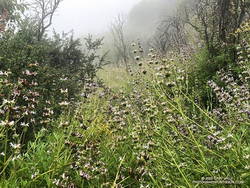
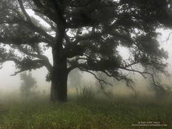
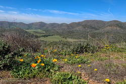
It was a good day to visit Serrano — I was looking to do a longer run; the weather was perfect; the meadows green; and many wildflowers were in bloom.

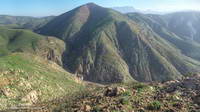
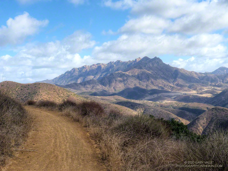
There are a couple of ways I like to run to Serrano Valley from the Wendy Drive Trailhead. Both do the initial 1.6 mile, 900′ climb up the Old Boney Trail from Danielson Road. At the top of the climb, one route goes up and over Boney Mountain’s western ridge to the Backbone Trail, and the other continues on the Old Boney Trail. Both routes join at the Chamberlain junction of the Backbone and Old Boney Trails. I’d done the western ridge of Boney Mountain recently, so opted for the Old Boney route.

Prickly phlox along Overlook Fire Road

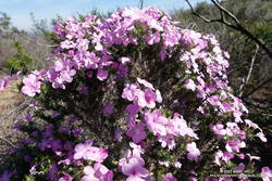
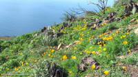
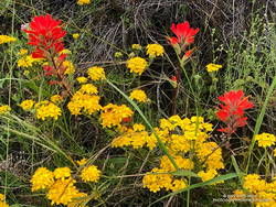
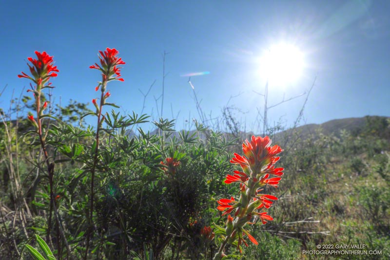
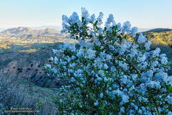
Wildflowers were everywhere. The December rain and February heat wave seems to have encouraged many plants to bloom — among them blue dics, Encelia, clematis, California poppy, greenbark Ceanothus, shooting star, nightshade, paintbrush, poison oak, milkmaids, prickly phlox, hummingbird sage, and larkspur.

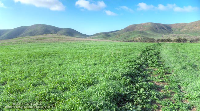
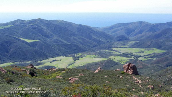
Serrano Valley was Spring-green and spectacular. Serrano Creek was gurgling away, and the Serrano Canyon Trail had survived December’s storms. After a pleasant run down Serrano Canyon, I stopped to get some water from the faucet at the junction of the Serrano Canyon Trail and Sycamore Canyon.

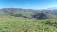
A right turn here — up Sycamore Canyon — produces a run of about 20 miles. Today I was looking to do a little more than that, so turned south and ran about a quarter-mile down Sycamore Canyon and picked up the Fireline Trail. This trail gains about 700′ in elevation on its way up to Overlook Fire Road.

California poppies along Overlook Fire Road, above La Jolla Valley
La Jolla Valley from Overlook Fire Road

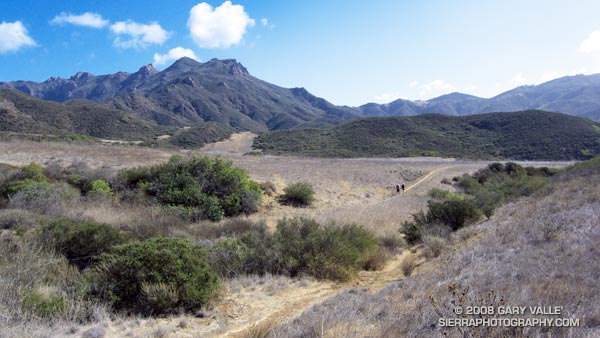
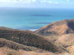
Overlook Fire Road leads northwest to the top of the Ray Miller Trail. I was feeling good and briefly debated descending to the Ray Miller Trailhead. I did a quick estimate of the mileage. I was at about mile 14. Descending Ray Miller would add about 2.5 miles, and then the run back from the trailhead to Wendy would add another 12 miles. Hmmmm… nearly 29 miles. My legs were way ahead of my brain, and were already continuing up Overlook Fire Road.

I followed the usual route back — Overlook -> Hell Hill -> Wood Canyon -> Two Foxes -> Sycamore Canyon -> Upper Sycamore -> Danielson Road -> Satwiwa. The paved part of Sycamore can be a bit tedious and it helped when I happened upon a couple of friends.

Here is an interactive, 3D terrain view of the GPS track of my route. The map can be zoomed, tilted, rotated, and panned. To change the view, use the control on the upper right side of the screen. Track and placename locations are approximate and subject to errors. Poor weather, and other conditions may make this route unsuitable for this activity.

Some related posts: Over Boney Mountain to Sandstone Peak and Serrano Valley, Serrano Valley from Wendy Drive, Pt. Mugu State Park Debris Flows and Flash Floods

Just Me and the Meadowlarks

La Jolla Valley from Mugu Peak

I had to stop running and take it all in. Soaked by recent rains, La Jolla Valley was renewed and green. To my right a meadowlark warbled its silvery call, and in the distance at first one and then another bird followed in song.

Isolated for weeks by the closure of Pacific Coast Highway and Pt. Mugu State Park, the La Jolla Loop Trail was trackless and in places overgrown. Wet with dew, the mustard choking the trail had soaked my shoes and socks.

Sprinkled among the greens were whites, purples, pinks, reds and yellows of the first stage of a wildflower explosion. A sweet scent drifted on the breeze. Running in the valley was like running in a remote and seldom-visited wilderness.


There had been much to see on the run from Wendy Drive. Before the Park closed in December I had surveyed the aftermath of the December 12 flash floods in Sycamore Canyon, Blue Canyon and Upper Sycamore Canyon. One of the reasons for today’s run was to see what had happened in this part of the Park.

Wood Canyon parallels Sycamore Canyon and is probably its largest tributary. Based on the height of the debris piled against the trees, the flash flood that roared down Wood Canyon must have been astounding! Looking down the stream course reminded me of flash floods I’d seen on creeks and streams during the El Nino’s of 1997-98 and 2004-2005.


Bowl-shaped La Jolla Valley is an independent drainage, separate from Sycamore and Wood Canyons and their tributaries. It acts like a huge rain collector and funnels all the runoff down deeply cut La Jolla Canyon to the ocean. In La Jolla Valley all the creeks were scoured by the flash flooding and the small footbridge west of the group campground was washed out. The vernal stock pool on the Loop Trail above La Jolla Canyon was once again full.


It’s no surprise that the December flash floods washed out the trail in La Jolla Canyon. I can’t think of a steeper and more narrow canyon in the park.  The flow must have been phenomenal! The La Jolla Canyon Trail is closed and barricaded at its juncture with the Loop Trail. Here are archived maps of Rancho Sierra Vista/Satwiwa and Pt. Mugu State Park originally from the NPS Santa Monica Mountains web site. Also see the Pt. Mugu State Park maps on VenturaCountyTrails.org.

In recent years the drought has dramatically reduced the number and variety of wildflowers blooming in the Santa Monica Mountains. Not so this year. Since October 1 Camarillo Airport has recorded 7.0 inches of rain, which is about 92% of normal. Last year over the same period only 0.84 inch had been recorded.


Many species are already blooming and many more will be blooming soon. On today’s run I saw shooting stars, encelia, lupine, nightshade, monkeyflower, paintbrush, California poppy, bladder pod, wild hyacinth, phacelia, wishbone bush and more. A small patch of chocolate lilies were in bloom along the eastern segment of the Loop Trail.

La Jolla Valley and Mugu Peak can be busy places, but today it was just me and the meadowlarks.

Update February 3, 2015. According to the Ventura Star six miles of Pacific Coast Highway from Las Posas Road to the Sycamore Cove Day-use Area reopened today providing access to Pt. Mugu State Park from the south. Note that the La Jolla Canyon Trail is still closed and likely to be for some time.

Some related posts: Pt. Mugu State Park Debris Flows and Flash Floods, Wendy Drive – Mugu Peak Challenge, Laguna Peak, La Jolla Valley, and the Channel Islands

Serrano Valley from Wendy Drive

Descending to Serrano Valley in Pt. Mugu State Park

Scruffy clouds clung to the mountain ridges and summits, confirmation that a weak cold front was moving through the area, cooling temperatures and stirring up the wind. The forecast for the Santa Monica Mountains National Recreation Area had mentioned 25 to 35 mph winds with gusts to 60 mph. So far the weather in Pt. Mugu State Park had been nearly perfect — breezy and little chilly, but without the impenetrable winds that can take all the joy out of running.

Earlier we had climbed the Fossil Trail, a steep mile-long trail that connects the Upper Sycamore Trail, near its junction with Sycamore Canyon Road, to the Old Boney Trail. With only a few weeks remaining to the Solstice, shadows in the canyon were long and the light wintery. I thought we might have missed the fossils, but we happened on a nice exposure about a tenth of a mile below the Old Boney Trail junction.

About 5.5 miles later, we turned off the Old Boney Trail and descended to the rolling grasslands of Serrano Valley, another “must see” area of the Santa Monica Mountains.

Located on the east side of Big Sycamore Canyon, Serrano Valley is a more rugged counterpart to La Jolla Valley, just three miles to the west. Overseen by the castle-like summits of Boney Mountain, its vistas have a roughhewn edge, reminiscent of the most wild areas of the western U.S.

Here is a Google Earth image and Google Earth KMZ file of a GPS trace of our approximately 19 mile route to Serrano Valley and back to Wendy Drive.

Related posts: La Jolla Valley & Mugu Peak from Wendy Drive, Fossil Trail – Pt. Mugu State Park

A Really Overgrown Trail, Thirty Creek Crossings, and Thousands of Wildflowers

Yarrow and paintbrush along the Old Boney Trail in Pt. Mugu State Park.
Old Boney Trail in Pt. Mugu State Park.

Starting at the Wendy Drive Trailhead, I’d crossed Satwiwa, run down Danielson Road, rock-hopped across Upper Sycamore Creek, and picked up the Old Boney Trail. The condition of the Old Boney Trail between Danielson Road and the Fossil Trail junction was better than expected. Maybe the trail was going to be in good shape after all.

A section of the Old Boney Trail overgrown with black sage following the wet rain season of 2022-2023.
A section of the Old Boney Trail overgrown with black sage.

Wrong! Once I passed the turnoff to the Fossil Trail, the vegetation closed in. In places it was so thick I couldn’t see the trail at my feet, much less a few yards ahead. All I could do is smile and work my way through it. Everything was overgrown — bushes, grasses, wildflowers. And everything was wet with dew. A hundred yards past the Fossil Trail, I was soaked from head to toe.

I tried to see the positive. It was an amazing display of the effect of a wet rainy season. Without trail work and use, it wouldn’t take long for the trail to be completely consumed.

The Old Boney Trail continued to be a tangle of chaparral for about two miles — until I reached the Backbone Trail at Blue Canyon. At that point, it becomes part of the Backbone Trail system, and I was relieved to see that some work had recently been done on the trail.

Coast live oak and fog along the Old Boney Trail in Pt. Mugu State Park.
Coast live oak along the Old Boney Trail.

As I worked up the Backbone Trail toward the Chamberlain Trail junction, I recalled other times I’d run to Serrano Valley using Old Boney. What would the condition of the trail be beyond this point? I’d been on that part of the Old Boney Trail following a wet rain season and knew how overgrown it could be. Some refer to that section of trail as “tick alley.”

But when I got to the junction, surprise, surprise, the Old Boney Trail had been trimmed. More than two miles of trail were groomed. It was good all the way to the Serrano Valley Trail and partway into Serrano Valley. The trail in Serrano Valley was a little overgrown, but NOTHING like the Old Boney Trail between the Fossil and Backbone Trails.

Part of the fun of doing this route is all the stream crossings in Serrano Canyon — what is it 13 or 14? Today, most of these could be done without getting your shoes wet — especially if you have poles. I didn’t have poles, and my shoes and socks were already wet, so I didn’t worry about keeping them dry. Some sections of the Serrano Canyon Trail were also overgrown, but not bad. However, there was a lot of poison oak, some of which wasn’t avoidable.

Paintbrush and golden yarrow along Sycamore Canyon Fire Road in Pt. Mugu State Park.
Paintbrush and golden yarrow

After getting a drink of water at the faucet at the junction of the Serrano Canyon Trail and Sycamore Canyon Fire Road, I headed up-canyon. Almost immediately, the fire road crossed Big Sycamore Canyon Creek. I did this first crossing without getting my shoes wet, but nine more crossings followed, and most resulted in soaked shoes. The water crossings and wildflowers helped distract me from the five mile run up Sycamore Canyon to the Upper Sycamore Trail.

Getting off Sycamore Canyon Road and onto the Upper Sycamore Trail was a relief. Whatever run I do from Wendy Drive, I always finish it via this trail. The trail gets enough use that it was in good shape. This time all the creek crossings could easily be rock-hopped.

Even with a few tedious sections, it was an adventurous and mostly enjoyable 20 miles. Here are some photos taken along the way.

Some related posts: Old Boney to Serrano Valley, Plus Fireline and Overlook; Looking for Ogres in Serrano Canyon; Running to Serrano and La Jolla Valleys from Wendy Drive; You Can’t Run Just Part Way Up Serrano Canyon

A Windy Run, Walk, Ride, for Wildlife Research

Boney Mountain and Serrano Valley from Overlook Fire Road
Boney Mountain and Serrano Valley from Overlook Fire Road.

The Overlook Fire Road in Pt. Mugu State Park was nearly empty. I’d seen only two hikers between the top of the Fireline Trail and the top of the Wood Canyon Vista Trail. Maybe it was the wind. There had been 20-25 mph wind gusts much of the morning. Along the ridgelines, the gusts were even stronger.

Run, Walk, Ride 2020

I’d picked Pt. Mugu State Park to do a run in support of the Santa Monica Mountains Fund’s Run, Walk, Ride, for Wildlife Research. Many mountain lions have included Pt. Mugu State Park in their home range, including P-1, the patriarch of the mountain lions in the Santa Monica Mountains study.

According to the NPS website, the Santa Monica Mountains National Recreation Area is the world’s largest urban national park. Wildlife in the Park is affected by issues resulting from the proximity of urban and wild areas. Among the problems are poisoning from anticoagulant rodenticides, limited genetic diversity, and vehicular deaths. Only by studying Park wildlife can we better understand and manage these and other issues.

Because water is usually available at several spots in Sycamore Canyon, it’s a great place to do a self-supported ultra-length trail run.

A very windy Pacific and the Ray Miller segment of the Backbone Trail
A very windy Pacific

So far, today’s run had taken me from Wendy Drive in Newbury Park to Serrano Valley via the Old Boney Trail. I’d circled past the old ranch in Serrano Valley and then descended the Serrano Canyon Trail to Sycamore Canyon. A short jog south in Sycamore Canyon put me at the bottom of the Fireline Trail, which I’d followed up to the Overlook fire road.

Next up was a scenic loop in La Jolla Valley. After that, I would work my way back to the Upper Sycamore Trail via Sycamore Canyon. From there, it would only be a few miles back to the Wendy Drive Trailhead.

The Santa Mountain Mountains Trails Council has been hard at work. Even though they can’t currently accept volunteer assistance, it looked like the Old Boney, Serrano Canyon, and Upper Sycamore Trails had been recently maintained.

Some related posts: It’s Raining Mountain Lion Tracks!; Mountain Lion Tracks on Rocky Peak Road; Mountain Lion Saga; Reagan Ranch Bobcat; Hawk, Bobcat and Rabbit