Above are thumbnails of a few photos from a 20-mile out and back trail run to Mugu Peak from the Wendy Drive Trailhead. The run was on October 17, 2020. Click on an image for a larger photo and more information.
There are several ways to get to Mugu Peak from the Wendy Drive Trailhead on Potrero Road. When I do this run I’m usually looking to do a longer, faster-paced run without a huge amount of elevation gain. That translates to running down Big Sycamore Canyon to Wood Ranch Road and then either running up the Backbone Trail or Hell Hill to the “hub,” and from there to La Jolla Valley and Mugu Peak.
My legs hadn’t fully recovered from a bit-too-long training run a couple of weeks ago and I’d been looking to do a 4 to 5 hour trail run that didn’t involve a huge amount of elevation gain. In the areas of Southern California where I run, it’s tough to find a 20 mile trail run that isn’t hilly. With “only” about 3000′ of gain, I’d opted to do an out and back to Mugu Peak from from the Wendy Drive trailhead in Newbury Park.
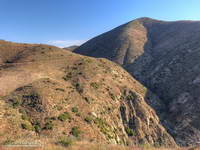
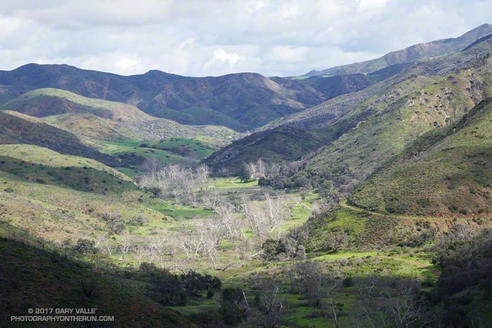
La Jolla Valley Loop Trail and La Jolla Canyon. Click for larger image.
Mugu Peak is a very popular summit. With the La Jolla Canyon Trail still closed, most of the hikers doing the peak are now using the Chumash Trail as an alternate. Runners have more options and can reach the peak from the Ray Miller, Sycamore Canyon, and Wendy Drive trailheads.
At the moment I was about a mile north the Danielson Multi Use Area, running on a paved section of road in Big Sycamore Canyon. The Sin Nombre and Hidden Pond trails can be used to avoid this stretch of pavement, but at this point in a long run I usually just want to get to the Upper Sycamore Trail as quickly and easily as possible.
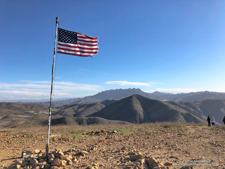
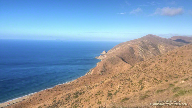
Pt. Mugu from Mugu Peak. Anacapa and Santa Cruz Islands are in the distance. Click for larger image.
Running a couple of miles on pavement isn’t necessarily a bad thing. Especially in Sycamore Canyon. The road is lined with sycamores and oaks and there is plenty of shade. The uniformity of the road is both good and bad. It’s good because the running is more automatic and bad for the same reason. It can be tedious — especially on tired legs at the tail end of a long run.
The traffic along the road is usually not an issue. Today, I had passed a couple of groups of hikers and been passed by a few mountain bikers. Most of the time the road was empty.
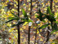
California bay along the Upper Sycamore Trail. Click for larger image.
I first heard the sound some distance behind me. Hissing isn’t quite the right word. It was a synchronized blend of aerodynamic, mechanical and road noises and it was getting closer. At first I thought it might be a ranger’s truck, but it didn’t sound like a vehicle. I glanced behind me to see a mass of approaching cyclists, and wondered how many bikes there would be.
I heard a shout of “Right!” as the lead cyclist alerted the group, and in an instant the peloton began to sweep past. I felt a little like the breakaway racer that is inevitably consumed by the unrelenting pack. For a few moments I could feel the push of the peloton and then they were gone.
The lead group was followed by a second group, nearly as large, and then an assortment of riders that had been left behind. After they were past, I settled back into the run and soon saw the yellow “narrow bridge” sign near the start of the Upper Sycamore Trail. Turning onto the rocky, narrow trail, I switched back into trail mode. A little less than three miles to go…
There’s magic in the morning, when the owls hoot softly and there is a chill in the air.
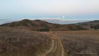
I’d started my run from the Wendy Dr. trailhead when there was just enough light to see the trail. The moon was poised low in the western sky, full and bright. As I passed the frame of the Chumash ‘Ap at the Satwiwa Native American Indian Culture Center I’d thought about the Chumash, and how well they must have known this land. It is one thing to visit a place, and quite another to live there.
Moon setting over Rancho Sierra Vista/ Satwiwa.
Today the plan had been to run to the Ray Miller Trailhead and do a little of the Ray Miller 50K course along the way. At the start of the run I hadn’t decided which route I was going to take to Ray Miller — Hell Hill or Fireline. I’d finally opted for Fireline, since that route would follow the last 5 miles of the 50M/50K course and is much more runnable.
I hadn’t run Fireline since the 2013 Ray Miller 50K. With only 7 miles on my legs (instead of 26) it didn’t seem nearly as steep. Once at the top of Fireline, and after doing a bit more uphill on Overlook fire road, I eventually got to the best part of today’s run — the 2.5 miles of scenic downhill on the Backbone Trail to the Ray Miller trailhead on PCH.
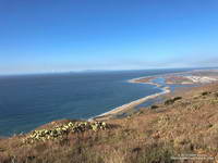
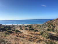
PCH at the Ray Miller Trailhead.
The Pacific was painted in a palette of wide-gamut blues and although it was hazy offshore, there were excellent views along the coast. To the west Anacapa and Santa Cruz Islands could just be seen in the ocean haze and Mugu Peak loomed golden in the morning sun. The Ray Miller Trail is very popular and on the way down I passed several runners in the first miles of their morning run.
At the Ray Miller parking lot my Garmin fenix read 12 miles. Just like climbing a mountain, getting to the turnaround point of a long self-supported run is only part of the adventure. I gulped down some water at the water fountain; checked how much water I had left in my pack; ate a Snickers left over from Halloween; and then started the 1000′ climb back up the Ray Miller Trail to the Overlook fire road.
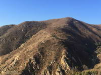
The Mugu Peak Trail starts in upper La Jolla Canyon and climbs up and around Mugu Peak.
The run was going well and at the start of the climb I was thinking about following the 50M/50K course up and around Mugu Peak before starting the trek back to Wendy Drive. By the time I’d reached the top of Ray Miller and had climbed up to the high point of Overlook fire road my mileage appetite wasn’t so big. Following a short side trip into La Jolla Valley, I returned to the Overlook fire road, descended Hell Hill and Wood Canyon, and started working my way back up Sycamore Canyon on the Two Foxes Trail.
At the Danielson Multi-use area there was a large group participating in a guided hike. A familiar runner with a distinctive hat was making his way around the group. It was photographer and ultrarunner Larry Gassan. Larry joined me for the remainder of the run and his stories made the run back up Sycamore Canyon and Upper Sycamore much more interesting.
Google Earth Images and KMZ Files of GPS Traces of Southern California Trail
Runs
Following is a list of Google Earth images and Google Earth KMZ files of GPS tracks of trail runs referenced in various postings on PhotographyontheRun.com. Included are trail runs from the wilderness and open space areas of Southern California and the Sierra Nevada. These are actual tracks recorded by a GPS during the trail run. In a few instances tracks have been modified to correct GPS errors, or to remove side excursions that are not part of the usual route. Not all errors have been corrected. No claim is being made regarding the appropriateness or suitability of the routes indicated. Mileages specified are approximate.
Santa Monica Mountain
Conservancy Open
Space & Santa Monica Mountains
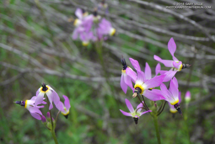
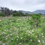
The title photo is Padre’s shooting star (Primula clevelandii, formerly Dodecatheon clevelandii) along the Old Boney Trail. Click an image below for more info and to display the image full-size.

 Above are thumbnails of a few photos from a 20-mile out and back trail run to Mugu Peak from the Wendy Drive Trailhead. The run was on October 17, 2020. Click on an image for a larger photo and more information.