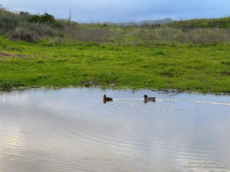
Over the first six days of February 2024, Downtown Los Angeles recorded 10.2 inches of rain. That’s almost three-quarters of L.A.’s normal ANNUAL rainfall in just a few days and the wettest start to February on record! Some stations in the Santa Monica and San Gabriel Mountains recorded even more — over 13 inches in some locations!
How much did it rain at Ahmanson Ranch (Upper Las Virgenes Canyon Open Space Preserve)? Unfortunately the Remote Automated Weather Station (RAWS) on a hill between Upper Las Virgenes Canyon and Cheeseboro Canyon hasn’t been accurately measuring precipitation. A citizen weather station (KCAWOODL130) near the Victory Trailhead at Ahmanson Ranch recorded over 11 inches from February 1 – 6. Another station near Cheeseboro Road in Agoura (KCAAGOUR41) recorded over 9 inches.
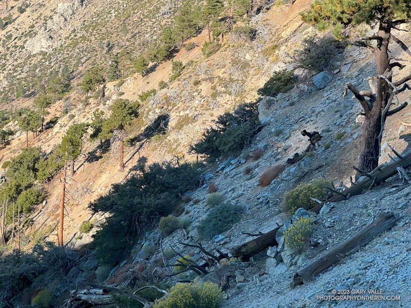
Bighorn sheep blend into the rocky terrain near Windy Gap
Had they not dislodged some rocks, I doubt I would have seen the three bighorn sheep in the photo above. They are easier to see in this zoomed-in photo of the sheep descending the rocky slopes just below Windy Gap (7,588′) in the San Gabriel Mountains. They crossed a brush-covered rib and disappeared from view.
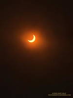
The partially-eclipsed sun crests a ridge east of Windy Gap.
A few minutes after seeing the sheep, I reached Windy Gap and stopped to put my arm sleeves away. It had been cool at the trailhead — about 40 degrees — but the temperature had warmed as I worked up the trail. As its name suggests, the wind can be fierce at Windy Gap, but this morning there was almost no wind, foretelling nearly ideal weather for today’s adventure.
Windy Gap was still in shade, and the sun was just peeking over the ridge to the east. You couldn’t tell, but the eclipse had already begun. The eclipse would be nearly total in parts of Oregon, Nevada, Utah, New Mexico, and Texas. In the Los Angeles area, the moon would obscure more than 70% of the sun’s disc.
Partially eclipsed sun.
From Windy Gap, I headed east on the Pacific Crest Trail toward Mt. Hawkins. From time to time, I would stop and check the progress of the eclipse using eclipse sunglasses. In sunny areas, I looked for lensed images of the sun in the shadows of trees but didn’t see any. Having needles instead of leaves, conifers don’t produce the myriad images of the eclipsed sun seen under trees with leaves.
With nearly three-quarters of the sun obscured, the light from the sun had become enfeebled. The feeling was more than that of a cloud passing in front of the sun. I stopped and listened… to nothing. It was eerily quiet. No birds called or sang, and only chill zephyrs of wind wafted about the area. Somehow, the sun was broken.
The south ridge of Mt. Lewis can be accessed from the CalTrans shed at Dawson Saddle.
As the eclipse slowly waned, I continued east in the corrupt light, past Mt. Hawkins and Throop Peak, to the PCT’s junction with the Dawson Saddle Trail. In what seemed fitting for the day, instead of continuing to Baden-Powell, I turned left and headed down the trail toward Angeles Crest Highway (Highway 2).
Why? Angeles Crest Highway was closed from Red Box to Vincent Gap, transforming Dawson Saddle into one of the more isolated areas of the Angeles National Forest. I hadn’t been on the Dawson Saddle Trail in years, and with Highway 2 closed, it would be a quirky way to climb Mt. Lewis. Instead of having one of the shortest approaches in the San Gabriels — a few feet from the CalTrans shed at Dawson Saddle — it would involve a trail run of nearly eight miles just to get to the base of the peak.
Angeles Crest Highway from the shoulder of Mt. Lewis.
The eclipse was nearly over when I reached the bottom of the Dawson Saddle Trail on Highway 2. From the trailhead, I ran up an empty Angeles Crest Highway a short distance to Dawson Saddle. Mt. Lewis’ south ridge was accessed from here.
Only about a half-mile long, the south ridge isn’t technical, but the first third is steep and rocky. The elevation gain from the saddle to the summit is about 500′. Offset from the crest of the San Gabriels, the flat summit of Mt. Lewis has unique views of the crest extending from Mt. Baden-Powell to Mt. Islip and beyond.
After a few minutes enjoying the summit, I turned southward and began working my way back down to Angeles Crest Highway, up to the PCT, over to Windy Gap, and back down to the trailhead in the Crystal Lake Recreational Area.
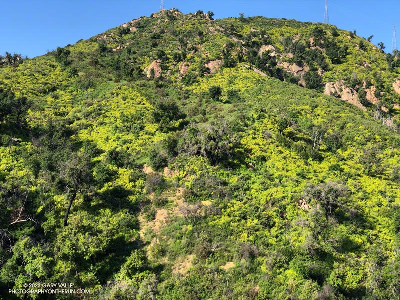
Canyon sunflowers covering a hillside burned in the 2018 Woolsey Fire
Update May 5, 2023. Did a run this afternoon in Malibu Creek State Park and the seasonal bridge across Malibu Creek on the Crags Road Trail is back in place!
As I approached the M*A*S*H site, I could see some people taking photos. I stopped to say hi, and without skipping a beat, one of them asked, “Did you wade across the creek?”
He was asking about the creek crossing where Crags Road crosses Malibu Creek upstream of Century Lake and east of the M*A*S*H site.
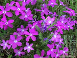
Prickly phlox along the Tapia Spur Trail.
There’s a substantial log spanning the creek at the moment, and I wanted to answer that I danced across it with my eyes closed. But instead, I explained that I decided to wade — and for sure keep my phone dry — rather than take a chance of falling uncontrolled into three feet of water, ker-splash.
Speaking of which, this morning, I talked to a mountain biker who saw the bridge pulled off to the side of the creek before any flooding had occurred and thought it may have been hauled away. Good news! According to the Malibu Creek Docents, the bridge is seasonal and was designed to be portable. It was removed and stored before this Winter’s rain. It is expected to be reinstalled when the threat of flooding is over — which should be soon.
Vinca growing at the base of a coast redwood along the Forest Trail.
After crossing Malibu Creek and before continuing to the M*A*S*H site, I took a quick detour on the Forest Trail. Bordered by Century Lake on one side, and steep, rocky slopes on the other, the Forest Trail has a character all its own. It’s a wonderful place to observe, reflect, and enjoy nature. It’s also home to several coast redwoods. Unfortunately, less than half the trees originally growing along the trail survived the 2011-2015 drought. This morning, a redwood that died several years ago had fallen and was partially blocking the trail near its halfway point.
As has been the case in most of Southern California this Spring, the wildflowers on this run were spectacular. Canyon sunflower was particularly prevalent, with many thousands of the bright-yellow blossoms covering the hillsides burned in the 2018 Woolsey Fire.
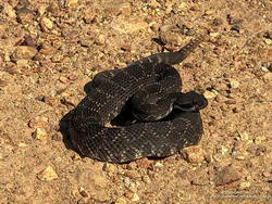
Southern Pacific Rattlesnake on Castro Peak Mtwy fire road.
Also exciting was my first rattlesnake encounter of 2023. I was running down Castro Peak Mtwy Fire Road from the Bulldog “T” when I saw something in the road that looked like a partially exposed root. As I neared, I could see it was a very dark — almost black — Southern Pacific Rattlesnake.
The snake was stretched out straight on the road, basking in the sun. As I approached, it did move, and it did not rattle. Usually, snakes in this state are pretty docile, and I can cautiously walk a few feet behind them. Yikes! This one was super-aggressive. In the blink of an eye, it turned and moved toward me, doubling back on itself. I jumped a mile! It coiled but still did not rattle! It must have recently emerged from its Winter hideaway.
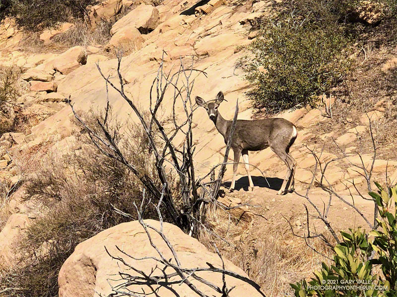
I saw a flash of brown through the bushes on the trail ahead. I stopped as a deer emerged from a switchback. The doe was walking slowly up the trail with her mule-like ears turned back toward me. I said something like, “Where are you going?”
She turned toward me and stared quizzically. As I slowly pulled the phone from my pack, I continued to talk. Her expression was a mix of caution and curiosity. It was as if she couldn’t quite make up her mind what I was about.
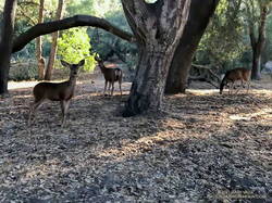
Mule deer at Trippet Ranch
This was peculiar behavior for a deer in this area. It wouldn’t be so strange if I was at Trippet Ranch. The deer there graze around the oaks and grasslands near the parking lot and are used to seeing people. But in decades of running the Chumash Trail, I’ve only occasionally seen deer, and they have always been skittish and quick to react.
This doe watched me as I slowly walked around the bend and toward her. I was reminded of a friend’s experience, when he was hit on the shoulder by a spooked deer. Not wanting to force a reaction, I stopped. The deer casually stepped off the trail and disappeared down the ravine.
Later, running down Las Llajas Canyon, I was startled by the sound of something large moving in the brush. This time I got only a fleeting glimpse, as the deer bounded uphill through the trees, rocks, and brush.
The rattlesnake track above was one of several snake tracks on Eagle Springs Fire Road this morning. This area, which is below Eagle Rock in Topanga State Park, was severely burned in the May 2021 Palisades Fire.
As I approached Musch Camp, a scrub jay flew from a trailside faucet and into a nearby eucalyptus. There had been a little rain the day before, but the birds at the closed camp were still thirsty. Less than a quarter-inch of rain had fallen, and nearby creeks were still dry.
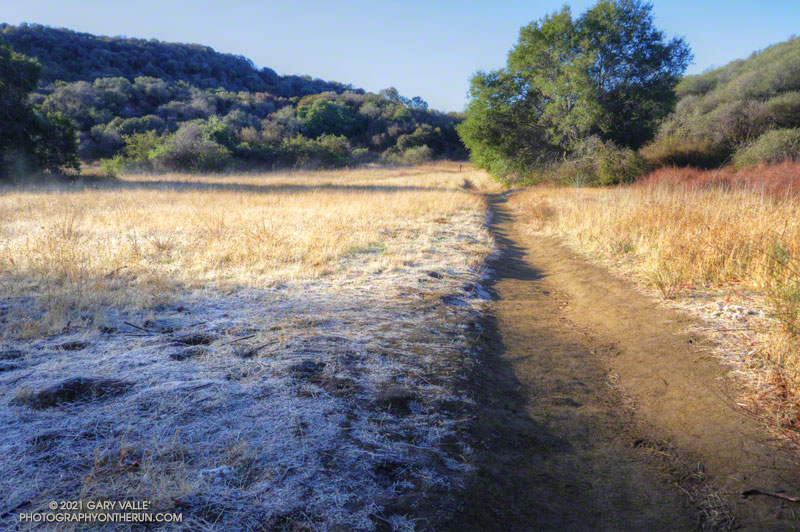
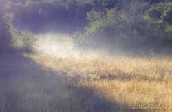
Melting frost “steaming” at Musch Meadow
I was doing a run from the “Top of Reseda,” and on a warmer day would have topped off my water bottle at the camp. I stopped at the faucet and briefly turned on the spigot. Maybe that would make it easier for the jay.
In another mile I reached the Trippet Ranch trailhead, and then begin the six mile run back to the Valley. At several points on the run there had been wintry views of the local mountains. On the way back the best view of the snowy mountains was from the Hub, where Mt. Baldy could be seen gleaming white in the morning sun.