Waterman Mountain: Fallen Trees, Forest and Ferns

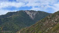
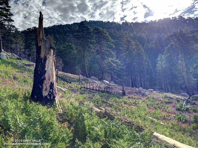
Area burned by the Station Fire on Waterman Mountain

The area in the image above was burned by the Station Fire on September 7, 2009. That morning I’d just crossed the peak-top finish line of the Baldy Run to the Top and using a tiny point and shoot camera took this snapshot of the Station Fire burning on Mt. Waterman.

Station Fire burning on Waterman Mountain the morning of September 7, 2009
Station Fire on Mt. Waterman

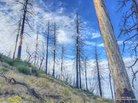
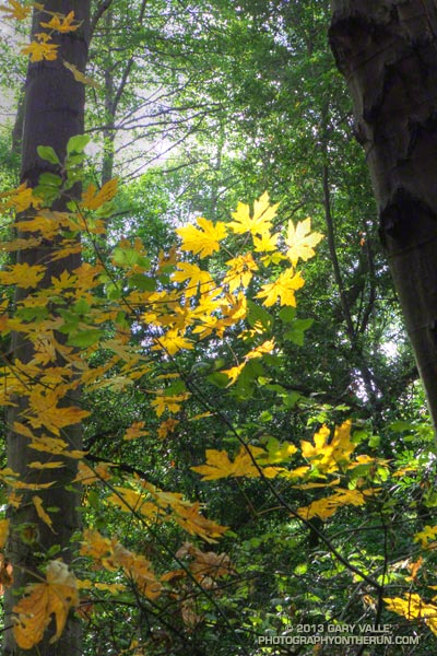
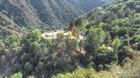
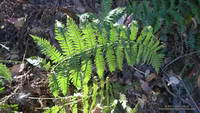
The image of the fallen trees and ferns is from today’s counterclockwise circuit of Waterman Mountain from Three Points. It was taken at an elevation of about 7100′ about 3.5 miles from Three Points and about 1.5 miles west of the Twin Peaks Trail junction. Here the Station Fire burned swaths of forest, running up steep gullies and ridges on the south slopes of the mountain.

Part of a Burned Area Emergency Response (BAER) image taken of the Station Fire Burn Area by the NASA Ikhana remotely piloted aircraft
Ikhana BAER Burn Intensity

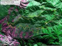
The purple hues in this Burned Area Emergency Response (BAER) image taken by the NASA Ikhana remotely piloted aircraft in 2009 are indicative of the burn severity in the vicinity of Three Points and Mt. Waterman. (Ikhana image courtesy of NASA Dryden and NASA Ames. Composite image created using Google Earth Pro.)

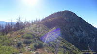
Coulter pines burned in the Station Fire along the Three Points - Mt. Waterman Trail
Pines Burned by the Station Fire

The yellow track in the BAER image is of the Three Points – Mt. Waterman loop. The track includes a side trip to the summit of Mt. Waterman I didn’t do today. About one-third of the approximately 20 mile loop was impacted by the fire. If the loop is done counterclockwise the first couple of miles are the most severely burned and have the most downed trees and Poodle-dog bush. Use trails have developed around the fallen trees, but it seems a new tree or two has fallen each time I do the route. With care the Poodle-dog bush is generally avoidable.

Some related posts: After the Station Fire: After the Station Fire:Three Points – Mt. Waterman Loop, Three Points – Mt. Waterman Loop, Southern Pacific Rattlesnake on the Burkhart Trail, Twin Peaks Trail Run

Strawberry Peak Summit Loop

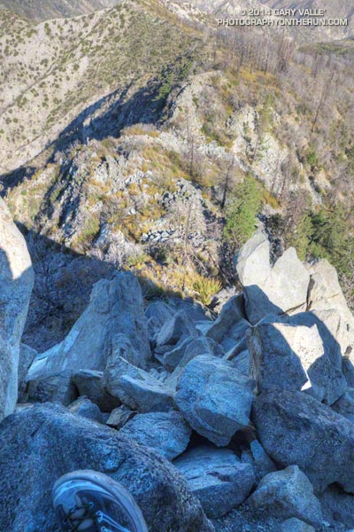
View down west ridge of Strawberry Peak

It was about 8:30 a.m. and I was nearly to the top of the steep, rocky ridge on the west side of Strawberry Peak. I gazed over the rocks and ridges to the layer of stratus that partially filled the Los Angeles basin and valleys and tried to find Saddle Peak or Castro Peak. These peaks would mark the location of Malibu Creek State Park. Today some friends were doing the Bulldog 50K and I wondered if the marine layer was too shallow to take the edge off the heat forecast for later in the day.


The loop over the top of Strawberry Peak is a more adventurous variation of the Strawberry Peak Circuit. Closed for 4 1/2 years by the Station Fire, the trails necessary to do the circuit and approach the peak — Josephine Peak Fire Road, Strawberry Spur Trail, part of the Colby Canyon Trail and Strawberry Peak Trail — reopened in late May. The trails from Josephine Saddle to the summit of Strawberry and from the summit down to Lawlor Saddle are unofficial paths created by use.

I’d done the circuit around Strawberry in July a couple of weeks before the Angeles Crest 100. Today’s hike, run and climb over the top of the peak was a fun way to continue to recover from the exertions of that event. As was the case with the Strawberry Peak Circuit, I started the loop at Clear Creek, but it is also possible to start at Switzer’s Picnic Area or Red Box.


Like anything adventurous, if it’s in your comfort zone the challenges can be fun; if not, the adventure can quickly turn into a nightmare. This route requires rock climbing and route-finding skill and a bad choice can ruin your whole day.  Strawberry Peak has been the site of numerous search and rescue operations. The rock on the west side of the peak is of variable quality and if you go off-route it’s easy to become trapped in a spot where you can’t safely go up or down.

Not only is the route-finding tricky on the rock climbing sections. As a result of the growth of Poodle-dog bush following the Station Fire, the use trail on the upper ridge on the west side of the peak is more circuitous than it used to be. Although much of the Poodle-dog bush was wilting and in some cases dying, it can still cause dermatitis. By staying on the use trail it was mostly avoidable. There was a bear track on this section of the ridge and I wondered if the tracks I’d seen on the Strawberry Peak Circuit were from the same bear.

The last section of rock climbing ends abruptly just below the summit. The use trail on the east side of the summit involves no rock climbing and sees much more traffic. Though steep and loose, by fell-running standards it is mostly runnable. At Lawlor Saddle the maintained trail begins and continues to Red Box. From there the loop is closed using the Gabrielino Trail and Nature’s Canteen Trail. Since I was last on the trail in July, the Nature’s Canteen Trail had been re-cut and was in great shape.

Some related posts: Strawberry Peak Traverse, Strawberry Peak Circuit

Strawberry Peak Circuit

North face Strawberry Peak

After being closed 4 1/2 years because of the 2009 Station Fire, Strawberry Peak and the trails comprising the Strawberry Peak loop reopened on May 25, 2014. Today, I finally got a chance to get back on the 15+ mile circuit around Strawberry, and was excited to find that much of it was in better shape than before fire.

Colby Canyon Trail about 0.25 mile from Josephine Saddle
Colby Canyon Trail near Josephine Saddle

I’d heard that COBRA was instrumental in the restoration of the loop, but that is only part of the story. The preservation and maintenance of trails is now largely a community effort — in this case CORBA, Mount Wilson Bicycling Association, Sierra Club, Los Angeles Conservation Corps, National Forest Foundation, REI, Bellfree Contractors, and the BSA all contributed to the effort.

The loop, which is part of the ANFTR/Mt. Disappointment 50K course, circumnavigates Strawberry Peak. The trails that comprise the loop are Josephine Fire Road, Strawberry Spur Trail, Colby Canyon Trail, Strawberry Peak Trail, Gabrielino Trail, and Nature’s Canteen Trail. The loop can be started at Red Box, Colby Canyo, Switzer’s or Clear Creek. I usually start it at Clear Creek so I can refill my hydration pack from the water faucet at the Haramokngna American Indian Cultural Center at Red Box. (Note: Water might not be available here, especially in winter!)

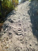
Bear tracks on the Strawberry Peak Trail.
Bear tracks on the Strawberry Peak Trail

Some things to note. The Colby Canyon Trail and the use trail up Strawberry Peak are somewhat hidden from view when you first get to Josephine Saddle. The trails are on the east side of the saddle, and well used. The Gabrielino Trail between Red Box and Switzer’s Picnic area is generally in good shape, but watch out for Poodle-dog bush. The start of Nature’s Canteen Trail is not currently marked. It can be picked up near the top of the paved road that climbs up from Switzer’s, near the telephone/power line poles. It starts on the west side of the road. Most of the trail was overgrown, but it looked like it was being restored, starting at its west end.

I was glad to see that most of the bigcone Douglas-fir on the north side of the peak survived the fire and that Strawberry Potrero was mostly intact. There was a nice set of bear tracks between Strawberry Potrero and the steep section of the Strawberry Peak Trail above the Colby Canyon Trail junction.

Here’s an overview of the Strawberry Peak circuit and an interactive Cesium browser View of the route that can be zoomed, panned, tilted and rotated.

Some related posts: Strawberry Peak Traverse, Blue Skies and Short Sleeves on Strawberry Peak

Mt. Wilson – Newcomb Pass – Chantry Flat Loop

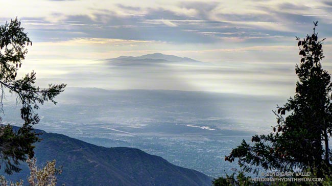
Santiago Peak (Saddleback) from the Rim Trail on Mt. Wilson

As I ran through the scrub oak near the summit of Mt. Wilson, my footfalls and the distant hum of a generator were the only sounds that disrupted the quiet of the early morning. A patchwork of high clouds covered the sky, muting the rising sun and prolonging the dawn-like light.

Suddenly, I caught the movement of something large off to the side on the trail ahead. It took a moment to decipher the scene, but over a second or two the camouflaged bowhunter emerged from the background of oak leaves and limbs. Never turning to look at me, he continued to creep up a game trail toward the observatory grounds.


I wasn’t sure how the bowhunter fit in the array of hunting seasons and regulations, but if the general deer hunting season was open in Angeles National Forest I hoped my bright blue shirt and yellow “rodeo clown” running shoes would make me appear sufficiently unnatural.

Unlike last week, today I had a plan — to run down the Rim Trail from Mt. Wilson to Newcomb Pass, then down the Gabrielino Trail to Chantry Flat and back up to Wilson on the Upper Winter Creek Trail. I had not done this loop and it would give me a chance to do the stretch of the AC100 course between Newcomb Pass and the Mt. Wilson Toll Road.


The Rim Trail is a key part of several Mt. Wilson loops. The trailhead is about a quarter-mile east of the Skyline parking lot along the lower paved road with the nature trail signs. It is an adventurous and scenic trail that switchbacks steeply down the rocky northeast shoulder of Mt. Wilson and then contours over to Newcomb Pass. The trail has many long stretches of outstanding running in a forest of bigcone Douglas-fir and oak.

I’d been on the Rim Trail a few times this year and today was glad to see the poison oak along the trail was leafless and the patches of Poodle-dog bush had been trimmed. It’s harder to spot the poison oak without its “leaves of three” but it seems when it is dormant it is less of an issue.

At Newcomb Pass I turned right (south) onto the Gabrielino Trail, joining the AC100 course and beginning the descent to Sturtevant Camp in Big Santa Anita Canyon. Of all the trails on today’s loop the Gabrielino was the most technical.


In true Fall fashion the temperature on the sun-facing, chaparral-covered upper reaches of Big Santa Anita Canyon contrasted sharply with the forested north-facing slopes traversed by the Rim Trail and along the streams in the depths of the canyon.

The running between Sturtevant Camp and Roberts Camp was superb. The forests of bigcone Douglas-fir, alder, California bay and bigleaf maple are remarkable and among the most developed in Southern California. The yellows of the bigleaf maples stood out brightly against the greens of the other trees, beacons of Autumn in a mostly evergreen habitat.


The 6 mile, 3100′ climb that starts at the green foot bridge below Chantry Flat and ends at the Mt. Wilson Toll Road is the biggest on the AC100 course. On today’s run it started at a little under the 10 mile point, but during the AC100 comes at about mile 74.

After huffing up the paved road three-quarters of a mile, I refilled my Camelbak at the picnic area at Chantry Flat and continued the loop on the Upper Winter Creek Trail. The uphill on this trail was mostly moderate and runnable, and there is even some downhill to be enjoyed on its descent to the Winter Creek Trail junction near Hoegees.


The climb out on the Winter Creek Trail to Manzanita Ridge is toughest on the loop. Last week I jumped onto the undulating and sunbaked Manzanita Ridge Trail to finish the climb to the Mt. Wilson Trail junction. The “Winton Bypass” extension of the Winter Creek Trail built by Hal Winton and AC100 volunteers is a much better trail and option.

From the turnout near the top of the Kenyon Devore Trail (outside of Skyline Park) the loop worked out to about 17.5 miles, with an elevation gain/loss of about 4500′. Two shorter variations of this loop are possible. At about mile 6.5 the Sturtevant Trail can be taken directly back up to Mt. Wilson or the trail can be used to connect to the Mt. Zion Trail and eventually the Winter Creek Trail near Hoegees.

Some related posts: Mt. Wilson Trail Plus; Bigcone ENSO Prediction, Poodle-dog Bush Blues, and a Surprise on Kenyon Devore; GSU Mt. Wilson CHARA Telescope Array; Mt. Wilson Rim Trail – Kenyon Devore Trail Loop; Twenty-Two Miles and Two Classic Climbs
Unwinding from the Backbone Ultra

Bear Canyon
Bear Canyon

Doing a moderate run in the San Gabriels and climbing a few peaks was a great way to unwind from the excitement of doing the 68 mile Backbone Ultra last weekend.

I felt good. I’d run more or less normally in the week following the event — depleted, but without any physical issues. In part that can be attributed to how Coyote Cohorts runs their events. It was basically a long training run in the company of a great bunch of runners and the help of incredible volunteers. Amazing! The long hours of training also really helped, particularly the back-to-back runs following 50Ks and the back-to-back night/day training runs. My shoes — Hoka Mafate 2s — also helped, reducing the impact of all the miles.

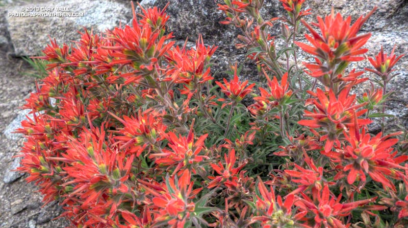
Paintbrush on the San Gabriel Peak Trail near Markham Saddle.
Paintbrush on the San Gabriel Peak Trail

One of the reasons for doing today’s run was to check how Poodle-dog Bush and some other plants are faring in this low rainfall water year. Since July 1 Downtown Los Angeles has recorded only 5.14 inches of rain. Unless we can manage to wring about a half-inch of rain from the heavens before June 30, this water year will go down as the fourth driest since record-keeping began in 1877. The driest water year on record was in 2005-2006 (3.21 inches). Assuming we don’t get that 0.48 inch of rain, three of the four driest water years have occurred since 2000.

Something I noticed on the Backbone run and recent training runs in the Santa Monica Mountains is that plant growth and flowering has been surprisingly robust given the amount of rainfall. This was also the case today on today’s run — the manzanita on the San Gabriel Peak Trail was covered in blossoms and bees, and the nightshade and paintbrush along the trail also seemed to be doing well.

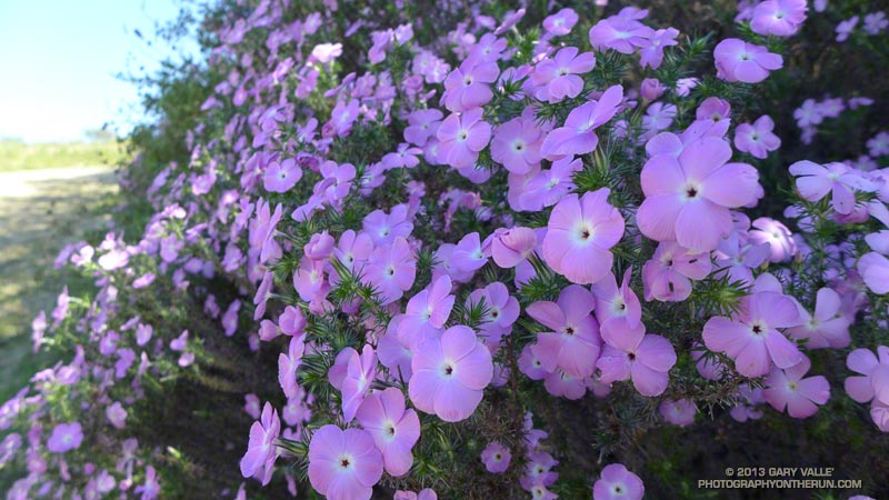
Prickly phlox along Calabasas Peak Mtwy.

What about the Poodle-dog bush, aka Turricula? It looked about the same as last year at this time — just starting to come out of Winter dormancy. Last year we had above average rainfall in April and it really seemed to spur the growth of Poodle-dog bush. This year maybe we’ll see what an extended period of dry weather does to it. Last year some of the Poodle-dog died before the rain in April.

Here’s a short slideshow of a few photos from today’s run in the San Gabriel Mountains, as well as some photos of plants and flowers on recent runs in the Santa Monica Mountains.

Mt. Wilson Rim Trail – Kenyon Devore Trail Loop

Big cone Douglas-fir on the Rim Trail near Mt. Wilson

Brett was down for Father’s Day weekend and one of the things we wanted to do was get in a couple of good trail runs. He’s heard me talk (a lot) about the Mt. Disappointment 50K and how it ends. Basically you run 27 hilly miles with over 3600′ of elevation gain, THEN finish the race by doing a 5 mile, 2650′ climb from West Fork up the Gabrielino & Kenyon Devore Trails to the top of Mt. Wilson.

This final climb tells the 50K tale. If you’ve trained well and run a good race a middle-of-the-pack runner might gain 15-20 minutes on this leg. If not, you could easily lose an hour or more. In any case you put everything you have left into this climb. An elevation profile and some stats for Kenyon Devore are included in the post Hitting the (Big) Hills of Southern California.

There are several ways to incorporate Kenyon Devore into a loop, but I could only think of two that didn’t involve running on Mt. Wilson Road. One option was a 22 mile/5000’gain loop from Shortcut Saddle to Mt. Wilson and back. That wasn’t going to happen because just five days before I’d run the Holcomb Valley 33 Mile race. Instead we opted to start on top of Mt. Wilson and use the Rim Trail, Gabrielino Trail and Rincon – Red Box Road to get to West Fork. This would pare down the loop to a manageable 12 miles and 3000′ of gain.


Other than a “few” gnats, a lot of poison oak and some Turricula (Poodle-dog bush), the Rim Trail was in good shape and the running excellent. Once away from the observatory complex the trail has an adventurous, backcounty feel. The trail was in good enough condition that Brett enjoyed running it in the KomodoSport LS.

The day was going to be a scorcher and I was glad that much of the Rim Trail was on the shaded, north side of the crest. The Gabrielino Trail and Rincon – Red Box Road were also relatively cool and in the shade. With no race clock ticking away, we stopped at West Fork and ate some blueberries and PB&J. So far the route had been down, down, down; but in a few minutes it was going to go up, up, up.


One of the surprises of the day was how much the Turricula (Poodle-dog bush) had grown along the Gabrielino and lower Kenyon Devore Trails since I had been here in early March. A rain gauge near here (Opids Camp) recorded nearly seven inches of precipitation from March 25 to April 26. This appears to have promoted the growth of the Turricula. In a very dry rain season the rain and snow had been much needed. It rejuvenated the streams and vegetation, and the area looked much as it would if the seasonal rainfall had been normal.

The Turricula could not be avoided in some places, but that will be remedied in a couple of weeks when Gary Hilliard’s Mt. Disappointment Endurance Run volunteer trailwork group works on this section of the Gabrielino Trail and the Kenyon Devore Trail.

Update June 21, 2012. Although my contact with Turricula on this run was very limited, I did have a mild reaction, mainly on my arms. There was very slight inflammation and the “prickly” itching that is characteristic of Turricula. The itching became noticeable about a day after exposure and persisted for 4-5 days. Although mild, the reaction was stronger than occurred following several similar encounters last year. One difference was the exposure to poison oak on the Rim Trail earlier in the run. It’s possible that there was a cross reaction. This was observed in animal testing, but not in (limited) human tests. However, my reaction following this latest encounter was much, much milder than my first bout of Turricula, which resulted from wading through large patches of the young Poodle-dog plants on miles of overgrown trail. That first very strong response may have also involved a cross reaction with poison oak.


With the Summer Solstice approaching and the Sun so high, the temperature difference between sunny and shaded sections of trail was remarkable. About the time we were on Kenyon Devore the Clear Creek RAWS recorded a fuel temperature — the temperature of a wood dowel in direct sun — at a scorching 104°F. Brett did well on the climb and could have zoomed ahead. I had not recovered from Holcomb and struggled a bit on the exposed and steep sections of trail. Higher on the trail there was a breeze and more shade and that helped. It also helped pouring water over my head at the creek crossing!

It was great to show Brett Kenyon Devore, and what better way to sharpen the appetite for one of his superbly prepared dinners!


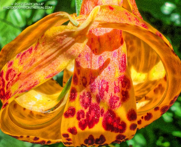
Humboldt Lily


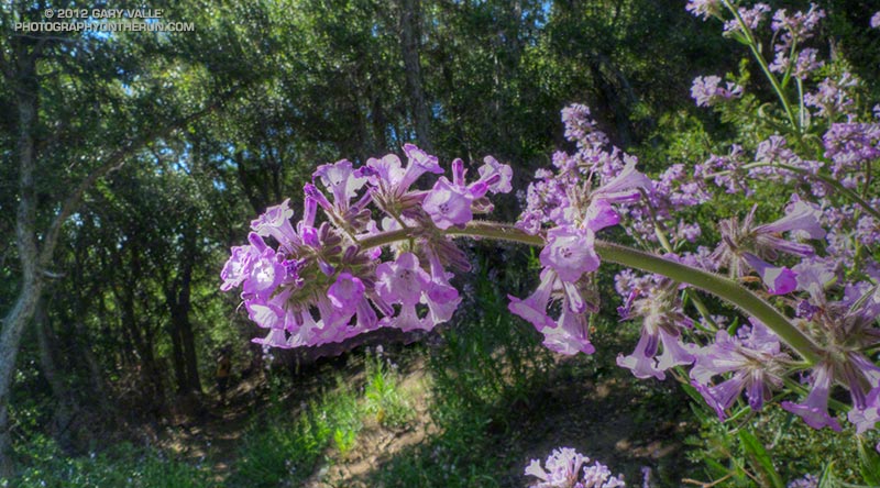
Turricula (Poodle-dog Bush)


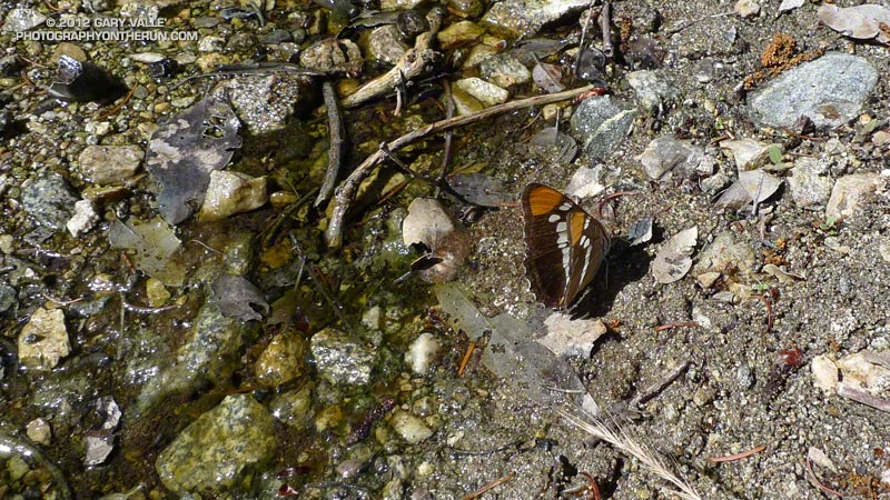
California Sister