Category Archives: trails|san gabriels

Strawberry Peak Circuit

North face Strawberry Peak

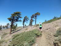
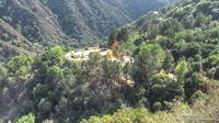
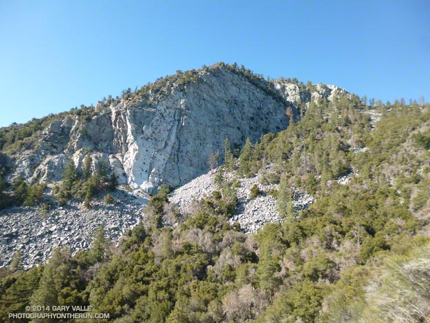
After being closed 4 1/2 years because of the 2009 Station Fire, Strawberry Peak and the trails comprising the Strawberry Peak loop reopened on May 25, 2014. Today, I finally got a chance to get back on the 15+ mile circuit around Strawberry, and was excited to find that much of it was in better shape than before fire.

Colby Canyon Trail about 0.25 mile from Josephine Saddle
Colby Canyon Trail near Josephine Saddle

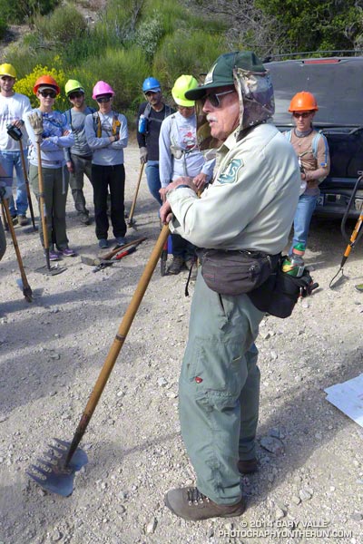
I’d heard that COBRA was instrumental in the restoration of the loop, but that is only part of the story. The preservation and maintenance of trails is now largely a community effort — in this case CORBA, Mount Wilson Bicycling Association, Sierra Club, Los Angeles Conservation Corps, National Forest Foundation, REI, Bellfree Contractors, and the BSA all contributed to the effort.

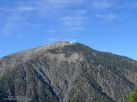
The loop, which is part of the ANFTR/Mt. Disappointment 50K course, circumnavigates Strawberry Peak. The trails that comprise the loop are Josephine Fire Road, Strawberry Spur Trail, Colby Canyon Trail, Strawberry Peak Trail, Gabrielino Trail, and Nature’s Canteen Trail. The loop can be started at Red Box, Colby Canyo, Switzer’s or Clear Creek. I usually start it at Clear Creek so I can refill my hydration pack from the water faucet at the Haramokngna American Indian Cultural Center at Red Box. (Note: Water might not be available here, especially in winter!)

Bear tracks on the Strawberry Peak Trail.
Bear tracks on the Strawberry Peak Trail

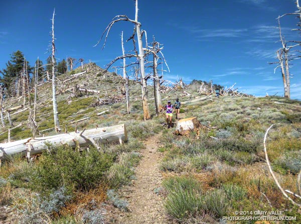
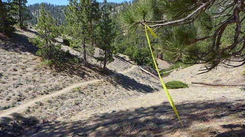
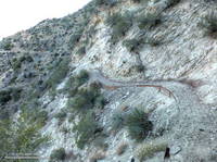
Some things to note. The Colby Canyon Trail and the use trail up Strawberry Peak are somewhat hidden from view when you first get to Josephine Saddle. The trails are on the east side of the saddle, and well used. The Gabrielino Trail between Red Box and Switzer’s Picnic area is generally in good shape, but watch out for Poodle-dog bush. The start of Nature’s Canteen Trail is not currently marked. It can be picked up near the top of the paved road that climbs up from Switzer’s, near the telephone/power line poles. It starts on the west side of the road. Most of the trail was overgrown, but it looked like it was being restored, starting at its west end.

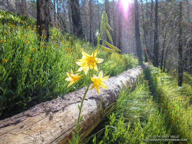
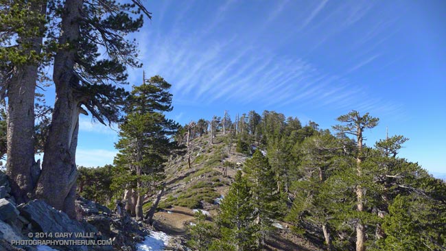
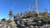
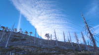
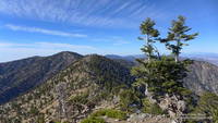
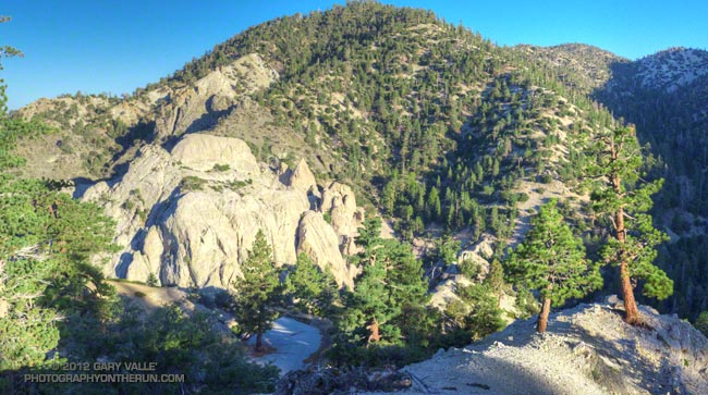
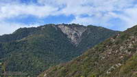
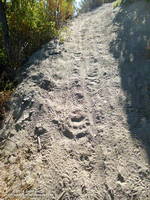
I was glad to see that most of the bigcone Douglas-fir on the north side of the peak survived the fire and that Strawberry Potrero was mostly intact. There was a nice set of bear tracks between Strawberry Potrero and the steep section of the Strawberry Peak Trail above the Colby Canyon Trail junction.

Here’s an overview of the Strawberry Peak circuit and an interactive Cesium browser View of the route that can be zoomed, panned, tilted and rotated.

Some related posts: Strawberry Peak Traverse, Blue Skies and Short Sleeves on Strawberry Peak

Three Points Loop: Lemon Lily Along the Mt. Waterman Trail

Lemon lily along the Three Points - Mt. Waterman Trail. border=0 src=

The bright yellow lemon lilies marked the trail. I hopped up on the log, followed it to it’s end, and stepped off. An ill-defined path through thick ferns gradually became more distinct and after a few yards became easier to follow.

I was on the Three Points – Mt. Waterman Trail (10W04) and doing a clockwise circuit of the 20 mile Three Points – Mt. Waterman loop. Counterclockwise because it was a way I could get in some additional training on the Cooper Canyon section of the AC100 course and also check how the south-facing slopes of Mt. Waterman were recovering from the 2009 Station Fire.

The Mt. Waterman Trail is less used than the major trails in the area, such as the PCT and Silver Moccasin Trail.  While it has seen some post-fire maintenance, it has more of the character of a “use trail” — as it did before the Station Fire. The trail is indistinct at times, winding its way around fallen trees and simply defining its route through use.

Some sections of the Mt. Waterman Trail near Three Points were severely burned. Higher up the mountain the fire made long runs up parallel ravines and ridges, creating a patchwork of burned understory and trees. The chaparral in the severely-burned areas appears to be recovering at a more or less normal rate. Of course the trees will take longer to grow, and it was great to see some pine seedlings and incense cedar seedlings have sprouted in the burn area.

The loop joined the AC100 course at Buckhorn Campground, descending the Burkhart Trail and then following the PCT up Cooper Canyon to Cloudburst Summit. From here it is nearly all downhill to Three Points.

Some related posts: Lemon Lily Along the Burkhart Trail, Three Points Loop Twice, Southern Pacific Rattlesnake on the Burkhart Trail, After the Station Fire: Three Points – Mt. Waterman Loop

Crest of the Angeles

Runners on the PCT west of Mt. Hawkins

Between Vincent Gap and Islip Saddle the Pacific Crest Trail follows one of the most scenic stretches of trail in Southern California, skirting the summit of Mt. Baden-Powell (9399′) and passing Mt. Burnham, Throop Peak and Mt. Hawkins before leaving the crest at Windy Gap (7600′), just east of Mt. Islip. It has long been a favorite of hikers and runners.

There are several ways this classic stretch of trail can be incorporated into a run or hike. Today we were doing the segment as part of a training run for the 2014 Angeles Crest 100 Mile Endurance Run. The AC100 starts at Wrightwood, California; then using parts of the PCT, Silver Moccasin, Gabrielino and several other trails, the AC100 works west through the peaks and canyons of the San Gabriel Mountains to Loma Alta Park near JPL.


The AC100 training runs, organized and supported by AC100 co-director Hal Winton, cover the 100 mile course in approximately 25 mile segments. With the help of AC100 Racebook editor/photographer Larry Gassan and a host of generous volunteers, “Uncle Hal” makes it happen and always seem to be where runners need him to be. Today’s training run was the fourth, and last, of the 2014 series.


Just a few days before we’d done the third AC100 training run from Chantry Flats to the finish at Loma Alta Park. Beginning at Mile 75 of the AC100, this difficult segment includes the Wintercreek and Idlehour climbs and some of the most technical trails on the course. As a result of the drought water wasn’t easily accessible at Idlehour Creek, so Hal and 2013 AC100 finishers Dave Tan and Rainer Schultz were at the “Cape of Good Hope” on Mt. Lowe fire road to provide much-needed water to thirsty runners.


This morning’s run from Wrightwood had begun with an ascent of the Acorn Trail — a climb that matches foot for foot the 2650′ elevation gain of the PCT up Baden-Powell and is every bit as strenuous. After climbing up the Acorn Trail we’d joined the PCT and followed it along spectacular Blue Ridge, past the top of Mountain High Ski Resort, to Angeles Crest Highway at Inspiration Point. From there it had taken less than an hour to reach Vincent Gap and Hal’s aid station. A quick stop to refill my hydration pack and I was back on the PCT and chugging up Baden-Powell.

Far too many switchbacks later, far too much of the peak remained. I was maxed out and doing my best to keep up with Skye’s brisk pace. Finally we rounded a corner and I could see the Wally Waldron tree a 150 yards ahead. Just 150′ in elevation from the top of Baden-Powell, the gnarled and weathered limber pine — estimated to be 1500 years old — stands sentinel at the juncture of Mt. Baden-Powell’s summit trail and the PCT.


I’d pushed the pace up the Acorn and Baden-Powell climbs and now was paying the penalty. My legs were toast. When I’d reached the Wally Waldron tree the decision whether or not to go to the summit of baden-Powell had been very easy — one trail led steeply up and the other gently down. As we turned west onto the PCT I told Skye I was going to have to take it easy for a bit. She had already started to pick up the pace and it didn’t take long for her to disappear into the forest on the trail ahead.

After a while I glanced at my watch and was surprised to see that it was already 3:00 pm. Because of the long shuttle to Wrightwood we hadn’t started running until 9:20 am. After skirting Baden-Powell, I’d run past Mt. Burnham, struggled up to the shoulder of Throop Peak and now was near Mt. Hawkins. Here, the beginning of the descent to Windy Gap is marked by a prominent Jeffrey pine that has been struck by lightning.


West of Mt. Hawkins the Pacific Crest Trail passes through a ghost forest of large trees burned in the 2002 Curve Fire. Recovery in the area is progressing well, and amid the dead trees are numerous pine and fir saplings. I ran this segment in mid-January and again at the end of May. Sometime between the two runs a large number of the dead trees had been blown down. During the May run it had been necessary to crawl over or work around a log jam of fallen trees. The trees likely blew down during a storm on February 28th, when Chilao recorded winds as high as 91 mph. That wasn’t necessary today, thanks to the expert trail work of PCTA volunteer Ray Drasher and his equine crew.


Most of the trail maintenance in the San Gabriels (and elsewhere) is now done by volunteers. One of the requirements to run in the AC100 is eight hours of trail work. This year AC100 entrants have worked on the Idlehour and Wintercreek Trails and will be working on the Gabrielino Trail below Newcomb Saddle in a couple of weeks. For more info about Hal and volunteering see the April 2014 issue of the VOLUNTEER TODAY newsletter (PDF).

Once through the ghost forest on Mt. Hawkins, it didn’t take long to get down to Little Jimmy Spring and from there over to Islip Saddle. It had been another tough training week in a series of tough training weeks. As I descended the final short switchbacks to the Islip Saddle parking area on Highway 2 I tried to visualize what it would be like on race day. How would I feel compared to today? Would I make here before noon? How hot would it be on Cooper Canyon? Would the cutoff at Cloudburst be a problem? Would I make it to Horse Flats before dark? On what trail would I be when sun rose for the second time during the run? All these and many other questions would be answered in just a few weeks.

Mid January Trail Run from Islip Saddle to Mt. Baden-Powell

Mt. Burnham from the PCT in the San Gabriel Mountains, near Los Angeles
Mt. Burnham from the PCT
It’s been warm in Southern California. Thursday Bob Hope Airport reached a high of 90 degrees and it seems every couple of days another high temperature record is broken or one SoCal city or another is the hottest spot in the nation.
Not only has it been really warm, it’s been really dry. Downtown Los Angeles recorded only 0.2 inch of rain in December and not a measurable drop of rain has fallen so far this January. We already set the record for the driest calendar year, and at the moment we’re vying for the driest water year on record.
The PCT just west of Mt. Hawkins during the unusually warm and dry Winter of 2013-2014.

The PCT just west of Mt. Hawkins. January 18, 2014.

The unusually warm and dry weather made me wonder what the conditions were like in the Angeles high country. Might the PCT be runnable between Islip Saddle (6650′) and Mt. Baden-Powell (9399′)? As warm and as dry as its been, how much snow could there be?

At Islip Saddle there was very little snow. Here and there tiny remnants hid under the snowbush, but for the most part the north slopes of Mt. Islip looked more like July than January.


I encountered the first larger patches of snow and ice in the deeply shaded corners of trail before Little Jimmy Campground and Spring. It was easily traversed, but reminded me of November runs on San Jacinto Peak and San Gorgonio Mountain, when early season snow had melted and refrozen, turning sections of trail into a skating rink.
The thing is, it doesn’t take a lot of snow to transform a straightforward trail run into a slip and slide adventure, especially when the snow is icy. As warm as it was in the sun, several sections of the PCT between Islip and Baden-Powell never see the sun in Winter and were surprisingly cold. Even if it was 80-something degrees in the lowlands.


In this case if you wanted to bypass most of the snow patches you could do that by following the crest. On the way to Baden-Powell I tried to stay on the trail to see what sections were clear.  On the way back I climbed Mt. Burnham, Throop Peak, Mt. Hawkins and a couple other peaklets, so stayed on the crest.
Here’s a very short video (under 2 minutes) that will give you an idea what the conditions were like.

Williamson Rock – Angeles National Forest

Williamson Rock - Angeles National Forest

Update 8/21/18. Nearly 13 years after the closure of Williamson Rock and a key segment of the Pacific Crest Trail, the Forest Service has released a Draft Environmental Impact Statement for the Williamson Rock Project. The public comment period is from July 27 to September 10, 2018. For additional information see the Forest Service Williamson Rock Project page and the Access Fund page REOPEN WILLIAMSON ROCK TO CLIMBING!

Update 12/22/13. New Williamson Rock/PCT scoping letter, dated 12/18/13, from Angeles National Forest to “consider resuming recreation opportunities in the currently closed area, in and around Williamson Rock.”

————

The following was posted 10/5/12.

It’s been nearly seven years since the Forest Service “temporarily” closed approximately 1,000 acres in the upper Little Rock Creek drainage in the San Gabriel Mountains in order to protect critical habitat of the mountain yellow-legged frog (MYLF). The closed area includes Williamson Rock, a once-popular rock climbing area, and a key 3.5 mile segment of the Pacific Crest Trail between Eagle’s Roost and the Burkhart Trail.

As might be expected when an issue is complex and involves several concerned parties, resolution has been painfully slow. Williamson Rock is a large formation encompassing many smaller climbing sub-areas. The majority of these areas are outside of MYLF habitat. The Recreational Development Alternative protects MYLF habitat while allowing recreational access to other areas of the formation. (See the Access Fund Williamson Rock page for more information.)

Last year United States District Judge Marilyn Hall Patel (Northern District of California) ordered Angeles National Forest to “halt all construction and close access to the Williamson Rock Area of the Angeles National Forest until the Amended Biological Opinion and accompanying ITS is filed and the matter is reviewed by the parties and the court.” It is unclear how much time will be required to complete these filings and subsequent reviews.

In the meantime, a recent article in the Los Angeles Times suggests there might be some reason for optimism concerning the fate of the MYLF, with “the fist-sized amphibians breeding in numbers not seen in decades.”

The title photograph is from last Sunday’s Pleasant View Ridge run.

Mt. Wilson – Newcomb Pass – Chantry Flat Loop

Santiago Peak (Saddleback) from the Rim Trail on Mt. Wilson

As I ran through the scrub oak near the summit of Mt. Wilson, my footfalls and the distant hum of a generator were the only sounds that disrupted the quiet of the early morning. A patchwork of high clouds covered the sky, muting the rising sun and prolonging the dawn-like light.

Suddenly, I caught the movement of something large off to the side on the trail ahead. It took a moment to decipher the scene, but over a second or two the camouflaged bowhunter emerged from the background of oak leaves and limbs. Never turning to look at me, he continued to creep up a game trail toward the observatory grounds.


I wasn’t sure how the bowhunter fit in the array of hunting seasons and regulations, but if the general deer hunting season was open in Angeles National Forest I hoped my bright blue shirt and yellow “rodeo clown” running shoes would make me appear sufficiently unnatural.

Unlike last week, today I had a plan — to run down the Rim Trail from Mt. Wilson to Newcomb Pass, then down the Gabrielino Trail to Chantry Flat and back up to Wilson on the Upper Winter Creek Trail. I had not done this loop and it would give me a chance to do the stretch of the AC100 course between Newcomb Pass and the Mt. Wilson Toll Road.


The Rim Trail is a key part of several Mt. Wilson loops. The trailhead is about a quarter-mile east of the Skyline parking lot along the lower paved road with the nature trail signs. It is an adventurous and scenic trail that switchbacks steeply down the rocky northeast shoulder of Mt. Wilson and then contours over to Newcomb Pass. The trail has many long stretches of outstanding running in a forest of bigcone Douglas-fir and oak.

I’d been on the Rim Trail a few times this year and today was glad to see the poison oak along the trail was leafless and the patches of Poodle-dog bush had been trimmed. It’s harder to spot the poison oak without its “leaves of three” but it seems when it is dormant it is less of an issue.

At Newcomb Pass I turned right (south) onto the Gabrielino Trail, joining the AC100 course and beginning the descent to Sturtevant Camp in Big Santa Anita Canyon. Of all the trails on today’s loop the Gabrielino was the most technical.


In true Fall fashion the temperature on the sun-facing, chaparral-covered upper reaches of Big Santa Anita Canyon contrasted sharply with the forested north-facing slopes traversed by the Rim Trail and along the streams in the depths of the canyon.

The running between Sturtevant Camp and Roberts Camp was superb. The forests of bigcone Douglas-fir, alder, California bay and bigleaf maple are remarkable and among the most developed in Southern California. The yellows of the bigleaf maples stood out brightly against the greens of the other trees, beacons of Autumn in a mostly evergreen habitat.


The 6 mile, 3100′ climb that starts at the green foot bridge below Chantry Flat and ends at the Mt. Wilson Toll Road is the biggest on the AC100 course. On today’s run it started at a little under the 10 mile point, but during the AC100 comes at about mile 74.

After huffing up the paved road three-quarters of a mile, I refilled my Camelbak at the picnic area at Chantry Flat and continued the loop on the Upper Winter Creek Trail. The uphill on this trail was mostly moderate and runnable, and there is even some downhill to be enjoyed on its descent to the Winter Creek Trail junction near Hoegees.


The climb out on the Winter Creek Trail to Manzanita Ridge is toughest on the loop. Last week I jumped onto the undulating and sunbaked Manzanita Ridge Trail to finish the climb to the Mt. Wilson Trail junction. The “Winton Bypass” extension of the Winter Creek Trail built by Hal Winton and AC100 volunteers is a much better trail and option.

From the turnout near the top of the Kenyon Devore Trail (outside of Skyline Park) the loop worked out to about 17.5 miles, with an elevation gain/loss of about 4500′. Two shorter variations of this loop are possible. At about mile 6.5 the Sturtevant Trail can be taken directly back up to Mt. Wilson or the trail can be used to connect to the Mt. Zion Trail and eventually the Winter Creek Trail near Hoegees.

Some related posts: Mt. Wilson Trail Plus; Bigcone ENSO Prediction, Poodle-dog Bush Blues, and a Surprise on Kenyon Devore; GSU Mt. Wilson CHARA Telescope Array; Mt. Wilson Rim Trail – Kenyon Devore Trail Loop; Twenty-Two Miles and Two Classic Climbs