Category Archives: birds

A Trail That Doesn’t Go Anywhere

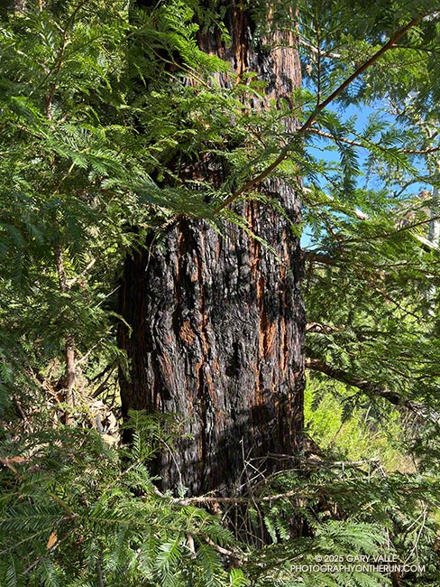
Coast redwood in Malibu Creek State Park scorched by the 2018 Woolsey Fire
Coast redwood scorched by the 2018 Woolsey Fire

Jogging east on the Forest Trail, I stopped to take in the sights and sounds of the early morning. A chorus of bird songs filled the canyon, oblivious to the roar of a passing jet. There was the familiar “honking” of Canada geese and the happy improvisations of a spotted towhee, but also several other birds I could not identify.

Curious to see what Merlin Bird ID would find, I started the app and watched as it matched the songs of a red-winged blackbird, yellow warbler, ash-throated flycatcher, northern house wren, and yellow-breasted chat.

Continuing along the trail, I rounded a corner where some fallen trees had been cleared and was surprised to see someone else hiking toward me.

“You know this trail doesn’t go anywhere,” He commented.

I told him I knew, but I just liked being on the trail.
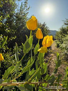
Bush poppy along the Lake Vista Trail in Malibu Creek State Park. (thumbnail)
Bush poppy along the Lake Vista Trail

That’s the thing, a trail doesn’t have to “go somewhere.” If you are open to what it tells you, a trail can take you on a journey beyond its start and end. On a trail, you can explore and experience the wonders of Nature and all that is around you.

The Forest Trail is one of the special trails of Malibu Creek State Park. I often include it when doing more well-known and popular routes, such as the Bulldog Loop and Phantom Loop.

Earlier, I’d used the Cistern, Lookout, and Yearling Trails to run through Reagan Ranch to the parking area near Mulholland Hwy and Lake Vista Drive. Frost covered the grass near the top of the Cage Creek Trail. I’d dressed for what the temperature would be later in the morning, and my hands complained of the cold.

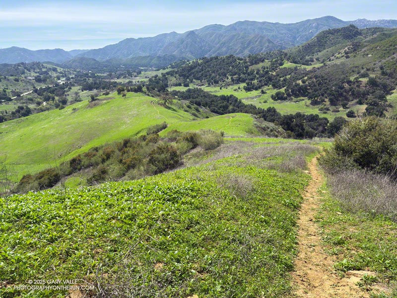
From the parking area off Lake Vista Drive, an indistinct trail leads south along a fence line and private property to a steep SCE service road. The dirt road can be followed to the western trailhead of the Lake Vista Trail. Once on the trail, it’s about a tenth of a mile up to a pretty overlook of Malibou Lake.
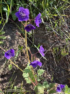
Parry's Phacelia along the Lake Vista Trail in Malibu Creek State Park. (thumbnail)
Parry’s Phacelia along the Lake Vista Trail

From the overlook, the Lake Vista Trail winds in and out of ravines on the north side of “Lake Vista Butte” as it descends to the Deer Leg Trail. This stretch of trail is home to one of the largest populations of hummingbird sage I have seen on a local trail. The aromatic, distinctly-colored, large-flowered member of the Mint Family stands out along the trail. Also blooming on the Lake Vista Trail were bush poppy, stinging lupine, and Parry’s Phacelia.

Back on the Forest Trail, I continued to count the coast redwoods that survived the 2011-2015 drought and the 2018 Woolsey Fire. In July 2016, I counted about sixteen redwoods, some of which were multi-trunked. At that time only one tree appeared to be dead. Today, I counted six surviving redwoods.

There are three solitary trees and three multi-trunked clusters of trees. Two of the solitary trees appear to be those originally planted in the Century Lake area more than 100 years ago. One old redwood is on the Crags Road Trail, near the start of the Forest Trail, and the other is on the north side of the Forest Trail, as it nears Century Lake.

A very young, naturally germinated redwood is found near the east end of the Forest Trail. The three multi-trunked family groups appear to be intermediate in age and could also be naturally germinated.

Some related posts:
Forest Run
Lake Vista Ridge, the Forest Trail, and September Wildflowers
Redwoods, Raptors, and the Phantom Loop
Malibu Creek State Park Redwoods: Fighting the Drought
The Malibu Creek State Park Redwoods Are Dying

The Best Trailhead for Trail Running in Malibu Creek State Park

Talepop Trail - Malibu Creek State Park

In a 2013 post, I suggested that the Cistern/Phantom Trailhead on Mulholland Highway might be the best trailhead to start the Bulldog Loop.

More than 10 years and a lot of trail running miles later, I still prefer to do the Bulldog Loop from that trailhead. More than that, most of the trail runs I do in Malibu Creek State Park are from the Cistern/Phantom Trailhead.

There are two key reasons — the scenery is spectacular and the route options endless. Over the past year, I’ve run from the Cistern/Phantom Trailhead a dozen times, on routes ranging from 2 to 23 miles.

Two of those runs were this March. One was on March 9. I’d done the Bulldog Loop several times recently, so the idea was to do a Bulldog-length run, without doing the Bulldog Loop. It was a “follow my nose” run that included Reagan Ranch, Malibou Lake overlook, Crags Road, Tapia Spur Trail, Grasslands Trail, Talepop Trail, Las Virgenes Trail, Liberty Canyon Trail, and Phantom Trail. It turned out to be about 17 miles, with an elevation gain/loss of about 2400′.

I enjoyed that run so much, I came back a week later and did a similar run. But this time the route included the Bulldog Loop. The idea was to use established trails and do the longest loop I could in Malibu Creek State Park, without repeating any part of the route. The run turned out to be about 23 miles, with around 4200′ gain/loss.

It was an outstanding run, with a delicate creek crossing, eye-catching halo, green hills, Spring wildflowers, and an unusual encounter with a Great Blue Heron (video).

Here’s an interactive, 3-D terrain view of the 23-mile loop in Malibu Creek State Park, and a few photos from the run.

Some related posts:
Best Trailhead to Start the Bulldog Loop?
Bulldog Loop Plus the Phantom Loop
Reagan Ranch at Sunrise
Wandering Around Malibu Creek State Park
Spring Fever Running the Phantom Loop in Malibu Creek State Park
Late Start on the Bulldog Loop

Ahmanson Ranch and Upper Las Virgenes Creek After Six Days of Rain

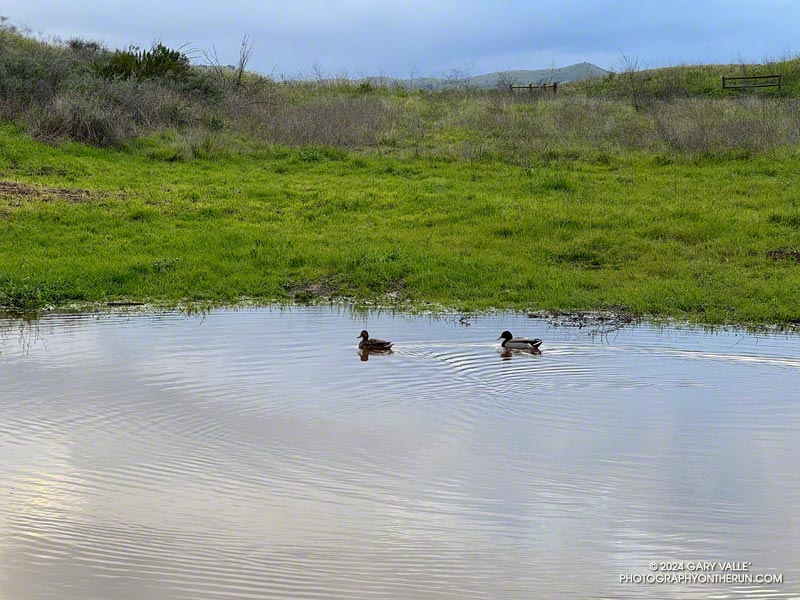
A female (left) and male mallard enjoying a large puddle adjacent to the Victory Trailhead parking lot.
A female (left) and male mallard enjoying a large puddle adjacent to the Victory Trailhead parking lot at Ahmanson Ranch.

After January 2023’s torrential rains and Hurricane/Tropical Storm Hilary’s drenching in August, here we are again, experiencing record rainfall.

Over the first six days of February 2024, Downtown Los Angeles recorded 10.2 inches of rain. That’s almost three-quarters of L.A.’s normal ANNUAL rainfall in just a few days and the wettest start to February on record! Some stations in the Santa Monica and San Gabriel Mountains recorded even more — over 13 inches in some locations!

How much did it rain at Ahmanson Ranch (Upper Las Virgenes Canyon Open Space Preserve)? Unfortunately the Remote Automated Weather Station (RAWS) on a hill between Upper Las Virgenes Canyon and Cheeseboro Canyon hasn’t been accurately measuring precipitation. A citizen weather station (KCAWOODL130) near the Victory Trailhead at Ahmanson Ranch recorded over 11 inches from February 1 – 6. Another station near Cheeseboro Road in Agoura (KCAAGOUR41) recorded over 9 inches.

Whatever the amount, it was a lot. Here is a short video, from a run at Ahmanson Ranch on February 7, 2024, to check out the conditions and creeks.

As I write this, more wet weather is forecast to affect the Los Angeles area, beginning sometime over the weekend of February 17-18. We’ll see!

Update Friday, February 16, 2024.  Latest forecast for Los Angeles area suggest the rain may hold off until Sunday night or Monday.

Crow Meetup on Eagle Springs Road

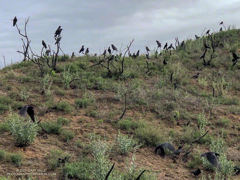
Winter congregation of crows along Eagle Springs Fire Road in Topanga State Park

It was the day before the strongest of a series of Pacific storms was forecast to move into Southern California. It would add several inches of rain to an already impressive total. I was curious to see how the trails and roads in Topanga State Park were holding up before the big one hit.

I’d just run up Fire Road #30 to the Hub and was part way down Eagle Springs Fire Road when I heard the caw, caw, cawing of hundreds of crows. They were everywhere — perched on burned branches of chaparral, on the road, and soaring overhead. Anywhere I looked, there were crows.

Here is a very short (19-second) video of the crow congregation.

The run went well. Most of the mud could be avoided, and I didn’t have to wade through any puddles or creeks. Except for the Bent Arrow Trail, the damage to the roads and trails at this point wasn’t too bad. But that was going to change.

Related posts: Winter Colony of Crows in Cheeseboro Canyon, Congregating Crows on Lasky Mesa, Trippet Ranch Loop Plus Temescal Peak

Bigberry Manzanita – A Hummingbird Hotel

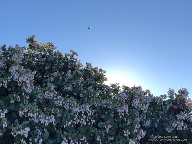
Bigberry Manzanita - A Hummingbird Hotel

From a hummingbird perspective, it was the perfect place to spend a cold night.

The big berry manzanita was situated on the spine of a north-south oriented ridge near Topanga Lookout. In that location, a bird might benefit from the warmth of both the setting and rising sun.

In addition, the bush’s thicket of stiff branches afforded some protection from predators, and the multitude of nectar-rich blossoms would provide a badly needed boost of wake-up energy.

The temperature was warmer now, but it had been near freezing at the Cold Canyon trailhead when I started the Topanga Lookout Ridge loop. It had been cold enough that I had jogged the steeper sections of Calabasas Peak fire road, just to ward off the chill.

Humans are funny that way — a small drop in body temperature can be life-threatening. How in the world can a diminutive hummingbird, whose caloric needs require it to feed almost constantly, survive a long, cold Winter night?

Research reveals that hummingbirds accomplish this feat by reducing their body temperature and metabolic rate. This physiological state — called torpor — dramatically reduces their energy requirements.

This particular manzanita apparently receives a lot of 5-star reviews, and at the time I passed, was occupied by several buzzing birds.

From Sunday’s run of the Topanga Lookout Ridge loop.

Related post: Hummingbird Stories

Musch Meadow Frost

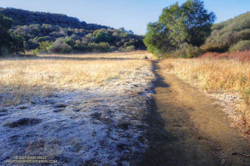
Frost along the Backbone Trail at Musch Meadow

As I approached Musch Camp, a scrub jay flew from a trailside faucet and into a nearby eucalyptus. There had been a little rain the day before, but the birds at the closed camp were still thirsty. Less than a quarter-inch of rain had fallen, and nearby creeks were still dry.

Melting frost
Melting frost “steaming” at Musch Meadow

I was doing a run from the “Top of Reseda,” and on a warmer day would have topped off my water bottle at the camp. I stopped at the faucet and briefly turned on the spigot. Maybe that would make it easier for the jay.

Leaving the camp behind, I continued south on the Backbone Trail, across frost-covered Musch Meadow. Early morning sun had just reached the meadow, and water vapor from the melting frost steamed in the cold air.

In another mile I reached the Trippet Ranch trailhead, and then begin the six mile run back to the Valley. At several points on the run there had been wintry views of the local mountains. On the way back the best view of the snowy mountains was from the Hub, where Mt. Baldy could be seen gleaming white in the morning sun.

Some related posts: Garapito Trail Runs, Musch Trail Mule Deer, Musch Trail Morning