Category Archives: trails|san jacinto

Sizzling San Jacinto

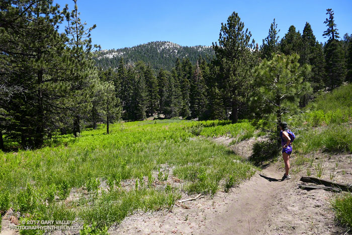
Tahquitz Meadow
Tahquitz Meadow

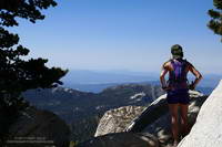
We were nearly to the junction of the Pacific Crest Trail and the South Ridge Trail and about a half-mile from Tahquitz Peak (8846′). It was hot. In the shade the temp was in the high 80s, but in direct sun the temperature was close to 100°F.

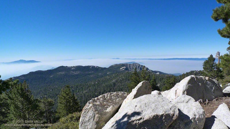
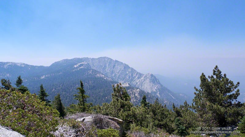
Tahquitz Peak from Wellman Divide

A few hours earlier Skye and I had grabbed the first car up on the Palm Springs Tram and done the 5 mile, 2435′ ascent of San Jacinto Peak. At 10,800’+ at 10:00 in the morning it had been 70°F — warm for one of the higher mountains of Southern California. Remarkably, a couple of small patches of snow remained on the south side of the summit.

Where we were now, 70 degrees would feel like a refrigerator. We’d given up that cooler clime and all the elevation we’d gained, and run five miles down the Wellman Divide Trail and PCT to Saddle Junction — a descent of about 2700′. The temperature had increased all the way down.

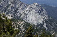
Tahquitz Rock from the Wellman Divide Trail

We might as well have been in a drying oven. The combination of the hot weather, a high sun, low humidity and higher altitude had desiccated me. At the turn-off off from the PCT to Tahquitz Peak I lifted my pack and squeezed the reservoir — again. In the few minutes since I last checked, no water had magically found its way into my pack. There was less than 20 ounces remaining and that wasn’t going to be enough.

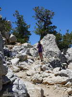
Descending from Tahquitz Peak

After running over to Tahquitz Peak and visiting the lookout, there was still the minor detail of getting back to the Tram. The Mountain Fire closure was still in effect, which meant we could not use the Willow Springs Trail and would have to retrace our steps and climb all the way back up to Wellman Divide.

During the drought I would bring extra water when doing this route, and stash it along the trail. With this year’s good snowpack it seemed we should be able to find water if we needed it.

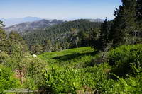
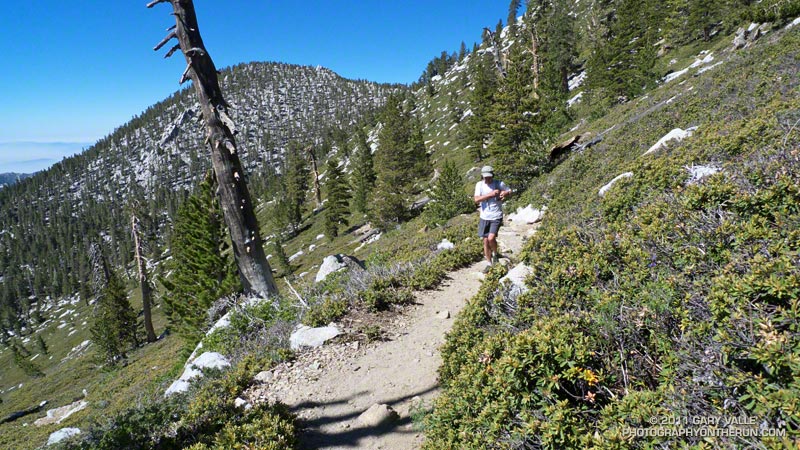
Wellman Cienaga from the Wellman Divide Trail

Prior to the Mountain Fire I’d used Willow Creek as a water source, but since the Willow Springs Trail was closed, that was out. The seep at Wellman Cienaga was too far up and the flow was low. Skunk Cabbage Meadow and Tahquitz Valley were a possibility. Originally included in the Mountain Fire closure area, they had reopened. I recalled a water source in Skunk Cabbage Meadow, but didn’t remember much about it.

When we got to Tahquitz Peak we asked Joe, the volunteer Ranger at the Tahquitz Peak Lookout, what he thought would be a good water source. He suggested Tahquitz Creek in Tahquitz Valley. I hadn’t been to Tahquitz Valley, so this was a great time to check it out.

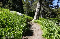
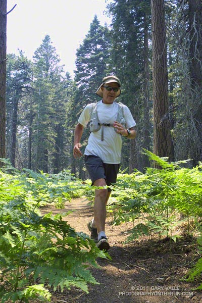
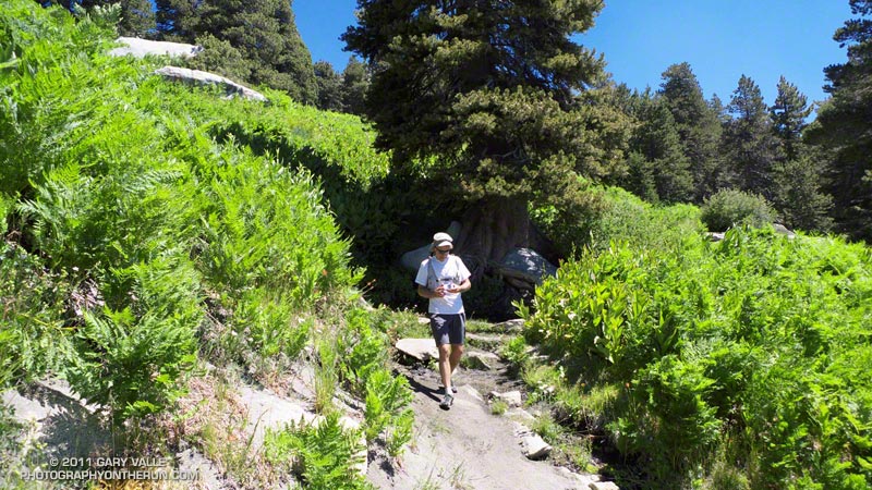
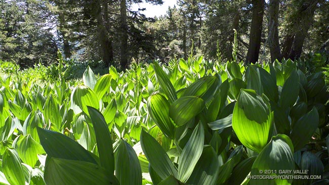
Corn lilies and ferns along the Wellman Divide Trail.

Although small in its upper reaches, Tahquitz Creek had plenty of water. Using a UV Pen, we refilled our packs and drank until we couldn’t drink any more. Continuing, we found there was also water available at Skunk Cabbage Meadow. At least for now. I wouldn’t hazard a guess how long these water sources will last.

Ah water, wonderful water. With water the hike and run back to Wellman Divide was just a sweaty, strenuous and scenic climb, and not the hellish ascent it might have been.

Some related posts: San Jacinto Peak and Tahquitz Peak Trail Run, Room With a View, Mountain Weather

San Jacinto Peak and Tahquitz Peak Trail Run

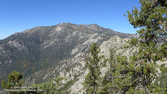
San Jacinto area peaks from near Tahquitz Peak

Summits that can be accessed by trail are usually busy places, especially in good weather. That was certainly the case this morning. Each of us had encountered someone we knew on or near San Jacinto’s rocky summit.

It seemed everyone on the peak was doing a different adventure. One hiker mentioned he had run out of food at Wellman Divide. That seemed strange until he explained he was doing the “8000 Meter Challenge” — ascending Baldy, Gorgonio and San Jacinto consecutively in 24 hours. The 8000 meters refers to the (approximate) cumulative gain and loss when doing the three peaks. In round numbers Baldy via the Ski Hut would be about 2375 meters of gain+loss, Gorgonio via Vivian Creek 3350 meters and San Jacinto via the Tram about 1500 meters. If you skip the Tram and do San Jacinto from Idyllwild the gain+loss is about 2680 meters.

The Coachella Valley from the Wellman Divide Trail about a half mile from the summit of San Jacinto Peak.
Coachella Valley from near the summit of San Jacinto Peak

An ultrarunning friend that reached the summit shortly after we did was doing Cactus to Clouds to Cactus (C2C2C). This arduous route starts in Palm Springs at an elevation of about 460 feet and climbs all the way to the summit of San Jacinto at about 10,834 feet. Including a couple of short downhills along the way, the total elevation gain is around 10,800 feet. Round trip that works out to about 6600 meters of gain+loss.

Tahquitz Peak and the mountains beyond, from Wellman Divide
View from Wellman Divide

Ann, Telma and I were doing a route I’ve enjoyed for many years — ascending San Jacinto from the Tram and then running down to the fire lookout on Tahquitz Peak. The route has excellent running and (on a clear day) hundred-mile vistas. The views of Tahquitz and Suicide Rocks bring to mind many fine days spent with friends at these superb rock climbing areas.

When we got our wilderness permit at the Long Valley Ranger Station the ranger had warned us about 45 mph winds and cold temps on the summit. The strong winds had been forecast to moderate before sunrise and the forecast was spot on. The weather on the summit was near perfect — warm in the sun and cool in the shade with light winds.

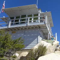
Tahquitz Peak Fire Lookout

After ascending San Jacinto we returned to Wellman Divide and then descended the Wellman Divide Trail and PCT to Saddle Junction. From Saddle Junction it is only a couple of (mostly uphill) miles to Tahquitz Peak. This Google Earth image shows my GPS track from Wellman Divide to Tahquitz Peak and back.

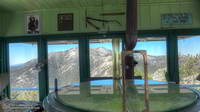
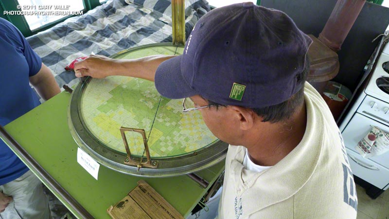
Osborne Fire Finder at the Tahquitz Peak Fire Lookout
Osborne Fire Finder

A dozen or so hikers were enjoying the warm sun and great weather at the lookout. As always, the fire lookout host was friendly and informative, answering questions about the lookout’s equipment and surrounding landmarks. Want to become a volunteer host? Check this page.

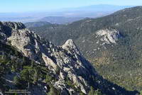
Tahquitz Rock and Suicide Rock rock climbing areas from the South Ridge Trail
Tahquitz & Suicide Rocks

My usual return route from Tahquitz Peak is to go back to Saddle Junction and then follow the Willow Springs Trail to Hidden Lake Divide. With the Willow Springs Trail closed due to the 2013 Mountain Fire it’s necessary to climb back up to Wellman Divide and then descend to the Tram from there. This adds about a mile and 800′ of gain to the usual route. Although we had descended it earlier in the day, the trail going up to Wellman Divide had a different feel to it, and the out and back wasn’t nearly as onerous as I thought it might be.

About an hour after topping out at Wellman Divide we were back at the Long Valley Ranger Station and not long after that on the Tram and headed down the mountain. I smiled as the decades-old recording in the tram car began, “You’ve had a great day…”

Some related posts: Summery San Jacinto; Smoky Tahquitz Peak, Room With a View, Mountain Weather, Hitting the (Big) Hills of Southern California

Hitting the (Big) Hills of Southern California


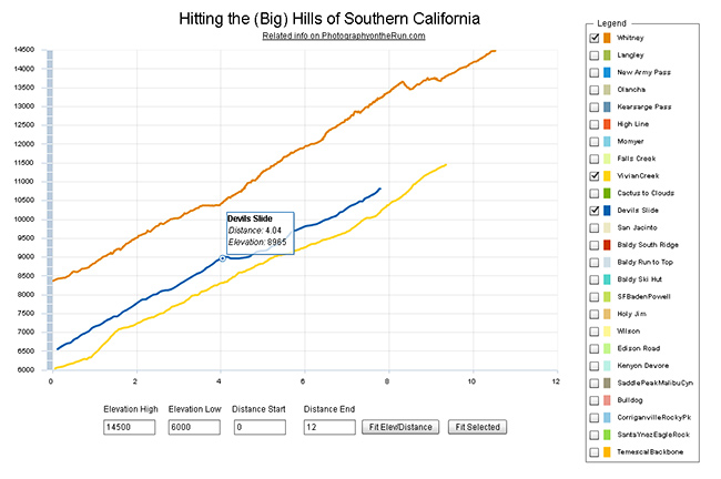
Comparison of Whitney (Trail), San Gorgonio (Vivian Creek) and San Jacinto (Devils Slide)

Updated November 12, 2014. Added Register Ridge on Mt. Baldy and the Siberia Creek Trail in Big Bear.

Southern California is noted for its foothills and mountains. It’s so hilly here that most trail runs have at least one good climb. Even if you aren’t a high mileage runner, the elevation gained on those hills can add up fast. So far this year SportTracks puts my cumulative elevation gain at about 320,000 feet.

I was curious to see how some of the “hills” in Southern California compare, so I wrote a Flash application that interactively displays the elevation profiles of a selection of SoCal ascents. Generally trails were picked that could be done in day from L.A. The selection includes some East Side Sierra ascents, routes up most of the major Southern California peaks, and some hills from some Southern California races.

The profiles and other stats are based on DEM corrected data from GPS tracks. All distances, elevations, elevation gains and elevation profiles are approximate. Elevations have been corrected and elevation gains (conservatively) calculated using SportTracks.

The Flash app is loading a lot of data, so it may take a while to load. The app is best viewed on a desktop, laptop, or tablet. It can’t be viewed on an iPad/iPhone unless a browser that supports Flash, such as Photon, is used. Here is the updated selection of elevation profiles and the selection from 2012. The “Fit Selected” button is used to fit the chart to the currently selected set of elevation profiles. The “Fit Elev/Distance” button is used to format the chart according to user specified elevations and distances.

In this selection of hills Cactus to Clouds is the longest (14.7 miles) and has the most altitude gain (10,812 feet). Register Ridge on Mt. Baldy has the steepest mile (1745 fpm) and is the steepest overall (1127 fpm). Mt. Whitney has the highest finishing elevation (14,505 feet).

Following are some additional details about each of the ascents, including the length of the climb, elevation gain, average gradient and steepest mile. The distance specified is just for climb described — not the entire run. The headings below are the shorthand name of the climb used in the legend of the app.

Whitney

Mt. Whitney via the trail from Whitney Portal.
Distance: 10.5 mi – Gain: 6657 ft – Avg Gradient: 632 fpm – Steepest Mile: 900 fpm @ mile 4.5

Requires permit. The 1991 Los Angeles Times story about Marty Hornick’s 2:08:30 ascent of Whitney via the Mountaineers Route mentions a 2:17 time via the trail. According to the China Lake Mountain Rescue Group’s Talus Pile December 2002, Issue # 126, Jason Lakey did the roundtrip via the Mountaineer’s Route in a record 3:10:07.

Related post: East Face Mt. Whitney, Tower Traverse

Langley

Mt. Langley via Army Pass from Horseshoe Meadow Cottonwood Lakes Trailhead.
Distance: 10.2 mi – Gain: 4161 ft – Avg Gradient: 408 fpm – Steepest Mile: 1275 fpm @ mile 8.8

Army Pass is often choked with snow. New Army Pass is used as an alternative. Last couple of miles is on use trails and depending on your route could involve a little scrambling.

Related post: Mt. Langley in a Day from L.A.

New Army Pass

New Army Pass from Horseshoe Meadow Cottonwood Lakes Trailhead.
Distance: 8.4 mi – Gain: 2409 ft – Avg Gradient: 274 fpm – Steepest Mile: 617 fpm @ mile 7.4

Related post: New Army Pass – Cottonwood Pass Loop

Olancha

Olancha Peak via the Sage Flat Trail and “cow driveway”.
Distance: 9.2 mi – Gain: 6213 ft – Avg Gradient: 676 fpm – Steepest Mile: 1437 fpm @ mile 8.2

Last mile or so to the summit is not on a trail and involves some scrambling up rocks.

Related post: Olancha Peak Sierra Panorama

Kearsarge Pass

Kearsarge Pass from Onion Valley.
Distance: 4.9 mi – Gain: 2610 ft – Avg Gradient: 531 fpm – Steepest Mile: 641 fpm @ mile 1.0

Various runs can be done from the pass.

Related post: Up and Over Kearsarge Pass

High Line

Mt. San Gorgonio via Momyer and San Bernardino Divide Trail.
Distance: 15.0 mi – Gain: 7146 ft – Avg Gradient: 478 fpm – Steepest Mile: 1119 fpm @ mile 4.0

Requires permit. Total distance starting/ending at Momyer is about 26 miles.

Related post: San Gorgonio High Line 2009

Momyer

The Momyer Trail to the San Bernardino Divide Trail.
Distance: 7.1 mi – Gain: 5023 ft – Avg Gradient: 707 fpm – Steepest Mile: 1119 fpm @ mile 4.0

Requires permit. Once up to the San Bernardino Divide Trail there is a choice of around ten peaks over 10,000′.

Related post: San Gorgonio High Line

Falls Creek

Mt. San Gorgonio via Momyer and Falls Creek Trails.
Distance: 15.0 mi – Gain: 6397 ft – Avg Gradient: 481 fpm – Steepest Mile: 872 fpm @ mile 1.7

Requires permit. Total distance starting/ending at Momyer is 24 miles.

Related post: San Gorgonio Mountain – Falls Creek Loop 2011

Vivian Creek

Mt. San Gorgonio via Vivian Creek Trail.
Distance: 9.4 mi – Gain: 5464 ft – Avg Gradient: 585 fpm – Steepest Mile: 920 fpm @ mile 7.7

Requires permit. This is the descent route for High Line and Falls Creek loops.

Cactus to Clouds

Mt. San Jacinto via the Skyline Trail, Round Valley Trail and San Jacinto Peak Trail.
Distance: 14.7 mi – Gain: 10812 ft – Avg Gradient: 736 fpm – Steepest Mile: 1499 fpm @ mile 7.3

Requires permit. The biggest hill in Southern California.

Devils Slide

Mt. San Jacinto from Humber Park via Devils Slide Trail, PCT and San Jacinto Peak Trail.
Distance: 7.8 mi – Gain: 4407 ft – Avg Gradient: 566 fpm – Steepest Mile: 716 fpm @ mile 2.9

Requires permit.

San Jacinto

Mt. San Jacinto from the Long Valley Tram Station via the Round Valley Trail and San Jacinto Peak Trail.
Distance: 5.4 mi – Gain: 2520 ft – Avg Gradient: 470 fpm – Steepest Mile: 709 fpm @ mile 4.4

Requires permit.

Related post: Summery San Jacinto, Smoky Tahquitz Peak

Baldy South Ridge

Mt. Baldy from the Village via Bear Canyon and South Ridge on the Old Mt. Baldy Trail.
Distance: 6.8 mi – Gain: 5811 ft – Avg Gradient: 850 fpm – Steepest Mile: 1273 fpm @ mile 2.1

Related post: Up & Down Mt. Baldy’s South Ridge

Baldy Run to the Top

Mt. Baldy from base of ski lift parking lot.
Distance: 6.9 mi – Gain: 3868 ft – Avg Gradient: 558 fpm – Steepest Mile: 799 fpm @ mile 4.9

Last 0.6 mi to summit is approximately 1090 fpm.

Related post: Mt. Baldy Run to the Top 2009

Baldy Ski Hut

Mt. Baldy from Manker Flat via the Baldy Bowl Trail — aka the Ski Hut Trail.
Distance: 4.4 mi – Gain: 3883 ft – Avg Gradient: 891 fpm – Steepest Mile: 1201 fpm @ mile 2.8

Related post: Back to Baldy

Baldy Register Ridge (New)

Mt. Baldy from Manker Flat via the Register Ridge Trail.
Distance: 3.5 mi – Gain: 3909 ft – Avg Gradient: 1127 fpm – Steepest Mile: 1745 fpm @ mile 0.9

SFBadenPowell

Mt. Baden-Powell from South Fork Campground via Manzanita Trail and PCT. Vincent Gap is at about mile 5.75.
Distance: 10.0 mi – Gain: 5074 ft – Avg Gradient: 510 fpm – Steepest Mile: 805 fpm @ mile 8.6

Part of a 23.5 mile loop from Islip Saddle

Related post: San Gabriel Mountains Running Adventure

Siberia Creek (New)

The Siberia Creek climb starts at Bear Creek and climbs to Forest Service Road 2N11 via the Siberia Creek Trail and a short segment of the Champion Lodgepole Trail. It is part of the Kodiak 100M and 50M courses.
Distance: 6.9 mi – Gain: 3008 ft – Avg Gradient: 435 fpm – Steepest Mile: 698 fpm @ mile 1.4

Related post: Kodiak 50 Mile 2014

Holy Jim

Holy Jim Trail from Trabuco Canyon to Santiago Peak. Was part of Twin Peaks 50K.
Distance: 8.0 mi – Gain: 3921 ft – Avg Gradient: 489 fpm – Steepest Mile: 691 fpm @ mile 5.3

Related post: Blue Skies and Sunshine for the 2010 Twin Peaks 50K & 50M Trail Runs

Wilson Trail

Mt. Wilson from Sierra Madre via the Mt. Wilson Trail. Orchard Camp is at about mile 3.5.
Distance: 7.1 mi – Gain: 4720 ft – Avg Gradient: 662 fpm – Steepest Mile: 925 fpm @ mile 4.0

Edison Road (In 06/08/2012 selection.)

Edison Road from the West Fork San Gabriel River to Angeles Crest Highway at Shortcut Saddle. Part of Mt. Disappointment 50K.
Distance: 5.5 mi – Gain: 2027 ft – Avg Gradient: 372 fpm – Steepest Mile: 520 fpm @ mile 3.3

Related post: Mt. Disappointment 50K 2011 Notes

Kenyon Devore

Gabrielino and Kenyon Devore Trails from West Fork to Mt. Wilson. Part of Mt. Disappointment 50K.
Distance: 4.9 mi – Gain: 2622 ft – Avg Gradient: 532 fpm – Steepest Mile: 801 fpm @ mile 1.9

Related post: Trail Work and Tree Rings

SaddlePeakMalibuCyn (In 06/08/2012 selection.)

Saddle Peak from Piuma Road near Malibu Canyon via the Backbone Trail.
Distance: 6.3 mi – Gain: 2350 ft – Avg Gradient: 372 fpm – Steepest Mile: 680 fpm @ mile 4.9

Related post: Bulldog Loop or Saddle Peak Out & Back?

Bulldog

Bulldog Lateral and Motorway from Crags Rd. to Castro Motorway. Part of Bulldog 25K/50K, XTERRA Malibu Creek Challenge and other races.
Distance: 3.4 mi – Gain: 1727 ft – Avg Gradient: 514 fpm – Steepest Mile: 732 fpm @ mile 2.0

Related post: Bulldog 50K 2010 Notes

CorriganvilleRockyPk (In 06/08/2012 selection.)

Corridor Trail from Corriganville to Rocky Peak Rd. Then Rocky Peak Rd to high point near Rocky Peak. Part of Bandit 15K/30K/50K. Does not include initial loop in Corriganville. 50K descends to Santa Susana Pass.
Distance: 3.3 mi – Gain: 1547 ft – Avg Gradient: 464 fpm – Steepest Mile: 836 fpm @ mile 0.6

Related post: Bandit 30K 2009

SantaYnezEagleRock (In 06/08/2012 selection.)

Eagle Rock from Vereda De La Montura via the Santa Ynez Canyon Trail, Musch Trail and East Topanga Fire Road.
Distance: 5.6 mi – Gain: 1292 ft – Avg Gradient: 230 fpm – Steepest Mile: 643 fpm @ mile 1.0

Related post: Clouds, Canyons and Wildflowers

TemescalBackbone (In 06/08/2012 selection.)

Temescal Canyon to the Backbone Trail Junction via Temescal Canyon and Temescal Ridge Trails.
Distance: 5.4 mi – Gain: 1709 ft – Avg Gradient: 318 fpm – Steepest Mile: 760 fpm @ mile 0.8

Related post: Will Rogers – Temescal Loop

Las Llajas (In 06/08/2012 selection.)

Las Llajas Canyon from near Evening Sky Drive to high point above oil field. Part of Bandit 30K/50K
Distance: 4.9 mi – Gain: 1418 ft – Avg Gradient: 290 fpm – Steepest Mile: 625 fpm @ mile 3.1

Related post: Bandit 50K 2011 Notes
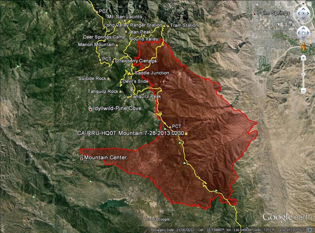
Mountain Fire 2013

Mountain Fire perimeter from GEOMAC timestamped 07/28/13 0230

Mountain Fire perimeter from GEOMAC timestamped 07/28/13 0230

Update Wednesday, July 31, 2013 7:00 a.m. As of 6:00 PM yesterday, Inciweb reported the Mountain Fire at 27,531 acres and 100% contained. The fire perimeter has been refined and updated.

Update Saturday, July 27, 2013 3:30 p.m. As of about 2:30 PM today, Inciweb reported the Mountain Fire at 27,531 acres and 98% contained. Full containment is expected by Tuesday, July 30, 2013. The fire perimeter has been refined and updated.

Update Thursday, July 25, 2013 7:00 a.m. As of 6:00 AM today, Inciweb reported the Mountain Fire at 27,531 acres and 92% contained. Full containment is expected by Friday, July 26, 2013. The fire perimeter has been refined and updated.

Update Wednesday, July 24, 2013 8:30 a.m. As of 6:00 AM today, Inciweb reported the Mountain Fire at 27,531 acres and 91% contained. The fire perimeter has been refined and updated.

Update Monday, July 22, 2013 1:15 p.m. Significant rain fell in the area of the Mountain Fire yesterday. The Mt. San Jacinto automated weather station located near Long Valley recorded 2.36 inches of rain. As of 6:00 PM yesterday (July 21), Inciweb reported the Mountain Fire was 68% contained. This morning’s AFMP MODIS fire dectections showed no new detections in the last 24 hours.

Here’s an interactive Cesium browser View the Mountain Fire perimeter from GEOMAC timestamped 07/28/13 0230. This is a 3D view that can be zoomed,rotated and tilted. Placemark locations are approximate. GPS tracks (yellow) of some of the area’s trails have been added. Requires Google Earth plugin.

Previous snapshots (most recent first):

Mountain Fire perimeter from GEOMAC timestamped 07/28/13 0230.

Mountain Fire perimeter from GEOMAC timestamped 07/24/13 1521.

Mountain Fire perimeter from GEOMAC timestamped 07/24/13 0128.

Mountain Fire perimeter from GEOMAC timestamped 07/22/13 2348.

Mountain Fire perimeter from GEOMAC timestamped 07/21/13 2211.

Mountain Fire perimeter from GEOMAC timestamped 07/21/13 0118.

Mountain Fire MODIS fire detections as of 07/21/13 1330 MDT with GEOMAC fire perimeter timestamped 07/21/13 0118.

Mountain Fire MODIS fire detections as of 07/20/13 1430 MDT with GEOMAC fire perimeter timestamped 07/18/13 1402.

Mountain Fire MODIS fire detections as of 07/19/13 1630 MDT with GEOMAC fire perimeter timestamped 07/18/13 1402.

Mountain Fire MODIS fire detections as of 07/19/13 1200 MDT with GEOMAC fire perimeter timestamped 07/18/13 1402.

Mountain Fire MODIS fire detections as of 07/19/13 0730 MDT with GEOMAC fire perimeter timestamped 07/18/13 0000.

Mountain Fire MODIS fire detections as of 07/18/13 2200 MDT with GEOMAC fire perimeter timestamped 07/18/13 0000.

Mountain Fire MODIS fire detections as of 07/18/13 1600 MDT with GEOMAC fire perimeter timestamped 07/18/13 0000.

Mountain Fire MODIS fire detections as of 07/18/13 1430 MDT with GEOMAC fire perimeter timestamped 07/18/13 0000.

MODIS Google Earth fire data is from the USDA Forest Service Remote Sensing Applications Center Active Fire Mapping Program web site. Fire perimeter is the most recently available from the GEOMAC web site at the time this post was updated.

The following additional information was included with the MODIS fire detections KML file:

This KML displays the MODIS fire detections at a spatial resolution of 1km for the past 6 hours, 6-12 hours, 12-24 hours and the previous 6 day period. Each 1km MODIS fire detection is depicted as a point representing the centroid of the 1km pixel where the fire is detected. The 1km footprint of the MODIS pixel for each detection is also displayed.

KML file generated by the USDA Forest Service Active Fire Mapping Program. Please see //activefiremaps.fs.fed.us for additional fire mapping products and information.

Disclaimer: Although these data have been used by the USDA Forest Service, the USDA Forest Service shall not be held liable for improper or incorrect use of the data described and/or contained herein. The information contained in these data is dynamic and is continually updated. This disclaimer applies both to individual use of the data and aggregate use with other data. The USDA Forest Service reserves the right to correct, update or modify this data and related materials without notification.

Summery San Jacinto, Smoky Tahquitz Peak

Running in the San Jacinto Wilderness, near Skunk Cabbage Meadow

It had been about four months since I’d been to the summit of Mt. San Jacinto. Last time there had been several feet of snow, and the summit had been an inhospitable place with frigid temperatures and buffeting winds. Not so today. Short sleeves and running shorts were the attire of the day, and the weather was more like Malibu Beach than the summit of a 10,000 foot peak.


I was running with Craig Kinard, a long-time backpacker, but relatively new convert to trail running. With the help of Team CrossFit Academy, Craig discovered he likes to run up mountains, and has done well in both the Baldy Run to the Top and Mt. Wilson trail races. Next month he’s planning to run his first ultra — the Mt. Disappointment 50K.

Today we were doing an approximately 20 mile course from Long Valley (8400′), near the top of the Palm Springs Tram, up to San Jacinto Peak (10,834′), then down to the historic Tahquitz Peak Fire Lookout (8,828′). From the Lookout we would return to the Tram by way of Hidden Lake Divide. Totaling about 4000′, the ups and downs would be good training for the 6200′ of elevation gain in this year’s Mt. Disappointment race.


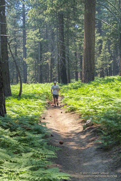
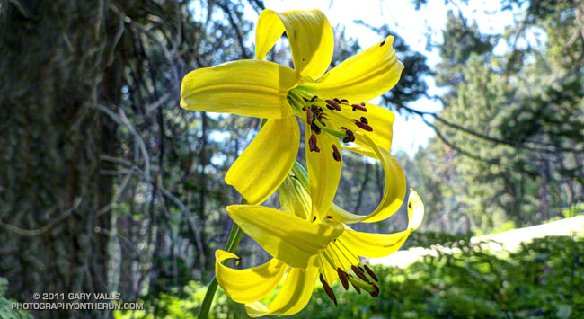
Winter snow translates to Summer water, and its beneficial effects could be seen in everything from the new growth on the chinquapin to the healthy green of the pines. Wellman Cienega was a green wonderland of ferns and corn lily, and near Skunk Cabbage Meadow bright yellow lemon lilies were sprinkled among the bracken and old growth Jeffrey pines. In places western azalea bloomed in profusion, its sweet fragrance mixing with the smells of damp earth and sun-warmed pine needles.


Smoke from the Eagle Fire remained trapped below a strong inversion most of the morning, and for a while views of Tahquitz Peak were crisp and clear. As temps warmed the inversion weakened and there was a flare-up on the Eagle Fire. By the time we reached Tahquitz Peak Lookout, a smoky haze had moved into the area.

At the fire lookout volunteer host Joe Mendoza described the history of the tower and demonstrated the use of the Osborne Fire Finder. Using an earlier sighting he plotted the location of the fire and showed us it was in the vicinity of Warner Hot Springs. He also showed us the “hot seat” used in lightning storms. Thanks Joe!

It was an outstanding run! Here’s a Cesium browser View of a GPS trace of the route, and an elevation profile generated in SportTracks.

Here are a few additional photographs:


Toro & Tahquitz Peaks


Near Miller Peak


Wellman Cienega


Corn Lily


Tahquitz Peak & Rock


Near Tahquitz Peak

Some related posts: Room with a View, Autumn Trail Running on Mt. San Jacinto, Mountain Weather

Mountain Weather

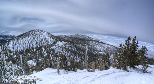
Orographic lift, waves, and turbulence over the San Jacinto Mountain Range

After last Sunday’s record-setting storm in Southern California, and the cool, unsettled weather during the week, we expected snow conditions on Mt. San Jacinto to be even better than on previous trips this March. But snow conditions — especially backcountry snow conditions — aren’t always what you expect. The new snow, maybe a foot of it, was as thick as wet concrete. If we’d had a little kiwi fruit flavoring, it would have been perfect for shave ice.

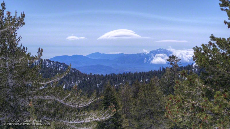
A mountain wave cloud near Toro Peak
A mountain wave cloud near Toro Peak.

Even if the snow wasn’t what we had hoped for, the day was extraordinary. Another weak front was moving into Southern California and the strong onshore flow ahead of the front was creating several kinds of interesting mountain weather phenomena — some common and some not so common.

Riding up the tram, we could see plumes of dust blowing across the desert floor east of Banning Pass, and a stack of lenticular clouds hovered over the mountains east of San Gorgonio Mountain. It was breezy at the upper tram station, and from the walkway descending to Long Valley, we could see rimed trees on the southeast side of San Jacinto Peak.

Video of sheets and filaments of turbulence-induced cloud on San Jacinto Peak.
Video of sheets and filaments of turbulence-induced cloud.

We skied up a beautiful untracked drainage south of the Round Valley trail, and eventually worked our way over to Long Valley Creek and then to Tamarack Valley. We were almost to the top of the steep step above Tamarack Valley, and had paused for a moment to look around. There was a distinctive wave cloud to the southeast, and the lower cloud deck was beginning to engulf Toro Peak (8716′). I turned to continue up the slope, and as I looked up, the first of a series of tumbling and twining filaments of gossamer cloud swept past in the turbulent west-northwest flow (video).

Six months ago, also before the passage of a cold front, I’d seen similar clouds on Boney Mountain, in the Santa Monica Mountains. In that case and here on San Jacinto, a moist layer in a stably stratified westerly flow was being lifted over a mountain range. Depending on whether the flow remained laminar, or became transitional or turbulent; a wave cloud, transient wave cloud, or these turbulent thin sheets of cloud might form. In each case the atmosphere was becoming more moist and the clouds were precursors to the formation of a more widespread and persistent cloud layer.

Cygnus Loop Supernova Shockwave

These vaporous, turbulence-induced clouds bear a striking resemblance to interstellar molecular clouds. Both appear to occur in a high-Reynolds-number regime, and each appears to consist of a cohesive, thin sheet of condensate that can be stretched, sheared, undulated and torn. As in the case of its interstellar counterpart, when viewed edgewise, the clouds look like they are comprised of thin, web-like filaments.

The title photo was taken a little below the summit, after ascending the peak. It’s a view to the south, past Jean Peak (10,670′) and Marion Mountain (10,362′), and shows the terrain induced uplift, waves, and turbulence over the San Jacinto mountain range. The flow is from the right to left.