It had rained another inch overnight, and my shoes were soaked from the wet grass along the trail. Seeking some relief from the 20 mph northwest wind, I descended a single-track trail to an old paved road east of the ranch house on Lasky Mesa.
Motivated more by staying out of the wind than anything else, I did two sets of hill repeats on different sections of the road. Then, on tired legs, I jogged up to Lasky Mesa and was greeted by an Arctic blast. The temperature had dropped to the mid-40s, and the wind was blowing a steady 20 mph, gusting to around 30 mph. I didn’t need a wind chill chart to tell me the effective temperature was in the 30s.
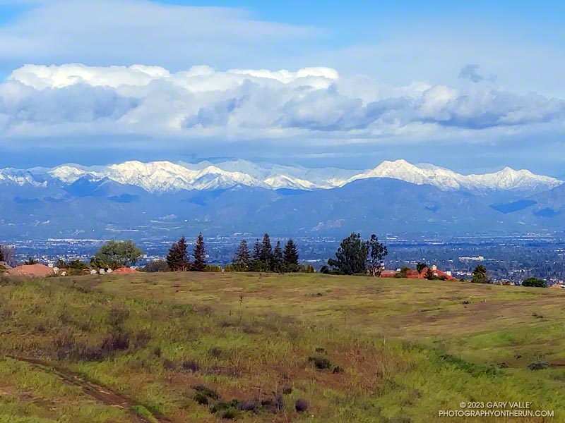
I was so focused on dealing with the cold I wasn’t paying much attention to my surroundings. Deciding to do one more hill, I rounded a corner, and the brilliantly sunlit, snow-covered San Gabriel Mountains came into full view. It was just jaw-dropping!
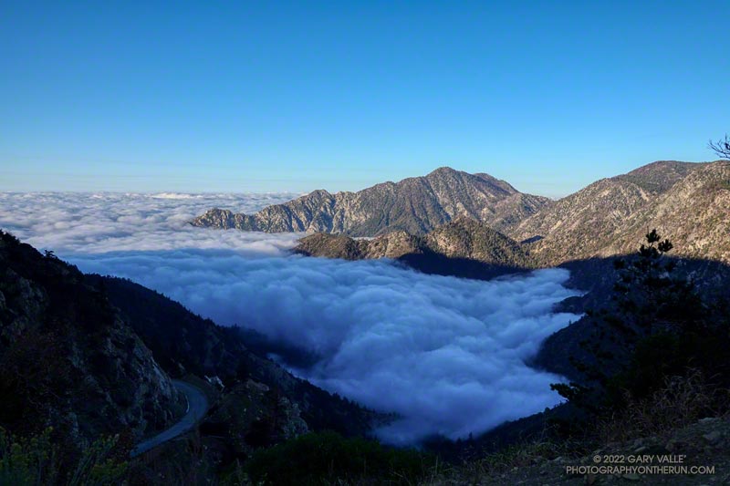
After weeks of dealing with one heatwave after another it was a strange sensation. I was cold. I had on an extra shirt and sleeves, but the slopes of Mt. Islip were deep in shadow and the wind was gusting to 20 mph. The thermometer on my pack read 41 degrees, but the “feels like” temperature had to be in the 30s.
I was in the first mile of an out and back trail run from Islip Saddle to Mt. Baden-Powell. A San Gabriels classic, the route gains (and loses) about 3800′ over 16.5 miles on the PCT.
This morning I was doing the basic out and back, but Mt. Hawkins, Throop Peak and Mt. Burnham are easy peaks that can done along the way. Mt Islip is is a bit more of a detour, but can also be added to the route.
Mt. Baldy and environs from the PCT, between Mt. Hawkins and Throop Peak.
It’s also possible to start the out and back at the Windy Gap Trailhead (5836′) in the Crystal Lake Recreation Area. The distance to Baden-Powell is about the same, but the lower trailhead adds about 800′ of gain.
As I chugged up one of the initial steep sections, I thought about what it must have been like for this year’s participants in the AC100. This year, because the AC100 was an out and back from Wrightwood to Shortcut Saddle, runners got to do this tough segment after running more than 75 miles!
Here is an interactive, 3D terrain view of the out and back from Islip Saddle to Mt. Baden-Powell. The map can be zoomed, tilted, rotated, and panned using the navigation control on the right. Track and placename locations are approximate and subject to errors. Poor weather, and other conditions may make this route unsuitable for this activity.
As long as I was in the neighborhood, I also wanted to do the short side trip to Mt. Waterman’s summit and see how it fared in the Bobcat Fire. (I’d skipped that side trip on the most recent Three Points Loop run.)
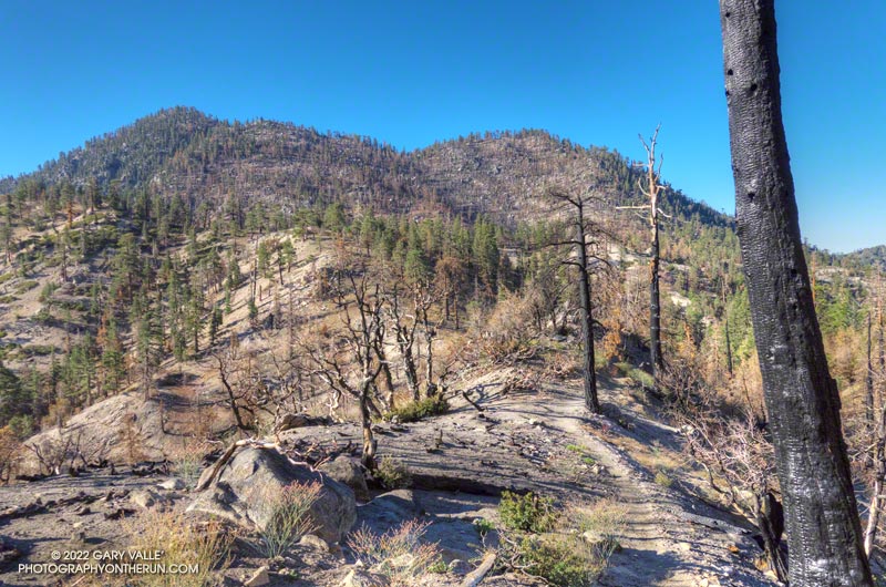
My general impression of Bobcat Fire impacts in the Mt. Waterman – Twin Peaks area is of varying severity. In some areas nearly all the trees were killed, while in other the trees are virtually untouched. Perhaps the most common scenario is a mix of burned, partially burned, and unburned trees.
Overall, I was surprised to find that there were so few fallen trees on the Twin Peaks Trail. I think I had to step over one log, go around another, and a couple others had been cleared from the trail. The most serious obstacle was some Poodle-dog bush completely blocking the trail. Poodle-dog bush causes dermatitis in many people.
There was little damage from the heavy December storms. The elevation ranges from about 6540′ at the low point of the Twin Peaks Trail, up to 7761′ on Twin Peaks East, so much of the precipitation must have fallen as snow.
A couple of trees were burned on the perimeter of Twin Peaks East’s flat summit, but the tops of both Twin Peaks East and Mt. Waterman were pleasant places to be.
Most of the time, when I do a trail run in the San Gabriel Mountains, it starts from a trailhead along or near Highway 2 — Angeles Crest Highway.
There are many fine point-to-point and out-and-back runs along Hwy 2, but not very many loops. Of the handful of loops that are currently open and accessible, two start and end at Three Points.
One is the Three Points – Mt. Hillyer Loop and the other is the Three Points Loop around Mt. Waterman. The Three Points – Mt. Hillyer Loop was not affected by the Bobcat Fire and is described in this April 2021 post.
On the other hand, significant parts of the Three Points Loop around Mt. Waterman were burned in Bobcat Fire, and the trails that comprise the loop were closed until April of this year (2022).
A large area on Mt. Waterman was burned by both the Bobcat and Station Fires. This can be seen in this interactive, 3D terrain view of the area. The Bobcat Fire is yellow and the Station Fire is red. Where they overlap near Mt. Waterman is orange.
The Three Points Loop is the loop I do most often in the San Gabriel Mountains. The basic loop, not including the side trip to the summit of Mt. Waterman, is about 20 miles long and has about 4000′ of gain/loss. The terrain and trails are varied and interesting, and Buckhorn Campground is conveniently placed near the halfway point of the course. Water is USUALLY — BUT NOT ALWAYS — available when the campground is open.
Doing the side trip to Mt. Waterman adds about 1.7 miles and 350′ of elevation gain. The side trip to Cooper Canyon Falls is even shorter — only about a quarter-mile.
Fire perimeters and burn severity maps don’t tell the whole story, and I’ve been curious to see how the area was affected by the Bobcat Fire; how the Station Fire recovery is continuing; and how the area burned by both fires has fared.
Here is an interactive, 3D terrain view of the Three Points Loop. The map can be zoomed, tilted, rotated, and panned using the navigation control on the right. Track and placename locations are approximate and subject to errors. Poor weather and other conditions may make this route unsuitable for this activity.
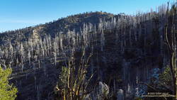
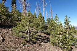
Tree regrowth along the PCT about five miles east of Islip Saddle
The Curve Fire started on Labor Day Weekend 2002, along Highway 39 in the San Gabriel Mountains. Between Mt. Islip and Throop Peak, the fire burned over the crest and down to Angeles Crest Highway. Between Throop Peak and Mt. Baden-Powell, the fire generally burned up to, but did not breach the crest.
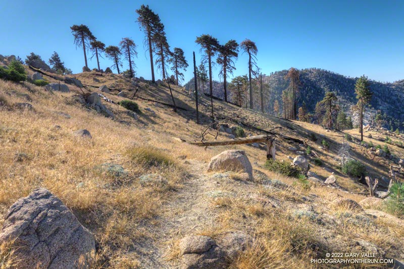
Dead trees on a ridge west of Mt. Hawkins that were burned in the 2002 Curve Fire
The Curve Fire killed many trees, including some large, old-growth trees. The most common species along the trail between Mt. Islip and Throop Peak are white fir, Jeffrey pine, sugar pine, and lodgepole pine. Incense cedar also grows in the area, and limber pine is found on and to the east of Throop Peak. Here is a cross-section of a tree along the PCT about 3.0 miles from Islip Saddle. It is representative of the older trees killed in the Curve Fire.
Prior to the Curve Fire, the FRAP geodatabase of California fires has no record of a large fire that burned along the crest of the San Gabriels between Mt. Islip and Mt. Baden-Powell. The FRAP record extends back to the early 1900s, when the San Gabriel Timberland Reserve became Angeles National Forest. A study of mercury levels in Crystal Lake and newspaper accounts suggest the possibility that a large fire occurred in this area in 1878, or about 124 years before the Curve Fire.
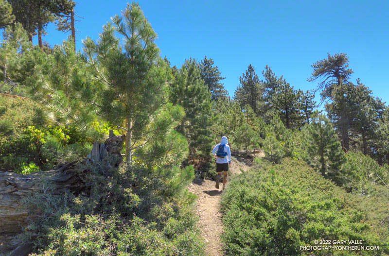
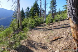
I’ve run and hiked the PCT between Islip Saddle and Mt. Baden-Powell for many years, so have had the opportunity to follow the regrowth of conifers where the Curve Fire burned over the crest. Studying conifer regrowth in this area can provide insights into regrowth in the 2009 Station Fire and 2020 Bobcat Fire burn areas, and in areas burned by more than one of these fires.
This area of young trees is on a south-facing slope, just west of Throop Peak, about 5.1 miles east of Islip Saddle on the PCT. The elevation is about 8900 ft. Because of its aspect, the new trees are taller than in the other areas photographed. Here’s what this area looked like in May 2012, June 2016, and July 2022.
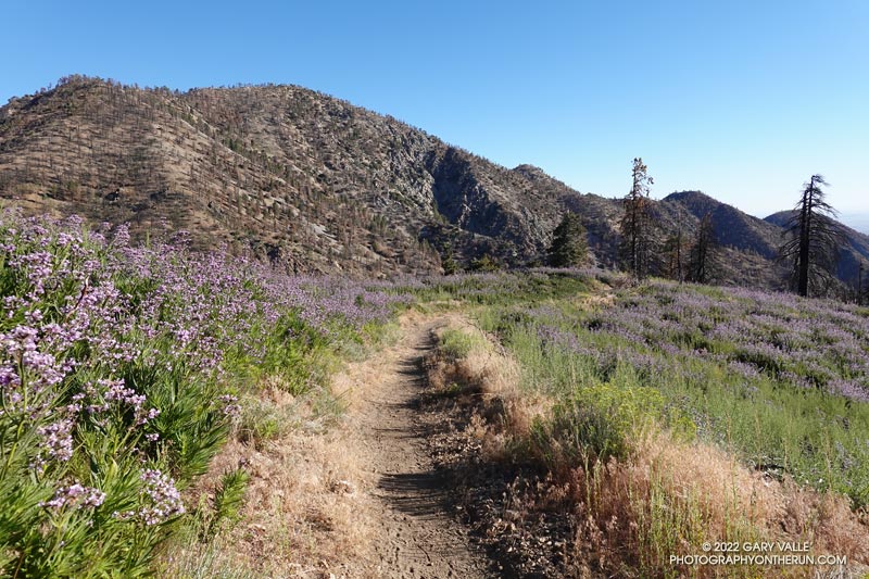
Poodle-dog Bush along the Pacific Crest Trail near Islip Saddle with Mt. Williamson in the background.
Nope, my eyes weren’t deceiving me, the hiker was carrying his full-size poodle up the trail.
I was running down the PCT, east of Islip Saddle, after a run/hike to Mt. Hawkins and Throop Peak. I’m guessing the hiker was carrying his dog to keep it out of the Poodle-dog Bush on both sides of the trail.
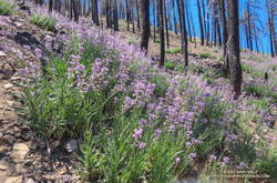
Poodle-dog bush along the PCT above Islip Saddle
Poodle-dog Bush (Eriodictyon parryi) is a fire-follower that can cause severe dermatitis in some people. In this case the plants sprouted following the 2020 Bobcat Fire.
The last big outbreak of Poodle-dog Bush followed the 2009 Station Fire. At that time many people were unfamiliar with its potential effects, and were caught off-guard.
The plant can get you in a couple of ways — the plant’s resin can affect sensitized people in a manner similar to poison oak, and the plant’s numerous hairs can break off and irritate the skin.