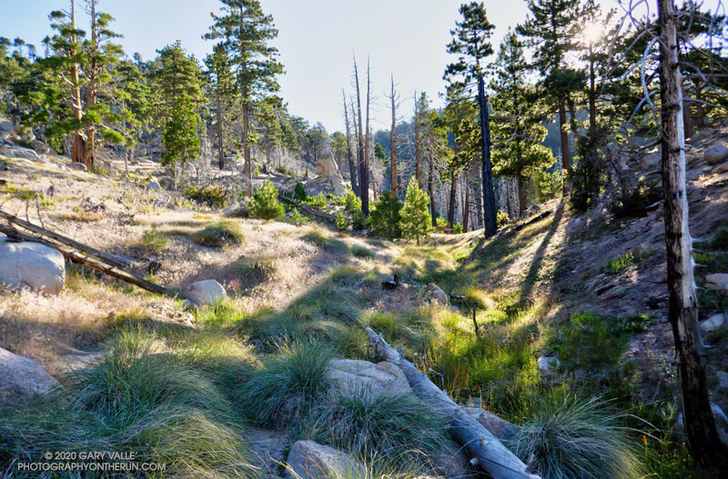
Approaching Waterman Meadow on the Three Points – Mt. Waterman Trail
You know what they say about making assumptions. Did the Three Points loop around Mt. Waterman today (July 25), and assumed that water would be available at Buckhorn Campground. In a normal summer that would be a reasonable assumption, but this has been anything but a normal summer.
Running down through the campground, I thought it was strange that many of the spaces were empty. Following the signs that said, “Day Use Parking,” and then “Burkhart Trail,” I stopped at a spigot across from some restrooms.
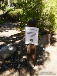
Routine water tests were pending.
Surprise, surprise! The stapled-on Forest Service sign said, “Non-potable water. Please boil water for a minimum of 5 minutes before using.”
Later, I talked to a ranger and learned that the campground had just reopened on Friday! He said routine tests on the water system had to be completed before the water could be deemed potable.
So I had a choice to make. I was doing the loop counterclockwise, which put Buckhorn at about mile 9 of a 20-mile loop. The second half of the loop — on the PCT — can bake on a hot day, with the climb out of Cooper Canyon being especially blistering.
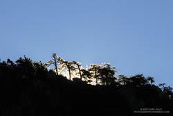
Morning sun crests a ridge on Waterman Mountain.
So far, the run had gone well. The Mt. Waterman Trail between Three Points and the turn off to Twin Peaks had been in excellent shape. No trees had blocked the trail, and the wildflowers and ferns at Waterman Meadow had been extraordinary. Like last year, a rejuvenated spring about 0.5 mile west of the Twin Peaks junction had water. (Not aware of the situation at Buckhorn, I didn’t top off my water.)
As usual, the run down the Mt. Waterman Trail to Highway 2 was excellent. A lot of people were enjoying the hike to the peak, but no more than is typical for that trail in the summertime.
Which brings me back to Buckhorn and my water problem. I could have shortcut the loop by skipping Cooper Canyon and running directly to Cloudburst Summit on Highway 2. That would have shortened the loop by 5 miles. But the day wasn’t super-hot, and there were several places where water could be used for cooling — even if I couldn’t drink it.
Reconfirming how much water I had left, I squeezed the Camelbak(TM) in my pack, and then started running down the Burkhart Trail into Cooper Canyon.
By maintaining a comfortable pace, and using seeps for cooling, my water lasted until I was within sight of the Three Points parking lot. This probably wouldn’t have been the case on a hot day.
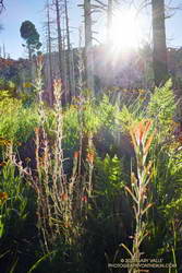
While doing the Bulldog Loop earlier this year, I encountered an enthusiastic hiker who commented, “Aren’t the wildflowers amazing?”
He added, “There are so many, uh… What’s it called? You know, the one that smells like maple syrup.”
“Do you mean Everlasting?” I asked.
“Yea, that’s it! California Everlasting,” he exclaimed.
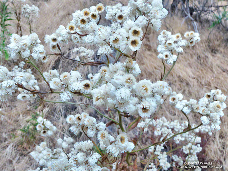
That’s what people remember about California Everlasting — the leaves smell like maple syrup.
The somewhat nondescript plant is especially abundant this year.
As suggested by its name, California Everlasting (Pseudognaphalium californicum) can be found along trails in Southern California chaparral and coastal sage-scrub just about any month of the year.
The plant looks like it is blooming in the title photo, but each “petal” is a botanical structure called a phyllary. The phyllaries form a protective covering around a disc of tiny flowers as they develop. Here is a closer view.
The plant dries out in the Summer, but the flower-like structures often remain – an everlasting dried flower arrangement.
The photos are from this morning’s run to Calabasas Peak on the Secret Trail.
Flower stalks of bleeding heart on the Chamberlain segment of the Backbone Trail
After climbing the western ridge route on Boney Mountain and scrambling over Tri Peaks, I was trying to run down the Chamberlain segment of the Backbone Trail. Usually one of my favorite downhills, the trail was so glutted with the flower stalks of bleeding heart, it made running difficult. Here’s a video snapshot of one short section of trail.
During this second Spring following the Woolsey Fire, bleeding heart has become a predominant fire follower in the Boney Mountain Wilderness. Its rampant growth is reminiscent of the explosion of Poodle-dog bush in the San Gabriel Mountains the second Spring following the 2009 Station Fire.
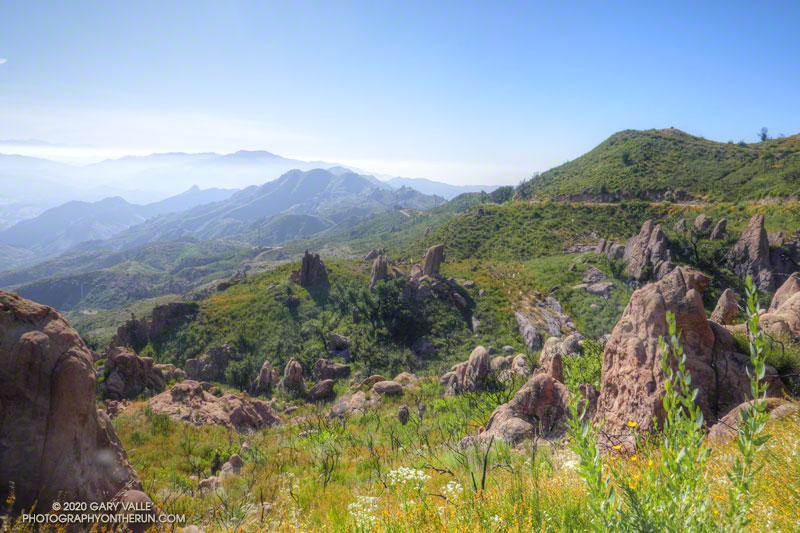
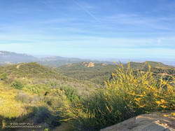
View east of the Santa Monica Mountains from near the top of the Bulldog fire road.
With the reopening of trails in the Santa Monica Mountains, my list of “must do” trails is impossibly long. Today, I headed over to Malibu Creek State Park to do a variation of the popular Bulldog Loop, and catch-up on what was happening in the Park as it recovers from the Woolsey Fire.
The route I was running starts at the Cistern Trail trailhead on Mulholland and descends to Crags Road using the Lookout and Cage Creek Trails. After a side trip on the Forest Trail to see the coast redwoods, it continues counterclockwise around the regular Bulldog Loop. Here’s an interactive, 3D view of the approximately 17-mile variation of the Bulldog Loop.
Crossing Malibu Creek
Summer 2022 Update. A seasonal bridge has been installed across Malibu Creek at the site of the original bridge. The bridge is removed when there is a threat of flooding on Malibu Creek. This is typically during the rainy season.
As I ran along Crags Road toward the M*A*S*H site, I wondered how much water would be in Malibu Creek, and if the fallen tree used to cross the creek would still be there.
Washed-out footbridge on Malibu Creek
Since February 2019, hikers, runners, and riders doing the Bulldog Loop or headed to the M*A*S*H site have had to either get their feet wet or use a fallen tree to cross Malibu Creek. The concrete slab bridge is still there, but the stream now flows around the bridge, rendering it useless.
The bridge survived a canyon-wide flood in mid-February 2017. But two years later, and just 11 weeks after the Woolsey Fire, sediment-laden runoff from burned hillsides clogged the drainage pipes embedded in the bridge’s concrete slab. With nowhere to go, the stream simply circumvented the structure.
Nearly to the bridge, I turned right off of Crags Road and followed the well-trodden path along the creek for about 70 yards. The downed tree had not washed away. Not wanting to take an early morning bath, I carefully worked across the logs and limbs and then rejoined the Crags Road Trail, near a coast redwood.
Checking on the Malibu Creek State Park Redwoods
Whenever I do the Bulldog Loop, I usually stop by the Forest Trail and see how the 100+ year-old coast redwoods are doing. Several of the 16 or so redwoods were killed by the 2011-2015 drought, and virtually all the trees were scorched in the Woolsey fire.
New growth on a young redwood burned in the Woolsey Fire
I’d last checked on the redwoods at Christmas and had been encouraged by the condition of the remaining trees. In Los Angeles, three of the past four rain years have recorded average or above-average rainfall. This seems to have really helped the surviving redwoods.
There are five or six trees that are doing well. They’ve added a lot of new foliage and look healthy. I was excited to see that a young, naturally-germinated redwood was thriving. It was burned in the Woolsey Fire and lost most of its foliage.
Leaving the redwoods behind, I continued toward the M*A*S*H site and then up the Bulldog climb.
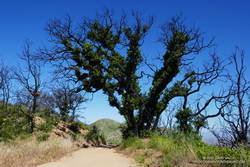
As I worked up the Bulldog fire road, I marveled at the number of live oaks sprouting new foliage on their burned trunks and limbs. On Mesa Peak Mtwy fire road, there is a grove of live oaks that used to provide welcome relief from the blazing-hot summer sun. On the crest of a ridge, the trees must have been fully-engulfed in fire when burned during Woolsey Fire. None the less, the trees are recovering. Compare this December 2018 photo of one of the larger live oaks, to what it looks like today. Incredible!
Digger Bees
Cruising along Mesa Peak Mtwy fire road, I took an auditory double-take. What the heck was all the buzzing around me? That’s when I realized the loud, resonate buzz was from thousands and thousands of bees. I’d just run into a huge aggregation of digger bees.
Digger bees along Mesa Peak Mtwy fire road
I’ve encountered them before. Even though the males (reportedly) don’t have a stinger and the females (reportedly) aren’t usually aggressive, it was a little unnerving walking through so many active bees. Here’s a video snapshot of the digger bees on Mesa Peak fire road.
Digger bees are not social in the same way as honeybees. Female digger bees build their individual brood cells in a communal area to efficiently reproduce. According to behavioral ecologist John Alcock, the males emerge slightly before the females and then fly low over the area, searching for females that are about to emerge. Using their antennae, the males can find the females in a burrow, before they emerge, gaining a competitive edge. For more info, see the article Desert Diggers, in Arizona State University School of Life Sciences’ Ask A Biologist web site.
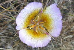
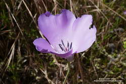
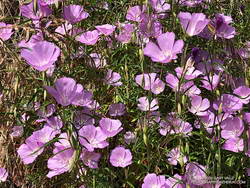
Splendid Mariposa and Other Wildflowers
Splendid mariposa lily
At first I ran past it. I was descending the Tapia Spur Trail and nearly to the gravel parking lot in Malibu Creek State Park when a flash of purple caught my eye. My thought was that it was a solitary farewell-to-spring (Clarkia). But something didn’t seem right, and it would be unusual to see just one farewell-to-spring. So I went back to take a look, and it turned out to be a splendid mariposa lily (Calochortus splendens). Although it is common in areas south of Los Angeles, it is the first I have photographed in the Santa Monica Mountains. This one was not quite so splendid as it might have been since a beetle had been feasting on its petals.
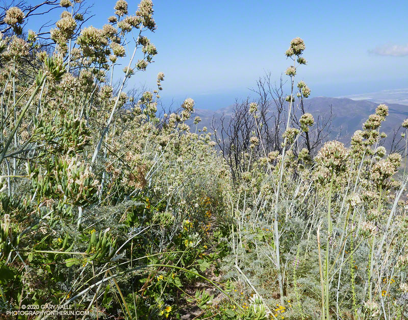
On recent weekends I’ve enjoyed running some of the less-used trails in Angeles National Forest. With trails reopening in the Santa Monica Mountains, this weekend I decided to do an old favorite — the out and back run from the Top of Reseda to Trippet Ranch.
Overgrown path to the top of Temescal Peak.
Even with an early start, more cars than usual were parked at Marvin Braude Mulholland Gateway Park. After hiking up the hill to the trailhead, I took the single-track connector to dirt Mulholland, and then ran a quarter-mile west and turned left (south) onto Fire Road #30.
The fire road starts with a warm-up downhill and then over about 1.5 miles ascends to the Hub, ending the stretch with a strenuous hill. The distance from the trailhead to the Hub by this route is about 2.5 miles. (On May 17, the pit toilet at the Hub was closed.)
View toward Eagle Rock from Temescal Peak
At the Hub, I took a quick detour over to Temescal Peak, the little peak with a big view. The path to its summit is on the south side of the peak. It takes off from the Rogers Road segment of the Backbone Trail, just east of Temescal Ridge Fire Road. Usually a well-defined path, today it was totally overgrown with monkeyflower and deerweed. The morning was a bit hazy, but there were still good views toward Eagle Rock, the Hub, and other areas of the Santa Monica Mountains.
The side trip to Temescal Peak added about 1.6 miles to the run. After returning to the Hub, I turned left onto Eagle Springs Fire Road and continued (mostly downhill) to Trippet Ranch.
Farewell-to-Spring along the Garapito Trail
The return from Trippet Ranch was mainly on single-track trails. There were maybe a dozen hikers on the Musch Trail and a couple of hikers on each of the Garapito and Bent Arrow Trails. I had my InknBurn mask handy for when I passed others on the trail. As might be expected, the trails were a little overgrown. (On May 17, water was available from the spigot at Musch Camp.)
Right from the start of the run, it was evident that several species of wildflowers were blooming in a big way. Some of the most prolific were monkeyflower, yarrow, deerweed, and canyon sunflower. There were several large patches of farewell-to-spring along the Garapito Trail. Plus, there was a trickle of water in Garapito Creek.
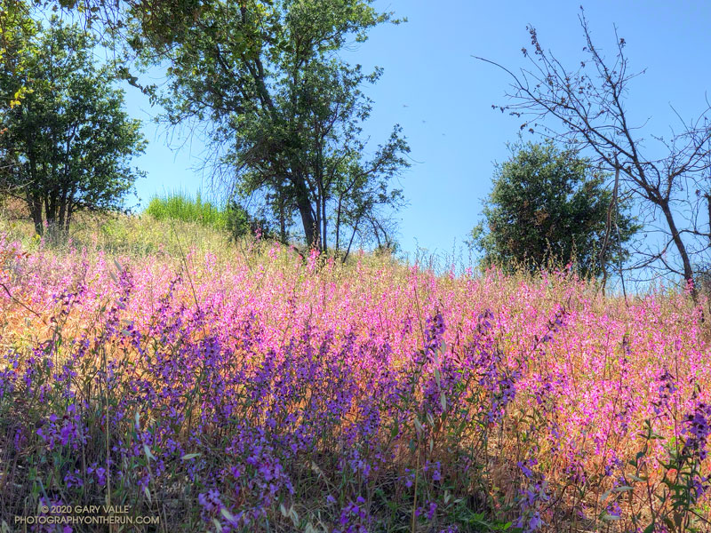
Over many years of running in Upper Las Virgenes Canyon Open Space Preserve (Ahmanson Ranch), I’ve noticed that the height of Elegant Clarkia is closely related to the amount of Spring rainfall. During some years of our most recent drought, the plants were short and scarce.
Spring 2020 was particularly wet in the Los Angeles area. Downtown Los Angeles (USC) recorded 179% of normal rainfall in March, and 332% in April. This was the wettest March and April in Los Angeles since 1992.
This year’s bloom of Elegant Clarkia is the most profuse I’ve seen in Upper Las Virgenes Canyon Open Space Preserve. Look for Elegant Clarkia along the Lasky Mesa Trail and along the Mary Wiesbrock Loop Trail on the north side of Lasky Mesa.
Another Clarkia currently blooming at Ahmanson Ranch is Purple Clarkia (Clarkia purpurea). Look for it along East Las Virgenes Canyon Road/Trail.