Category Archives: backbone trail

Not So Busy Sandstone Peak

Boney Mountain area peaks from the top of Sandstone Peak.

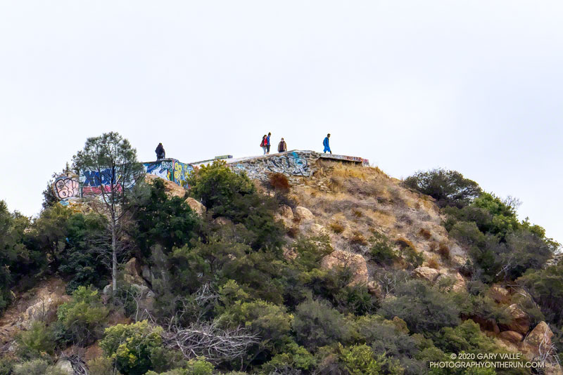
With the closure of Los Padres, Angeles, San Bernardino, and Cleveland National Forests until Thursday, I did not expect to find the summit of the highest peak in the Santa Monica Mountains empty. Even if it was by happenstance, I’ve rarely found the summit of Sandstone unoccupied on a Saturday or Sunday morning.

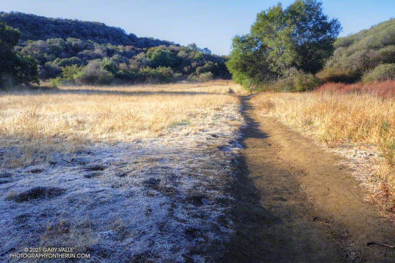
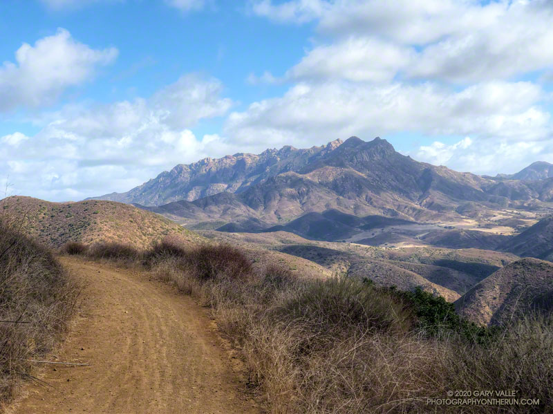
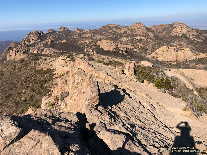
Like last weekend’s run, this morning’s trail run started at the Wendy Drive Trailhead on Potrero Road in Newbury Park. But today’s route had a lot more elevation gain, and some steep scrambling up the rocks of Boney Mountain’s Western Ridge. It’s an adventurous way to do Boney Mountain, Tri Peaks, and Sandstone Peak, and get in some excellent running on a very scenic stretch of the Backbone Trail.

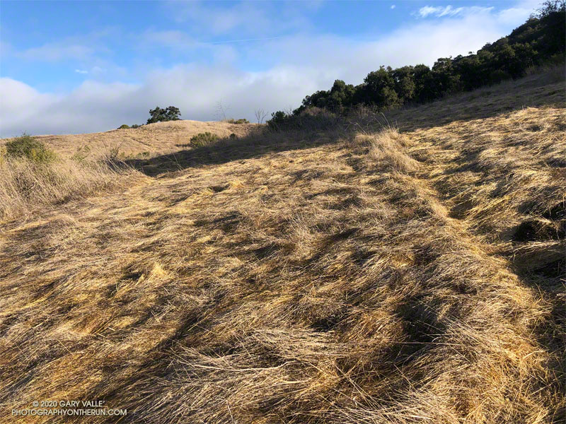
Overall, the route was in the best shape I’ve seen since the 2018 Woolsey Fire. The path that works up the north side of Tri Peaks and around the east side of its summit blocks was relatively clear. Following trailwork by the Santa Monica Mountains Trails Council, the Chamberlain Trail segment of the Backbone Trail was once again an enjoyable downhill run.

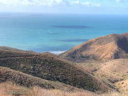
Here’s an interactive, 3D terrain view of a GPS trace of my usual route (yellow) to Sandstone Peak from Wendy Drive via Boney Mountain’s Western Ridge, and return via Big Sycamore Canyon. A GPS track of the Cabin trail is also shown. Variations of the route include doing the Mishe Mokwa loop after climbing Sandstone Peak; and returning to Sycamore Canyon via Serrano Valley/Canyon instead of Blue Canyon.

Some related posts: Sandstone Peak from Wendy Drive, Over Boney Mountain to Sandstone Peak and Serrano Valley, An End of Year Boney Mountain Adventure, Too Many Flowers on the Chamberlain Trail

Musch Meadow Frost

Frost along the Backbone Trail at Musch Meadow

As I approached Musch Camp, a scrub jay flew from a trailside faucet and into a nearby eucalyptus. There had been a little rain the day before, but the birds at the closed camp were still thirsty. Less than a quarter-inch of rain had fallen, and nearby creeks were still dry.

Melting frost
Melting frost “steaming” at Musch Meadow

I was doing a run from the “Top of Reseda,” and on a warmer day would have topped off my water bottle at the camp. I stopped at the faucet and briefly turned on the spigot. Maybe that would make it easier for the jay.

Leaving the camp behind, I continued south on the Backbone Trail, across frost-covered Musch Meadow. Early morning sun had just reached the meadow, and water vapor from the melting frost steamed in the cold air.

In another mile I reached the Trippet Ranch trailhead, and then begin the six mile run back to the Valley. At several points on the run there had been wintry views of the local mountains. On the way back the best view of the snowy mountains was from the Hub, where Mt. Baldy could be seen gleaming white in the morning sun.

Some related posts: Garapito Trail Runs, Musch Trail Mule Deer, Musch Trail Morning

A Sandstone Mammoth and a Spiral Labyrinth on the Bulldog Loop

A natural sculpture of a sandstone mammoth on the Backbone Trail

Updated June 26, 2023. The spiral has been periodically removed and rebuilt over the years. Google Earth historical imagery shows that it was removed sometime between March 2021 and February 2022. As of June 25, 2023, it had not yet been rebuilt.

Instead of struggling to escape a tar pit, this “mammoth” seems to have been caught up in 25-30 million-year-old sandstone.

The beast can be seen along the Backbone Trail, east of the Corral Canyon Trailhead. When running/hiking/riding east from the trailhead, the trail climbs over two steep steps and up to gap in the rock. In the photo above, the gap is on the left and the mammoth figure is on the right. From the gap, the trail descends a rock corridor to Mesa Peak fire road.

A closer look at the mammoth reveals that it is pockmarked and there are rocks embedded in the sandstone. The embedded rocks are cobble from an ancient river and the pockmarks are where rounded rocks have fallen out of the eroding sandstone.

Spiral labyrinth constructed of ancient stream cobble along the Backbone Trail
Spiral labyrinth along the Backbone Trail

Stream cobble that has eroded out of sandstone formations in this area has been used to construct a spiral labyrinth on the north side of Mesa Peak Fire Road. The cobble was tumbled and smoothed by streams that drained a range much older than the Santa Monica Mountains.

The title photo is from this morning’s run of the Bulldog Loop.

Some related posts: Moon and Sycamores, Malibu Creek State Park; Bulldog Loop Near Corral Canyon

Trippet Ranch Oak Grassland

Trippet Ranch oak grassland

Taken on today’s trail run from the “Top of Reseda” to Trippet Ranch and back.

Here’s a Cesium 3D interactive view of a GPS track of my usual route. Today I did the Garapito and Musch Trails on the way out, then ran the fire roads on the way back.

Some related posts: The Heavenly Ranch in the Hills, Garapito Trail Runs

A Windy Run, Walk, Ride, for Wildlife Research

Boney Mountain and Serrano Valley from Overlook Fire Road
Boney Mountain and Serrano Valley from Overlook Fire Road.

The Overlook Fire Road in Pt. Mugu State Park was nearly empty. I’d seen only two hikers between the top of the Fireline Trail and the top of the Wood Canyon Vista Trail. Maybe it was the wind. There had been 20-25 mph wind gusts much of the morning. Along the ridgelines, the gusts were even stronger.

Run, Walk, Ride 2020

I’d picked Pt. Mugu State Park to do a run in support of the Santa Monica Mountains Fund’s Run, Walk, Ride, for Wildlife Research. Many mountain lions have included Pt. Mugu State Park in their home range, including P-1, the patriarch of the mountain lions in the Santa Monica Mountains study.

According to the NPS website, the Santa Monica Mountains National Recreation Area is the world’s largest urban national park. Wildlife in the Park is affected by issues resulting from the proximity of urban and wild areas. Among the problems are poisoning from anticoagulant rodenticides, limited genetic diversity, and vehicular deaths. Only by studying Park wildlife can we better understand and manage these and other issues.

Because water is usually available at several spots in Sycamore Canyon, it’s a great place to do a self-supported ultra-length trail run.

A very windy Pacific and the Ray Miller segment of the Backbone Trail
A very windy Pacific

So far, today’s run had taken me from Wendy Drive in Newbury Park to Serrano Valley via the Old Boney Trail. I’d circled past the old ranch in Serrano Valley and then descended the Serrano Canyon Trail to Sycamore Canyon. A short jog south in Sycamore Canyon put me at the bottom of the Fireline Trail, which I’d followed up to the Overlook fire road.

Next up was a scenic loop in La Jolla Valley. After that, I would work my way back to the Upper Sycamore Trail via Sycamore Canyon. From there, it would only be a few miles back to the Wendy Drive Trailhead.

The Santa Mountain Mountains Trails Council has been hard at work. Even though they can’t currently accept volunteer assistance, it looked like the Old Boney, Serrano Canyon, and Upper Sycamore Trails had been recently maintained.

Some related posts: It’s Raining Mountain Lion Tracks!; Mountain Lion Tracks on Rocky Peak Road; Mountain Lion Saga; Reagan Ranch Bobcat; Hawk, Bobcat and Rabbit

Topanga Lookout From Topanga Ridge

Topanga Lookout From Topanga Ridge

This morning, did the Topanga Lookout Ridge loop, plus the twin summits of Saddle Peak.

California buckwheat along the Backbone Trail, east of Saddle Peak
California buckwheat along the Backbone Trail

Here’s what the Topanga Fire Lookout looked like in 1969.

For more info about the loop, see the posts: Topanga Lookout Loop, Plus Saddle Peak and Topanga Lookout Ridge Loop

The short service road at the top of Saddle Peak’s antennae-festooned west peak was closed when I did this run, but was open again on December 5, 2020.