Category Archives: photography|wildlife

Tamalpais Trail Run

Running ahead of me at a brisk pace, Brett suddenly stopped and turned, gesturing for me to slow and be quiet. On the shaded trail ahead I could see something large and brown hunched over on the trail. It took a moment to realize that it was a big male turkey in full regalia.

We were on Mt. Tamalpais, and about a half-mile into an afternoon run from the Bootjack parking area in Mt. Tamalpais State Park. This scenic loop was the first of several runs over a too-short Bay area weekend visit. One of the innumerable loops and variations in and near the Park, our route included segments of the Old Mine, Rock Spring and Matt Davis Trails.

According to this November 2012 article in the Marin Independent Journal the turkeys were introduced into Marin County in 1988 by Fish & Game to provide hunting opportunities on private land. They have since become a nuisance and usurp resources from native species. During the birds’ mating season they have reportedly frightened hikers and bikers. (I might have scoffed at that statement before seeing the size of this tom.)

It was a warm in the sun, cool in the shade afternoon with the temperature in the mid-70s. Earlier in the week an offshore flow had pushed temperatures in the Bay area well into the 90s. The heatwave produced numerous record highs, with the temperature at San Francisco Airport reaching over 90 degrees on Tuesday and Wednesday. The remote automated weather station (RAWS) on Middle Peak can be used to get an idea of the weather on Mt. Tam.

Today the winds were onshore, but the visibility was still very good. The twin summits of Mt. Diablo could be clearly seen across the bay, about 40 miles away. Mt. Diablo would be the site of one of tomorrow’s runs. Rumor had it the rare Mt. Diablo fairy lantern was blooming, and Brett had planned a run on Diablo that included North Peak, Bald Ridge and Eagle Peak.

Here are a few photos from today’s run on Mt. Tam. More info can be found on the Mt. Tamalpais State Park and the Friends of Mt. Tam web sites. This State Park brochure includes a trail map.

Celebrating the 10th Anniversary of the Acquisition of Ahmanson Ranch

Valley oaks and cirrus clouds near sunset at Ahmanson Ranch

Today those instrumental in the acquisition of Ahmanson Ranch and supporters of the open space area gathered at the park — now Upper Las Virgenes Canyon Open Space Preserve — to celebrate its purchase. For more on the festivities see this article in the Simi Valley Acorn.

I’ve been running at Ahmanson Ranch for more than ten years and have spent hundreds of hours in the open space area. Following are a few photographs, stories and wildlife encounters from these runs.

 – Northern Harrier Turning to Strike

 – Moonrises and Sunsets

 – Sunset Shower

 – Ahmanson Ranch Moonrise

 – Red-winged Blackbird Song Spread

 – Racing the Sun, Catching the Moon

 – Coyote Tag and Coyote Tag II

 – Southern Pacific Rattlesnake and Big Southern Pacific Rattlesnake

 – Ahmanson Blue Oak

 – Astronomical Trail Running

 – Ahmanson Ranch Trail Runs

 – September & October are Tarantula Months!

 – Southern California Greenscape

 – A Sunset and Moonrise

 – Dealing With Drought

 – Lenticular Wave Clouds

Signs of Winter

 – King of the Hill

Comet PanSTARRS and the Crescent Moon

The title photograph is from a run at Ahmanson Ranch earlier this November.

September & October are Tarantula Months!

Tarantula at Ahmanson Ranch

Updated October 24, 2013.

Since 2005 these are the dates I’ve photographed a tarantula at Ahmanson Ranch (Upper Las Virgenes Canyon Open Space Preserve).

September 05 (2012)
September 08 (2006)
September 13 (2005)
September 19 (2007)
September 15 (2009)
October 3 (2012)
October 9 (2012)
October 11 (2006)
October 12 (2011)
October 17 (2012) (2)
October 23 (2013)

Autumn is when maturing male tarantulas (Aphonopelma spp.) wander about in search of a mate.


I was beginning to wonder if I would see a tarantula at Ahmanson this Fall. The last time I hadn’t seen a tarantula in September or October was 2008. Yesterday I spotted this one on the main fire road in East Las Virgenes Canyon on a run over to Cheeseboro Canyon.

The title photograph is from a run on September 5, 2012. The raised abdomen is a defensive posture. Tarantulas will scrape their abdomen with their bristly rear legs, launching irritating (urticating) barbed hairs into the air. Most tarantulas I’ve encountered this time of year do not react defensively — they’re just interested in finding a mate.

Some related posts: Tarantula Time, Sting of the Tarantula Hawk, Tarantula Hawk

Watch and Wonder

Crown-sprouting laurel sumac in Pt. Mugu State Park following the Springs Fire.

Trying to understand the behavior of wildlife can be perplexing, particularly when it involves human interaction. Sometimes I just shake my head and wonder what an animal is thinking.

I was in the middle of a 13.5 mile loop in Pt. Mugu State Park, chugging up the Old Boney Trail in the Boney Mountain Wilderness, about 2.5 miles past its junction with the Blue Canyon Trail.


From time to time I’ve been checking the progress of recovery in Springs Fire burn area. Ecologically the area is very complex and as a result of the varied terrain, habitats, vegetation patterns, soil moisture and burn severity, the rate of recovery has also been varied.

The recovery has been further complicated by the season of the fire — just before Summer — and by below average rainfall. Taking into account the unusual circumstances, the sprouting of sycamore, oak, walnut, bay, red shanks, laurel sumac, toyon, mule fat and other plants has been surprisingly robust.

The stretch of the Old Boney Trail I was on now had been severely burned. It was along a steep, rocky canyon that still looked quite barren. Many chaparral plants sprout from surviving roots following a fire, but some plants such as the bigpod Ceanothus in this area must regrow from seeds which sprout following Winter rains.

With the lack of vegetation I was a little surprised to see a California Towhee land on the rocky trail a few feet ahead of me.

The California Towhee lives in the chaparral and I see them frequently on trail runs. It is about as nondescript as a bird can be — gray-brown and little smaller than a dove. They have a peculiar habit of emerging from the brush, scurrying a few feet along a trail just ahead of a hiker or runner, and then darting back into the brush.


Inexplicably this particular bird carried this behavior to the extreme, scampering along the trail just ahead of me for more than 2 minutes, eventually pausing on some rocks along the trail and watching me pass. The time from the first picture of the bird on the trail to the last was 2 minutes 14 seconds. That’s one-Mississippi, two-Mississippi, all the way up to one hundred thirty-four-Mississippi.

I often see towhees in pairs and sometimes with rabbits when both are foraging. The rabbit acts as an early warning device for the bird and vice versa. Did the towhee see me as a really big rabbit? All I could do is watch the bird and wonder.

Some related posts: Chasing Towhees and Other Rainy Day Activities, Coyote Tag, Coyote Tag II, Hawk, Bobcat and Rabbit

Acorn Woodpeckers at Ahmanson Ranch

Acorn Woodpeckers at Ahmanson Ranch

The health of an ecosystem can be measured by the sounds it produces. The more full the spectrum (and the more niches filled) the healthier the habitat.


One of the spectrum-filling sounds you’ll hear at Ahmanson Ranch (now Upper Las Virgenes Canyon Open Space Preserve) is the squawking and talking of acorn woodpeckers in the valley oaks and coast live oaks.

Acorn woodpeckers have a surprisingly complex social structure, a part of which is related to the maintenance and protection of acorn granaries within their territory.

Despite last rain season’s meager rainfall, the valley oaks at Ahmanson Ranch have managed to produce a decent crop of acorns this Fall, so much of the banter in the oaks overhead must be about that!

For more info about these birds see Cornell Lab’s All About Birds and the Forest Service’s Fire Effects Information System.

More Highs and Lows on the PCT Between Inspiration Point & Islip Saddle

Young deer on the PCT on Blue Ridge in the San Gabriel Mountains

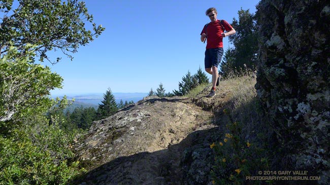
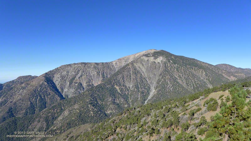
The trail run from Inspiration Point to Islip Saddle traverses a rolling section of the PCT along Blue Ridge, descends to Vincent Gap (6565′) and then climbs a switchbacking trail to the summit of Mt. Baden-Powell (9399′). The run continues along the crest of the San Gabriels on the PCT past several 9000′ peaks to Little Jimmy Spring and campground. From there it is a couple of miles to the parking lot in the saddle between Mt. Islip and Mt. Williamson.


A longer version of the run continues over the shoulder of Mt. Williamson to Eagles Roost. Many runners stop at Eagles Roost because of the now seven year (!) closure of the 3.5 mile segment of the PCT between Eagles Roost and Cooper Canyon. Continuing past Eagles Roost requires running 2.7 miles on Highway 2 to Buckhorn Campground, picking up the Burkhart Trail and following it down to the PCT in Cooper Canyon.


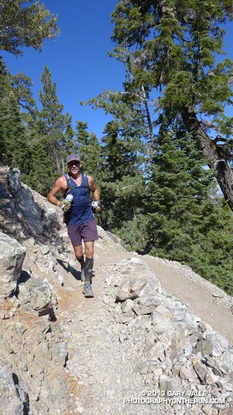
Today we were looking to do under 20 miles and keep the elevation gain to something sensible. Tim had run this stretch just a couple weeks before while doing the Angeles Crest 100 — his first 100 miler. Craig had crewed and paced a friend in the AC100 and was training for an upcoming 50 miler. Over the past several weeks I’d been doing a series of higher altitude runs and was also training for a 50 miler.

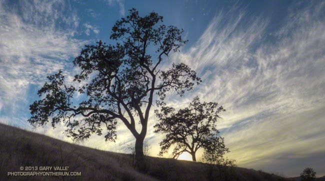
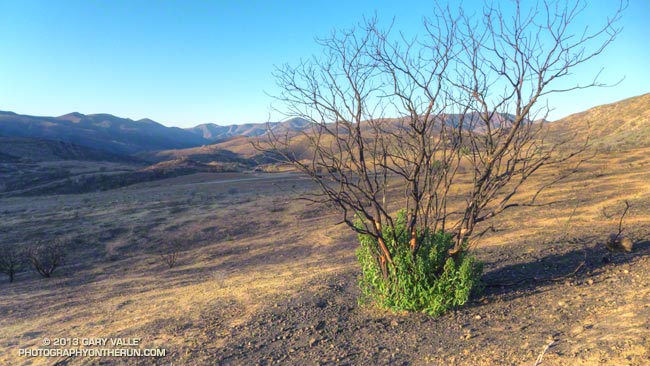
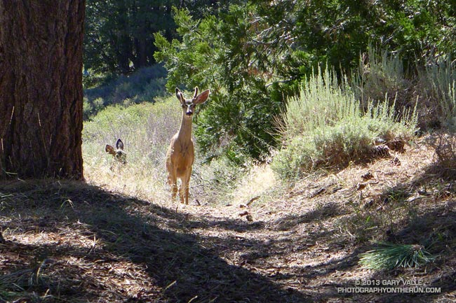
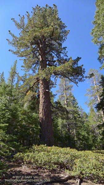
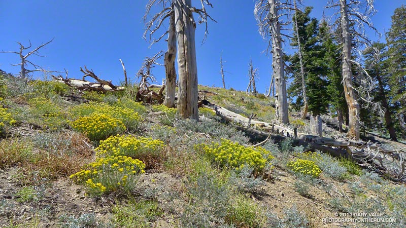
So far the run had been really relaxed and low key. We’d encountered a pair of young deer near Jackson Flat. They’d eyed us curiously before bounding off into the trees and the encounter seemed to have set the tone for the run. From time to time we stopped to enjoy a view point, look at the geology, or take a picture of a big ol’ tree. Rabbitbrush was blooming everywhere, adding a bright yellow accent to the rocks and ridges.


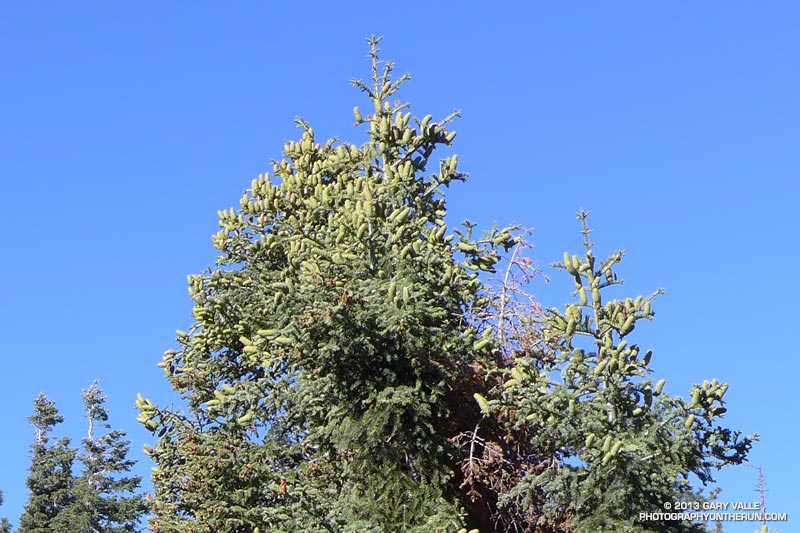
Earlier this year I photographed a bumper crop of cones on bigcone Douglas-fir in the Mt. Wilson area and here on Blue Ridge white firs had produced a huge number of cones. Other plants, such as bush chinquapin, had also produced large crops this year. Currant bushes along the trail had been productive, but because it has been so dry the fruit was smaller than normal.


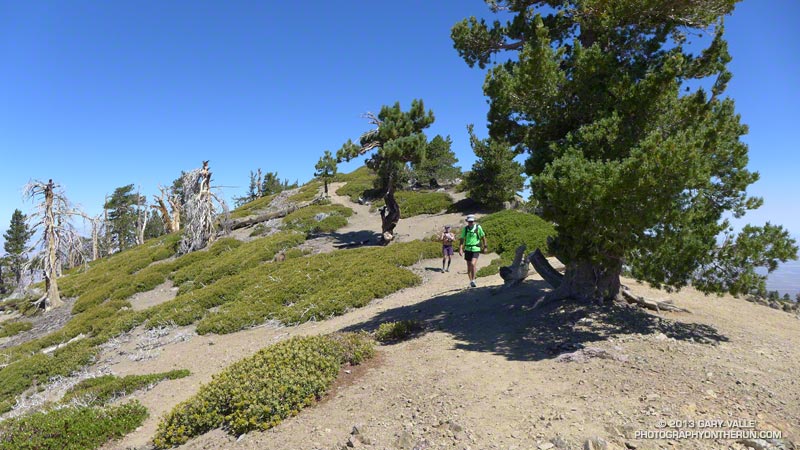
The demeanor of the run changed part way up Baden-Powell. Mt. Baden-Powell is an immensely popular peak, and on a Summer weekend you’ll find an assortment of youth groups, fitness groups, hikers, runners and on rare occasions even an equestrian or two.

I stuffed another just-discarded nut bar wrapper into the back of my pack. That was a bad sign, and about two-thirds of the way up the peak things got a little crazy. The switchbacks above looked like escalators in a mall during the Holidays. People going up; people going down; people cutting switchbacks. A lot of people cutting switchbacks. At one point it seemed more people were short-cutting the trail than were on the trail.

Request: “Please don’t cut the trail…”

Response: “I figure Indians hiked all over this mountain; it’s my choice where I hike…”


0
The mindset of the people that throw trash on the trail and shortcut the trail is much the same. They just don’t care. They don’t consider that someone else is going to have to clean up their mess. A person that shortcuts a trail doesn’t realize several other people — usually volunteers — are going to have to repair the damage. Cutting switchbacks causes erosion, tramples plants and looks ugly. It tells others that you are unfit and inexperienced.

A couple of switchbacks above the chaos settled, and when two young boys cut a switchback just ahead of me it was heartening to hear their father explain why that was a bad idea.


The summit of the Baden-Powell was not nearly as busy as I thought it might be. Just a few people were enjoying the great view from the summit. We took a short side trip down the south ridge to look at a lodgepole pine whose limbs and bark had been torn off in an ice storm during the Winter of 2010-11. In the same area was a stout limber pine that has a scar from a lightning strike. Later in the run we would pass another lightning tree near Mt. Hawkins.

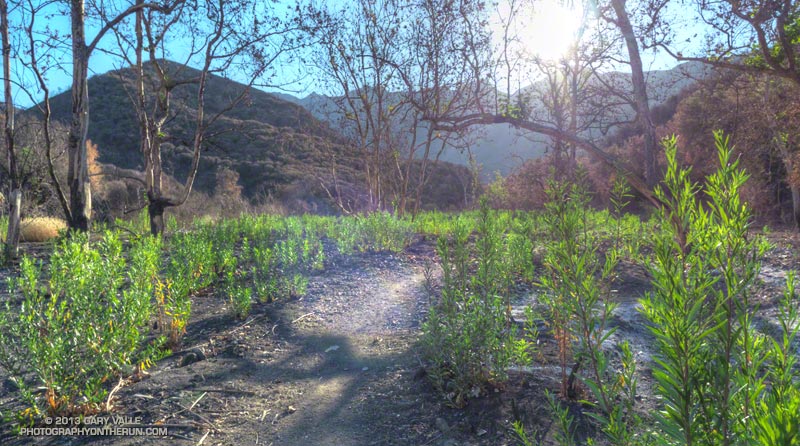
The last several miles of the run were as relaxed and low key as the first few miles. Recovery continues among the ghost trees in the area burned in the 2002 Curve Fire, and the water and wildflowers at Little Jimmy Spring were as refreshing as ever!

Some related posts: Highs and Lows on the PCT, Inspiration Point to Islip Saddle Trail Run, PCT from Inspiration Point to Islip Saddle