Category Archives: trails|malibu creek state park

Hitting the (Big) Hills of Southern California


Comparison of Whitney (Trail), San Gorgonio (Vivian Creek) and San Jacinto (Devils Slide)

Updated November 12, 2014. Added Register Ridge on Mt. Baldy and the Siberia Creek Trail in Big Bear.

Southern California is noted for its foothills and mountains. It’s so hilly here that most trail runs have at least one good climb. Even if you aren’t a high mileage runner, the elevation gained on those hills can add up fast. So far this year SportTracks puts my cumulative elevation gain at about 320,000 feet.

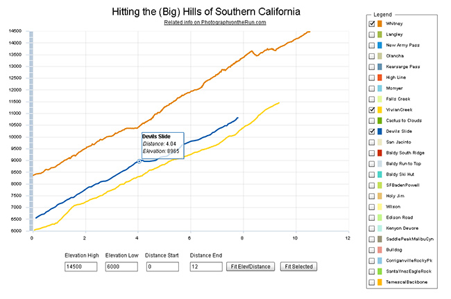
I was curious to see how some of the “hills” in Southern California compare, so I wrote a Flash application that interactively displays the elevation profiles of a selection of SoCal ascents. Generally trails were picked that could be done in day from L.A. The selection includes some East Side Sierra ascents, routes up most of the major Southern California peaks, and some hills from some Southern California races.

The profiles and other stats are based on DEM corrected data from GPS tracks. All distances, elevations, elevation gains and elevation profiles are approximate. Elevations have been corrected and elevation gains (conservatively) calculated using SportTracks.

The Flash app is loading a lot of data, so it may take a while to load. The app is best viewed on a desktop, laptop, or tablet. It can’t be viewed on an iPad/iPhone unless a browser that supports Flash, such as Photon, is used. Here is the updated selection of elevation profiles and the selection from 2012. The “Fit Selected” button is used to fit the chart to the currently selected set of elevation profiles. The “Fit Elev/Distance” button is used to format the chart according to user specified elevations and distances.

In this selection of hills Cactus to Clouds is the longest (14.7 miles) and has the most altitude gain (10,812 feet). Register Ridge on Mt. Baldy has the steepest mile (1745 fpm) and is the steepest overall (1127 fpm). Mt. Whitney has the highest finishing elevation (14,505 feet).

Following are some additional details about each of the ascents, including the length of the climb, elevation gain, average gradient and steepest mile. The distance specified is just for climb described — not the entire run. The headings below are the shorthand name of the climb used in the legend of the app.

Whitney

Mt. Whitney via the trail from Whitney Portal.
Distance: 10.5 mi – Gain: 6657 ft – Avg Gradient: 632 fpm – Steepest Mile: 900 fpm @ mile 4.5

Requires permit. The 1991 Los Angeles Times story about Marty Hornick’s 2:08:30 ascent of Whitney via the Mountaineers Route mentions a 2:17 time via the trail. According to the China Lake Mountain Rescue Group’s Talus Pile December 2002, Issue # 126, Jason Lakey did the roundtrip via the Mountaineer’s Route in a record 3:10:07.

Related post: East Face Mt. Whitney, Tower Traverse

Langley

Mt. Langley via Army Pass from Horseshoe Meadow Cottonwood Lakes Trailhead.
Distance: 10.2 mi – Gain: 4161 ft – Avg Gradient: 408 fpm – Steepest Mile: 1275 fpm @ mile 8.8

Army Pass is often choked with snow. New Army Pass is used as an alternative. Last couple of miles is on use trails and depending on your route could involve a little scrambling.

Related post: Mt. Langley in a Day from L.A.

New Army Pass

New Army Pass from Horseshoe Meadow Cottonwood Lakes Trailhead.
Distance: 8.4 mi – Gain: 2409 ft – Avg Gradient: 274 fpm – Steepest Mile: 617 fpm @ mile 7.4

Related post: New Army Pass – Cottonwood Pass Loop

Olancha

Olancha Peak via the Sage Flat Trail and “cow driveway”.
Distance: 9.2 mi – Gain: 6213 ft – Avg Gradient: 676 fpm – Steepest Mile: 1437 fpm @ mile 8.2

Last mile or so to the summit is not on a trail and involves some scrambling up rocks.

Related post: Olancha Peak Sierra Panorama

Kearsarge Pass

Kearsarge Pass from Onion Valley.
Distance: 4.9 mi – Gain: 2610 ft – Avg Gradient: 531 fpm – Steepest Mile: 641 fpm @ mile 1.0

Various runs can be done from the pass.

Related post: Up and Over Kearsarge Pass

High Line

Mt. San Gorgonio via Momyer and San Bernardino Divide Trail.
Distance: 15.0 mi – Gain: 7146 ft – Avg Gradient: 478 fpm – Steepest Mile: 1119 fpm @ mile 4.0

Requires permit. Total distance starting/ending at Momyer is about 26 miles.

Related post: San Gorgonio High Line 2009

Momyer

The Momyer Trail to the San Bernardino Divide Trail.
Distance: 7.1 mi – Gain: 5023 ft – Avg Gradient: 707 fpm – Steepest Mile: 1119 fpm @ mile 4.0

Requires permit. Once up to the San Bernardino Divide Trail there is a choice of around ten peaks over 10,000′.

Related post: San Gorgonio High Line

Falls Creek

Mt. San Gorgonio via Momyer and Falls Creek Trails.
Distance: 15.0 mi – Gain: 6397 ft – Avg Gradient: 481 fpm – Steepest Mile: 872 fpm @ mile 1.7

Requires permit. Total distance starting/ending at Momyer is 24 miles.

Related post: San Gorgonio Mountain – Falls Creek Loop 2011

Vivian Creek

Mt. San Gorgonio via Vivian Creek Trail.
Distance: 9.4 mi – Gain: 5464 ft – Avg Gradient: 585 fpm – Steepest Mile: 920 fpm @ mile 7.7

Requires permit. This is the descent route for High Line and Falls Creek loops.

Cactus to Clouds

Mt. San Jacinto via the Skyline Trail, Round Valley Trail and San Jacinto Peak Trail.
Distance: 14.7 mi – Gain: 10812 ft – Avg Gradient: 736 fpm – Steepest Mile: 1499 fpm @ mile 7.3

Requires permit. The biggest hill in Southern California.

Devils Slide

Mt. San Jacinto from Humber Park via Devils Slide Trail, PCT and San Jacinto Peak Trail.
Distance: 7.8 mi – Gain: 4407 ft – Avg Gradient: 566 fpm – Steepest Mile: 716 fpm @ mile 2.9

Requires permit.

San Jacinto

Mt. San Jacinto from the Long Valley Tram Station via the Round Valley Trail and San Jacinto Peak Trail.
Distance: 5.4 mi – Gain: 2520 ft – Avg Gradient: 470 fpm – Steepest Mile: 709 fpm @ mile 4.4

Requires permit.

Related post: Summery San Jacinto, Smoky Tahquitz Peak

Baldy South Ridge

Mt. Baldy from the Village via Bear Canyon and South Ridge on the Old Mt. Baldy Trail.
Distance: 6.8 mi – Gain: 5811 ft – Avg Gradient: 850 fpm – Steepest Mile: 1273 fpm @ mile 2.1

Related post: Up & Down Mt. Baldy’s South Ridge

Baldy Run to the Top

Mt. Baldy from base of ski lift parking lot.
Distance: 6.9 mi – Gain: 3868 ft – Avg Gradient: 558 fpm – Steepest Mile: 799 fpm @ mile 4.9

Last 0.6 mi to summit is approximately 1090 fpm.

Related post: Mt. Baldy Run to the Top 2009

Baldy Ski Hut

Mt. Baldy from Manker Flat via the Baldy Bowl Trail — aka the Ski Hut Trail.
Distance: 4.4 mi – Gain: 3883 ft – Avg Gradient: 891 fpm – Steepest Mile: 1201 fpm @ mile 2.8

Related post: Back to Baldy

Baldy Register Ridge (New)

Mt. Baldy from Manker Flat via the Register Ridge Trail.
Distance: 3.5 mi – Gain: 3909 ft – Avg Gradient: 1127 fpm – Steepest Mile: 1745 fpm @ mile 0.9

SFBadenPowell

Mt. Baden-Powell from South Fork Campground via Manzanita Trail and PCT. Vincent Gap is at about mile 5.75.
Distance: 10.0 mi – Gain: 5074 ft – Avg Gradient: 510 fpm – Steepest Mile: 805 fpm @ mile 8.6

Part of a 23.5 mile loop from Islip Saddle

Related post: San Gabriel Mountains Running Adventure

Siberia Creek (New)

The Siberia Creek climb starts at Bear Creek and climbs to Forest Service Road 2N11 via the Siberia Creek Trail and a short segment of the Champion Lodgepole Trail. It is part of the Kodiak 100M and 50M courses.
Distance: 6.9 mi – Gain: 3008 ft – Avg Gradient: 435 fpm – Steepest Mile: 698 fpm @ mile 1.4

Related post: Kodiak 50 Mile 2014

Holy Jim

Holy Jim Trail from Trabuco Canyon to Santiago Peak. Was part of Twin Peaks 50K.
Distance: 8.0 mi – Gain: 3921 ft – Avg Gradient: 489 fpm – Steepest Mile: 691 fpm @ mile 5.3

Related post: Blue Skies and Sunshine for the 2010 Twin Peaks 50K & 50M Trail Runs

Wilson Trail

Mt. Wilson from Sierra Madre via the Mt. Wilson Trail. Orchard Camp is at about mile 3.5.
Distance: 7.1 mi – Gain: 4720 ft – Avg Gradient: 662 fpm – Steepest Mile: 925 fpm @ mile 4.0

Edison Road (In 06/08/2012 selection.)

Edison Road from the West Fork San Gabriel River to Angeles Crest Highway at Shortcut Saddle. Part of Mt. Disappointment 50K.
Distance: 5.5 mi – Gain: 2027 ft – Avg Gradient: 372 fpm – Steepest Mile: 520 fpm @ mile 3.3

Related post: Mt. Disappointment 50K 2011 Notes

Kenyon Devore

Gabrielino and Kenyon Devore Trails from West Fork to Mt. Wilson. Part of Mt. Disappointment 50K.
Distance: 4.9 mi – Gain: 2622 ft – Avg Gradient: 532 fpm – Steepest Mile: 801 fpm @ mile 1.9

Related post: Trail Work and Tree Rings

SaddlePeakMalibuCyn (In 06/08/2012 selection.)

Saddle Peak from Piuma Road near Malibu Canyon via the Backbone Trail.
Distance: 6.3 mi – Gain: 2350 ft – Avg Gradient: 372 fpm – Steepest Mile: 680 fpm @ mile 4.9

Related post: Bulldog Loop or Saddle Peak Out & Back?

Bulldog

Bulldog Lateral and Motorway from Crags Rd. to Castro Motorway. Part of Bulldog 25K/50K, XTERRA Malibu Creek Challenge and other races.
Distance: 3.4 mi – Gain: 1727 ft – Avg Gradient: 514 fpm – Steepest Mile: 732 fpm @ mile 2.0

Related post: Bulldog 50K 2010 Notes

CorriganvilleRockyPk (In 06/08/2012 selection.)

Corridor Trail from Corriganville to Rocky Peak Rd. Then Rocky Peak Rd to high point near Rocky Peak. Part of Bandit 15K/30K/50K. Does not include initial loop in Corriganville. 50K descends to Santa Susana Pass.
Distance: 3.3 mi – Gain: 1547 ft – Avg Gradient: 464 fpm – Steepest Mile: 836 fpm @ mile 0.6

Related post: Bandit 30K 2009

SantaYnezEagleRock (In 06/08/2012 selection.)

Eagle Rock from Vereda De La Montura via the Santa Ynez Canyon Trail, Musch Trail and East Topanga Fire Road.
Distance: 5.6 mi – Gain: 1292 ft – Avg Gradient: 230 fpm – Steepest Mile: 643 fpm @ mile 1.0

Related post: Clouds, Canyons and Wildflowers

TemescalBackbone (In 06/08/2012 selection.)

Temescal Canyon to the Backbone Trail Junction via Temescal Canyon and Temescal Ridge Trails.
Distance: 5.4 mi – Gain: 1709 ft – Avg Gradient: 318 fpm – Steepest Mile: 760 fpm @ mile 0.8

Related post: Will Rogers – Temescal Loop

Las Llajas (In 06/08/2012 selection.)

Las Llajas Canyon from near Evening Sky Drive to high point above oil field. Part of Bandit 30K/50K
Distance: 4.9 mi – Gain: 1418 ft – Avg Gradient: 290 fpm – Steepest Mile: 625 fpm @ mile 3.1

Related post: Bandit 50K 2011 Notes

Backbone Ultra 2014

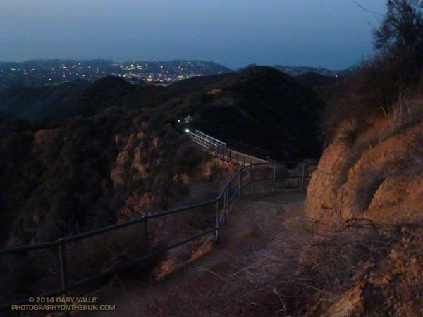
Headlamps of runners in the Coyote Backbone Trail Ultra on the Rogers Road Trail.

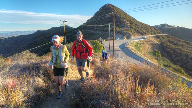
Runners on the Backbone Trail at About Mile 2 of the Backbone Ultra

Last year I ran the Coyote Backbone Trail Ultra and enjoyed everything about it — the trails and scenery, the runners, the volunteers, the approach of the organizers, and just the general vibe of the event. The Backbone Ultra team did a superb job, and as far as I know there no major issues. Nobody got lost or seriously injured. The runners and volunteers were respectful to the environment and everyone I talked to had a great time participating in the event.

Still I wondered. Because of its complex logistics and administrative requirements would there be a 2nd annual Backbone Trail Ultra? Then on August 22, a little after lunchtime, the news was posted — there would be a “Game 2!” I needn’t have worried, RDs Howard Cohen and Mike Epler were on it!


On March 15 at 6:07 a.m., at Will Rogers State Park, under the light of a 99% full moon, myself and 46 other runners in the first start group began our Backbone Trail adventure.

In the weeks leading up to the Backbone Ultra I’d been closely watching the weather. Two weeks prior to the run the area was inundated by the most rain in 48 hours since 2011. There had been some concern that heavy rainfall in the Springs Fire burn area in Pt. Mugu State Park would severely damage trails. That didn’t happen.


Ten days out it looked like an upper level low might affect the area. That didn’t happen. As the event neared, the forecast trended drier and warmer — much warmer. Friday as I was getting my drop bag ready, @NWSLosAngeles tweeted “Still expecting high temps to approach records at some locations this weekend” along with this graphic. That did happen!

On Saturday, the first day of the event, Santa Ana winds pushed the temperature at noon at Malibu & Piuma to 86 degrees — 16 degrees higher than during last year’s event! Note that this is the temperature in a ventilated, white-painted box several feet off the ground. The “in the sun” temperature, near the ground, on south-facing slopes was likely in the 90’s. Even more telling, the temperature at Circle X was in the 80’s from noon until 5:00 p.m. and at midnight was 74 degrees!


It must have been something to be on the Backbone Trail at its highpoint near Sandstone Peak in the middle of the night, with 100 mile visibility, a full moon and warm weather. I am really bummed to have missed that! I didn’t get to experience it because I had some kind of heat-related issue and dropped at the Encinal Aid Station at around mile 43.

This is the first time heat has kept me from completing a run or race. So what was the problem? Probably a combination of things. I don’t think I was under-trained or over-trained. I hadn’t just had the flu or a cold. My taper seemed OK. It wasn’t under-hydration, at least not in the first 30 miles. My best guess is that anticipating the heat, I drank too much early on. Not having trained much in the heat this year probably also contributed. It’s hard to know for sure. Sometimes it’s just not your day!

Although I didn’t get to the finish this year, I still very much enjoyed the miles I did run on the Backbone Trail. Here’s a slideshow of some images taken along the way.

It is a tribute to the many people that helped support the Backbone Trail Ultra that — by a substantial margin — there were more volunteers than runners! Many thanks to:

– RDs Howard Cohen & Mike Epler and their team Fred & Lauren Case, Willie Roland, Tres Smith, Erica Gratton and Dan Dicke.
– California State Parks and the National Park Service.
– Trippet Aid: Rene Canizales and the New Basin Blues.
– Stunt Aid: Alison Chavez/Amy Chavez and the SoCal Coyotes.
– Piuma Aid: Art Byrne and the Trail Runners Club.
– Corral Aid: George Plomarity and Patagonia.
– Kanan Aid: Paul Van Zuyle and his leprechauns.
– Encinal Aid: Bill Kee and wife Paula and the Coyote Cohorts.
– Mishe Mokwa Aid: Manley Klassen and wife Mara and the Coyote Cohorts.
– Sycamore  Aid: Puerto Mauricio and the Coyote Cohorts.
– Finish: Erica Gratton & Janna Williams and the Conejo Valley Trail Runners.
– Breakfast: Luis Escobar, Jerry Gonzales and team.
– Medical: The Josepho Team and Ventura County Search and Rescue.
– HAM radio operators at each of the aid stations and the finish.
– Volunteers at the road crossings at Stunt, Piuma, Malibu Canyon, Latigo Canyon, Encinal Canyon, Mulholland Highway and Yerba Buena times 2.
– Sweeps: Kathy Higgins, Rene Canizales, Erin Chavin & Pedro Martinez, Ken Hughes and Jack Fierstadt.
– All the Course Markers & Safety Patrols.

Some related posts: Backbone Training Run 2014 #1, Backbone Training Run 2014 #2, Run, Lop and Shiver, Backbone Ultra 2013

Backbone Trail Training 2014 – Stunt to Kanan

Backbone Trail Training 2014 - Stunt to Kanan
With the 2nd Annual Coyote Backbone Trail Ultra a mere 62 days away 28 assorted trail runners gathered under the tutelage of Mike Epler for Backbone Training Run #1.
The run was from the top of Stunt Road, at about mile 18 of the BBT, to Kanan Road at about mile 37. The segment included one of the three big climbs on the BBT and near Saddle Peak reached the second highest point on the Backbone Trail. Race day the segment will follow a long climb from Topanga Canyon up Hondo Canyon to Fossil Ridge. The elevation gain on the approximately 19 mile run was around 3400 feet and the elevation loss about 4300 feet.
It was a superb run on an excellent section of the Backbone Trail! Here’s a short slideshow with a few photos from the run.

Running from the Wind

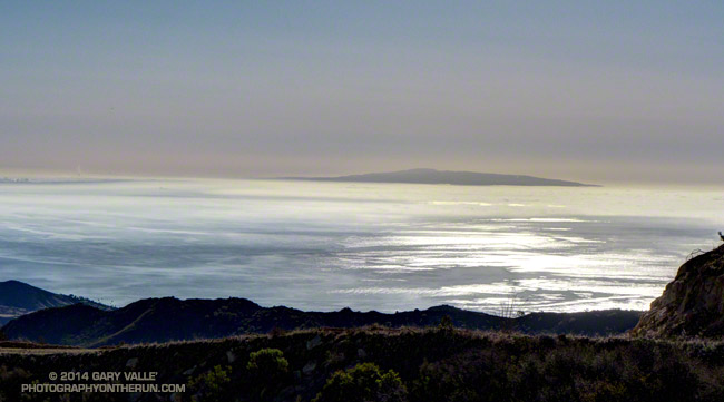
Windblown stratus on Santa Monica Bay with Palos Verdes Peninsula in the distance

The tinge of frost on the rusty M*A*S*H ambulance wasn’t so much of a surprise, but that there was not even a breath of wind at the M*A*S*H site was astonishing.

Overnight unrelenting winds had rushed and roared through the palm trees above the house and I’d steeled myself for what would surely be a difficult run.

A cold December morning at the M*A*S*H site in Malibu Creek State Park.

But when I arrived at the Cistern trailhead on Mulholland Drive there was almost no wind. A layer of cold air trapped against the crest of the Santa Monica Mountains in the Malibu Creek drainage was shielding the area from the wind. At least for a while.

When I’d left the house in the West Valley the temperature had been a balmy 64 degrees. As I turned onto Mulholland Highway from Malibu Canyon Road my car’s thermometer had read 32 degrees and at the trailhead it had been 46 degrees. Along Malibu Creek at the M*A*S*H site I’d guess the temperature was in the mid-thirties.

California fuscia along the Bulldog Motorway fire road.

Incredibly, the climb up Bulldog Motorway was one of the most pleasant I’ve done. Near freezing temperatures gave way to warming Winter sunshine, and as I worked up the grade I wondered how long the respite from the wind would last. To the northeast I could see the telltale dusty haze from strong offshore winds in the San Fernando Valley. At some point those winds would scour out the protective layer of cold air or I would climb above it.

It wasn’t until about halfway up the Bulldog climb that the wind started to pick up. But it was still far less windy than I had expected. Several sections of Castro Peak and Mesa Peak fire roads were in the lee of the crest, and the running was excellent. The variegated patterns of sun, stratus and wind on the Pacific was spectacular.

Rocks along the Backbone Trail near the top of Corral Canyon in the Santa Monica Mountains.
Rocks along the Backbone Trail near the top of Corral Canyon.

Once I was off the crest the wind diminished to little more than a zephyr. In many areas — such as at Tapia Park and along Crags Road there was no wind at all.

But it was still windy in the West Valley. When I got home from the run I checked the Cheeseboro RAWS, which is about 6 miles NNE of Malibu Creek State Park. Between 9:30 and 10:30, when it had been dead still on Crags Road, the Cheeseboro RAWS had recorded steady winds of 30 mph, gusting to as high as 50 mph!

The title photo is of windblown stratus on Santa Monica Bay with Palos Verdes Peninsula in the distance.

Some related posts: Malibu Creek State Park Scenic Loop, Vertical Relief

Best Trailhead to Start the Bulldog Loop?

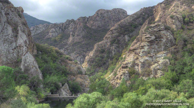
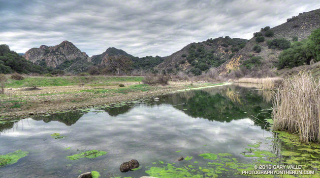
Goat Buttes and Century Lake and Gorge in Malibu Creek State Park.

There are several places runners can start the Bulldog Loop: the main parking lot at MCSP, Piuma & Malibu Canyon, and Malibu Canyon & Mulholland are all popular starting points.


One of the best trailheads for starting this loop is often overlooked — the Cistern Trail and Phantom Trail trailhead on Mulholland Highway. Starting at this trailhead adds about 1.5 mile and 500′ gain/loss to the standard 14+ mile loop. Less than a quarter-mile into the run this variation passes one of the best viewpoints in Malibu Creek State Park. 

The run begins on the Cistern Trail on the south side of Mulholland and follows that trail about a quarter-mile to the Lookout Trail junction. At the junction the route turns right on the Lookout Trail and follows it about 0.4 mile to the Cage Creek Trail, which leads down to Crags Road and the regular Bulldog Loop. Near the end of the loop, after climbing a hill and passing the spur trail down to Century Lake, the Lookout Trail is taken from Crags Road back up to the Cistern Trail and car.


Much of Malibu Creek State Park and the route of the Bulldog Loop can be seen from the Cistern Trail at the beginning of the run. There are excellent views of Reagan Ranch, Brents Mountain, Goat Buttes, Century Lake and Gorge on the way down the Cistern Trail and climbing back up the Lookout Trail at the end of the loop.

The run can be easily extended by tacking on the Yearling and Deer Leg Trails in the Reagan Ranch area or by doing the Phantom Loop when the Grasslands Trail & Crags Road junction is reached after passing the MCSP parking lot.

The title photo is of Goat Buttes and Century Lake & Gorge from this morning’s run of the loop.

Some related posts: Century Lake, Dam and Gorge on Malibu Creek, Malibu Creek State Park Scenic Loop, Vertical Relief