Escape to Mt. Pinos – An Alternative to Closed Angeles Crest Highway Trailheads

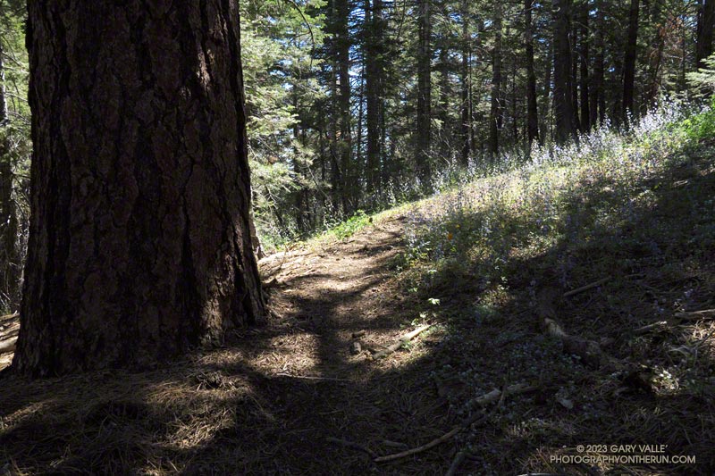
Large Jeffrey pine and larkspur along the Vincent Tumamait Trail in the Chumash Wilderness.
Jeffrey pine and larkspur along the Vincent Tumamait Trail

A long stretch of Angeles Crest Highway (Highway 2) between Red Box and Vincent Gap remains closed because of storm damage. According to a tweet from Caltrans District 7, it sounds like it may be closed through Summer. Some affected trailheads include Shortcut Saddle, Three Points, Mt. Waterman, Buckhorn, Mt. Williamson, and Islip Saddle.
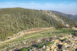
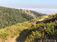
Starting down the Vincent Tumamait Trail, near the Condor Observation Site on Mt. Pinos.
Starting down the Vincent Tumamait Trail

Mt. Pinos is often overlooked as a trail running destination but offers several options for those that enjoy running or hiking in hilly terrain at higher altitude. Most of the runs at Mt. Pinos start at the Chula Vista Trailhead (8350′) at the end of Mt. Pinos Road.

Today, I was doing an out-and-back from the Chula Vista Trailhead to Mt. Abel/Cerro Noroeste (8280+’). The route includes short side trips to Mt. Pinos (8831′), Sawmill Mountain (8818′), Grouse Mountain (8582′), and Sheep Camp (8300′).
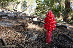
Snow plant along the Vincent Tumamait Trail

Including the side trips, the run/hike is about 15.5 miles long, with about 3700′ of gain/loss. Google Earth calculates the average elevation of the route to be 8434′. In comparison, the average elevation of the out and back from Islip Saddle to Mt. Baden-Powell is 8201′.

With triple-digit highs expected in some low-elevation areas, the temps on Mt. Pinos today were ever so pleasant — short-sleeves from the start and only a little toasty in a few exposed areas.
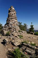
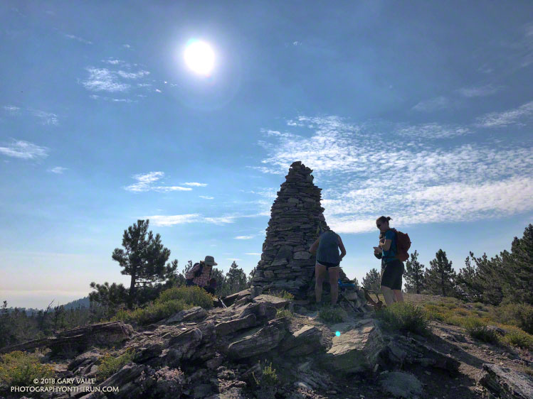
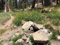
Chumash spirit tower on Sawmill Mountain., west of Mt. Pinos.
Chumash spirit tower on Sawmill Mountain.

Despite the harsh Winter, there were only one or two small trees down on the Vincent Tumamait Trail, and those were inconsequential. As elsewhere in Southern California, the wildflowers along the trail were sensational. After nearly drying up last year, the spring at Sheep Camp was running at full flow.

Explore the scenery and terrain of this out and back run from Mt. Pinos to Mt. Abel using our high resolution,  interactive, 3D viewer. The imagery is so detailed, it’s almost like being there! To change the view, use the control on the upper right side of the screen, the CTRL key and your mouse, or touch gestures. Track and placename locations are approximate and subject to errors. Snow, ice, poor weather, and other conditions may make this route unsuitable for this activity.
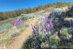
Lupine and other wildflowers along the Vincent Tumamait Trail, near Mt. Abel Road.
Lupine and other wildflowers along the trail, near Mt. Abel Road.

If you are looking to run longer, add additional elevation gain, or explore the area, running to Lily Meadows and back from Sheep Camp extends the run to about 21 miles, with around 5400′ of elevation gain/loss.

Another option for a longer run is doing an out-and-back to Mesa Spring Camp, instead of Mt. Abel. Including a stop at Sheep Camp on the way back, this run is about 20.5 miles, with about 4800′ of gain/loss.

Lily Meadows and Mesa Springs see far less traffic than the Vincent Tumamait Trail. The trade-off is that both places are at lower elevation and can be 15-20 degrees warmer than Mt. Pinos.

Some related posts:
Thirsty Mt. Pinos
Mt. Pinos to Mt. Abel Out & Back – Plus Sawmill Mountain, Grouse Mountain and Sheep Camp
Up, Down and Around on Mt. Pinos’ Tumamait and North Fork Trails
Mt. Pinos Adventure Run to Mesa Spring

Chumash-Las Llajas Loop

Rocky Peak Fire Road between the Chumash Trail and Fossil Point

Update of a post from December 30, 2006.

The Chumash-Las Llajas Loop is a scenic 9.3 mile trail run in the eastern Simi Valley. Run counterclockwise, it combines a  strenuous climb on a single-track trail and fire road with a fast-paced 4-mile downhill on a dirt road. The cumulative elevation gain/loss on the loop is about 1600′.

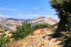
View of Oat Mountain from near the top of the Chumash Trail.
Nearing the top of the Chumash Trail

I like to do the loop starting at the Las Llajas Canyon trailhead on Evening Sky Drive. A short jog up Evening Sky Dr., then across a field, and you’re on your way up the Chumash Trail. From this point, it’s an approximately 1000′ climb over 2.7 miles of rocky trail to Rocky Peak fire road.

After turning left (north) on Rocky Peak fire road, a short downhill is followed by three-quarters of a mile of climbing to “Fossil Point.” A short detour off the main fire road leads to a cairn marking the high point. From here there is a panoramic view of Oat Mountain, San Fernando Valley, San Gabriel Mountains, Santa Monica Mountains, Simi Valley, Boney Mountain, Channel Islands, and Ventura Mountains.

Exposures of fossil shells are found near the high point. According to the area’s Dibblee geology map, these may have been deposited in shallow marine lagoons a couple million years ago.

From the high point, the loop continues north on Rocky Peak Road. At first, it descends steeply, then climbs to a hilltop with a few valley oaks. Partway up the hill, a roadcut reveals the long roots of the chamise plants on the hillside.

Road connecting Rocky Peak Road to Las Llajas Canyon.

Following a short downhill, the road continues past a fallen valley oak that was killed by the 2011-2015 drought. There is a fork in the road here. The road connecting to Las Llajas Canyon goes up a short hill to an overlook of the canyon. From the top of the hill, there are more than 4 miles of downhill through the winding canyon. There used to be oil field equipment on the connector between Rocky Peak Rd. and Las Llajas Canyon, but it has been removed.

If the creek in the canyon is flowing, there are several places where the (usually) small stream crosses the road. In the Spring and early Summer, many species of wildflowers can be found in the canyon.

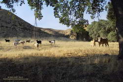
Cattle on the Las Llajas Loop

Some of the wildlife, and not-so-wild animals, I’ve encountered on the loop include rattlesnakes and other snakes, deer, longhorn cattle, roadrunners, and a kangaroo rat. Although others have seen mountain lions in the area, I’ve only photographed their tracks.

The loop ends with a short, steep climb up a paved road. At the top of the hill, turn left to return to the trailhead.

Explore the scenery and terrain on the Chumash-Las Llajas Loop trail run using our high resolution,  interactive, 3D viewer. The imagery is so detailed, it’s almost like being there! To change the view, use the control on the upper right side of the screen, the CTRL key and your mouse, or touch gestures. Track and placename locations are approximate and subject to errors. Poor weather, and other conditions may make this route unsuitable for this activity. (It is also possible to start the loop at the Chumash Trail trailhead at the end of Flanagan Dr.)

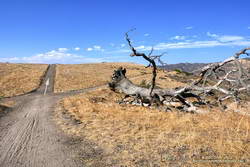
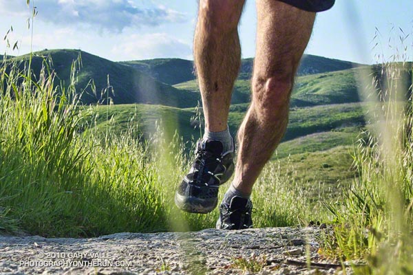
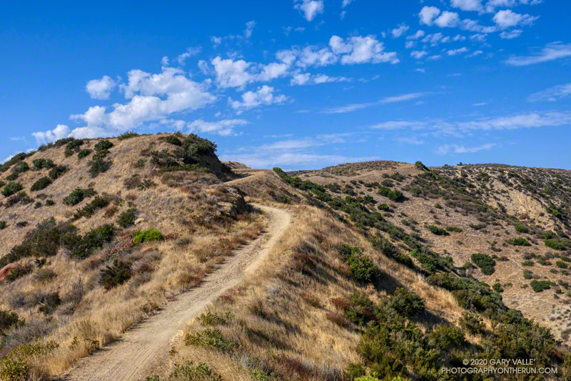
The title photo is a section of Rocky Peak fire road between the top of the Chumash Trail and Fossil Point. It is from a run on October 6, 2020.

Some related posts: Chumash Trail Rocks & Snow, Exploring Las Llajas, Marr Ranch WildflowersThings Found on the Chumash Trail

Up, Down and Around on Mt. Pinos’ Tumamait and North Fork Trails

A Chumash spirit tower on Sawmill Mountain, near Mt. Pinos

Yellows, reds and greens marked its location, but the seep above Sheep Camp was dry. As I approached the camp, the uppermost campsite was empty and I wondered if the spring at the camp was also going to be dry. If it was, I was going to have to revise my running plan.

Rabbitbrush blooming along the Tumamait Trail near its eastern trailhead on Mt. Pinos.
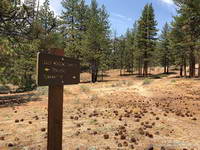
Near the start of the Tumamait Trail on Mt. Pinos.

So far the run had gone well. From the Chula Vista parking area (8350′), I’d run the service road up to Mt. Pinos (8831′), then followed the Tumamait Trail west to Mt. Abel Road. Along the way Sawmill Mountain (8818′)and Grouse Mountain (8582′) had been short side trips; and from the end of the trail, the summit of Mt. Abel (8280′) was a short hike up through the pines.

Compared to the triple-digit temperatures in the parched West Valley — as high as 117 °F this July — the temps on the Tumamait Trail had been wonderfully cool. The hotter than average weather seems to have become the new norm, and also — unfortunately — the resulting wildfires.

On a run here Last July, smoke from a fire near Lake Cachuma had nearly enveloped Mt. Pinos. Today several fires were burning in California, and once again smoke could be seen in the valleys and canyons to the north of the mountain.

The North Fork Trail and small spring at Sheep Camp.
The small spring at Sheep Camp.

To get in a bit more mileage and elevation gain the next part of my run was supposed to be an out and back to the sun-baked environs of Lily Meadows (6600′). That wasn’t going to happen if the spring was dry.

When I stopped at the wildflower-accented spring I could see that there was the barest thread of water trickling from the pipe. It didn’t look like much, but it filled my 18 oz. cut-off water bottle in about three minutes. I gulped down most of the first bottle and it took a couple more to fill my Camelbak. In about 10 minutes I was headed downhill.

The North Fork Trail at Lily Meadows Camp.

The North Fork Trail is far less used than the Tumamait Trail. That’s part of the fun. Thunderstorms had not only wiped away any previous tracks, but had severely eroded some sections of the trail as well.

With the loss of elevation came an increase in temperature. By the time I reached Lily Meadows Camp the temp was in the 90s. This time of year there were no lilies or meadows at the campsite, but there was a nice grove of Jeffrey pines and a new camp table!

I didn’t spend much time down there. There was a hill to climb and the cool temps along the crest were only about an hour away.

Some related posts: Pinos to Abel Plus, Thunderstorm, Vincent Tumamait Trail

GPS Traces of Southern California Trail Runs

Google Earth Images and KMZ Files of GPS Traces of Southern California Trail
Runs

Following is a list of Google Earth images and Google Earth KMZ files of GPS tracks of trail runs referenced in various postings on PhotographyontheRun.com. Included are trail runs from the wilderness and open space areas of Southern California and the Sierra Nevada. These are actual tracks recorded by a GPS during the trail run. In a few instances tracks have been modified to correct GPS errors, or to remove side excursions that are not part of the usual route. Not all errors have been corrected. No claim is being made regarding the appropriateness or suitability of the routes indicated. Mileages specified are approximate.

Santa Monica Mountain
Conservancy Open
Space & Santa Monica Mountains
Trail Run (Google Earth Image) Distance (mi) Google Earth KMZ File Blog Entry

Ahmanson-Cheeseboro
Canyon Loop

13.3 KML/KMZ file (opens in Google Earth) Classic Cheeseboro Canyon
Category Is: Things Found on the Cheeseboro Canyon Trail

Ahmanson
– Cheeseboro Ridge Loop

12.7 KML/KMZ file (opens in Google Earth) Ahmanson – Cheeseboro Ridge Loop

Ahmanson Ranch Trail Runs

Various KML/KMZ file (opens in Google Earth) Ahmanson Ranch Trail Runs

Boney Mountain Half Marathon

13.1 KML/KMZ file (opens in Google Earth) Boney Mountain Half Marathon -January 2008

Bulldog Loop

14.25 KML/KMZ file (opens in Google Earth) After the Woolsey Fire: Bulldog Loop

Best Trailhead to Start the Bulldog Loop?

Chumash-Las
Llajas Loop

9.3 KML/KMZ file (opens in Google Earth) Chumash-Las
Llajas Loop
Las Llajas Longhorns

Chumash
Trail

5.3 KML/KMZ file (opens in Google Earth) Chumash Trail Training

Category Is: Things Found on the Chumash Trail

Garapito
Figure-eight Course

7.5 KML/KMZ file (opens in Google Earth) Christmas Berry

Lower Stagecoach-Hummingbird Loop

6.2 KML/KMZ file (opens in Google Earth) Lower Stagecoach-Hummingbird Loop

Rocky Peak Summit from 118 at Santa Susana Pass

5.3 KML/KMZ file (opens in Google Earth) Rocky Peak

Scenic Route to Simi Peak

21.5 KML/KMZ file (opens in Google Earth) Scenic Route to Simi Peak

Secret Trail to Calabasas Peak

4.2 KML/KMZ file (opens in Google Earth) Secret Trail to Calabasas Peak

Simi Peak Out & Back

22.8 KML/KMZ file (opens in Google Earth) Simi
Peak Out & Back

End
of Reseda to Trippet Ranch

12.2 KML/KMZ file (opens in Google Earth) Musch
Trail Mule Deer

End
of Reseda to Trailer Canyon and Trippet Ranch

17.2 KML/KMZ file (opens in Google Earth) Garapito Trail Runs

End of Reseda to Will
Rogers SHP and Temescal Canyon

21.1 KML/KMZ file (opens in Google Earth) Will
Rogers – Temescal Loop

Wendy Dr. to Boney Mtn and Big Sycamore Canyon

18.6 KML/KMZ file (opens in Google Earth) Boney Mountain – Big Sycamore Canyon Circuit

Wendy
Dr. to Boney Mtn, Big Sycamore Canyon and Coyote Trail

20.7 KML/KMZ file (opens in Google Earth) Boney Mountain – Big Sycamore Canyon Circuit – Coyote Trail Variation

Wendy
Dr. to La Jolla Valley and Mugu Peak

20.8 KML/KMZ file (opens in Google Earth) La Jolla Valley & Mugu Peak from Wendy Drive
San Gabriel Mountains
Trail Run (Google Earth Image) Distance (mi) Google Earth KMZ File Blog Entry

Mt.
Baldy North Backbone Trail

8.0 KML/KMZ file (opens in Google Earth) North Backbone Trail Revisited

Mt. Baldy Run to the Top

7.0 KML/KMZ file (opens in Google Earth) Mt. Baldy Run to the Top

Condor Peak Trail Run

16.9 KML/KMZ file (opens in Google Earth) Condor Peak Trail Run

ANFTR/Mt. Disappointment 50K Course

31.8 KML/KMZ file (opens in Google Earth) Mt. Disappointment 50K 2008 Notes

Islip
Saddle – Mt. Baden-Powell Out & Back

16.9 KML/KMZ file (opens in Google Earth) San Gabriels High Five

Islip Saddle – SF Camp. – Vincent Gap – Baden Powell Loop

23.2 KML/KMZ file (opens in Google Earth) Wally Waldron Lodgepole Pine

Pleasant
View Ridge Loop

14.4 KML/KMZ file (opens in Google Earth) Pleasant View Ridge

Shortcut – Mt. Wilson Loop

21.7 KML/KMZ file (opens in Google Earth) Angeles High Country

Strawberry – Bear Canyon Loop

25.5 KML/KMZ file (opens in Google Earth) Strawberry – Bear Canyon Loop

Strawberry
Peak Circuit

15.3 KML/KMZ file (opens in Google Earth) Spring Growth

Strawberry
Peak Traverse and Loop

12.9 KML/KMZ file (opens in Google Earth) Strawberry Peak Traverse

Three
Points-Mt. Waterman Loop

20.0 KML/KMZ file (opens in Google Earth) Manzanita Morning

Three Points Loop Plus Mt. Waterman

22.0 KML/KMZ file (opens in Google Earth) Three Points Loop Plus Mt. Waterman

Buckhorn to Three Points Plus Twin Peaks

14.0 KML/KMZ file (opens in Google Earth) Mt. Wilson Area Peaks From Twin Peaks

Vincent
Gap – Mt. Baden-Powell – Islip Saddle – South Fork Loop

23.2 KML/KMZ file (opens in Google Earth) Heat Wave
Los Padres National
Forest & Mt. Pinos
Trail Run (Google Earth Image) Distance (mi) Google Earth KMZ File Blog Entry

Lower McGill to Mt. Pinos & Mt. Abel and Back

26.3 KML/KMZ file (opens in Google Earth) Snow Plant Still Life

Mt. Pinos to Mt. Abel Out & Back

14.8 KML/KMZ file (opens in Google Earth) Vincent Tumamait Trail

Mt. Pinos Thunderstorm Run

19.2 KML/KMZ file (opens in Google Earth) Thunderstorm

Sisar
to Topatopa Bluff

15.7 KML/KMZ file (opens in Google Earth) Topatopa
Bluff
San Gorgonio & San Jacinto
Trail Run (Google Earth Image) Distance (mi) Google Earth KMZ File Blog Entry

Mt.
San Gorgonio Loop

26.2 KML/KMZ file (opens in Google Earth) San Gorgonio High Line

Mt. San Gorgonio – Falls Creek Loop

24.6 KML/KMZ file (opens in Google Earth) San Gorgonio Mountain – Falls Creek Loop

Mt.
San Jacinto and Tahquitz Peak from the Tram

19.7 KML/KMZ file (opens in Google Earth) Room with a View
Sierra Nevada
Trail Run (Google Earth Image) Distance (mi) Google Earth KMZ File Blog Entry

Cottonwood Pass – New Army Pass Loop

21.2 KML/KMZ file (opens in Google Earth) Cottonwood
Pass – New Army Pass Loop
New Army Pass – Cottonwood Pass Loop
Mt. Langley Keyhole Loop 21.2 KML/KMZ file (opens in Google Earth) Mt. Langley in a Day from L.A.

Olancha
Peak Out & Back

19.8 KML/KMZ file (opens in Google Earth) Olancha Peak Sierra Panorama

Onion Valley – Kearsarge Pass – PCT/John Muir Trail

18.1 KML/KMZ file (opens in Google Earth) Up and Over Kearsarge Pass

Owens Peak from Walker Pass

20.5 KML/KMZ file (opens in Google Earth) Owens Peak from Walker Pass

Whiskey Flat Trail: Fairview to Kernville

15.1 KML/KMZ file (opens in Google Earth) Whiskey Flat Trail

Salomon XT Hawk 2 Trail Running Shoe

Salomon XT Hawk 2 Trail Running Shoe

It’s funny the things you think about during a race. Running down the Chumash Trail in the Bandit 30K on Saturday, one of my thoughts was, “Wow, these may be the most comfortable trail shoes I’ve ever run in.”


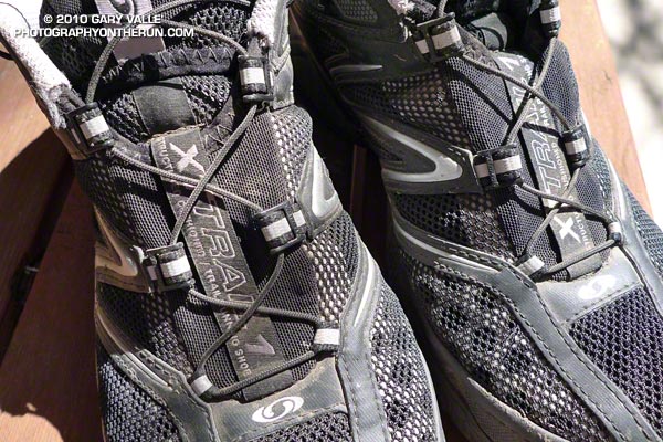
Salomon XT Hawk 2 speed laces
I purchased my XT Hawk 2’s from Zappos a couple of weeks ago. Right out of the box there were several things I liked about the shoes:

  • They are light. My pair of US size 9’s tipped the scale at a light 22.3 oz. This is about the same as the Salomon SpeedComp. 
  • The shoes fit well. No weird seams, pressure points or other problems.
  • The updated speed-lacing system is symmetric. It has no offset lace anchor across the toe, and uses a new eyelet design. I’ve never had Salomon speed-lacing fray on shoes with symmetric lacing, and the new eyelet should make the laces even more bombproof.
  • The outsole looks nearly identical to the sole on the XT Wings, which in my experience provides a good balance of traction versus predictability.

Out on the trail, the first thing that stood out was the shoe’s cushioning. It feels like the shoe has more cushioning than either the original XT Wings or SpeedComp. The heel is particularly well cushioned, but for mid-foot strikers like me, there is also plenty of forefoot cushioning.
 
What I didn’t notice until I was running down the irregular surfaces of the Chumash Trail is how the XT Hawk 2’s combination of flexibility, support and cushioning combine to produce a really comfortable ride. Based on the shoe’s performance on the Bandit’s tough 19.5 mile course, I’m looking forward to trying the shoe on some longer mountain runs or races.

Montrail Mountain Masochist

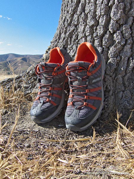
Montrail Mountain Masochist

Last updated 08/05/09.

The trail shoes I’ve been running in the most over the last several months are the Salomon XT Wings, Salomon SpeedComp, and the adidas Response Trail 15. I’ve been happy with the performance of these shoes, but still like to try something new from time to time.

Recently, the cushioning on one of my pairs of XT Wings died, so I thought I’d give the Montrail Mountain Masochist a try. I’ve now run about 35 miles in the Mountain Masochist, on a variety of courses, including the Mt. Pinos trail run on Sunday. Trail surfaces have ranged from smooth dirt road to very rocky, technical single track trail.

From the first mile the shoes have been comfortable, and fit my moderately high-arched, D-width foot well. At 12 oz./each (US size 9.5) are on the lighter side for a medium weight shoe.


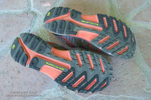
Outsole of Montrail Mountain Masochist.
The outsole appeared to have good traction on a mix of dry surfaces without being overly aggressive and grabby. On the rocky sections of trail, the shield in the midsole did a good job of protecting against pointy rocks.

My foot likes a neutral shoe with little or no pronation control, and so far the modest amount of pronation control in the Mountain Masochist has not felt overly restrictive. (See update below.)

The shoe seems to encourage a more forward body position and foot strike, which I prefer. The forefoot cushioning is good, and the strike-to-toe transitions feel smooth. On rough trails, the shoe has been stable, and I have not noticed any abnormal tendency to roll an ankle.

Overall, the Mountain Masochist appears to be a balanced, well thought out design. I hope to get them out on a 20+ mile mountain run soon.

Update 08/05/09. I now have 81 miles on this shoe and used it on the Cottonwood – New Army Pass loop in the Sierra back in July. Overall, the shoe has performed well. I do notice the pronation control on longer runs, and would love to see a version of this shoe designed for a neutral foot.